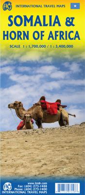

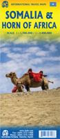
Wegenkaart - landkaart Somalië & Hoorn van Afrika | ITMB

0
Een degelijke kaart met aanduidingen van o.a. nationale parken, vliegveld, benzinepomp, dirt-roads en kleine plattegrond van hoofdstad. Als overzichtskaart goed te gebruiken. Met aan de ene zijde een kaart van Somalië, schaal 1:1.700.000, en op de andere zijde een overzichtskaart van de Hoorn van Afrika, schaal 1:3.400.000 Somalia is one of the mo...

Alle aanbiedingen van dit product

Verkoper
Bezorging
Prijs
DeZwerver.nl logo
DeZwerver.nl
2,95
14,95

Anderen bekeken ook

Wegenkaart - landkaart Somalië & Hoorn van Afrika | ITMB
Een degelijke kaart met aanduidingen van o.a. nationale parken, vliegveld, benzinepomp, dirt-roads en kleine plattegrond van hoofdstad. Als overzichtskaart goed te gebruiken. Met aan de ene zijde een kaart van Somalië, schaal 1:1.700.000, en op de andere zijde een overzichtskaart van de Hoorn van Afrika, schaal 1:3.400.000 Somalia is one of the more interesting off-the-beaten-path countries. The area around Mogadishu prefers to call itself Somalia, but controls only a portion of the overall country area. Then there is Jubaland, on the Kenyan border, aligned very closely to the former Italian colony boundaries of the same name. Truly, an amazing juxtaposition of countries within countries! The reverse side of the sheet presents a very interesting regional perspective of the area between the northern border of Ethiopia, a small portion of Sudan and a reasonable portion of South Sudan, all of Uganda, most of Kenya, all of Djibouti, and a fair portion of Eritrea, as well as the former Ade…
14,95
Wegenkaart - landkaart Laos | ITMB
Een degelijke kaart van Laos met aanduidingen van o.a. nationale parken, vliegveld, benzinepomp, dirt-roads en kleine plattegronden van Vientiane, Luang Prabang we're very pleased to introduce you to this new, double-sided, map at a great scale, with fantastic detail. To me, the north side is the most interesting, covering the portion of Laos from Vientiane, the capital, to the Chinese border. Detailed inset maps of Vientiane and Louang Prabang, the temple city, are included on this side, as are bits of both Thailand and Vietnam. The south portion fills the other side of the sheet, including a goodly portion of Vietnam, showing all border crossings. Much of Thailand has had to be obscured, unfortunately, to make room for the place names index, but the immediate border areas are shown, including the rail line south from Vientiane. In an interesting departure from previous ITMB maps, the back cover consists of a detailed inset map of Vientiane at 1:16,000 scale, making it easy to use in…
14,95
Wegenkaart - landkaart Japan North & Hokkaido | ITMB
Een degelijke kaart met aanduidingen van o.a. nationale parken, vliegveld, benzinepomp, dirt-roads en kleine plattegrond van hoofdstad. Als overzichtskaart goed te gebruiken. In one sense, this is a brand new map, in that the artwork is all brand new. In another sense, it is our map of Hokkaid re-worked into a more marketable format. In any case, it is a very much-needed sectional map of that portion of Japan from Tokyo northwards. Hokkaido is actually one of the most interesting parts of Japan to visit. The island was opened to settlement only after the Ameicans forced Japan to allow contacts with foreign countries in 1868, thanks to Admiral Peary and Gunboat Diplomacy. Hokkaido has been relatively untouched by Japan’s rush to economic dominance, so is the country’s skiing capital in winter and the part of Japan most similar to America. An inset map of Sapporo is included. The other side shows the main island of the country from Nagoya and Toyama (which are considerably west of Tokyo…
14,95
Wegenkaart - landkaart Western Canada | ITMB
Een degelijke kaart met aanduidingen van o.a. nationale parken, vliegveld, benzinepomp, dirt-roads. Als overzichtskaart goed te gebruiken. This is actually our second attempt at mapping the western portion of Canada; the first covered everything from northwestern Ontario to the Pacific Ocean and, while it was an excellent map, the scale that such a huge area covered necessitated severe problems. In this version, all of British Columbia, Alberta, and the Yukon have been mapped from fresh digital data and presented at 1:1.4T scale. This would have been impossible when we prepared the first map. The Northwest Territories portion had to be compressed in two ways; first, the scale is 1:2M; second, only the portion with roads is shown. This is still an extremely large area. One has to consider the actual size of Canada when designing a map. Most countries in Europe would fit into this area, which only covers 20% of Canada. The Fort McMurray forest fire of a year ago covered an area larger t…
14,95
Wegenkaart - landkaart Kamchatka Peninsula & Russia Far east | ITMB
Een degelijke kaart met aanduidingen van o.a. nationale parken, vliegveld, benzinepomp, dirt-roads en kleine plattegrond van hoofdstad. Als overzichtskaart goed te gebruiken. Schaal: Kamchatka 1 : 1,700.000 & Eastern Siberia 1 : 3.600.000 This is the most recently released title in our Russia series. In this revised edition, we have expanded the area of coverage to include the portion of Russia known as the Far East Republic and the eastern portions of Siberia (in January, we released Siberia itself). Lets start with the Kamchatka peninsula itself. This is a very interesting adventure travel destination, famous for its geothermal geysers and its isolation from the rest of Russia. There is only one city of any size, Petropavlovsk Kamchatsky (which I genuinely hope is colloquially known as PK), the capital and location of the peninsula only significant airport. We have included an inset map of the city. We also include a map of the famous Valley of Geysers (south of Klyuchi). Interestin…
14,95
Wegenkaart - landkaart Benelux - Nederland, België en Luxemburg | ITMB
Een degelijke wegenkaart met aanduidingen van o.a. nationale parken, vliegveld, benzinepomp, dirt-roads. Als overzichtskaart goed te gebruiken.   This is a double sided map with Netherlands & Belgium on 1 side. The Belgium portion occupies other shared with Luxembourg. The map has two covers, one side saying Belgium and Luxembourg, with a cover picture of a town square, and the other side says Netherlands and Belgium, with a cover picture of a windmill. The map's artwork is completely new and different from the previous edition, and much more in keeping with ITMB's style for Europe. Motorways are in blue, main roads in green, and other roads in red casing. Road distances between points are noted, as well as motorway rest areas, and touristic sites such as windmills, noteworthy churches, and camping areas. Height elevations are minimal, but park areas have been shown. The border portion of France is also included, as well as appropriate border portions of Germany. The 'Low Countries' a…
14,95
Wegenkaart - landkaart Zuid Afrika - South Africa | ITMB
Uitstekende wegenkaart van Zuid Afrika met zowel de toeristische informatie als Nationale Parken en bezienswaardigheden, maar ook de topografische details en afstanden. Gedrukt op 'waterproof' papier. Double-sided map of South Africa printed on waterproof and tear-resistant synthetic paper, with plans of Cape Town, Johannesburg and Pretoria. The map divides the country east/west with a small overlap between the two sides. Elevation tinting in feet shows the general relief. Mountain passes are marked, but there are no spot heights. Road network includes selected local tracks, gives driving distances on major and secondary roads and indicates border crossings. Railways, major ferry connections and local airports are also shown. National parks and protected areas are marked and symbols highlight various places of interest, campsites or huts, rest houses and other tourist accommodation, beaches and diving sites, etc. Presentation of Lesotho and Swaziland is the same as for South Africa. L…
14,95
Wegenkaart - landkaart Québec | ITMB
Een degelijke kaart met aanduidingen van o.a. nationale parken, vliegvelden en grote wegen. Als overzichtskaart goed te gebruiken. Tweezijdig. La Belle Province is historically rich, linguistically unique in North America, and attractive for tourism. It is a very large area of land, forcing us to portray the northern portion at a different scale than the more populated southern portion. The map extends to Ottawa in the west and includes most of New Brunswick in the east, as well as all the border areas with the USA to the south. Due to the size of Quebec, the focus of this map is concentrated on providing road information to get around, parks and geographic features, and symbols portraying ski resort areas, urban areas, and road numbers. A basic inset showing the major routes around Montreal is an added feature.   Legend Includes: Roads by classification, Points of Interest, Mines, Museums, Airports, National Parks, Rivers, Lakes, Mountain Peaks, Waterfalls, Border Crossings, Rest Are…
14,95
Wegenkaart - landkaart Ontario | ITMB
Een degelijke kaart voor Ontario met aanduidingen van o.a. nationale parken, vliegveld, benzinepomp, dirt-roads en kleine plattegrond van Toronto, Sault Ste. Marie. Als overzichtskaart goed te gebruiken. Ontario and Quebec form the portion of Canada known as Central Canada. Ontario is the industrial heartland of the country, and the southern portion is the most densely-populated and urbanized part of Canada. Toronto is a city of 2.8M people and the heartland of an economic region serving 100,000,000 people in two countries. Southern Ontario is also home for six million residents, some of the most historic sites in the country, and major recreational land masses (Algonquin Park, Bruce Trail, Muskoka/Haliburton). Northern Ontario, on the other side of the map, occupies the bulk of the land area of the province, and is dominated by the Canadian Shield (a pre-Cambrian rock formation that is the oldest land on earth, rich in mineral wealth). The North is dominated by recreational activitie…
14,95
Wegenkaart - landkaart Oman & Yemen - Jemen | ITMB
Een degelijke kaart met aanduidingen van o.a. nationale parken, vliegveld, benzinepomp, dirt-roads en kleine plattegrond van hoofdstad. Als overzichtskaart goed te gebruiken.    We were in Oman a couple of weeks before year end and can certify that it is a safe and attractive country to visit; completely different from its neighbours. The main city is Muscat, which has an inset map on the country side of the sheet, as well as a map of Salalah, in the far west of the country. The road network of the country is well developed, with several crossings to the UAE. Unfortunately, none are available to Saudi Arabia, and the crossing to Yemen, while open, is not advised, due to on-going fighting. Oman also has two enclaves surrounded by UAE; a small one north of Fujairah, and another at the northern tip of the peninsula, separating the Gulf of Oman from the Persian (or Arabic) Gulf. Oman has a long history and an interesting culture, and is well worth a visit. The other side of the sheet con…
14,95

Klanten-reviews van Wegenkaart - landkaart Somalië & Hoorn van Afrika | ITMB

Er zijn nog geen beoordelingen voor dit productBen jij de eerste die een review plaatst?

Meer over Wegenkaart - landkaart Somalië & Hoorn van Afrika | ITMB

Productomschrijving

Een degelijke kaart met aanduidingen van o.a. nationale parken, vliegveld, benzinepomp, dirt-roads en kleine plattegrond van hoofdstad. Als overzichtskaart goed te gebruiken.

Met aan de ene zijde een kaart van Somalië, schaal 1:1.700.000, en op de andere zijde een overzichtskaart van de Hoorn van Afrika, schaal 1:3.400.000

Somalia is one of the more interesting off-the-beaten-path countries. The area around Mogadishu prefers to call itself Somalia, but controls only a portion of the overall country area. Then there is Jubaland, on the Kenyan border, aligned very closely to the former Italian colony boundaries of the same name. Truly, an amazing juxtaposition of countries within countries! The reverse side of the sheet presents a very interesting regional perspective of the area between the northern border of Ethiopia, a small portion of Sudan and a reasonable portion of South Sudan, all of Uganda, most of Kenya, all of Djibouti, and a fair portion of Eritrea, as well as the former Aden portion of war-torn Yemen. The strategic island of Socotra is in the upper right corner. This is a fascinating regional map, never before published to my knowledge, of an extremely significant part of the world. Think of the following: Socotra guards and controls access to the Gulf of Aden and the Red Sea, leading to the Suez Canal. What an interesting part of the world! How can anyone not be captivated by such wonderfully exotic names as Hargeysa, Boosaaso, or Kismayyo? Somalia and the region of the Horn remain crucially important to world peace, so this map is important.   Legend Includes: Roads by classification, Rivers and Lakes, National Park, Airports, Points of Interests, Mining, Highways, Main Roads, Zoos, Fishing, , and much more...

Productinformatie

    Verken gerelateerde categorieën

    Webshop.nl maakt gebruik van cookies. Ga je verder op onze website, ga dan akkoord met het plaatsen van cookies en de verwerking van deze data door ons en vermelde partners.