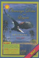
Wegenkaart - landkaart Okavango Delta - Tourist Map of the Okavango Delta and Linyanti Botswana - Veronica Roodt | Shell

0
Zeer bijzondere landkaart van de Okavango Delta en Linyanti. Uitermate handig zijn de GPS coördinaten van de meest belangrijke punten als campings of uitzichtpunten. De kaart is gebaseerd op een luchtfoto, waarbij alle details zijn ingetekend. The map: The map of the Okavango and Linyanti was compiled by using LANDSAT satellite images. The main re...

Verkopers met dit product

Verkoper
Bezorging
Prijs
DeZwerver.nl logo
DeZwerver.nl
2,95
17,50

Anderen bekeken ook

Wegenkaart - landkaart Okavango Delta - Tourist Map of the Okavango Delta and Linyanti Botswana - Veronica Roodt | Shell
Zeer bijzondere landkaart van de Okavango Delta en Linyanti. Uitermate handig zijn de GPS coördinaten van de meest belangrijke punten als campings of uitzichtpunten. De kaart is gebaseerd op een luchtfoto, waarbij alle details zijn ingetekend. The map: The map of the Okavango and Linyanti was compiled by using LANDSAT satellite images. The main reason for a tourist map of the area is to indicate the localities of the lodges as well as the wildlife management areas in which they occur. Tourists to the Okavango often visit more than one lodge and this will give them a good idea of where they have been. On the back of the map are enlargements of the different tourist areas, which shows more detail of the landscape. There are no GPS co-ordinates on the Okavango map as all the Wildlife areas consist of private concessions, which are not open to the general public. The roads in the private concessions have also not been indicated as this may mislead the self-driving public, making them thin…
17,50
Reisgids Botswana - Okavango & Victoriafälle | Iwanowski's
Een zeer uitvoerige Duitstalige reisgids: één van de beste gidsen over Botswana. Botswana ist ein Land voll unberührter Naturparadiese und ursprünglicher afrikanischer Wildnis. Das macht es zu einem besonderen Reiseziel. Der Großteil der Bewohner führt zwar in den großen Siedlungen im Osten einen eher westlichen Lebensstil, in der Kalahari leben jedoch noch einige Mitglieder des Volkes San nach traditionellen Lebensweisen. Die Ursprünglichkeit der Gesellschaft und die Unberührtheit der Natur machen Botswana zu einem interessanten Reiseziel.   Reiseführer Botswana gibt Empfehlungen und Routenvorschläge   Der Iwanowski Reiseführer Botswana gibt Ihnen einen Überblick über Land und Leute. Erfahren Sie mehr zu Geschichte, Geografie, Wirtschaft, Gesellschaft und Kultur Botswanas. Als Reiseziel wird das Land immer beliebter, nicht zuletzt auch wegen der insgesamt gut ausgebauten touristischen  Infrastruktur und dem verbesserten Straßennetz eignet es sich gut für Selbstfahrer. Im Reisef…
28,95
Wegenkaart - landkaart Moremi - Tourist Map of Moremi Game Reserve Botswana | Shell
Zeer bijzondere landkaart van Moreni Game Reserve in Botswana. Uitermate handig zijn de GPS coördinaten van de meest belangrijke punten als campings of uitzichtspunten. De kaart is gebaseerd op een luchtfoto, waarbij alle details zijn ingetekend. The map: The Moremi map is based on satellite photos. The front of the map consists of a map of the entire Reserve and on the back are six separate maps of Khwai river-front east, Khwai river-front west, an orientation map of Moremi, Xakanaxa area and the Moanachira river, Xakanaxa game-drive area and Bodumatau area. The roads were tracked by GPS and there are 162 GPS co-ordinates on the map. General: As part of the Okavango Delta, Moremi consists of permanent swamp, seasonally swamped areas and dry land. It is one of the prime tourist destinations in Botswana and offers water activities, top game-viewing, some of the best bird-life in Africa and incredible scenery. Not to be missed! Locality and size: The Moremi Game Reserve is nestled withi…
17,50
Wegenkaart - landkaart Kavango (Okavango) - Zambezi | Tracks4Africa
  Uitstekende wegenkaart van het gebied van de Okavango en Zambesi en ver daar buiten (zie uitsnede van kaart) , gemaakt door gerenommeerde kaartenmaker Track4Africa in Afrika. Met afstanden en reistijden tussen steden en op alle wegen vermeld. GPS via hun website te downloaden. De kaart wordt door vrijwel elke reisorganisatie geadviseerd als je met een eigen auto er rond gaat rijden.   Deze kaart is ontworpen op je te helpen het gebied van de Okavango en Zambesi  in volle vertrouwen te verkennen. Of je nu op asfalt-, of grindwegen, of een combinatie van de twee reist, deze kaart is zowel een navigatie-instrument, als een hulpmiddel om je trip te plannen.   Tracks4Africa, een bedrijf gevestigd in Zuid-Afrika is gekend voor zijn kaarten met GPS verwijzingen. Van Kaapstad tot Timboektoe worden deze kaarten gewaardeerd omwille van hun betrouwbaarheid. De gegevens op de kaart zijn opgetekend door een grote groep van reizigers over het land en hierdoor ontstaat er een continue update en ve…
27,50
Wegenkaart - landkaart Kgalagadi - Tourist Map of Kgalagadi Transfrontier Park Botswana | Shell
Zeer bijzondere landkaart van het grensgebied van Botswana en Zuid Afrika. Uitermate handig zijn de GPS coordinaten van de meest belangrijke punten als campings of uitzichtpunten. De kaart is gebaseerd op een luchtfoto, waarbij alle details zijn ingetekend. The map: The map consists of a large map of the entire Park on the front of the map. On the back is enlargements of six maps - the South African side, Mabuasehube, Swart Pan area, Gemsbok Wilderness Trail, Mabuasehube Wilderness Trail and of the Kaa Kalahari Concession. Satellite images were used and the roads were tracked by GPS. There are 168 GPS coordinates on this map. Establishment of a Transfrontier Park: On the 7 th of April 1999 Botswana and South Africa signed a bilateral agreement in which they agreed to manage their adjacent national parks, Gemsbok National Park in Botswana and Kalahari Gemsbok National Park in South Africa, as a single ecological unit – the Kgalagadi Transfrontier Park. It is the first formally declared…
17,50
Natuurgids - Vogelgids Wildlife of the Okavango | Struik Nature
A remarkable variety of animals and plants can be found in the wilderness region surrounding the Okavango Delta. This photographic guide covers more than 470 of the area's most conspicuous and interesting mammals, birds, reptiles, frogs, fishes, invertebrates, trees and aquatic plants   An informative introduction describes the area's geology, climate, habitats and the key roles played by some animals, such as termites and elephants. The species accounts feature concise text describing the species' appearance, size, habits, habitat and status, with full-colour photographs to facilitate identification. Contents   INTRODUCTION HOW TO USE THIS GUIDE GEOLOGY AND TOPOGRAPHY MAP OF REGION CLIMATE IDENTIFYING AND WATCHING WILDLIFE HABITAT DESCRIPTIONS Open Water Permanent Swamp Floodplain Grasslands Islands Riverine Forest Savanna and Scrub Woodland Rocky Outcrops SPECIES DESCRIPTIONS Mammals Birds Reptiles Frogs Freshwater Fishes Invertebrates Trees and Woody Shrubs Soft-stemmed Shrubs and …
20,95
Tourist map of the Ngorongoro conservation area Tanzania | Veronica Roodt
Zeer bijzondere landkaart van Ngorongoro conservation area in Tanzania. Uitermate handig zijn de GPS coördinaten van de meest belangrijke punten als campings of uitzichtspunten. De kaart is gebaseerd op een luchtfoto, waarbij alle details zijn ingetekend. The cartographic design displays the information of the Tourist Map of the Ngorongoro Conservation Area with strong accents and is based on satellite photography. The main map and the enlarged maps show grids of parallels and meridians with degree data and a choice of 180 GPS coordinates. The legend indicates boundaries, tarred and gravel main routes, secondary routs that require 4x4, walking trails including distance and time, day and long walking trails, walking trail camp sites, bomas, villages and protected areas. Also indicated are gas stations, public, NCA and special camp sites, lodges, rangers posts, airstrips, look-out points, places of interest, picnic sites and toilets, distance legs and aggregated distances. There is inf…
17,50
Wegenkaart - landkaart Botswana - Zimbabwe | ITMB
Een degelijke kaart met aanduidingen van o.a. nationale parken, vliegveld, benzinepomp, dirt-roads en kleine plattegrond van hoofdstad. Als overzichtskaart goed te gebruiken. 7th Edition 1:1,600,000/11:1,000,000 on waterproof stone paper Both Botswana and its neighbour, Zimbabwe, form a common entity and a British heritage in Central Southern Africa, but there the resemblance ends. The Bechuana formed an alliance of sorts with the Pritish to protect them from the Boers in the then-nearby Transvaal. Upon a peaceful transition to independence as Botswana, it has evolved into a democratic and peaceful country. Zimbabwe, formerly Rhodeisa, is a failed state, although potentially, Zimbabwe could dominate tourism if governmental affairs were orderly. This map focuses on Botswana simply because that country is a beacon of orderly pleasantness in the continent; well run, routistacally well developed, with good infrastructure, and close to the game preserves of both South Africa and Zimbabwe. …
13,95
Wegenkaart - landkaart Tourist Map of Kilimanjaro National Park | Veronica Roodt
Veronika Roodts Kilimanjaro-Karte, die Tourist Map of Kilimanjaro National Park, ist wie alle anderen Karten aus ihrer Ostafrika-Kartenserie, auf Satellitenaufnahmen aufgebaut und mit einem kräftigen, gut lesbaren Kartendesign versehen. Hier finden sich Höhenlinien, Kartengitter mit Gradangaben, die die Ablesung eigener GPS-Daten ermöglicht.   Die Karte hat ihren Schwerpunkt natürlich auf dem Bergsteigen und alles für die Besteigung des Map of Kilimanjaro wichtige ist auf der Legende indiziert, zum Beispiel die Schutzhütten und das Wegesystem. Mit der Karte wird reichlich geschriebene Information geliefert. Dies betrifft natur-, landeskundliche und historische Fragen und Themen der Kilimanjaro-Besteigung wie Vorbereitung, Verpflegung, Fitness, Gesundheit und Vorsichtsmaßnahmen.   Zur Sache geht es bei der Vorstellung der acht ausgewiesenen Besteigungsrouten für den Kilimanjaro: hier erfahren Sie die wesentlichen Unterschiede und Besonderheiten hinsichtlich der Aufstiegsdauer und des A…
10,-
Reisgids Botswana Safari Guide | Bradt Travel Guides
Er bestaat geen uitgebreide Lonely Planet van Botswana. Voor Afrikaanse landen net zo goed, zo niet beter dan de Planet. Beduidend soberder uitgevoerd, maar ook met veel informatie voor backpackers en met veel kaartmateriaal. Een aanrader! This new, thoroughly updated sixth edition of Bradt's Botswana Safari Guide remains the only full-blown, standalone guide to one of Africa's most popular and rewarding safari destinations. This is the sole guide to focus on Botswana's key safari locations: the Okavango Delta, Chobe National Park and the Northern Kalahari. Botswana's wilderness is pristine, a virtue underpinned by governmental commitment to sustainable tourism.   The Okavango Delta's permanent waters attract year-round wildlife, including all the 'big five'. Outside the Delta, this English-speaking country offers tremendous variety in landscapes, from the arid Kalahari to lush forests. Riverine areas harbour spectacular herds of elephants and buffalo, as well as mighty predator po…
27,95

Klanten-reviews van Wegenkaart - landkaart Okavango Delta - Tourist Map of the Okavango Delta and Linyanti Botswana - Veronica Roodt | Shell

Er zijn nog geen beoordelingen voor dit productBen jij de eerste die een review plaatst?

Meer over Wegenkaart - landkaart Okavango Delta - Tourist Map of the Okavango Delta and Linyanti Botswana - Veronica Roodt | Shell

Productomschrijving

Zeer bijzondere landkaart van de Okavango Delta en Linyanti. Uitermate handig zijn de GPS coördinaten van de meest belangrijke punten als campings of uitzichtpunten. De kaart is gebaseerd op een luchtfoto, waarbij alle details zijn ingetekend.

The map: The map of the Okavango and Linyanti was compiled by using LANDSAT satellite images. The main reason for a tourist map of the area is to indicate the localities of the lodges as well as the wildlife management areas in which they occur. Tourists to the Okavango often visit more than one lodge and this will give them a good idea of where they have been. On the back of the map are enlargements of the different tourist areas, which shows more detail of the landscape. There are no GPS co-ordinates on the Okavango map as all the Wildlife areas consist of private concessions, which are not open to the general public. The roads in the private concessions have also not been indicated as this may mislead the self-driving public, making them think that they are public roads. All the localities of lodges were done by means of GPS references.

General: The Okavango Delta is a unique ecosystem situated in the middle of the largest stretch of continuous sand in the world – the Kalahari basin. This wetland lies like an oasis in an otherwise inhospitable landscape. The vegetation is lush, but very fragile and the wildlife is of the best to be seen in Africa. The Linyanti area lies to the north-east of the Okavango and forms part of the same ecosystem.

How to get there: Most visitors fly to Maun or to Kasane and fly to their various destinations. The only areas open to the self-driving public is the western pan-handle, the eastern pan-handle, the Moremi Game Reserve and the public road to Savute from Maun.

Where to stay: All the lodges are indicated on the map and their contact details are provided in detail in the directory of the Botswana Travel Guidebook which is discussed elsewhere on this site.

Productinformatie

    Verken gerelateerde categorieën

    Webshop.nl maakt gebruik van cookies. Ga je verder op onze website, ga dan akkoord met het plaatsen van cookies en de verwerking van deze data door ons en vermelde partners.