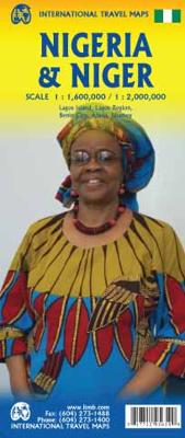
Wegenkaart - landkaart Niger - Nigeria | ITMB

0
Een degelijke kaart met aanduidingen van o.a. nationale parken, vliegveld, benzinepomp, dirt-roads en kleine plattegrond van hoofdstad. Als overzichtskaart goed te gebruiken. Op de ene zijde Niger en op de andere kant Nigeria....

Verkopers met dit product

Verkoper
Bezorging
Prijs
DeZwerver.nl logo
DeZwerver.nl
2,95
13,95

Anderen bekeken ook

Wegenkaart - landkaart Togo en Benin | ITMB
Een degelijke kaart met aanduidingen van o.a. nationale parken, vliegveld, benzinepomp, dirt-roads en kleine plattegrond van hoofdstad. Als overzichtskaart goed te gebruiken. Togo and Benin. These two countries have developed an incredible tourism industry and are very popular with visitors. They are larger than one expects; small in comparison to neighbouring Nigeria, but large as countries go. This map is brand new artwork at a much more attractive scale than the previous version; printed double-sided with much more information than was available to us when the original map was being developed. We’ve also added a few capsule comments about interesting facts related to the two countries, and large inset maps of Lome and Porto Novo. The map is divided into a north half and south half, as most attractions are in the south. As with all ITM maps, this one shows physical features, road conditions, and petrol stations in more isolated parts of both countries. Legend Includes: Roads by clas…
13,95
Wegenkaart - landkaart Saint Lucia & Martinique | ITMB
Een degelijke kaart van Saint Lucia, schaal 1:45.000, en Martinique, schaal 1:65.000, met aanduidingen van o.a. nationale parken, vliegveld, benzinepomp, dirt-roads en kleine plattegrond van hoofdstad. Als overzichtskaart goed te gebruiken. Legend Includes: Roads by classification, Highways , Main Roads, Minor Roads, Dirt Roads, Hiking Trails, Larger Urban Areas, Smaller Urban Areas, Parks, UNESCO World Heritage Sites, Diving / Scuba Locations or Dive-shops, Points of Interest / Churches, Hotels / Accommodations, Gas / Petrol Stations, Marinas / Sea Ports / Watersports, Coral Reefs, Camping / Hot Springs / Caves, Park Areas, Industrial / Parking, Institutional Areas, Attractions / Shopping, Cruise Ship Terminals / Shopping / Restaurants, Police Stations / Post Offices / Churches, Hospitals / Embassies / Schools, Regional Boundaries and more.
13,95
Wegenkaart - landkaart Mali | ITMB
Een degelijke kaart met aanduidingen van o.a. nationale parken, vliegveld, benzinepomp, dirt-roads en kleine plattegrond van hoofdstad. Als overzichtskaart goed te gebruiken.   Folded road and travel map in color. Scale 1:2,400,000. Distinguishes roads ranging from primary paved roads to other roads or tracks. Legend includes international airport/national airports, air fields, gasoline/petrol stations, post office, hospital/medical facilities, hotels, motels/lodging, resthouse or hostel, campsites or huts, museums, border crossings, no border crossings, points of interest, crafts/pottery, archaelogical sites, historic ruins or sites, mines, bus station, forts, mosques, churches/missions, oasis, caves, fishing ports, beaches, hiking/trekking. Includes inset map of Bamako and Timbuktu, road distance chart and extensive index.
13,95
Wegenkaart - landkaart Queensland | ITMB
Een degelijke wegenkaart van Queensland met aanduidingen van o.a. nationale parken, vliegveld, benzinepomp, dirt-roads en kleine plattegrond van hoofdstad. Als overzichtskaart goed te gebruiken. We complete our series of regional maps covering Australia with this map of Queensland, which nicely fills a double-sided sheet with only small portions of adjoining states showing. The map also includes a large inset map of central Brisbane. At this scale, the road/rail network of this part of Australia becomes very clear. The first side concentrates on the northern portion of the state, and the other side, the more densely-developed southern half. The map includes a listing of the state’s top attractions, and notes al major touristic attractions. Although gas/petrol stations are commonly found, we have included some gas symbols in remoter parts of Queensland to encourage drivers to venture into roads less travelled. All states and territories of Australia are now available from ITMB as separ…
13,95
Wegenkaart - landkaart Bolivia | ITMB
Een degelijke kaart met aanduidingen van o.a. nationale parken, vliegveld, benzinepomp, dirt-roads en kleine plattegrond van hoofdstad. Als overzichtskaart goed te gebruiken. This map is prepared to the publishers usual high standard with elevation shading and tourist information included with road and rail information. Place name index and inset maps of central La Paz; central Santa Cruz and Potosi. Legend includes: All highways, roads & trails, railways, parks, elevation info, points of interest, archaeological sites, campgrounds, spas, waterfalls, glaciers, salt lakes, lava fields.   This Travel Map of Bolivia is double sided, splitting the country into north and south halves, and uses color shading to illustrate the elevation differences. An impressive Travel Map of Bolivia considering the large number of villages that aren't on any roads, just connected by trails!
13,95
Wegenkaart - landkaart Guatemala | ITMB
Een degelijke kaart met aanduidingen van o.a. nationale parken, vliegveld, benzinepomp, dirt-roads en kleine plattegrond van hoofdstad. Als overzichtskaart goed te gebruiken. Guatemala has emerged as a major touristic destination, and this detailed map shows touristic sites, historic towns, and remote roads to good advantage. Insets of Guatemala City and of Antigua are included; printed double-sided on durable ITM plastic paper. Roads by classification, parks, points of interest, airports, archaeological sites, waterfalls, lighthouses, gas stations, border crossing points, and other information
13,95
Wegenkaart - landkaart China | ITMB
Een degelijke kaart met aanduidingen van o.a. nationale parken, vliegveld, benzinepomp, dirt-roads en kleine plattegrond van hoofdstad. Als overzichtskaart goed te gebruiken. Tweezijdig, op de ene kant West China en op de andere zijde Oost China. This edition is printed on waterproof, tear-resistant paper, and has a new cover picture showing a portion of the Great Wall. A cursory glance at the map will show an incredible number of motorways. We still show some as being under construction, but updating the road network is now essentially completed. The amazing rapid rail network is now also essentially complete and all such train lines are noted on the map in a red-dashed format. Inset maps of Beijing and Shanghai are shown on side 2, as well as a list of Top Attractions. We continue to show contentious political disputed territories based on practical administrative control, so India's northeast is shown as being under India's control, whereas parts of the northwest are shown under Ch…
13,95
Wegenkaart - landkaart Philippines - Filipijnen | ITMB
Een degelijke kaart met aanduidingen van o.a. nationale parken, vliegveld, benzinepomp, dirt-roads en kleine plattegrond van hoofdstad. Als overzichtskaart goed te gebruiken. Inclusief plattegrond van Manilla 1:12000 This is an excellent map of the Philippines; newly updated. There are improvements on road classification a re-working of the Manila inset. double-sided. Legend Includes: Roads by classification, Point of Interest, National Park, Museum, Church, Cave, Beach, Dive Site, Golf Course, Airports and more.
13,95
Wegenkaart - landkaart Namibia - Namibië | ITMB
Een degelijke kaart met aanduidingen van o.a. nationale parken, vliegveld, benzinepomp, dirt-roads en kleine plattegrond van hoofdstad. Als overzichtskaart goed te gebruiken. The former German colony and mandated territory of South-west Africa has emerged as a major touristic destination. Following our recent research trip to the country, we have made numerous changes to the map – upgrading roads that have been paved, changing our Caprivi Strip information, and re-doing our inset map of Windhoek. Printed on paper, single-sided; Folded road and travel map. Scale 1:1,600,000. Distinguishes roads ranging from highways to tracks (seasonal). Legend includes points of interest, internet cafes, restricted access roads, railroads, international/domestic airports, aerodromes, lodging, rest houses, guest farms, campsites, ruins historic/archaeological), museums, vistas, hot springs, caves, forts, shipwrecks, gas stations, medical facilities, missions, national parks/reserves, salt pans, restric…
13,95
Wegenkaart - landkaart Cuba | ITMB
Een degelijke wegenkaart van Cuba met aanduidingen van o.a. nationale parken, vliegveld, benzinepomp, dirt-roads en kleine plattegrond van hoofdstad. Als overzichtskaart goed te gebruiken. Cuba is the hidden agenda in this year's US election. Thus far, no candidate is making extreme statements about it. This is good, because with the withdrawal of Fidel from active politics, the government is starting to open its doors and effect some real changes. As a tourist destination, Cuba is without doubt the Number One attraction in the Caribbean. With easy access from Toronto, Mexico City, and the Bahamas, Cuba is within reach by everyone - even American running-dog imperialist war-mongers are welcomed. Hey, it's Cuba, man; everyone parties! Printed on ITM plastic paper, double-sided. Legend Includes: Roads by classification, international and domestic airports, mines, rivers, parks, points of interests, beaches, viewpoints, caves, dams, ports, hotels, gas stations, lighthouses, and other inf…
13,95

Klanten-reviews van Wegenkaart - landkaart Niger - Nigeria | ITMB

Er zijn nog geen beoordelingen voor dit productBen jij de eerste die een review plaatst?

Meer over Wegenkaart - landkaart Niger - Nigeria | ITMB

Productomschrijving

Een degelijke kaart met aanduidingen van o.a. nationale parken, vliegveld, benzinepomp, dirt-roads en kleine plattegrond van hoofdstad. Als overzichtskaart goed te gebruiken. Op de ene zijde Niger en op de andere kant Nigeria.

Verken gerelateerde categorieën

Webshop.nl maakt gebruik van cookies. Ga je verder op onze website, ga dan akkoord met het plaatsen van cookies en de verwerking van deze data door ons en vermelde partners.