webshop.nl
Categorieën
  Sluiten

Meer Tracks4Africa

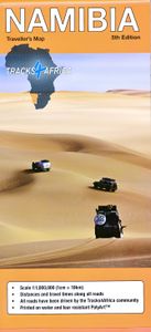
Wegenkaart - landkaart Namibia - Namibië | Tracks4Africa

0
Uitstekende dubbelzijdige wegenkaart van Namibië, gemaakt door gerenommeerde kaartenmaker Track4Africa in Afrika. Met afstanden en reistijden tussen steden en op alle wegen vermeld. GPS via hun website te downloaden. De kaart wordt door vrijwel elke reisorganisatie geadviseerd als je met een eigen auto in Namibië rond gaat rijden. The Tracks4Africa...

Webshops met dit product

Webshop
Bezorging
Prijs

Anderen bekeken ook

Wegenkaart - landkaart Namibia - Namibië | Tracks4Africa
Uitstekende dubbelzijdige wegenkaart van Namibië, gemaakt door gerenommeerde kaartenmaker Track4Africa in Afrika. Met afstanden en reistijden tussen steden en op alle wegen vermeld. GPS via hun website te downloaden. De kaart wordt door vrijwel elke reisorganisatie geadviseerd als je met een eigen auto in Namibië rond gaat rijden. The Tracks4Africa Namibia paper map is designed to be used in conjunction with the T4A GPS Map of Namibia. It is the largest available Namibia map at 1:1,000,000 scale, offering you the perfect trip planning tool for your next Namibian holiday.  This T4A paper map series are probably the first comprehensive country maps in the world, offering travel time information for the entire road network, be it on tar, gravel or sand!    Key features:    Large 1:1,000,000 scale  Travel times and distances included on the map  What you see on the paper map is exactly what you get on T4A GPS Maps  Comprehensive set of roads and tracks in nature reserves  Detailed inf…
27,50
Wegenkaart - landkaart Botswana | Tracks4Africa
Uitstekende wegenkaart van Botswana, gemaakt door gerenommeerde kaartenmaker Tracks4Africa in Afrika. Met afstanden en reistijden tussen steden en op alle wegen vermeld. GPS via hun website te downloaden.  The Tracks4Africa Botswana paper map, now in its 4th edition, is designed to be used in conjunction with the T4A GPS Map of Botswana. It is the largest available Botswana map at 1:1,000,000 scale, offering you the perfect trip planning tool for your next Botswana holiday. This T4A paper map series are probably the first comprehensive country maps in the world, offering travel time information for the entire road network, be it on tar, gravel or sand!   Key features: Printed on tear proof and water resistant Polyart Scale 1:1,000,000 (1cm = 10km) All roads have been driven by the Tracks4Africa Community Map key included Map index included Detailed vector maps of the Okavango Delta, Mabuasehube, Savuti, Gaborone, Maun, Kasane, Khwai East and West  Travel information like border …
27,50
Wegenkaart - landkaart Mozambique and Malawi | Tracks4Africa
Uitstekende wegenkaart van Mozambique en Malawi, gemaakt door gerenommeerde kaartenmaker Tracks4Africa in Afrika. Met afstanden en reistijden tussen steden en op alle wegen vermeld. GPS via hun website te downloaden.  The integrated Tracks4Africa Mozambique and Malawi map is designed to be used in conjunction with the T4A GPS Map of Mozambique and Malawi. It is the largest available map at 1:1,000,000 scale, offering you the perfect trip planning tool for your next trip through Mozambique and Malawi. This T4A paper map series are probably the first comprehensive country maps in the world, offering travel time information for the entire road network, be it on tar, gravel or sand! The roads, tracks, places of interest as well as the distance data and travel time estimates on the map reflect the collective travel experience of the Tracks4Africa community of travellers over the past 10 years, with every single road being GPS recorded and verified by this community. No need to transfer GPS …
27,50
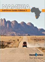
Accommodatiegids Namibia Self-Drive Guide | Tracks4Africa
So, what is so special about the Tracks4Africa guide books? These are not guides written by armchair travellers or the personal experience of one person, but the combined experiences of a whole community of travellers. The T4A community travel far and wide – not by luxury bus or safari vehicle but on their own wheels. Sometimes they travel in groups and sometimes as lone rangers, but they always travel by motorbike, sedan or 4WD, therefore this guide is specifically aimed at self-drive travellers.   If you are a self-drive tourist, there are five things that you need to know when you are on the road: 1. Where to sleep. 2. Where to get fuel. 3. What to see and do. 4. Where to buy supplies. 5. Where to go in case of an emergency.   If you have the Tracks4Africa Self-Drive Guide as your travel companion, the answers to all these and many more questions will be at hand. If you are well prepared and well informed, you can really enjoy the unspoilt beauty of Africa! The Tracks4Afric…
52,50
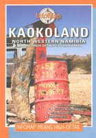
Wegenkaart - landkaart Kaokoland and northern Damaraland - Namibië | I
Goede betrouwbare kaart van het noordwesten van Namibië: Damaraland en Kaokoland. Met GPS coordinaten. Engels Colour folding Map, 52x73 cm, scale 1:620.000. The first scale road map of this area to be produced with GPS co-ordinates. 100 GPS Co-ordinates of major intersections, refuelling points and accommodation information. Map range 11°45’ to 15°00’ East and 17° to 20°00’ South. Detailed road map Kaokoland / Kaokoveld (Namibia) includes GPS co-ordinates of major intersections, refuelling points and accomodation information.   This map covers North-Western Namibia on the one side and BUSHMANLAND and CAPRIVI in North-Eastern Namibia on the reverse side. This map is very much recommended for travelers to these regions as an addition to our bigger scaled Namibia map. Here you get a nice amplified look at the regions with loads of GPS coordinates, accommodation and petrol points. Furthermore we included extensive route and travel ideas and general information on Kaokoland. Sold in a plast…
15,95
Reisgids Botswana & Namibia - Namibië | Lonely Planet
De perfecte reisgids voor zowel de georganiseerde als de zelfstandige reiziger. Naast een algemene inleiding van het land / streek vol met praktische informatie over hoe je er het beste kunt reizen: slapen, eten, vervoer, excursies ... alles kun je er in vinden. Engelstalig. Lonely Planet Lonely Planet's Botswana and Namibia is our most comprehensive guide that extensively covers all the region has to offer, with recommendations for both popular and lesser-known experiences. Spot jackals in Etosha National Park, explore the German colonial town of Luederitz; or marvel at mighty Victoria Falls; all with your trusted travel companion. Inside Lonely Planet's Botswana and Namibia Travel Guide: Lonely Planet's Top Picks - a visually inspiring collection of the destination's best experiences and where to have themItineraries help you build the ultimate trip based on your personal needs and interestsLocal insights give you a richer, more rewarding travel experience - whether it's history, p…
23,95
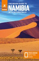
Reisgids Namibia - Namibië | Rough Guides
Zeer goede reisgids voor zowel de georganiseerde maar vooral voor de zelfstandige reiziger. Boordevol informatie over reizen, slapen, eten, maar ook musea en cultuur. Voor  de meeste  landen meestal completer en beter dan de Lonely Planet ! This Namibia with Victoria Falls guidebook is perfect for independent travellers planning a longer trip. It features all of the must-see sights and a wide range of off-the-beaten-track places. It also provides detailed practical information on preparing for a trip and what to do on the ground. And this Namibia with Victoria Falls travel guidebook is printed on paper from responsible sources, and verified to meet the FSC's strict environmental and social standards.   This Namibia with Victoria Falls guidebook covers: Windhoek and around, The southwest, The southern Kalahari and the far south, Central-northern Namibia, Central coast, Etosha and the far north, The northeast, Victoria Falls.   Inside this Namibia with Victoria Falls travel book, you'll …
23,95

Klanten-reviews van Wegenkaart - landkaart Namibia - Namibië | Tracks4Africa

Er zijn nog geen beoordelingen voor dit productBen jij de eerste die een review plaatst?

Meer over Wegenkaart - landkaart Namibia - Namibië | Tracks4Africa

Productomschrijving

Uitstekende dubbelzijdige wegenkaart van Namibië, gemaakt door gerenommeerde kaartenmaker Track4Africa in Afrika. Met afstanden en reistijden tussen steden en op alle wegen vermeld. GPS via hun website te downloaden. De kaart wordt door vrijwel elke reisorganisatie geadviseerd als je met een eigen auto in Namibië rond gaat rijden. The Tracks4Africa Namibia paper map is designed to be used in conjunction with the T4A GPS Map of Namibia. It is the largest available Namibia map at 1:1,000,000 scale, offering you the perfect trip planning tool for your next Namibian holiday.  This T4A paper map series are probably the first comprehensive country maps in the world, offering travel time information for the entire road network, be it on tar, gravel or sand!    Key features:    Large 1:1,000,000 scale  Travel times and distances included on the map  What you see on the paper map is exactly what you get on T4A GPS Maps  Comprehensive set of roads and tracks in nature reserves  Detailed information on camp sites and attractions  Border crossings indicated with opening and closing times  Visit www.tracks4africa.com for detail on places of interest  Kaokoland in great detail with all off road tracks shown  Detailed maps for Swakopmund and Windhoek  Each town is shown with up to date tourist services information  Shaded relief to accentuate mountains and other topographical features    The roads, tracks, places of interest as well as the distance data and travel time estimates on the map reflect the collective travel experience of the Tracks4Africa community of travellers over the past 10 years, with every single road being GPS recorded and verified by this community.    No need to transfer GPS coordinates from the map to your GPS as everything you see on the map is contained in our T4A GPS Maps. Our maps offer the most comprehensive coverage of tourist destinations in Namibia. Use T4A GPS Maps to navigate you to all the destinations you see on this country map.   Afmetingen uitgevouwen 126 x 100 cm

Productspecificaties

Artikelnummer(s)
Brand
Tracks4Africa
Webshop.nl maakt gebruik van cookies. Ga je verder op onze website, ga dan akkoord met het plaatsen van cookies en de verwerking van deze data door ons en vermelde partners.