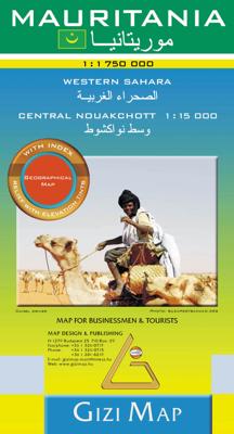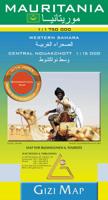
Wegenkaart - landkaart Mauritania - Mauritanië en Westelijke Sahara | Gizi Map

0
Tweetalig Mauritania and Western Sahara with excellent topographic information on an indexed map with a street plan of central Nouakchot. Vivid altitude colouring with graphics for deserts, flood plains and salt flats shows the terrain. Oases, water wells and numerous spot heights are marked and the map provides plenty of names of geographical fea...

Verkopers met dit product

Verkoper
Bezorging
Prijs
DeZwerver.nl logo
DeZwerver.nl
2,95
17,95

Anderen bekeken ook

Wegenkaart - landkaart Mauritania - Mauritanië en Westelijke Sahara | Gizi Map
Tweetalig Mauritania and Western Sahara with excellent topographic information on an indexed map with a street plan of central Nouakchot. Vivid altitude colouring with graphics for deserts, flood plains and salt flats shows the terrain. Oases, water wells and numerous spot heights are marked and the map provides plenty of names of geographical features: peaks, mountain chains and rock outcrops, plains, etc.    Road network shows distances on main roads and includes dirt tracks. The map also shows locations of local airfields and the route of the iron ore railway line from the mines at Zouérat to the coast. Symbols highlight various places of tourist interest including world heritage sites, forts and archaeological remains, national parks and protected areas, beaches, etc.   Names of main towns and important geographical features are also given in Arabic. Internal administrative boundaries are shown with names of the provinces. The map had latitude and longitude lines at intervals of 1…
17,95
Wegenkaart - landkaart Mauritania & Mali | ITMB
Een degelijke kaart met aanduidingen van o.a. nationale parken, vliegveld, benzinepomp, dirt-roads en kleine plattegrond van hoofdstad. Als overzichtskaart goed te gebruiken. Mali 1:1.900.000 Mauretanië 1:2.200.000 In this edition, we have combined Mauritania with Mali. Although both are interesting countries, the two fit naturally together as a unit, albeit at slightly differing scales. Technically, this should be a 1st edition map, as it is the first time we have combined these two desert countries on to one sheet, but I ll let Robert at the Library of Congress worry about the niceties of bibliographic accuracy as soon as Trump allows him to do the work he loves for a salary. Mauritania was one of the most unusual countries I visited as a young traveller. Of course, I had an advantage, in that I was too young to know that what I was doing was supposed to be impossible. I entered from what was then the Spanish Sahara via a piste (a sandy track with multiple pathways, only some of whi…
13,95
Wegenkaart - landkaart 3327 Adventure Map Western Balkans - Westelijke Balkan | National Geographic
Wegenkaart van de Westelijke Balkan met vermelding van veel bezienswaardigheden en attrakties. Watervast en scheurvast. Juist door deze vermeldingen onderscheidt de kaart zich van andere wegenkaarten. Landen: Slovenië, Kroatië, Bosnië Herzegovina, Montenegro, Albanië, Servië,  Kosovo, and Macedonië.   The Western Balkans region, an adventure playground and rising star of Europe, is loaded with Old World traditions, slow food culture, ancient towns, and rarely visited villages. The area stretches from the Adriatic Sea in the west, up and over mountain ranges, raging rivers, tectonic lakes, steep gorges, and thousands of miles of paths, trails, and routes. Discover eight countries—all with their special brand of Balkan magic: Slovenia, Croatia, Bosnia and Herzegovina, Montenegro, Albania, Serbia, Kosovo, and Macedonia.   National Geographic's Western Balkans Adventure Map will meet the needs of travelers with its detailed and accurate information. The map includes the locations of UNESC…
17,50
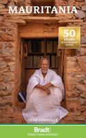
Reisgids Mauritania | Bradt Travel Guides
Brand new from Bradt, and written by Africa expert Sean Connolly, is the first English-language guide dedicated to Mauritania, one of an ever more exclusive list of countries where the Sahara Desert can be securely and freely explored. Straddling the west coast of Africa for 700km between Western Sahara and Senegal, Mauritania occupies the threshold between North and sub-Saharan Africa, but remains a world apart from either – neither Moroccan nor Senegalese, but with strong influences from both.  The country is now on a well-travelled route for overlanders heading south from Europe to start African trips. But most burn through to the southern border, rather than sticking around. Those who do stay may marvel at stone-built oasis towns tucked into dune fields the size of small countries, admire wild geological oddities like the Richat Structure (reputedly home to the lost city of Atlantis), explore a nearly uninhabited, wind-battered coast where you can sail between end-of-the-earth fis…
30,95
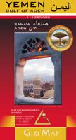
Wegenkaart - landkaart Yemen - Jemen | Gizi Map
Yemen, including the Gulf of Aden, at 1:1,250,000 on an excellent and informative map from Gizi Maps, with a street plan of central Sana’a and enlargements of the environs of the capital and Aden, plus the Aden Peninsula.   The map has the publisher’s characteristic bold altitude colouring and plenty of names of various mountain chains, peaks, deserts, etc. Graphics indicate swamps, salt flats, wadis, deserts, lava flows, water wells, oasis, etc, to provide a vivid picture of the country’s topography. Names of the larger towns, provinces and many geographical features are given in both Latin and Arabic alphabets; all other place names are shown only transliterated.   Coverage extends southward to the northern coastline of the Horn of Africa, including the whole of Djibouti and most of Eritrea. Within the Gulf of Aden the Internationally Recommended Transit Corridor (IRTC) is marked, as well as other ferry and shipping routes including those leading to the Socotra Archipelago and in th…
17,95
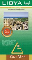
Wegenkaart - landkaart Lybië - Libya | Gizi Map
Libya at 1:1,750,000 on an indexed road map from Gizi Map with exceptionally fine and detailed presentation of its physical geography, oil and gas wells and pipelines, water aqueducts, ancients sites and other places of interest, etc. Names of larger towns and selected smaller locations, as well as of many topographic features are also shown in Arabic.   The map provides a very fine presentation of the country’s geography through relief shading and graphics for sandy or stone deserts, swamps, salt flats, oasis, and water wells, plus numerous spot heights and plenty of names of mountain ranges, wadis, etc. Road network shows desert tracks and gives distances on main routes. Railway lines are included and domestic airports/aerodromes are marked. The map also shows oil or gas wells and pipelines, water aqueducts and boundaries of administrative provinces. Symbols indicate locations with campsites or youth hostels, various places of interest including archaeological sites and natural curi…
17,95
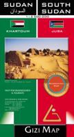
Wegenkaart - landkaart Sudan and South Sudan | Gizi Map
Sudan and South Sudan as separate countries on an excellent indexed map at 1:2,500,000 from Gizi Maps with detailed presentation of the topography, administrative divisions, street plans of Khartoum and Juba, etc. Excellent presentation of the terrain in the publisher’s characteristic style provides a vivid picture of the region’s geography: bold altitude colouring with plenty of spot heights and names of peaks, mountain ranges, etc, plus additional graphics for flood plains, swamps, salt flats, deserts, lava fields, wadis and water wells. National parks or other protected areas and interesting natural sites are highlighted. The map indicates the boundary of the disputed Abyei area and shows the internal administrative boundaries and names of the provinces. Within North Sudan names of larger towns and of the provinces are also given in Arabic. Where appropriate, alternative versions of town names are provided (Khartoum/Al Khartum, Omdurman/Umm Durman, etc). The map shows the road n…
17,95
Wegenkaart - landkaart Kosovo & Westelijke Balkan | ITMB
Kosovo is the country that shouldn’t exist, but does. When Yugoslavia fells to pieces after Tito died, Kosovo was lumped in with Serbia but was very unhappy with being a part of an Eastern Orthodox regime. It broke away, resulting in genocidal fighting until the Americans stepped in and stopped the fighting. The region was then placed under a European Union control in the faint hope that it would merge with Albania, or Montenegro, but it didn’t. Relations with Serbia are still quite strained, but Kosovo is still surviving as a mountainous Balkan state. Fought over for centuries by Turks and Serbs, Kosovo is emerging as a small but touristic European country. This is definitely an off-the-beaten-path travel destination! The second side of the sheet provides an excellent regional coverage for the Western Balkans, essentially Slovenia, Croatia, Montenegro, Serbia, and reasonably large tracks of land for Hungary, Albania, and North Macedonia, showing the growing number of wilderness parks…
13,95
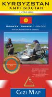
Wegenkaart - landkaart Kyrgyzstan - Kirgizië | Gizi Map
Met name door het kleurgebruik een mooie kaart: heel duidelijk wordt het landschap weergegeven. Daarnaast veel topografische details.   Kyrgyzstan at 1:750,000 from Gizi Map with excellent presentation of the country’s mountainous terrain through bold altitude colouring and plenty of names of mountain ranges, etc, road network indicating routes of the old Silk Road, plus a street plan of Bishkek and an administrative map of the country. All place names are in the Latin alphabet.   Topography is vividly shown by bold elevation colouring, with spot heights and graphics for swamps, salt flats and deserts, plus plenty of names of mountain ranges, peaks, valleys, etc. National parks are highlighted. The map shows internal provincial boundaries and also clearly indicates the country’s Uzbek and Tadjik enclaves. Road network includes selected local tracks and highlights routes which used to the part of the old Silk Road. Railway lines are included and local airports are marked. Symbols indic…
17,95
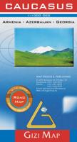
Wegenkaart - landkaart Kaukasus - Caucasus | Gizi Map
  The Caucasus at 1:1,000,000 from Gizi Map, presenting the region in a road edition with relief shading to show its topography and make the road network stand out better against the background. Coverage includes the southern republics of Russia. International boundaries are clearly marked.    Within Georgia the map indicates the boundaries of South Ossetia, Abkhazia and Adjara; in Azerbaijan the border of Nagorno Karabach and the ceasefire line are marked. Coverage within Russia extends north of Krasnodar and Stavropol, with boundaries of individual republics including Chechnya, North Ossetia and Dagestan. Place names are shown in Latin alphabet, but within Georgia, Armenia and Russia larger towns are also named in local script.   Relief shading with plenty of names of geographical features such as individual mountain ranges, peaks, swamps, salt flats, etc, presents the topography. Road network is graded in six types, with driving distances on main and selected connecting routes. Rai…
17,95

Klanten-reviews van Wegenkaart - landkaart Mauritania - Mauritanië en Westelijke Sahara | Gizi Map

Er zijn nog geen beoordelingen voor dit productBen jij de eerste die een review plaatst?

Meer over Wegenkaart - landkaart Mauritania - Mauritanië en Westelijke Sahara | Gizi Map

Productomschrijving

Tweetalig

Mauritania and Western Sahara with excellent topographic information on an indexed map with a street plan of central Nouakchot. Vivid altitude colouring with graphics for deserts, flood plains and salt flats shows the terrain. Oases, water wells and numerous spot heights are marked and the map provides plenty of names of geographical features: peaks, mountain chains and rock outcrops, plains, etc.    Road network shows distances on main roads and includes dirt tracks. The map also shows locations of local airfields and the route of the iron ore railway line from the mines at Zouérat to the coast. Symbols highlight various places of tourist interest including world heritage sites, forts and archaeological remains, national parks and protected areas, beaches, etc.   Names of main towns and important geographical features are also given in Arabic. Internal administrative boundaries are shown with names of the provinces. The map had latitude and longitude lines at intervals of 1º. Map legend includes English. The index lists separately locations in Mauritania, Western Sahara, plus the adjoining regions of Mali and Senegal. Also included is a plan of central Nouakchott indicating main public buildings, hotels and various facilities.  

Productinformatie

    Verken gerelateerde categorieën

    Webshop.nl maakt gebruik van cookies. Ga je verder op onze website, ga dan akkoord met het plaatsen van cookies en de verwerking van deze data door ons en vermelde partners.