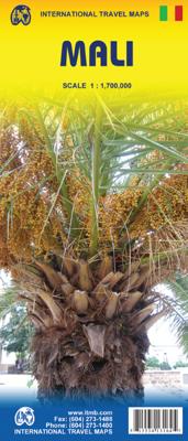
Wegenkaart - landkaart Mali | ITMB

0
Een degelijke kaart met aanduidingen van o.a. nationale parken, vliegveld, benzinepomp, dirt-roads en kleine plattegrond van hoofdstad. Als overzichtskaart goed te gebruiken.   Folded road and travel map in color. Scale 1:2,400,000. Distinguishes roads ranging from primary paved roads to other roads or tracks. Legend includes international airport...

Verkopers met dit product

Verkoper
Bezorging
Prijs
DeZwerver.nl logo
DeZwerver.nl
2,95
13,95

Anderen bekeken ook

Wegenkaart - landkaart Mali | ITMB
Een degelijke kaart met aanduidingen van o.a. nationale parken, vliegveld, benzinepomp, dirt-roads en kleine plattegrond van hoofdstad. Als overzichtskaart goed te gebruiken.   Folded road and travel map in color. Scale 1:2,400,000. Distinguishes roads ranging from primary paved roads to other roads or tracks. Legend includes international airport/national airports, air fields, gasoline/petrol stations, post office, hospital/medical facilities, hotels, motels/lodging, resthouse or hostel, campsites or huts, museums, border crossings, no border crossings, points of interest, crafts/pottery, archaelogical sites, historic ruins or sites, mines, bus station, forts, mosques, churches/missions, oasis, caves, fishing ports, beaches, hiking/trekking. Includes inset map of Bamako and Timbuktu, road distance chart and extensive index.
13,95
Wegenkaart - landkaart Kenia - Kenya | ITMB
Een degelijke kaart met aanduidingen van o.a. nationale parken, vliegveld, benzinepomp, dirt-roads . Als overzichtskaart prima te gebruiken. Gedrukt op waterproof papier! Folded paper (waterproof), road and travel map in color. Scale 1:920,000. Distinguishes roads ranging from freeways/expressways to other roads (unpaved). Legend includes tracks, railroads, ferry routes, waterfalls, wildlife reserves/game sanctuaries, sites of natural interest, parks or reserves, international airports, national airports, airfields, gas stations, hospitals/medical facilities, campsites/huts, rest houses, hotels, border crossings, UNESCO World Cultural Heritage Sites, UNESCO World Natural Heritage Sites, park gates, beaches, poits of interest, archaeological sites, museums, train/bus stations. Elevation in feet. About the Author
13,95
Wegenkaart - landkaart Bulgaria - Bulgarije | ITMB
Een degelijke kaart met aanduidingen van o.a. nationale parken, vliegveld, benzinepomp, dirt-roads en kleine plattegrond van hoofdstad. Als overzichtskaart goed te gebruiken.  Very detailed, double sided road and travel map, scale 1:390,000, includes inset map of Sofia and extensive place name index. Distinguishes roads ranging from motorways to local roads. Legend includes tracks/paths, railways, border crossings, national parks, mountain huts, castles/fortresses, monasteries, churches, archaeological sites, other points of interest, camp sites, beaches, caves, international/domestic airports.
13,95
Wegenkaart - landkaart Belize & Guatemala East | ITMB
Een degelijke kaart met aanduidingen van o.a. nationale parken, vliegveld, benzinepomp, dirt-roads en kleine plattegrond van hoofdstad. Als overzichtskaart goed te gebruiken. Met oost Guatemala waaronder Tikal. A folded travel and road map in color showing elevations. Indexed with town, camps, and villages. Scale 1:250,000. Legend is in English and Spanish. The map distinguishes paved and unpaved roads, seasonal roads, and tracks. Icons locate international airport, domestic airports with scheduled service, airstrips/ landing ground, lakes, rivers, swamps, coral reefs, protected area, bird sanctuaries, diving, border crossings, bridges, ports, fishing, major and minor archaeological sites. Includes: location of the barrier reefs, marine reserves, forest reserves, and other sites of ecological interest
13,95
Wegenkaart - landkaart Québec | ITMB
Een degelijke kaart met aanduidingen van o.a. nationale parken, vliegvelden en grote wegen. Als overzichtskaart goed te gebruiken. Tweezijdig. La Belle Province is historically rich, linguistically unique in North America, and attractive for tourism. It is a very large area of land, forcing us to portray the northern portion at a different scale than the more populated southern portion. The map extends to Ottawa in the west and includes most of New Brunswick in the east, as well as all the border areas with the USA to the south. Due to the size of Quebec, the focus of this map is concentrated on providing road information to get around, parks and geographic features, and symbols portraying ski resort areas, urban areas, and road numbers. A basic inset showing the major routes around Montreal is an added feature.   Legend Includes: Roads by classification, Points of Interest, Mines, Museums, Airports, National Parks, Rivers, Lakes, Mountain Peaks, Waterfalls, Border Crossings, Rest Are…
13,95
Wegenkaart - landkaart Morocco - Marokko | ITMB
Een degelijke kaart met aanduidingen van o.a. nationale parken, vliegveld, benzinepomp, dirt-roads. Als overzichtskaart goed te gebruiken. One of the most stable and attractive Arabic countries for visitors is Morocco. The sea crossing from Spain is short, and travel facilities for visitors arriving by air are modern. We have updated our map to show the latest road improvements and have prepared insets of Casablanca, Marrakesh, Rabat/Sale, and Tangier. We have visited Morocco three times in recent years and have always found the people to be hospitable, the accommodations satisfactory, the food excellent, and the scenery superlative. We have printed the map on durable ITM plastic paper. Legend Includes: Roads by classification, airports, ferry Routes, bus stations, train stations, parks, points of interest, post offices, hospitals, border crossings, churches, mosques, oases, golf courses, embassies, banks, restaurants, schools, parking, museums, cinemas, accommodations, beaches, light…
13,95
Wegenkaart - landkaart Ghana | ITMB
Een degelijke kaart met aanduidingen van o.a. nationale parken, vliegveld, benzinepomp, dirt-roads en kleine plattegrond van hoofdstad. Als overzichtskaart goed te gebruiken. Folded road and travel map in color. Scale 1:500,000. Distinguishes roads ranging from motorways to other roads. Legend includes tracks, railroads, ferry routes, international airports, national airports, aerodromes/small aircrafts, gasoline/petrol stations, bus stations, hospitals/medical facilities, castles/forts, points of interest, ruins or archaeological sites, campsites and huts, museums, lodges, churches, mosques. Includes inset map of Cape Coast, Accra and Kumasi. Extensive index.
13,95
Wegenkaart - landkaart USA Southwest - zuidwest | ITMB
Een degelijke kaart met aanduidingen van o.a. nationale parken, vliegveld, benzinepomp, dirt-roads. Als overzichtskaart goed te gebruiken   We're introducing a map of the US Southwest States, notably most of California and Nevada, Arizona, most of Utah, and the western third of New Mexico and Colorado. Our regional series is at 1:1M scale. This results in instances where the name of the map may differ from the common perception. In US parlance, the 'Southwest' is often thought to be Arizona and New Mexico, whereas in reality it is southern California, Nevada, and Arizona. If one includes New Mexico, the square sheet of paper has to go so far north that one ends up including Denver. This is our compromise and we'll figure out how to deal with Texas, New Mexico, Louisiana, and Oklahoma a bit further down the line. This double-sided map covers from Reno and Sacramento in the north to Tijuana and Deming NM in the south, and from the Pacific coastline in the west to Gallop NM and Grand Jun…
13,95
Wegenkaart - landkaart Ethiopia Ethiopië - Eritrea | ITMB
Een degelijke kaart met aanduidingen van o.a. nationale parken, vliegveld, benzinepomp, dirt-roads en kleine plattegrond van hoofdstad. Als overzichtskaart goed te gebruiken. This is the latest updating of one of the most interesting countries in Africa. There isn’t anything brilliantly innovative to report. We have tidied up the different layers of the artwork, have updated the road system, and have added more tourist information. We have also modernized the cover design and changed the ISBN – printed on paper, single-sided, inset map of Addis Ababa. Legend Includes: roads by classification, Airports, Ports, Gasolines, Polices, Post Offices, Bus Stations, Hospitals, Schools, Universities, Buildings, Point of Interests, Bridges, Lodgings, Campsites or Huts, Museums, and many more   Double-sided map from ITMB presenting on one side a road map of Ethiopia at 1:2,000,000 accompanied by a street plan of Addis Ababa, with on the reverse Eritrea at 1:900,000 with a plan of Asmara. Both roa…
13,95
Wegenkaart - landkaart Libya - Tunisia / Libië - Tunesië | ITMB
The recent 'jasmine revolution' brings real-life reality very close to our consciousness. It is fitting that a new map of Tunisia is coming out just at this momentous time of the country's long history, as the country has long been seen as a small but stable fortress in the sea of shifting sand known as North Africa. Having visited the country, the publishers wish its inhabitants well as they undertake the next leg of their political development, and hope that the 'revolution' won't be hijacked by extremist elements. This map benefits from the research the publishers were able to carry out during their recent visit to Tunisia. They were able to confirm a lot of road information, and improve the information on this map. The map also now includes several text blocks called capsule comments, describing in words certain brief facts about points of interest in the country.  The north coast of Africa is also the southern edge of Roman Africa, and the best-preserved ruins are in Libya, which…
13,95

Klanten-reviews van Wegenkaart - landkaart Mali | ITMB

Er zijn nog geen beoordelingen voor dit productBen jij de eerste die een review plaatst?

Meer over Wegenkaart - landkaart Mali | ITMB

Productomschrijving

Een degelijke kaart met aanduidingen van o.a. nationale parken, vliegveld, benzinepomp, dirt-roads en kleine plattegrond van hoofdstad. Als overzichtskaart goed te gebruiken.   Folded road and travel map in color. Scale 1:2,400,000. Distinguishes roads ranging from primary paved roads to other roads or tracks. Legend includes international airport/national airports, air fields, gasoline/petrol stations, post office, hospital/medical facilities, hotels, motels/lodging, resthouse or hostel, campsites or huts, museums, border crossings, no border crossings, points of interest, crafts/pottery, archaelogical sites, historic ruins or sites, mines, bus station, forts, mosques, churches/missions, oasis, caves, fishing ports, beaches, hiking/trekking. Includes inset map of Bamako and Timbuktu, road distance chart and extensive index.

Productinformatie

    Verken gerelateerde categorieën

    Webshop.nl maakt gebruik van cookies. Ga je verder op onze website, ga dan akkoord met het plaatsen van cookies en de verwerking van deze data door ons en vermelde partners.