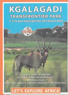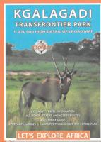
Wegenkaart - landkaart Kgalagadi Transfrontier Park | Infomap

0
Kgalagadi Transfrontier Park in Zuid Afrika, wegenkaart 1:500.000. Met toeristische informatie en geschikt voor gebruik met GPS   The reverse side of the map shows the main tourist areas in the large scale of 1: 270 000.   The traveller can make use of the well established and well maintained infrastructure and roads on the South African side of t...

Verkopers met dit product

Verkoper
Bezorging
Prijs
DeZwerver.nl logo
DeZwerver.nl
2,95
15,95

Anderen bekeken ook

Wegenkaart - landkaart Kgalagadi Transfrontier Park | Infomap
Kgalagadi Transfrontier Park in Zuid Afrika, wegenkaart 1:500.000. Met toeristische informatie en geschikt voor gebruik met GPS   The reverse side of the map shows the main tourist areas in the large scale of 1: 270 000.   The traveller can make use of the well established and well maintained infrastructure and roads on the South African side of the Park including rest camps that offer all luxuries or rough it on the Botswana side with deep sandy tracks and unfenced camping spots. Apart from the park itself our map covers also the immediate surrounding of the park with emphasis on the area north of the park in Western Botswana between Hukuntsi and Ukhwi known as the Western Woodlands, a remote and wild paradise for the 4x4 enthusiast.Easy to read in a vehicle   Practical, user-friendly scale Accommodation listed with booking details Waterholes Distances between points through the park Viewpoints and picnic sites GPS co-ordinates Botswana section with camps listed Gate times Border pos…
15,95
Wegenkaart - landkaart Kgalagadi - Tourist Map of Kgalagadi Transfrontier Park Botswana | Shell
Zeer bijzondere landkaart van het grensgebied van Botswana en Zuid Afrika. Uitermate handig zijn de GPS coordinaten van de meest belangrijke punten als campings of uitzichtpunten. De kaart is gebaseerd op een luchtfoto, waarbij alle details zijn ingetekend. The map: The map consists of a large map of the entire Park on the front of the map. On the back is enlargements of six maps - the South African side, Mabuasehube, Swart Pan area, Gemsbok Wilderness Trail, Mabuasehube Wilderness Trail and of the Kaa Kalahari Concession. Satellite images were used and the roads were tracked by GPS. There are 168 GPS coordinates on this map. Establishment of a Transfrontier Park: On the 7 th of April 1999 Botswana and South Africa signed a bilateral agreement in which they agreed to manage their adjacent national parks, Gemsbok National Park in Botswana and Kalahari Gemsbok National Park in South Africa, as a single ecological unit – the Kgalagadi Transfrontier Park. It is the first formally declared…
17,50
Wegenkaart - landkaart 3207 Adventure Map Botswana | National Geographic
Wegenkaart van Botswana met vermelding van veel bezienswaardigheden, nationale parken en attrakties. Watervast en scheurvast. Juist door deze vermeldingen onderscheidt de kaart zich van andere wegenkaarten. National Geographic's Botswana Adventure Map is designed to meet the unique needs of adventure travelers with its durability and accurate information. This folded map provides global travelers with the perfect combination of detail and perspective, highlighting hundreds of points of interest and the diverse and unique destinations within the country. The map includes the locations of cities and towns with a user-friendly index, plus a clearly marked road network complete with distances and designations for major highways, main roads, and tracks and trails for those seeking to explore more remote regions.   The front side of the Botswana map details the northern region of the country, from Namibia to the north and west, to the bordering country of Zimbabwe to the east. The reverse s…
17,50
Wegenkaart - landkaart Botswana - Zimbabwe | ITMB
Een degelijke kaart met aanduidingen van o.a. nationale parken, vliegveld, benzinepomp, dirt-roads en kleine plattegrond van hoofdstad. Als overzichtskaart goed te gebruiken. 7th Edition 1:1,600,000/11:1,000,000 on waterproof stone paper Both Botswana and its neighbour, Zimbabwe, form a common entity and a British heritage in Central Southern Africa, but there the resemblance ends. The Bechuana formed an alliance of sorts with the Pritish to protect them from the Boers in the then-nearby Transvaal. Upon a peaceful transition to independence as Botswana, it has evolved into a democratic and peaceful country. Zimbabwe, formerly Rhodeisa, is a failed state, although potentially, Zimbabwe could dominate tourism if governmental affairs were orderly. This map focuses on Botswana simply because that country is a beacon of orderly pleasantness in the continent; well run, routistacally well developed, with good infrastructure, and close to the game preserves of both South Africa and Zimbabwe. …
13,95
Wegenkaart - landkaart Moremi - Tourist Map of Moremi Game Reserve Botswana | Shell
Zeer bijzondere landkaart van Moreni Game Reserve in Botswana. Uitermate handig zijn de GPS coördinaten van de meest belangrijke punten als campings of uitzichtspunten. De kaart is gebaseerd op een luchtfoto, waarbij alle details zijn ingetekend. The map: The Moremi map is based on satellite photos. The front of the map consists of a map of the entire Reserve and on the back are six separate maps of Khwai river-front east, Khwai river-front west, an orientation map of Moremi, Xakanaxa area and the Moanachira river, Xakanaxa game-drive area and Bodumatau area. The roads were tracked by GPS and there are 162 GPS co-ordinates on the map. General: As part of the Okavango Delta, Moremi consists of permanent swamp, seasonally swamped areas and dry land. It is one of the prime tourist destinations in Botswana and offers water activities, top game-viewing, some of the best bird-life in Africa and incredible scenery. Not to be missed! Locality and size: The Moremi Game Reserve is nestled withi…
17,50
Wegenkaart - landkaart Richtersveld National Park and Northern Namaqualand | Infomap
Wegenkaart met toeristische informatie en geschikt voor gebruik met GPS   The original InfoMap! Now in its 8th edition this map remains as popular as ever. For those who don’t know, the Richtersveld National Park is a 160 000 hectare national park found on the banks of the Orange River in South Africa’s Northern Cape. It is the only mountain desert park in Southern Africa and is one of the few national parks in which you are not confined to your car. Dry, arid with a feeling of isolation, life in the park is influenced by the mist created by the cold Atlantic Ocean. Known to the local Nama people as ‘malmokkie’ it brings moisture to an otherwise parched land. Despite its lack of rainfall the area is rich in flora containing many species, like the Halfmens, which exist nowhere else on earth.   The area has long been a favorite for botanists, photographers, lovers of remote places and 4×4 enthusiasts who flock to this corner of South Africa for its unique character, isolation and fee…
15,95
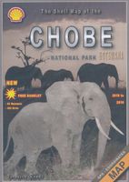
Wegenkaart - landkaart Chobe | Shell
Zeer bijzondere goede landkaart van Chobe National Park in Botswana. Uitermate handig zijn de GPS coordinaten van de meest belangrijke punten als campings of uitzichtpunten. De kaart is gebaseerd op een luchtfoto, waarbij alle details zijn ingetekend. The map: The Chobe map consists of a complete map of Chobe on the front of the map and there are 5 individual maps of the major tourist areas on the back of the map. These are Chobe river front east, Chobe river front west, Nogatsaa, Savute and a small orientation map. The map was compiled by using satellite images, giving one a birds eye-view of the area. The roads were tracked by means of a GPS and then super-imposed on the photographs. Detailed GPS co-ordinates are supplied for game-drive areas. The Chobe map contains 126 GPS co-ordinates. The four main tourist areas: The Chobe National Park consists of a variety of vegetation types and geological features, offering extreme contrasts and a wide range of wildlife experiences within the…
17,50
Wegenkaart - landkaart Kaokoland and northern Damaraland - Namibië | Infomap
Goede betrouwbare kaart van het noordwesten van Namibië: Damaraland en Kaokoland. Met GPS coordinaten. Engels Colour folding Map, 52x73 cm, scale 1:620.000. The first scale road map of this area to be produced with GPS co-ordinates. 100 GPS Co-ordinates of major intersections, refuelling points and accommodation information. Map range 11°45’ to 15°00’ East and 17° to 20°00’ South. Detailed road map Kaokoland / Kaokoveld (Namibia) includes GPS co-ordinates of major intersections, refuelling points and accomodation information.   This map covers North-Western Namibia on the one side and BUSHMANLAND and CAPRIVI in North-Eastern Namibia on the reverse side. This map is very much recommended for travelers to these regions as an addition to our bigger scaled Namibia map. Here you get a nice amplified look at the regions with loads of GPS coordinates, accommodation and petrol points. Furthermore we included extensive route and travel ideas and general information on Kaokoland. Sold in a plas…
15,95
Wegenkaart - landkaart Yellowstone National Park and Wyoming | ITMB
The USA is a vast and wonderful land to explore. ITMB is steadily increasing our coverage of this important travel destination and this month concentrates on the State of Wyoming, with a detailed travel map on one side, including small portions of adjacent states of Utah, Colorado, Nebraska, South Dakota, Montana, and Idaho. The state is lightly populated, with Cheyanne as its capital and main city. Interstates 80 and 90 both traverse the state, with Interstate 25 being the only north-south motorway. Yellowstone National Park occupies the northwest corner of the state and also occupies the second side of the sheet with an extremely detailed map. Yellowstone is the first area in the world to be proclaimed as a national protected area (Banff was second), and Yellowstone remains the paramount preserved wilderness environment in the world. There are several small urban areas within the park for accommodations and servicing, such as West Thumb, Canyon City, and Mammoth Hot Springs. The mai…
13,95

Klanten-reviews van Wegenkaart - landkaart Kgalagadi Transfrontier Park | Infomap

Er zijn nog geen beoordelingen voor dit productBen jij de eerste die een review plaatst?

Meer over Wegenkaart - landkaart Kgalagadi Transfrontier Park | Infomap

Productomschrijving

Kgalagadi Transfrontier Park in Zuid Afrika, wegenkaart 1:500.000. Met toeristische informatie en geschikt voor gebruik met GPS   The reverse side of the map shows the main tourist areas in the large scale of 1: 270 000.   The traveller can make use of the well established and well maintained infrastructure and roads on the South African side of the Park including rest camps that offer all luxuries or rough it on the Botswana side with deep sandy tracks and unfenced camping spots. Apart from the park itself our map covers also the immediate surrounding of the park with emphasis on the area north of the park in Western Botswana between Hukuntsi and Ukhwi known as the Western Woodlands, a remote and wild paradise for the 4x4 enthusiast.Easy to read in a vehicle   Practical, user-friendly scale Accommodation listed with booking details Waterholes Distances between points through the park Viewpoints and picnic sites GPS co-ordinates Botswana section with camps listed Gate times Border post information

Productinformatie

    Verken gerelateerde categorieën

    Webshop.nl maakt gebruik van cookies. Ga je verder op onze website, ga dan akkoord met het plaatsen van cookies en de verwerking van deze data door ons en vermelde partners.