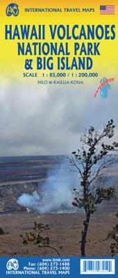
Wegenkaart - landkaart Hawaii Volcanoes National Park & Big Island | ITMB

0
Een degelijke kaart met aanduidingen van o.a. nationale parken, vliegveld, benzinepomp, dirt-roads. Als overzichtskaart goed te gebruiken. We didn't suspect, when we started developing this title, that Mauna Loa Volcano would erupt as soon as our map of the national park was printed, but it did! It is on the news every night, and a marvelous touri...

Verkopers met dit product

Verkoper
Bezorging
Prijs
DeZwerver.nl logo
DeZwerver.nl
2,95
13,95

Anderen bekeken ook

Wegenkaart - landkaart Hawaii Volcanoes National Park & Big Island | ITMB
Een degelijke kaart met aanduidingen van o.a. nationale parken, vliegveld, benzinepomp, dirt-roads. Als overzichtskaart goed te gebruiken. We didn't suspect, when we started developing this title, that Mauna Loa Volcano would erupt as soon as our map of the national park was printed, but it did! It is on the news every night, and a marvelous touristic attraction. How many of us can ever see a massive eruption of molten lava? Now, we can! (at least, from a safe distance). The national park occupies one side of the map and is the latest in ITMB's series of national parks. By the nature of such parks, we show all the features and elevations, but in this case, we'll add the proviso that heights and lava flows are changing the landscape on a daily basis. Volcanoes are sort of like elephants-they go where they please! The reverse side of the sheet is a map of Big Island, where the park is located. Its name comes from being the largest island in area of all the Hawaiian archipelago. The map …
13,95
Wegenkaart - landkaart Easter Island - Paaseiland en Santiago | ITMB
Easter Island is so isolated that it is not certain whether it is part of Polynesia or an off-shoot of South America. Geologically, it is neither; just a volcanic lump in the vast expanse of the Pacific Ocean. Its original inhabitants probably came from Polynesia; since supplanted by migrants from Chile, which is the political authority governing the island. Regardless, it is an intriguing place, famous for the Maoi - giant heads originally raised to protect family holdings. These huge, mysterious heads rest in various locations on the island and are one of the wonders of the world. This map also includes a detailed map of Santiago de Chile, the capital of Chile, for the simple reason that all flights to Easter Island originate in that city, so everyone going to Easter Island needs a map of Santiago as well. This usage is merely for the convenience of visitors going to Easter Island. ITMB publishes a separate map of Santiago and Central Chile and we intend to continue to do so.   Lege…
13,95
Wegenkaart - landkaart Tofino & Southern Vancouver Island | ITMB
Vancouver Island is one of the marvels of tourism in Canada. It is, in fact, so big that it needs to be explored in sections to reach its full potential. Tofino is the westernmost town on the island and is home to the great Pacific fleet of fishing boats. It is also the westernmost leg of the ten thousand kilometer-long Trans-Canada Highway, and the beginning of the Trans-Canada National Hiking Trail. Side 1 concentrates on the immediate surrounds of Tofino, Seven-Mile Beach, and Kennedy Lake. Side 2 covers the southern half of the large island, from Victoria north to Courtenay, and includes the Broken Islands region off the west coast, the West Coast Hiking Trail, Cathedral Grove old growth forest, the Gulf Islands, and all the ferry connections with Vancouver and various islands, as well as all the Backroads logging roads that are the main way to explore the interior of wonderful Vancouver Island.   Legend Includes: Roads by classification, Rivers and Lakes, National Park, Airports,…
13,95
Wegenkaart - landkaart Yellowstone National Park and Wyoming | ITMB
The USA is a vast and wonderful land to explore. ITMB is steadily increasing our coverage of this important travel destination and this month concentrates on the State of Wyoming, with a detailed travel map on one side, including small portions of adjacent states of Utah, Colorado, Nebraska, South Dakota, Montana, and Idaho. The state is lightly populated, with Cheyanne as its capital and main city. Interstates 80 and 90 both traverse the state, with Interstate 25 being the only north-south motorway. Yellowstone National Park occupies the northwest corner of the state and also occupies the second side of the sheet with an extremely detailed map. Yellowstone is the first area in the world to be proclaimed as a national protected area (Banff was second), and Yellowstone remains the paramount preserved wilderness environment in the world. There are several small urban areas within the park for accommodations and servicing, such as West Thumb, Canyon City, and Mammoth Hot Springs. The mai…
13,95
Wegenkaart - landkaart Cayman Islands (Kaaiman Eilanden) & Jamaica | ITMB
Een degelijke kaart met aanduidingen van o.a. nationale parken, vliegveld, benzinepomp, dirt-roads en kleine plattegrond van verschillende steden. Als overzichtskaart goed te gebruiken. De kaart is aan twee zijden bedrukt, de ene zijde omvat de Cayman Islands (schaal 1:37.500 en 1:70.000). Op de andere zijde staat de kaart van Jamaica (schaal 1:250.000) en plattegronden van onder andere Kingston. We are pleased to announce the latest new Caribbean map to our growing series. The Caymans, for there are three major islands and numerous little shoals, remains a British colony, like the British Virgin Islands, the Turks and Caicos, and Bermuda. Tourism is the number one industry of the Cayman Islands, with dozens of hotels dotting the beachfronts, especially north of George Town. There are numerous dive sites for viewing tropical fish and we have shown about a hundred on the map, as well as every side street and gas station. One interesting place to visit is Hell, which is a frozen lava er…
13,95
Wegenkaart - landkaart Jasper National Park & Northern Alberta | ITMB
  Jasper National Park kaart, zeer gedetailleerd (schaal 1:250.000) plus op de anderekant van de kaart staat Noord Alberta, schaal 1:1.000.000. Natuurkundige overzichtskaart met veel plaatsen en wegen, spoorlijnen en rivieren, hoogten, lengte- en breedtegraden.   Two words immediately come to my mind if I were to describe Northern Alberta: Oil and Cold. Oil sands could be found relatively easily within the Northern Alberta region. This pushes the Canadian economy forward as gasoline and other petroleum products are becoming higher in demand. Northern Alberta is also about the subzero temperature. The region of Northern Alberta mostly contains very cold, long winters and warm, short summers. Fort McMurray, for example, one of the famous urban communities located in the Wood buffalo municipality, has only a yearly mean temperature of 0.7 degrees Celsius. Nonetheless, Northern Alberta is also a land of recreation activities and wild adventures. On the other side of the Northern Alberta …
13,95
Wegenkaart - landkaart 3128 Adventure Travel Map Vancouver Island | National Geographic
Wegenkaart van Vancouver Island met vermelding van veel bezienswaardigheden, nationale parken en attrakties. Watervast en scheurvast. Juist door deze vermeldingen onderscheidt de kaart zich van andere wegenkaarten. National Geographic's Vancouver Island Adventure Map provides global travelers with the perfect combination of detail and perspective in a highly functional travel tool. Cities and towns are clearly indicated and easy to find in the user-friendly index. A road network complete with distances and designations for roads, motorways, and expressways will help you find the route that's right for you. Secondary routes are also marked for those seeking to explore off the beaten path. Hundreds of points of interest and diverse and unique destinations are highlighted including national parks, nature reserves, World Heritage sites, archeological sites, ski areas, hot springs, beaches, museums, and more.   The south side of the print map shows Victoria the capital of British Columbia,…
17,50
Wegenkaart - landkaart - Fietskaart Vanouver Island south - Victoria | ITMB
ITMB wegenkaarten en wandelkaarten kenmerken zich door het kleurgebruik waarbij zo de nadruk wordt gelegd op de natuurkundige aspecten van het land of de streek. Het soort landschap en de hoogte worden hierdoor zeer duidelijk zichtbaar. Natuurlijk vind je ook de 'gewone' zaken als wegennet, spoorwegen, vliegvelden, ferrys, toeristische bezienswaardigheden en nationale parken er op terug.. Vaak - maar niet op alle kaarten - staat op de achterzijde een stadsplattegrond van hoofdstad of belangrijkste stad in de regio.  Voorzijde: Vancouver Island zuidelijk gedeelte met schaal 1:270.000 Achterzijde: stadsplattegrond Victoria met schaal 1:10.000 Victoria is a brand new title for ITMB. The city is the capital of British Columbia (each of Canada’s provinces and territories has its own capital, in addition to Ottawa for the entire country). Located at the southern tip of Vancouver Island, Victoria was established as the colonial capital after the Oregon Treaty of 1846 forced the British to ab…
13,95
Spoorwegenkaart - Wegenkaart - landkaart Scotland Far North & Islands Railway & Road | ITMB
Great Britain, by its shape, is difficult to map. The population is dense, the road network intense, and the coastline convoluted. A map of the British Isles shows only the major features. Sectional maps of just England, or Just Wales, make little sense, due to the geographic shape of the island kingdom. Scotland also needs more than one map to show its treasures in sufficient detail. ITMB previously issued Scotland Central and South, and now extends its coverage at 1:300,000 to the sparsely-populated highlands and the isolated Western, Orkney, and Shetland island archipelagos that are usually shrunk to insignificance on most maps, as insets. This double-sided map covers the area from Loch Lochy south of Invergarry to John O’Groats in the north, and from the Western islands of Uist and Lewis to the Moray Firth and Craigellachie in the east. The second side has to duplicate part of the first side in order to extend the artwork further eastward to include Aberdeen and northward to inclu…
13,95
Wegenkaart - landkaart New Zealand North Island | ITMB
ITMB is very pleased to be expanding our coverage of New Zealand with the release of this fourth title (the others being the country map, the South Island, and Auckland). At this expanded scale, it takes both sides of the sheet to show off the attractions of the northern half of NZ, but the shape of the island provides ample space for a large inset of Auckland and more modest ones of the city region and of New Zealand’s public transport network on side one. Side two has an excellent inset map of Wellington and includes the northernmost portion of South Island, with the ferry connection linking the two islands. At this scale, the place names and road network are very readable, and there is lots of room to show attractions and touristic points of interest. The map also includes our Top Attractions list of must-sees, such as Napier Rotorua, and the Hobbitown Movie Set of Lord of the Rings fame.
13,95

Klanten-reviews van Wegenkaart - landkaart Hawaii Volcanoes National Park & Big Island | ITMB

Er zijn nog geen beoordelingen voor dit productBen jij de eerste die een review plaatst?

Meer over Wegenkaart - landkaart Hawaii Volcanoes National Park & Big Island | ITMB

Productomschrijving

Een degelijke kaart met aanduidingen van o.a. nationale parken, vliegveld, benzinepomp, dirt-roads. Als overzichtskaart goed te gebruiken.

We didn't suspect, when we started developing this title, that Mauna Loa Volcano would erupt as soon as our map of the national park was printed, but it did! It is on the news every night, and a marvelous touristic attraction. How many of us can ever see a massive eruption of molten lava? Now, we can! (at least, from a safe distance). The national park occupies one side of the map and is the latest in ITMB's series of national parks. By the nature of such parks, we show all the features and elevations, but in this case, we'll add the proviso that heights and lava flows are changing the landscape on a daily basis. Volcanoes are sort of like elephants-they go where they please! The reverse side of the sheet is a map of Big Island, where the park is located. Its name comes from being the largest island in area of all the Hawaiian archipelago. The map includes an inset of Hilo, the largest city on the island, located on a calm bay of the east coast, and a separate inset of Kailua-Kona on the west coast, which is also the focal point for surfing and resorts. This pretty much completes our detailed mapping of Hawaii; in addition to this title, we have maps of the complete state and of each major island, as well as a new map of Honolulu/Waikiki. The map is printed on waterproof stone paper, which could prove very useful in tropical Hawaii!   Legend Includes: Roads by classification, Rivers and Lakes, National Park, Airports, Points of Interests, Highways, Main Roads, Zoos, Fishing, and much more...

Productinformatie

    Verken gerelateerde categorieën

    Webshop.nl maakt gebruik van cookies. Ga je verder op onze website, ga dan akkoord met het plaatsen van cookies en de verwerking van deze data door ons en vermelde partners.