webshop.nl
Categorieën
  Sluiten

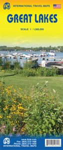
Wegenkaart - landkaart Great Lakes Region - Grote Meren | ITMB

To North Americans, there is only one "Great Lakes" - the waterway stretching far into the interior of the continent from the Gulf of St. Lawrence to the tip of Lake Superior. This vast region has exerted a fundamental hold on the development of both the USA and Canada; first as a canoeing trade route for trapping furs, then as a means of settlemen...
13,95

Webshops met dit product

Webshop
Bezorging
Prijs

Anderen bekeken ook

Wegenkaart - landkaart 3124 Great Lakes | National Geographic
Mooie kaart van de bekende kaartenmaker National Geographic. Veel details door kleurgebruik. De wegen zijn met kleuren verdeeld in drukke en minder drukke, de wegnummers zijn goed terug te vinden. De kaart onderscheidt zich van andere series door de hoeveelheid topografische details als counties, plaatsnamen en waterwegen en het bevat een register waarin het eenvoudig zoeken is. Daarnaast is de kaart gedrukt op scheur- en watervast papier.   The United States Great Lakes Adventure Map will guide you to the five Great Lakes of Superior, Michigan, Huron, Erie, and Ontario. This region of the country has used the Great Lakes as a pathway for exploration, trade and recreation for hundreds of years and these traditions still thrive as witnessed by the cities and towns that border the Great Lakes. The states of Minnesota, Wisconsin, Illinois, Michigan, Indiana, Ohio, Pennsylvania, and New York all benefit from their contact with the largest freshwater lake system on Earth. The map includes t…
17,50
Wegenkaart - landkaart 173 Great Lakes - Grote Meren USA | Michelin
Bijzonder goed leesbare kaart van een deel van de Verenigde Staten - USA, in dit geval het gebied van de staten rond de Great Lakes - Grote Meren.   Op deze kaart zijn de Nationale Parken goed zichtbaar ingetekend met een heldere achtergrondkleur. Wegnummers, register, afstanden tussen steden en bijvoorbeeld de beroemde groene wegenaanduiding van Michelin ontbreken niet.    Met stadsplattegronden (alleen het centrum) van Buffalo/Niagar Falls, Chicago, Cleveland, Detroit, Milwaukee en Toronto.   Michelin USA Great Lakes Map 173 (scale: 1:1,267,000)—part of Michelin's brand-new US regional map series with bright green covers—zooms in close for comprehensive coverage of Wisconsin and Michigan, as well as areas of the other states surrounding the Great Lakes (Minnesota, Iowa, Illinois, Indiana, Ohio, Pennsylvania) and southern Ontario in Canada. It contains city maps for easy driving in Buffalo, Chicago, Cleveland, Detroit, Indianapolis, Milwaukee, Minneapolis/St. Paul, Pittsburgh and Toro…
9,95
Wegenkaart - landkaart Nunavut - Northwest Territories | ITMB
The far north of Canada, north of 60 degrees, consists of three territories; the Yukon, the Northwest Territories, and Nunavut. Until now, there has never been a proper map of the territory that was carved off from the NWT a quarter century ago. With only 30,000 people and a scattering of settlements, Nunavut is larger than western Europe in area. This map took us years to prepare, using 1:250,000 government topo maps as a base and tracing thousands of little lakes. The traditional passageway of the fabled Northwest Passage is also shown. The most northerly civilian community in the world is on the map – Grise Bay, as well as Alert, the most remote place on earth. Originally, the NWT covered all of northwestern North America west of the Louisiana Purchase and the Loyalist colonies, and north of the Spanish provinces (essentially north of current day Sactamento). Political changes have reduced its size over the past century and a half to the region of Canada north of the 60th parallel a…
13,95
Wegenkaart - landkaart Siberia - Siberië | ITMB
Een degelijke kaart met aanduidingen van o.a. nationale parken, vliegveld, benzinepomp, dirt-roads en kleine plattegrond van hoofdstad. Als overzichtskaart goed te gebruiken. Can you name anyone who has published a detailed map of Siberia? I cannot! This is one of the largest geographical regions on earth, comparable in magnitude to the Sahara or Gobi desert areas, or the vast Prairie regions of Canada, but it has never had a travel map. Well, now it does and the last frontier of mapping the world has been breached. The part of Russia east of the Ural Mountains is vast; there is no other word to describe the enormity of this region of grassland and tundra. Technically, it does not extend all the way to the Pacific Ocean, but it does go from the Arctic Ocean to the Chinese and Mongolian borders. This is not a part of the world well travelled, but it could become so with a good, detailed map. We start in the west at Omsk on the Irtysh River, where the northern and southern branches of th…
13,95
Wegenkaart - landkaart Ierland | ITMB
As technology improves, we are able to produce more detailed maps than was previously possible. Such is the case with Ireland, a part of the world consisting of two countries divided by religion and history. Preparing a map of Ireland as a double-sided map means cutting the island into two geographic portions. Side 1 covers the northern half. This includes the portion known as Northern Ireland, or Ulster, and a fair portion of the Republic of Ireland, or Eire; essentially everything north of Dublin and west to Counties Mayo and Galway. Side 2 covers the southern half of the island from just north of Dublin to the outer tips of County Kerry. It also includes a nice inset map of central Dublin. Naturally, all motorways and roads are included, as are touristic attractions, camping/caravan sites, ferry terminals, and Top Attractions. This is a very detailed travel map of the island, printed on waterproof paper for durability. We had great fun driving around Ireland researching this map. It…
14,95
Wegenkaart - landkaart Southern Ontario | ITMB
Een degelijke kaart met aanduidingen van o.a. nationale parken, vliegveld, benzinepomp, dirt-roads en kleine plattegrond van hoofdstad. Als overzichtskaart goed te gebruiken. The Canadian province of Ontario is intimidatingly large. It is also mostly tundra with extremely few settlements and few roads; in fact, the geographic centre of Ontario is about 1,500 kms north of the nearest road. The very first map I prepared, at age 10, was of Ontario; and it took me six weeks to trace all the lakes. My point is that the developed portion of the province is a much smaller wedge of fertile ground south of the mineral belt of the Great Canadian Shield. This double-sided map focusses on the area south of Sudbury and North Bay and expands the scale to a much more useful purpose for most users. Imagine Detroit in the southwest corner of the map, with Highway 401 joining it to London and Toronto and a branch motorway cutting across to Buffalo. Add in the Bruce Peninsula and the major routes north t…
13,95
Wegenkaart - landkaart Afghanistan | ITMB
Een degelijke kaart met aanduidingen van o.a. nationale parken, vliegveld, benzinepomp, dirt-roads en kleine plattegrond van hoofdstad. Als overzichtskaart goed te gebruiken. Legend Includes: Roads by classification, silk road, airports, towns, villages, ruins, national parks, lakes, swamps, points of interest and other information It is a bit difficult to credit Afghanistan having touristic potential at the moment, but it is an extremely important country right now, and that justifies a very good map of the country. This is our third edition of this country and each one keeps getting better. We can’t justify sending a researcher into a combat zone to gather data, but we are thankful to those aid workers and soldiers who have added to our information base and helped make this map more useful. In this edition, we are showing some new roads, reflecting the reality that the country is succeeding in improving its infrastructure in spite of a very tense political situation. We have also pla…
13,95
Wegenkaart - landkaart - Stadsplattegrond Chicago and the Lake Michigan Region | ITMB
Stadsplattegrond van Chicago (1:12.500) en een overzichtskaart van Lake Michigan (1:100.000) op scheur- en watervast papier. Chicago is the third most populous city in the USA and has historically been a transportation hub. Americans have never developed trans-continental rail lines or highways and now are using O'Hare airport as one of the nation's regional hubs. Historic Route 66 begins its westward trek here and all passengers from eastern cities change trains here. I-90 does pass through Chicago on its westward route, but only because Lake Michigan forces it southward. As a city, Chicago offers fabulous lakeside parks, the 'Golden Mile' of shops, the Loop, the world-class Field Museum, a number of Frank Lloyd Wright designed houses, and the Lincoln Park Zoo. Apart from updating information, this map adds two aspects of value to the previous edition. First, the reverse side now includes a regional map that encompasses Indianapolis, Detroit, Marquette and Sault Ste. Marie at the nort…
13,95
Wegenkaart - landkaart - Stadsplattegrond Montreal & Southern Quebec | ITMB
Stadsplattegrond van Montreal met register. Op de achterzijde een kaart van het zuiden van Quebec. 1:12,500/1:850,000 on waterproof paper. In this third, updated, edition of Canada's third largest city, we have added a user-friendly bonus. As is common now to most of our city maps, we have included a regional map of the hinterland of the urban area, so buyers won't have to purchase a second map to explore the environs of the city being presented. In the case of Montreal, being in a huge geographic country, this means Southern Quebec which, because of its size, dictates a map of more than one to a million scale. In the European context this would be the equivalent of Paris and all of France as a 'regional' map of the surrounds of Paris - but that's France and this is Canada.   Montreal (or Mont Royale in its original) was a village called Hochelaga when the early French explorers arrived in the early 1600s. They established a trading fort and, generally speaking, maintained good relatio…
13,95
Wegenkaart - landkaart Vietnam - Laos - Cambodia | ITMB
Een degelijke kaart met aanduidingen van o.a. nationale parken, vliegveld, benzinepomp, dirt-roads. Als overzichtskaart goed te gebruiken. The former French-dominated region of Indochina evolved into three separate countries in the early 1950s. Vietnam, Laos, and Cambodia still retain strong ties and it is easy to travel from one country to another. Each has its particular charm, with a Top Attractions list highlighting the most popular attractions. Side 1 concentrates on the southern portion of the region and includes an inset map of Ho Chi Minh City; the second side covers the area from Sien Riep in Cambodia to the Chinese border areas of both Laos and Vietnam. An inset map of Hanoi is one this side. The region is prospering after many years of civil unrest, is friendly, safe, and easy to reach since Covid restrictions were removed last year. The new Chinese-built rail line through northern Laos to Chiang Kong in Thailand, and to Vientiane, Laos, is shown for the first time. This lin…
13,95

Klanten-reviews van Wegenkaart - landkaart Great Lakes Region - Grote Meren | ITMB

Er zijn nog geen beoordelingen voor dit productBen jij de eerste die een review plaatst?

Meer over Wegenkaart - landkaart Great Lakes Region - Grote Meren | ITMB

Productomschrijving

To North Americans, there is only one "Great Lakes" - the waterway stretching far into the interior of the continent from the Gulf of St. Lawrence to the tip of Lake Superior. This vast region has exerted a fundamental hold on the development of both the USA and Canada; first as a canoeing trade route for trapping furs, then as a means of settlement, and now as a water route to move products to world markets. The region is also densely populated with well-known touristic cities and attractions, and houses in excess of 100,000,000 people. Surprisingly, until now, there has never been a map for this interesting and historic part of the continent. Using this map, one can explore Lakes Ontario and Erie as circular routes; also Huron and Superior; visit Ottawa and Toronto, Chicago and Duluth, and find Fort William or the Wawa Goose. This is a double-sided map covering from Ottawa in the north to Pittsburgh and Columbus in the south and Duluth and Thunder Bay in the west. Both Canada and the USA portions of the Great Lakes Region are included.    Legend Includes: Roads by classification, Airports, Ferrie routes, States boudaries, border crossing, Time zones, State parks with or without campsites, Campsites, Wayside or Roadside parks, Hospitals, Museums, Tourist information centers, Points of interest, , Churches, Points of Interest, Waterfalls, zoos, World heritage sites, Viewpoints, Lighthouses, Hot springs, Mines and quarries, Native American reserves, Mountain peaks, Caves, Universities, Beaches, Skiing, Tennis courts, Golf courses and much more.
Webshop.nl maakt gebruik van cookies. Ga je verder op onze website, ga dan akkoord met het plaatsen van cookies en de verwerking van deze data door ons en vermelde partners.