Wegenkaart - landkaart Georgia & Armenia - Georgië & Armenië | ITMB

0
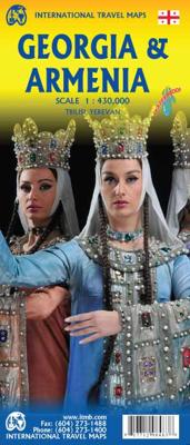
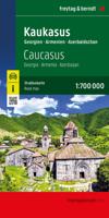
Een degelijke kaart met aanduidingen van o.a. nationale parken, vliegveld, benzinepomp, dirt-roads en kleine plattegrond van hoofdstad. De kracht van deze kaart is dat met kleurgebruik het landschap en de hoogtes heel duidelijk zichtbaar zijn, de natuurkundige aspecten van het land worden daardoor benadrukt. Als overzichtskaart goed te gebruiken. ...

Verkopers met dit product

Verkoper
Bezorging
Prijs
DeZwerver.nl logo
DeZwerver.nl
2,95
13,95

Anderen bekeken ook

Wegenkaart - landkaart Georgia and Tbilisi - Georgië | ITMB
Georgia, the country and not the American state, is a very nice, but threatened country of great historical importance. Bordered on the west by the Black Sea, on the north by Russia, and on the east by Azerbaijan, and with an ill-defined border with Turkey on the west, Georgians must be nimble to retain their independence. Only with neighbouring Armenia does Georgia enjoy relatively good relations. Historically, Georgia is a Christian enclave that dates back to the earliest days of Christianity, and its many churches are major touristic attraction. This map portrays the country as accurately as is possible, showing the expanding network of motorways, major churches, castles, touristic sites, and regrettably, areas of contention with both Russia and Azerbaijan. The reverse side shows a full-sized city map of Tbilisi, the capital. This is the first time that the city has been portrayed in such detail. Attractions include the Narikala Fortress, the cathedral, the old town centre, and the…
13,95
Reisgids Georgia - Georgië | Bradt Travel Guides
Georgië Bradt guide is een Engelstalige, praktische reisgids voor de avontuurlijke reiziger, boordevol informatie over accommodatie van budget tot luxe, vervoer, plaatsbeschrijvingen en natuur - kenmerk : kritisch op toeristische pleisterplekken en de stijl is verhalend. This new seventh edition of Bradt's Georgia remains the only dedicated guide to this fascinating, budget-friendly Caucasian country, where tourism continues to grow and domestic travel is increasingly straightforward. Thoroughly updated to reflect recent developments, this guidebook includes revised and new listings for hotels, homestays, restaurants, what to see and do, and how to get around by public transport. At the intersection of Europe and Asia, nestled between Russia, Armenia, Azerbaijan and Turkey, Georgia is the hub of the Caucasus - a country known for its mountains and Black Sea coast, and its wonderful food, wine and all-round hospitality.   With Bradt's Georgia, you can experience the new alongside th…
27,50
Wegenkaart - landkaart Oman & Yemen - Jemen | ITMB
Een degelijke kaart met aanduidingen van o.a. nationale parken, vliegveld, benzinepomp, dirt-roads en kleine plattegrond van hoofdstad. Als overzichtskaart goed te gebruiken.    We were in Oman a couple of weeks before year end and can certify that it is a safe and attractive country to visit; completely different from its neighbours. The main city is Muscat, which has an inset map on the country side of the sheet, as well as a map of Salalah, in the far west of the country. The road network of the country is well developed, with several crossings to the UAE. Unfortunately, none are available to Saudi Arabia, and the crossing to Yemen, while open, is not advised, due to on-going fighting. Oman also has two enclaves surrounded by UAE; a small one north of Fujairah, and another at the northern tip of the peninsula, separating the Gulf of Oman from the Persian (or Arabic) Gulf. Oman has a long history and an interesting culture, and is well worth a visit. The other side of the sheet con…
13,95
Reisgids Georgia, Armenia and Azerbaijan - Georgië | Rough Guides
Zeer goede reisgids voor zowel de georganiseerde maar vooral voor de zelfstandige reiziger. Boordevol informatie over reizen, slapen, eten, maar ook musea en cultuur. Uitputtende bron van informatie, veelal nog completer dan de Lonely Planet. Inleidende informatie over land en cultuur is zeer goed. This Georgia, Armenia & Azerbaijan guidebook is perfect for independent travellers planning a longer trip. It features all of the must-see sights and a wide range of off-the-beaten-track places. It also provides detailed practical information on preparing for a trip and what to do on the ground. And this Georgia, Armenia & Azerbaijan travel guidebook is printed on paper from responsible sources, and verified to meet the FSC's strict environmental and social standards. This Georgia, Armenia & Azerbaijan guidebook covers: Tbilisi, Central Georgia, West Georgia, Kakheti, Yerevan, Around Yerevan, North Armenia, South Armenia, Baku, Coastal Azerbaijan, Internal Azerbaijan, Nakhchivan, Nagorno Ka…
24,94
Wegenkaart - landkaart Laos | ITMB
Een degelijke kaart van Laos met aanduidingen van o.a. nationale parken, vliegveld, benzinepomp, dirt-roads en kleine plattegronden van Vientiane, Luang Prabang we're very pleased to introduce you to this new, double-sided, map at a great scale, with fantastic detail. To me, the north side is the most interesting, covering the portion of Laos from Vientiane, the capital, to the Chinese border. Detailed inset maps of Vientiane and Louang Prabang, the temple city, are included on this side, as are bits of both Thailand and Vietnam. The south portion fills the other side of the sheet, including a goodly portion of Vietnam, showing all border crossings. Much of Thailand has had to be obscured, unfortunately, to make room for the place names index, but the immediate border areas are shown, including the rail line south from Vientiane. In an interesting departure from previous ITMB maps, the back cover consists of a detailed inset map of Vientiane at 1:16,000 scale, making it easy to use in…
13,95
Reisgids Georgia, Armenia & Azerbaijan - Georgië, Armenië & Azerbeidzjan | Lonely Planet
De perfecte reisgids voor zowel de georganiseerde als de zelfstandige reiziger. Naast een algemene inleiding van het land / streek vol met praktische informatie over hoe je er het beste kunt reizen: slapen, eten, vervoer, excursies ... alles kun je er in vinden. Lonely Planet's local travel experts reveal all you need to know to plan the trip of a lifetime to Georgia, Armenia & Azerbaijan.   Discover popular and off the beaten track experiences from visiting Georgia's Truso Valley for a hike past majestic scenery to riding a cable car to the tiny village of Tatev, and seeing Tsminda Sameba Church in the South Caucasus with its extraordinary hilltop location.   Build a trip to remember with Lonely Planet's Georgia, Armenia & Azerbaijan travel guide:   Our classic guidebook format provides you with the most comprehensive level of information for planning multi-week trips Updated with an all new structure and design so you can navigate Georgia, Armenia & Azerbaijan and connect …
24,95
Wegenkaart - landkaart Cuba West | ITMB
Een degelijke wegenkaart met aanduidingen van o.a. nationale parken, vliegveld. Als overzichtskaart goed te gebruiken. his is a brand new title for ITMB and reflects the growing interest in travel to Cuba resulting from improved relations with the USA. Licenses to fly into the country from a dozen cities have already been approved; 60 more are awaiting approval. All are for flights into Havana and Varadero airports – in other words, the western half of the country. ITMB already has an exceptionally good map of the entire country. We also have a separate map of Havana. This map expands the scale and opens the information for the western half of the island nation as a double-sided map, with the portion west of Havana (La Habana) to Pinar del Rio province in the far west and south to the Isla de la Juventud (better known, but mis-named, as the Bay of Pigs Invasion Site). This side also has an excellent map of the Varadero beach resort area as an inset, and a map of greater Havana. The ot…
13,95
Wegenkaart - landkaart USA Verenigde Staten | ITMB
Een degelijke kaart met aanduidingen van o.a. nationale parken, vliegveld, benzinepomp, dirt-roads en kleine plattegrond van hoofdstad. Als overzichtskaart goed te gebruiken. United States of America (USA) Travel Reference Map has been mapped before, but the USA is a huge country, extremely developed, and almost impossible to show on a map without over-simplification. Most commercial maps use small sheets of paper and print single-sided, making it impossible to show this vast country to advantage. Well, Lan’s been hard at work developing a ‘proper’ traveller’s aid to navigating around the USA, and here it is. We printed it on an exceptionally large sheet of paper, 39” tall by 54” wide (our normal printing size is 27”x39”). To do this, we merged our four existing databases into one, then split them so that the west side is on one side and the east side on the other. What results is a very large sheet, but a map at a VERY good scale. We were able to fit in 6,765 urban areas, all the Int…
13,95
Wegenkaart - landkaart Litouwen & Letland | ITMB
ITMB is very pleased to release its first-ever map of the Baltic country of Lithuania, which occupies Side 1 of this double-sided map. It is bordered by Latvia on its north, the Russian enclave of Kalingrad on its southeast, and Poland and Belarus on its south and east. It is now on the front lines of tension between Russia and its neighbours, as are all the Baltic states. It is also a valued member of both NATO and the EU, and as such is easy to access from either Poland or Latvia. Lithuania fronts on to the Baltic Sea with a major port at Klaipeda (formerly Memel), with its capital being Vilnius. Historically, the country has suffered German and Russian invasions during the 20th century, the last of which resulted in the country losing its independence completely by being absorbed into the Russian Empire in the latter stages of WW2. It regained its independence in 1991, with the collapse of the USSR and shortly thereafter applied to join both the European Union and NATO. Touristical…
14,95
Wegenkaart - landkaart - Fietskaart Vanouver Island south - Victoria | ITMB
ITMB wegenkaarten en wandelkaarten kenmerken zich door het kleurgebruik waarbij zo de nadruk wordt gelegd op de natuurkundige aspecten van het land of de streek. Het soort landschap en de hoogte worden hierdoor zeer duidelijk zichtbaar. Natuurlijk vind je ook de 'gewone' zaken als wegennet, spoorwegen, vliegvelden, ferrys, toeristische bezienswaardigheden en nationale parken er op terug.. Vaak - maar niet op alle kaarten - staat op de achterzijde een stadsplattegrond van hoofdstad of belangrijkste stad in de regio.  Voorzijde: Vancouver Island zuidelijk gedeelte met schaal 1:270.000 Achterzijde: stadsplattegrond Victoria met schaal 1:10.000 Victoria is a brand new title for ITMB. The city is the capital of British Columbia (each of Canada’s provinces and territories has its own capital, in addition to Ottawa for the entire country). Located at the southern tip of Vancouver Island, Victoria was established as the colonial capital after the Oregon Treaty of 1846 forced the British to ab…
13,95

Klanten-reviews van Wegenkaart - landkaart Georgia & Armenia - Georgië & Armenië | ITMB

Er zijn nog geen beoordelingen voor dit productBen jij de eerste die een review plaatst?

Meer over Wegenkaart - landkaart Georgia & Armenia - Georgië & Armenië | ITMB

Productomschrijving

Een degelijke kaart met aanduidingen van o.a. nationale parken, vliegveld, benzinepomp, dirt-roads en kleine plattegrond van hoofdstad. De kracht van deze kaart is dat met kleurgebruik het landschap en de hoogtes heel duidelijk zichtbaar zijn, de natuurkundige aspecten van het land worden daardoor benadrukt. Als overzichtskaart goed te gebruiken. Met een stadsplattegrond (klein) van het cdentrum van Tiblisi en Yerevan.

Europeans consider Georgia to be in Asia because, by an accident of history, the country ended up on the wrong side of an arbitrary line drawn through some rolling hills called the Caucasus. Regardless, this is a European country, bound by ethnicity, history, and religion to the west, not the east.   The country has been threatened fairly recently by the Russian bear, but the country is recovering and the people are warm and hospitable.   Historically, Georgia has much to offer – ancient cities, churches and monasteries, mountain villages, and everywhere, smiling faces.   This is a very popular touristic destination, and we have updated information, improved readability, and generally done our best to portray this interesting country favorably.   The other side of the map covers Armenia in good detail showing the road and transport infrastructure as well as the geography.


Verken gerelateerde categorieën

Webshop.nl maakt gebruik van cookies. Ga je verder op onze website, ga dan akkoord met het plaatsen van cookies en de verwerking van deze data door ons en vermelde partners.