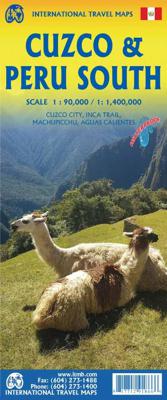
Wegenkaart - landkaart Cuzco Region - Cuzco & Peru South | ITMB

0
Een degelijke kaart met aanduidingen van o.a. nationale parken, vliegveld, benzinepomp, dirt-roads en kleine plattegrond van Cuzco excellent inset maps of Machu Picchu (schema), Inca Trail-scale 1:50,000, Cuzco-scale 1:11,000 and Lima-scale 1:13,500 to assist visitors – add a detailed map of the southern portion of Peru. Now, one map will cover al...

Verkopers met dit product

Verkoper
Bezorging
Prijs
DeZwerver.nl logo
DeZwerver.nl
niet bekend
13,95

Anderen bekeken ook

Wegenkaart - landkaart Peru | Borch
Mooie geplasticieerde kaart van Peru. Deze kaart biedt een goed overzicht van het land met detailkaarten.   Our soft-laminated folded map of Peru shows: Peru North 1:1 750 000, Peru South 1:1 750 000, Amazonian Peru 1:2 500 000, Central Lima 1:18 000, Greater Lima 1:150 000, Central Cuzco 1:12 000, Greater Cuzco 1:50 000, Ayacucho 1:20 000, Arequipa 1:17 000, Chan Chan 1:40 000, Trujillo 1:20 000, Sacsayhuaman 1:10 000, Machu Picchu 1:44 000, Peru administrative & time zones. Borch Maps are easy to fold, durable and water-repellent with a wipeable surface. Borch Maps show hotels, museums, monuments, markets, public transport, top sights and points of interest, useful statistics, conversion charts for temperatures, weights and measurements, climate charts showing temperatures, sunshine hours, precipitation and humidity, overview maps, time zones, and much more...   Bordering Brazil, Bolivia, Chile, Colombia, Ecuador and the Pacific Ocean, the Republic of Peru is the cradle of the Inca …
11,50
Wandelgids Peru - Hiking and Biking Peru's Inca Trails | Cicerone
The eastern slope of the Peruvian Andes is one of the most dramatic and diverse places on the planet, dropping from over 6000m (20,000ft) to just 200m above sea level. This dramatic drop in elevation produces a wide range of constantly changing climactic and vegetative zones – it is often possible to hike from the base of a glacier down to the jungle in just a day or two. Combined with the countless Inca sites and ubiquitous Inca roads, this makes the Sacred Valley one of the best trekking and mountain biking destinations in the world.    Machu Picchu is well known as one of the Seven Wonders of the World, and the Inca Trail trek that leads there is nearly as famous. What is less known, however, is the vast choice of other epic adventure trips that exist in the region – treks through soaring Andean glaciers and Incan ruins, bike rides through stunning alpine and jungle scenery. Nearly every route in this book uses an Inca road or visits an Inca ruin – and most do both. The majority of…
22,95
Reisgids Machu Picchu - Peru | Moon Travel Guides
Uitstekende Amerikaanse reisgids van uitgever Moon. De gids is vergelijkbaar met Lonely Planet en Rough guide en is voor de backpacker - zelfstandige reiziger geschreven; toch is deze door de grote mate van details en achtergronden geschikt voor alle reizigers! De gids onderscheidt zich door gedegen en uitgebreide achtergrondinformatie over bijvoorbeeld natuur en cultuur. Mystical, timeless, and full of adventure: embark on the trip of a lifetime to the jewel of Peru with Moon Machu Picchu. Inside you'll find: Strategic trekking guides, including two to four days on the Inca Trail, five days on the Salcantay, and an Inca Jungle Trail itinerary, plus focused coverage of Cusco, the Sacred Valley, and Lima Unique experiences beyond the beaten path: Explore seldom-seen ruins like the Ollantaytambo Temple and visit remote Quechua-speaking villages. Go horseback riding on a caballo de paso in the Sacred Valley, mountain biking to the hilltop fortress of Sacsayhuamán, or set up camp on th…
20,95
Wandelgids The Inca Trail - Cusco & Machu Picchu | Trailblazer Guides
Uitgebreide inleiding van de streek met veel aandacht voor geschiedenis, flora & fauna en tevens een stuk over Peru als geheel. Veel praktische informatie over de trekkings, een handleiding voor de ruïnes van Machu Picchu, uitgevoerd met veel schetskaarten. Engelstalig Fully revised 6th edition of this best-selling, all-in-one guide for hiking the Inca Trail. Includes Lima and Cusco city guides, route guide and maps for Classic Inca Trail, High Inca Trail, Salkantay, Choquequirao, Lares and Ausangate treks plus a full Machu Picchu guide. New for this edition   Lares Trek - with 9 maps and trail profile Ausangate Trek - with 10 maps and trail profile Lost to the jungle for centuries, Machu Picchu was rediscovered by Hiram Bingham 100 years ago.  It's now probably the most famous sight in South America – and justifiably so.  Perched high above the river on a knife-edge ridge, the ruins are truly spectacular.  The best way to reach them is on foot, following parts of the original paved I…
21,95
Stadsplattegrond Lima & Central Peru | ITMB
Peru is one of the most popular travel destinations in South America, and everyone going there arrives in Lima, which is a very large and complicated city. In this edition, we have updated all the information for the city, covering the portion between the ocean and the historic centre and southerly to the Miraflores district. Lima is not blessed with a good rapid transit system, but we show the two lines and the busway, embassies, hotels, shopping areas, historic sites etc. the new part of the map is a detailed travel map of the central portion of Peru on the other side. This side would be particularly useful for those visitors planning to travel from Lima to Cuzco, or Pisco, or north to Cajamarca., or even into the upper reaches of the Amazon. It has excellent road information, and hundreds of touristic points of interest are noted on the map. This map is printed double-sided, on paper. Legend Includes: Roads by classification, parks, sanctuaries, native tribes, churches, ruins, spri…
13,95
Wegenkaart - landkaart British Columbia South (Canada) | ITMB
Deze wegenkaart van British Columbia bestrijkt het gebied tussen Vancouver en Calgary, en is de perfecte toeristische kaart voor het verkennen van de regio Rocky Mountain. Alle wegen en spoorlijnen tussen de twee steden worden getoond, evenals campings en parken.   This map covers the area between Vancouver and Calgary, and is the perfect tourist map for exploring the Rocky Mountain region. All roads and rail lines between the two cities are shown, as well as camp grounds, parks. Legend Includes: Points of interests, airports, RV and camping sites, wilderness camps, picnic areas, waterfalls, tourist information, museums, golf courses, gas stations, outdoor activities and other information. Folded paper, road and travel map in color. Scale 1:900,000. Distinguishes roads ranging from divided highways to other roads-4WD/dry weather. Legend includes railways, trails, ferry routes, glaciers, points of interest, international airports, domestic airports, museums, mountain peaks, camping/rec…
13,95
Wegenkaart - landkaart South America - Zuid Amerika | ITMB
Een degelijke kaart met aanduidingen van o.a. nationale parken, vliegveld, benzinepomp, dirt-roads en kleine plattegrond van hoofdstad. Als overzichtskaart goed te gebruiken. ITMB is very pleased to release a new, digitally-prepared, double-sided map of South America. It covers the entire continent in great detail and has been able to capture the information on the 'old' map, while using the expanded scale of the new map to add and enhance countless details that were crammed on to the earlier editions or for which there was inadequate room to include. This is the most detailed continental map of this part of the world ever published. Legend Includes: Railways, ferry routes, roads by classification, international and domestic airports, rivers, lakes, points of interest, archaeological sites, beaches, lighthouses, mines, glaciers, volcanoes, national parks and other information.  
13,95
Wegenkaart - landkaart South America north- Zuid Amerika noordelijke deel | ITMB
Dekt het noordelijke deel van Zuid Amerika tot aan de grens van Chili - Paraguay - Rio de Janeiro. South America North Travel Reference Map (replacing South America North West) is brand new and is another brilliant cartographic coup for Lan and our production staff. She has come up with a way to preserve the wonderfully detailed artwork of the original version first published in 1980 by Kevin Healey, the co-founder of ITMB, and subsequently published by ITMB in four succeeding updated editions. We retired the artwork several years ago, feeling that the market preferred more detailed country maps, but repeated requests for a map of this nature convinced us to have a look at it again. This map replaces the former map of North West South America at a better scale than was previously thought possible and with the additional benefit of covering ALL of the northern half of South America on a double sided sheet. We have also re-introduced the capsule comments so loved by map aficionados in p…
13,95
Wandelgids The Inca Trail | Rucksack Readers
Uitgevoerd in de vorm van een klapper, met ringband geeft deze gids een goede beschrijving van de lange afstands route. De kaarten zijn schetsmatig maar wel duidelijk. This edition of our popular guidebook contains everything you need to plan and enjoy hiking a choice of three Inca Trails to Machu Picchu in Peru. Step-by-step sections cover the Classic trail (4-5 days), the longer, more strenuous trek from Mollepata (6-7 days) and the Shortest option (2 days). This guidebook contains all you need to plan and enjoy trekking the Inca Trail, including   site plan of Machu Picchu ruins description of Machu Picchu, with side-trips and photographs background on Inca culture and stonework, and on modern Peru extended section on Andean wildlife advice on planning and preparation, including packing checklist updated details on recent Trail regulations medical advice on how to prevent and manage altitude symptoms phrasebook in Spanish, Quechua and English drop-down map showing three va…
19,50
Wegenkaart - landkaart Wales & south of England - Zuid Engeland | ITMB
Een degelijke kaart met aanduidingen van o.a. nationale parken, vliegveld, benzinepompen. We are gradually increasing the scales for our data of Great Britain and this is our latest effort. Most visitors to the UK fly into one of London's four airports and combine a visit to the city with an opportunity to travel to various destinations within striking distance of London. England is so incredibly rich in heritage and scenic attractions that it is extremely difficult to portray the country as a map of the entire entity. As a result, England lends itself nicely to be divided into a central/northern portion and a southern portion. To fit areas as diverse as Cornwall and Norwich on one sheet, one needs to have a vertical frame, with Devon/Cornwall up to the top of Wales on one side and Wiltshire to Kent up to York (admittedly, not normally considered to be part of 'southern', but vertically, that's what happens. At this scale, all of southern England and all of Wales can be shown in good …
13,95

Klanten-reviews van Wegenkaart - landkaart Cuzco Region - Cuzco & Peru South | ITMB

Er zijn nog geen beoordelingen voor dit productBen jij de eerste die een review plaatst?

Meer over Wegenkaart - landkaart Cuzco Region - Cuzco & Peru South | ITMB

Productomschrijving

Een degelijke kaart met aanduidingen van o.a. nationale parken, vliegveld, benzinepomp, dirt-roads en kleine plattegrond van Cuzco

excellent inset maps of Machu Picchu (schema), Inca Trail-scale 1:50,000, Cuzco-scale 1:11,000 and Lima-scale 1:13,500 to assist visitors – add a detailed map of the southern portion of Peru. Now, one map will cover all the routes to Cuzco, as well as the gem of South America – Machu Picchu!

Legend Includes:
Roads by classification, Inca trail, settlements, campings, parks, ruins, museums, accommodation, theatres, markets, bus stop, world heritage sites, Inca culture, tourist information, points of interest and other information

Verken gerelateerde categorieën

Webshop.nl maakt gebruik van cookies. Ga je verder op onze website, ga dan akkoord met het plaatsen van cookies en de verwerking van deze data door ons en vermelde partners.