webshop.nl
Categorieën
  Sluiten

Wegenkaart - landkaart Costa Rica | Borch

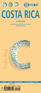
Mooie geplasticieerde kaart van Costa Rica. Deze kaart biedt een goed overzicht van het land met detailkaarten.   Our soft-laminated folded map of Costa Rica shows: Costa Rica 1:650 000, Cocos Island 1:150 000, San Jose 1:20 000, Meseta Central 1:300 000, Costa Rica administrative and time zones. Borch maps are easy to fold, durable and water-repel...
11,50

Webshops met dit product

Webshop
Bezorging
Prijs

Anderen bekeken ook

Wegenkaart - landkaart Thailand | Borch
Mooie geplasticieerde kaart van Thailand. Deze kaart biedt een goed overzicht van het land met detailkaarten van o.a. Bangkok, Phuket, Ko Samui. Our soft-laminated folded map of Thailand in the 8th edition shows: Thailand 1:1 500 000, Bangkok 1:22 000, Greater Bangkok 1:125 000, Chiang Mai 1:22 000, Mae Hong Son 1:14 000, Northwest Thailand 1:835 000, Phuket 1:350 000, Ko Samui & Ko Phangan 1:350 000, Thailand administrative & time zones. Borch Maps are easy to fold, durable and water-repellent with a wipeable surface. Borch Maps show hotels, museums, monuments, markets, public transport, top sights and points of interest, useful statistics, conversion charts for temperatures, weights and measurements, climate charts showing temperatures, sunshine hours, precipitation and humidity, overview maps, time zones, and much more...   Thailand - "Country of Liberty" - has every right to its name, as it is the only southeast Asian country never to have been ruled by a western colonial power.…
11,50
Wegenkaart - landkaart Belize | Borch
Mooie, geplastificeerde kaart van Belize. Deze kaart biedt een goed overzicht van het land met detailkaarten.   Our soft-laminated folded map of Belize in the 5th edition shows: Belize 1:500 000, Belize City 1:13 000, San Ignacio & Santa Elena 1:25 000, Yucatan Peninsula 1: 2 750 000, Ambergris Caye & Caye Caulker 1:250 000, the Maya sites Altun Ha 1:3 000, Cahal Pech 1:2 500, Caracol 1:7 000, Cerros 1:4 000, El Pilar 1:8 000, Lamanai 1:9 000, Lubaantun 1:5 000, Nim Li Punit 1: 7 000, Xunantunich 1:7 000 and Belize administrative. Borch Maps are easy to fold, durable and water-repellent with a wipeable surface. Borch Maps show hotels, museums, monuments, markets, public transport, top sights and points of interest, useful statistics, conversion charts for temperatures, weights and measurements, climate charts showing temperatures, sunshine hours, precipitation and humidity, overview maps, and much more...   Known as British Honduras until about 1973, Belize is today no longer a Brit…
11,50
Wegenkaart - landkaart Duitsland | Borch
Mooie geplasticieerde kaart van Duitsland. Deze kaart biedt een goed overzicht van het land met detailkaarten.   Our soft-laminated folded map of Germany shows: Germany North 1:800 000, Germany South 1:800 000, Germany administrative, Europe time zones. Borch Maps are easy to fold, durable and water-repellent with a wipeable surface. Borch Maps show hotels, museums, monuments, markets, public transport, top sights and points of interest, useful statistics, conversion charts for temperatures, weights and measurements, climate charts showing temperatures, sunshine hours, precipitation and humidity, overview maps, time zones, and much more...   The Federal Republic of Germany is situated in Central Europe and is a parliamentary federal republic of 16 states, among them the capital city Berlin counting as a city-state. Germany was a founding member of the European Union, is the largest country of the Union according to population, is counted as one of the modern world powers, is one of the…
11,50
Wegenkaart - landkaart Ecuador | Borch
Mooie geplasticieerde kaart van Ecuador. Deze kaart biedt een goed overzicht van het land met detailkaarten.   Our soft-laminated folded map of Ecuador shows: Ecuador West 1:1 000 000, Ecuador Est 1:2 000 000, Galapagos Islands1:1 300 000, Gran Quito 1:100 000, Quito 1:20 000, Cuenca 1:17 000, Guayaquil 1:18 000, Ecuador administrative and times zones. Borch maps are easy to fold, durable and water-repellent with a wipeable surface. Borch Maps show hotels, museums, monuments, markets, public transport, top sights and points of interest, useful statistics, conversion charts for temperatures, weights and measurements, climate charts showing temperatures, sunshine hours, precipitation and humidity, overview maps, time zones, and much more...   Dominated by the towering Andean range, Ecuador is a country of magnificent highlands, dramatic slopes, dense rainforests, fertile lowlands and tranquil sandy beaches. Its immense variety of landscapes and habitats support a unique flora and fauna c…
11,50
Wegenkaart - landkaart Italië | Borch
Mooie geplasticieerde kaart van Italië. Deze kaart biedt een goed overzicht van het land met detailkaarten.   Our soft-laminated folded map of Italy shows: Italy North, Italy South, Sardinia and Sicily 1:800 000, Italy administrative, Europe time zones. Borch Maps are easy to fold, durable and water-repellent with a wipeable surface. Borch Maps show hotels, museums, monuments, markets, public transport, top sights and points of interest, useful statistics, conversion charts for temperatures, weights and measurements, climate charts showing temperatures, sunshine hours, precipitation and humidity, overview maps, time zones, and much more...   Art, architecture, ancient Rome, Vatican City, San Marino, sculpture, culture, operas and arenas, beaches and mountains, music and dance, friendly and energetic people, delicious food, world-class fashion and design, splendid wines - just a few impressions of the beautiful Italian peninsula. Today Italy is a highly developed country and politically…
11,50
Wegenkaart - landkaart Chile - Chili | Borch
Mooie geplasticieerde kaart van Chili. Deze kaart biedt een goed overzicht van het land met detailkaarten. Our soft-laminated folded map of Chile shows: Northern Chile, Central Chile, Southern Chile & Patagonia 1:2 000 000, Torres del Paine National Park 1:240 000, Robinson Crusoe Island 1:200 000, Easter Island (Rapa Nui) 1:160 000, Punta Arenas, Antofagasta, Iquique 1:15 000, Valparaiso 1:10 000, Arica 1:16 000, La Serena 1:13 000, Vina del Mar 1:22 000, Santiago 1:20 000 and Chile administrative & time zones. Borch Maps are easy to fold, durable and water-repellent with a wipeable surface. Borch Maps show hotels, museums, monuments, markets, public transport, top sights and points of interest, useful statistics, conversion charts for temperatures, weights and measurements, climate charts showing temperatures, sunshine hours, precipitation and humidity, overview maps, time zones, and much more...   The Republic of Chile is a long and narrow coastal strip on the western side of the So…
11,50
Wegenkaart - landkaart Frankrijk | Borch
Mooie geplasticieerde kaart van Frankrijk. Deze kaart biedt een goed overzicht van het land met detailkaarten. Our soft-laminated folded map of France shows: France North 1:875 000, France South 1:875 000, Corsica 1: 875 000, France administrative, Europe time zones. Borch Maps are easy to fold, durable and water-repellent with a wipeable surface. Borch Maps show hotels, museums, monuments, markets, public transport, top sights and points of interest, useful statistics, conversion charts for temperatures, weights and measurements, climate charts showing temperatures, sunshine hours, precipitation and humidity, overview maps, time zones, and much more...   France, one of the largest countries in Western Europe, is bordered by the English Channel, the North Sea and the Benelux countries to the north. To the East the Rhine river creates a natural border, as do the mountains toward Switzerland and Italy down to the shores and picturesque fishing villages of the Mediterranean coast. The maj…
11,50
Wegenkaart - landkaart USA Interstate | Borch
Mooie, overzichtelijke wegenkaart van de snelwegen in Amerika. Handig als je grote afstanden in het land moet afleggen.   Our soft-laminated folded map of the USA in the 9th edition shows: USA West, USA East, Hawaiian Islands, Puerto Rico each 1:4 000 000, Alaska 1:8 000 000, USA administrative & time zones. Borch Maps are easy to fold, durable and water-repellent with a wipeable surface. Borch Maps show hotels, museums, monuments, markets, public transport, top sights and points of interest, useful statistics, conversion charts for temperatures, weights and measurements, climate charts showing temperatures, sunshine hours, precipitation and humidity, overview maps, time zones, and much more...   "Get your motor running, head out on the highway"! The Interstate highway system (officially the "Dwight D. Eisenhower National System of Interstate and Defense Highways") authorized by the Federal Aid Highway Act of 1956 and supported by former US President Eisenhower who had been impressed b…
11,50
Wegenkaart - landkaart Argentinië - Argentina | Borch
Mooie, geplastificeerde kaart van het Argentinië. Deze kaart biedt een goed overzicht van het land met detailkaarten.   Our soft-laminated folded map of Argentina shows: Argentina 1:3 800 000, Isla Grande de Tierra del Fuego 1:1 900 000, Los Glaciares National Park 1:750 000, Mount Fitz Roy 1: 250 000, Greater Buenos Aires 1:650 000, Buenos Aires 1:18 000, Cordoba 1:14 000, Salta 1:16 000, Argentina administrative and time zones. Borch Maps are easy to fold, durable and water-repellent with a wipeable surface. Borch Maps show hotels, museums, monuments, markets, public transport, top sights and points of interest, useful statistics, conversion charts for temperatures, weights and measurements, climate charts showing temperatures, sunshine hours, precipitation and humidity, overview maps, time zones, and much more...   Enchanted by the sophisticated European flair of Buenos Aires, watching the world go by from a sidewalk café whilst taking a break from the buzzing nightlife, one could a…
11,50
Wegenkaart - landkaart Groot - Brittannië | Borch
Mooie geplasticieerde kaart van Groot - Brittanië. Deze kaart biedt een goed overzicht van het land met detailkaarten.   Our soft-laminated folded map of Great Britain shows: Scotland and Northern Ireland 1:800 000, England and Wales 1:800 000, Channel Crossings 1:800 000, Great Britain and Ireland administrative, Europe time zones. Borch Maps are easy to fold, durable and water-repellent with a wipeable surface. Borch Maps show hotels, museums, monuments, markets, public transport, top sights and points of interest, useful statistics, conversion charts for temperatures, weights and measurements, climate charts showing temperatures, sunshine hours, precipitation and humidity, overview maps, time zones, and much more...   "Great Britain", the largest island in Europe, is not one individual country, but the combination of Wales, England and Scotland. It also includes smaller islands such as the Hebrides, the Isle of Wight, Anglesy, the Isles of Scilly as well as the Shetland and Orkney I…
11,50

Klanten-reviews van Wegenkaart - landkaart Costa Rica | Borch

Er zijn nog geen beoordelingen voor dit productBen jij de eerste die een review plaatst?

Meer over Wegenkaart - landkaart Costa Rica | Borch

Productomschrijving

Mooie geplasticieerde kaart van Costa Rica. Deze kaart biedt een goed overzicht van het land met detailkaarten.   Our soft-laminated folded map of Costa Rica shows: Costa Rica 1:650 000, Cocos Island 1:150 000, San Jose 1:20 000, Meseta Central 1:300 000, Costa Rica administrative and time zones. Borch maps are easy to fold, durable and water-repellent with a wipeable surface. Borch Maps show hotels, museums, monuments, markets, public transport, top sights and points of interest, useful statistics, conversion charts for temperatures, weights and measurements, climate charts showing temperatures, sunshine hours, precipitation and humidity, overview maps, time zones, and much more...   The Republic of Costa Rica ("rich coast") is bordered by Nicaragua, Panama, the Pacific Ocean and the Caribbean Sea. Costa Rica abolished its army in 1949 and is an oasis of peace and tranquility in Central America. Democracy, a policy of neutrality and exemplary environmental standards (approx. 25% of the country is protected as national parks and nature reserves, 5% of the world's biodiversity is to be found here) have ensured this paradise remains pristine, indeed the country has seen a boom in ecotourism in recent years. The vegetation varies from evergreen rainforests, mangrove swamps and oak forests to pampa and is the natural habitat of a wide variety of animals and plants. The face of the country is dominated by wide strips of cultivated land where tropical fruits and spices, used in Costa Rica's diverse and delicious cuisine, are grown. The colloquial term for a native of Costa Rica is "Tico" or "Tica", the local language is Spanish, "Pura Vida" being the omnipresent motto that pervades life for the approx. 4.3 million people who live here.  
Webshop.nl maakt gebruik van cookies. Ga je verder op onze website, ga dan akkoord met het plaatsen van cookies en de verwerking van deze data door ons en vermelde partners.