webshop.nl
Categorieën
  Sluiten

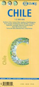
Wegenkaart - landkaart Chile - Chili | Borch

Mooie geplasticieerde kaart van Chili. Deze kaart biedt een goed overzicht van het land met detailkaarten. Our soft-laminated folded map of Chile shows: Northern Chile, Central Chile, Southern Chile & Patagonia 1:2 000 000, Torres del Paine National Park 1:240 000, Robinson Crusoe Island 1:200 000, Easter Island (Rapa Nui) 1:160 000, Punta Arenas, ...
11,50

Webshops met dit product

Webshop
Bezorging
Prijs

Anderen bekeken ook

Wegenkaart - landkaart Peru | Borch
Mooie geplasticieerde kaart van Peru. Deze kaart biedt een goed overzicht van het land met detailkaarten.   Our soft-laminated folded map of Peru shows: Peru North 1:1 750 000, Peru South 1:1 750 000, Amazonian Peru 1:2 500 000, Central Lima 1:18 000, Greater Lima 1:150 000, Central Cuzco 1:12 000, Greater Cuzco 1:50 000, Ayacucho 1:20 000, Arequipa 1:17 000, Chan Chan 1:40 000, Trujillo 1:20 000, Sacsayhuaman 1:10 000, Machu Picchu 1:44 000, Peru administrative & time zones. Borch Maps are easy to fold, durable and water-repellent with a wipeable surface. Borch Maps show hotels, museums, monuments, markets, public transport, top sights and points of interest, useful statistics, conversion charts for temperatures, weights and measurements, climate charts showing temperatures, sunshine hours, precipitation and humidity, overview maps, time zones, and much more...   Bordering Brazil, Bolivia, Chile, Colombia, Ecuador and the Pacific Ocean, the Republic of Peru is the cradle of the Inca e…
11,50
Wegenkaart - landkaart Thailand | Borch
Mooie geplasticieerde kaart van Thailand. Deze kaart biedt een goed overzicht van het land met detailkaarten van o.a. Bangkok, Phuket, Ko Samui. Our soft-laminated folded map of Thailand in the 8th edition shows: Thailand 1:1 500 000, Bangkok 1:22 000, Greater Bangkok 1:125 000, Chiang Mai 1:22 000, Mae Hong Son 1:14 000, Northwest Thailand 1:835 000, Phuket 1:350 000, Ko Samui & Ko Phangan 1:350 000, Thailand administrative & time zones. Borch Maps are easy to fold, durable and water-repellent with a wipeable surface. Borch Maps show hotels, museums, monuments, markets, public transport, top sights and points of interest, useful statistics, conversion charts for temperatures, weights and measurements, climate charts showing temperatures, sunshine hours, precipitation and humidity, overview maps, time zones, and much more...   Thailand - "Country of Liberty" - has every right to its name, as it is the only southeast Asian country never to have been ruled by a western colonial power.…
11,50
Wegenkaart - landkaart Seychelles - Seychellen | Borch
Mooie geplasticieerde kaart vande Seychellen. Deze kaart biedt een goed overzicht van het land met detailkaarten.   Our soft-laminated folded map of Seychelles shows: Bird Island, Denis, Arid, Fregate 1:25 000, Mahe, Silhouette, Praislin, La Digue, Marianne, Desroches, North 1:50 000, Inner Islands 1:750 000, Seychelles 1:4 500 000, Victoria 1:13 000, Vallée de Mai 1:13 000 and Aldabra, Amirantes, Farquhar 1:2 500 000, Seychelles time zones. Borch Maps are easy to fold, durable and water-repellent with a wipeable surface. Borch Maps show hotels, museums, monuments, markets, public transport, top sights and points of interest, useful statistics, conversion charts for temperatures, weights and measurements, climate charts showing temperatures, sunshine hours, precipitation and humidity, overview maps, time zones, and much more...   The Republic of Seychelles is an archipelago of 115 granitic and coralline islands in the Indian Ocean, located east of Africa and northeast of Madagascar. Se…
11,50
Wegenkaart - landkaart India Zuid | Borch
Mooie geplasticieerde kaart van het zuiden van india. Deze kaart biedt een goed overzicht van het land met detailkaarten. Our soft-laminated folded map of India South shows: India South 1:3 000 000, Mumbai 1:30 000, Kolkata 1:30 000, Chennai 1:30 000, Hyderabad 1:30 000, Bengaluru 1:30 000, Old Goa 1:15 000, Madurai 1:30 000, Trivandrum 1:30 000, Hampi 1:30 000, Kochi 1:30 000 and India administrative and time zones. Borch maps are easy to fold, durable and water-repellent with a wipeable surface. Borch Maps show hotels, museums, monuments, markets, public transport, top sights and points of interest, useful statistics, conversion charts for temperatures, weights and measurements, climate charts showing temperatures, sunshine hours, precipitation and humidity, overview maps, time zones, and much more...   Southern India, bordered by the Arabian Sea, the Indian Ocean, and the Bay of Bengal, is a culturally diverse region evoking images of colourful, chaotic cities, Ayurveda retreats, dr…
11,50
Wegenkaart - landkaart Cuba | Borch
Mooie geplasticieerde kaart van Cuba. Deze kaart biedt een goed overzicht van het land met detailkaarten. Our soft-laminated map of Cuba includes: Cuba West 1:1 000 000, Cuba East 1:1000 000, La Habana 1:16 000, Varadero 1:25 000, Playas del Este 1:22 000, Santiago de Cuba 1:16 000, Cuba administrative & time zones. Borch Maps are easy to fold, durable and water-repellent with a wipeable surface. Borch Maps show hotels, museums, monuments, markets, public transport, top sights and points of interest, useful statistics, conversion charts for temperatures, weights and measurements, climate charts showing temperatures, sunshine hours, precipitation and humidity, overview maps, time zones, and much more...   The largest island in the Caribbean evokes images of blue, crystal-clear waters lapping against immaculate white beaches or revealing the colourful underwater life of the stunning reefs, cool courtyards enclosed by colonial buildings, stylish barmen mixing exotic, potent cocktails, and…
11,50
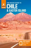
Reisgids Chile - Chili | Rough Guides
Zeer goede reisgids voor zowel de georganiseerde maar vooral voor de zelfstandige reiziger. Boordevol informatie over reizen, slapen, eten, maar ook musea en cultuur. Voor Europese landen en vooral steden meestal completer en beter dan de Lonely Planet ! This practical travel guide to Chile & Easter Island features detailed factual travel tips and points-of-interest structured lists of all iconic must-see sights as well as some off-the-beaten-track treasures. Our itinerary suggestions and expert author picks of things to see and do will make it a perfect companion both, ahead of your trip and on the ground. This Chile & Easter Island guide book is packed full of details on how to get there and around, pre-departure information and top time-saving tips, including a visual list of things not to miss. Our colour-coded maps make Chile & Easter Island easier to navigate while you're there. This guide book to Chile & Easter Island has been fully updated post-COVID-19 and it comes with a fr…
24,95
Wegenkaart - landkaart Hawaiian Islands - Hawaiï | Borch
Mooie geplasticieerde kaart van Hawaiï. Deze kaart biedt een goed overzicht van deze eilanden met detailkaarten.   Our soft-laminated folded map of Hawaii shows: Hawaii (Big Island) 1:400 000, Kilauea Caldera 1:150 000, Hilo 1:70 000, Maui, Molokai / Lanai / Kahoolawe 1:200 000, Wailuku & Kahului 1:35 000, Hawaiian Islands 1:4 000 000, Niihau 1:400 000, Kauai / Oahu 1:200 000, Honolulu & Pearl Harbour 1:26 000, Honolulu Downtown 1:15 500, USA administrative & time zones. Borch Maps are easy to fold, durable and water-repellent with a wipeable surface. Borch Maps show hotels, museums, monuments, markets, public transport, top sights and points of interest, useful statistics, conversion charts for temperatures, weights and measurements, climate charts showing temperatures, sunshine hours, precipitation and humidity, overview maps, time zones, and much more...   Borne of fire and water barely 300 million years ago, the eight islands of the Hawaiian Archipelago together form the 50th US st…
11,50
Wegenkaart - landkaart Patagonië en Zuid Chili - Patagonia - Chile south | ITMB
Een degelijke wegenkaart met aanduidingen van o.a. nationale parken, vliegveld, benzinepomp, dirt-roads. Als overzichtskaart goed te gebruiken.   Zuid Chili schaal 1:1.770.000 Patagonië schaal 1:2.200.000   This is a brand new map for ITMB and concentrates on the fast-changing southern portion of Chile (known as the Austral) and Patagonia, which technically only exists in southern Argentina, but in reality can't be shown easily on a map without including the same area in Chile. Thus, one side concentrates on Chile south of Los Angeles (yes, there's one there too!) in two long strip maps that go all the way to Cape Horn (or Hoorn, in Dutch) south of Tierra del Fuego. Although it has nothing to do with this part of Chile, we have also included the main portion of touristic Easter Island, an inset of what is popularly referred to as Robinson Crusoe Island (Alexander Selkirk was marooned here for a number of years, and is the real-life model of the fictional Crusoe) and an inset map of Ush…
13,95
Wegenkaart - landkaart Spanje | Borch
Mooie geplasticieerde kaart van Spanje. Deze kaart biedt een goed overzicht van het land met detailkaarten.   Our soft-laminated folded map of Spain shows: Spain East 1:875 000, Spain West 1: 875 000, Canary Islands 1:1 875 000, Spain administrative and Europe time zones. Borch Maps are easy to fold, durable and water-repellent with a wipeable surface. Borch Maps show hotels, museums, monuments, markets, public transport, top sights and points of interest, useful statistics, conversion charts for temperatures, weights and measurements, climate charts showing temperatures, sunshine hours, precipitation and humidity, overview maps, time zones, and much more...   The Kingdom of Spain is the twelfth-largest economy in the world and was once the leading power and colonial empire in Europe. Spain has suffered its share of wars, invasions, inquisitions, and isolation, contributing to the rich and diverse culture that democratic Spain today represents. Its territory covers the central and east…
11,50
Wegenkaart - landkaart Costa Rica | Borch
Mooie geplasticieerde kaart van Costa Rica. Deze kaart biedt een goed overzicht van het land met detailkaarten.   Our soft-laminated folded map of Costa Rica shows: Costa Rica 1:650 000, Cocos Island 1:150 000, San Jose 1:20 000, Meseta Central 1:300 000, Costa Rica administrative and time zones. Borch maps are easy to fold, durable and water-repellent with a wipeable surface. Borch Maps show hotels, museums, monuments, markets, public transport, top sights and points of interest, useful statistics, conversion charts for temperatures, weights and measurements, climate charts showing temperatures, sunshine hours, precipitation and humidity, overview maps, time zones, and much more...   The Republic of Costa Rica ("rich coast") is bordered by Nicaragua, Panama, the Pacific Ocean and the Caribbean Sea. Costa Rica abolished its army in 1949 and is an oasis of peace and tranquility in Central America. Democracy, a policy of neutrality and exemplary environmental standards (approx. 25% of th…
11,50

Klanten-reviews van Wegenkaart - landkaart Chile - Chili | Borch

Er zijn nog geen beoordelingen voor dit productBen jij de eerste die een review plaatst?

Meer over Wegenkaart - landkaart Chile - Chili | Borch

Productomschrijving

Mooie geplasticieerde kaart van Chili. Deze kaart biedt een goed overzicht van het land met detailkaarten. Our soft-laminated folded map of Chile shows: Northern Chile, Central Chile, Southern Chile & Patagonia 1:2 000 000, Torres del Paine National Park 1:240 000, Robinson Crusoe Island 1:200 000, Easter Island (Rapa Nui) 1:160 000, Punta Arenas, Antofagasta, Iquique 1:15 000, Valparaiso 1:10 000, Arica 1:16 000, La Serena 1:13 000, Vina del Mar 1:22 000, Santiago 1:20 000 and Chile administrative & time zones. Borch Maps are easy to fold, durable and water-repellent with a wipeable surface. Borch Maps show hotels, museums, monuments, markets, public transport, top sights and points of interest, useful statistics, conversion charts for temperatures, weights and measurements, climate charts showing temperatures, sunshine hours, precipitation and humidity, overview maps, time zones, and much more...   The Republic of Chile is a long and narrow coastal strip on the western side of the South American continent, located between the Pacific Ocean and the Andes Mountains. It borders Peru, Bolivia and Argentina. Its climatic regions differ vastly and include the driest desert in the world (Atacama) in the north and an Alpine climate in the south. First settled by migrating Native Americans, then ruled by the Inca and later colonized by the Spanish, Chile is today one of South America's wealthiest and most stable nations, it measures highly in all manner of international rankings. Chile prides itself on its nickname of "Country of Poets" and was home to Pablo Neruda and Gabriela Mistral, two Nobel Prize winners. Tourism has grown steadily in the last few decades and there are countless awesome natural sights to behold, e.g. the Valley of the Moon, Chungará Lake, the Parinacota and Pomerape volcanos, Patagonia, and Easter Island, to name but a few. Summer is from December to March, when locals concentrate in the coastal beach towns in the north or in the region around 
Webshop.nl maakt gebruik van cookies. Ga je verder op onze website, ga dan akkoord met het plaatsen van cookies en de verwerking van deze data door ons en vermelde partners.