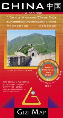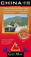
Wegenkaart - landkaart China Administrative Map | Gizi Map

0
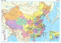
This folded, political map of China shows provinces in different colors. Map features province boundaries, major cities, airports, waterways, ports and the Great Wall. Inset of Pearl River Delta. Legend in 5 languages: English, German, French, Italian, and Chinese. Scale is 1:6.5 million. A basic political map of the country, with colours clearly ...

Verkopers met dit product

Verkoper
Bezorging
Prijs
DeZwerver.nl logo
DeZwerver.nl
2,95
15,95

Anderen bekeken ook

Nieuw
Wandkaart China - political, 95 x 69 cm | Gizi Map
Een wandkaart van China waarop de politieke grenzen en steden tweetalig staan weergeven. Natuurkundige aspecten zijn weggelaten, maar dat komt de politieke en bestuurlijke indeling duidelijk ten goede. Afmetingen: 69cm.x 95cm. (hxb) An administrative wall map of China at 1:6,500,000, size 96 x 68cm (38" x 27" approx), from Gizi Map showing the division of the country into provinces. All place names are given in both Chinese and Latin alphabet. Hong Kong and the Pearl River Delta are presented in a greater detail on an inset.   China’s provinces are shown in bright contrasting colours. Town symbols indicate the size of the population. Main airports and ports are marked, as well as coastal and international shipping routes, Topographic information is limited to the network of rivers. Latitude and longitude lines are at 5° intervals. The map is not indexed. Multilingual map legend includes English. An inset shows Hong Kong and the Pearl River Delta region at 1:1,000,000.
46,95
Nieuw
Wegenkaart - landkaart India | Gizi Map
Natuurkundige wegenkaart van India met ook veel aandacht voor het wegennet en plaatsen, achterop de kaart staat een uitgebreid register. A detailed and attractive general map showing relief through altitude tinting, with an inset administrative map also included. Coverage extends beyond India to include the whole of Nepal, Bangladesh and large sections of Myanmar, Pakistan and Afghanistan. The Maldives, Andaman & Nicobar Islands and Eastern India (Assam & surroundings) are shown in insets. Selected peak heights are indicated and some terrain features such as salt flats, glaciers & swamps are distinguished. Several categories of roads are distinguished, including selected minor roads and tracks, with intermediate driving distances marked on many routes. Railways, shipping routes, airports and ports are marked and administrative region boundaries (and disputed frontiers) are shown. Symbols denote major places of worship, palaces, temples, beach resorts, antiquities, archeological sites,…
15,95
Nieuw
Wegenkaart - landkaart Yemen - Jemen | Gizi Map
Yemen, including the Gulf of Aden, at 1:1,250,000 on an excellent and informative map from Gizi Maps, with a street plan of central Sana’a and enlargements of the environs of the capital and Aden, plus the Aden Peninsula.   The map has the publisher’s characteristic bold altitude colouring and plenty of names of various mountain chains, peaks, deserts, etc. Graphics indicate swamps, salt flats, wadis, deserts, lava flows, water wells, oasis, etc, to provide a vivid picture of the country’s topography. Names of the larger towns, provinces and many geographical features are given in both Latin and Arabic alphabets; all other place names are shown only transliterated.   Coverage extends southward to the northern coastline of the Horn of Africa, including the whole of Djibouti and most of Eritrea. Within the Gulf of Aden the Internationally Recommended Transit Corridor (IRTC) is marked, as well as other ferry and shipping routes including those leading to the Socotra Archipelago and in th…
15,95
Nieuw
Wegenkaart - landkaart 3008 Adventure Map China East - Oost | National Geographic
Wegenkaart van Oost China  met vermelding van veel bezienswaardigheden, nationale parken en attrakties. Watervast en scheurvast.   National Geographic's China East Adventure Map is designed to meet the unique needs of adventure travelers with its durability and detailed, accurate information. The map includes the locations of thousands of cities and towns with a user-friendly index, plus a clearly marked road network complete with distances and designations for major highways, major routes and secondary roads. The China Adventure Map is printed in the United States on a durable synthetic paper, making it waterproof, tear-resistant and tough—capable of withstanding the rigors of international travel.   The China East Adventure Map differs from a traditional road map for it includes hundreds of points of interest that highlight diverse and unique destinations in the region. UNESCO World Heritage sites, national parks and reserves, archaeological sites, temples, caves and points of …
17,50
Nieuw
Wegenkaart - landkaart 3400 Adventure Map Argentina - Argentinië | National Geographic
Wegenkaart van Argentinië met vermelding van veel bezienswaardigheden, nationale parken en attrakties. Watervast en scheurvast. Juist door deze vermeldingen onderscheidt de kaart zich van andere wegenkaarten. National Geographic's Argentina Adventure Map is designed to meet the unique needs of adventure travelers—detailed, durable, and accurate. Argentina includes the locations of thousands of major cities and towns with an index for easily locating them, plus a clearly marked road network complete with distances and designations for major highways, limited access highways, minor roads, and more.   What sets National Geographic Adventure Maps apart from traditional road maps are the hundreds of points-of-interest that highlight the diverse, unique, and exotic destinations within Argentina including national parks and preserves, World Heritage sites, archeological sites, churches of interest, scenic viewpoints, natural points of interest, and important travel aids like airports, airstr…
17,50
Nieuw
Wegenkaart - landkaart China | ITMB
Een degelijke kaart met aanduidingen van o.a. nationale parken, vliegveld, benzinepomp, dirt-roads en kleine plattegrond van hoofdstad. Als overzichtskaart goed te gebruiken. Tweezijdig, op de ene kant West China en op de andere zijde Oost China. This edition is printed on waterproof, tear-resistant paper, and has a new cover picture showing a portion of the Great Wall. A cursory glance at the map will show an incredible number of motorways. We still show some as being under construction, but updating the road network is now essentially completed. The amazing rapid rail network is now also essentially complete and all such train lines are noted on the map in a red-dashed format. Inset maps of Beijing and Shanghai are shown on side 2, as well as a list of Top Attractions. We continue to show contentious political disputed territories based on practical administrative control, so India's northeast is shown as being under India's control, whereas parts of the northwest are shown under Ch…
13,95
Nieuw
Wegenkaart - landkaart Sudan and South Sudan | Gizi Map
Sudan and South Sudan as separate countries on an excellent indexed map at 1:2,500,000 from Gizi Maps with detailed presentation of the topography, administrative divisions, street plans of Khartoum and Juba, etc. Excellent presentation of the terrain in the publisher’s characteristic style provides a vivid picture of the region’s geography: bold altitude colouring with plenty of spot heights and names of peaks, mountain ranges, etc, plus additional graphics for flood plains, swamps, salt flats, deserts, lava fields, wadis and water wells. National parks or other protected areas and interesting natural sites are highlighted. The map indicates the boundary of the disputed Abyei area and shows the internal administrative boundaries and names of the provinces. Within North Sudan names of larger towns and of the provinces are also given in Arabic. Where appropriate, alternative versions of town names are provided (Khartoum/Al Khartum, Omdurman/Umm Durman, etc). The map shows the road n…
15,95
Nieuw
Wegenkaart - landkaart 3204 Adventure Map South Africa - Zuid Afrika | National Geographic
Wegenkaart van Zuid Afrika met vermelding van veel bezienswaardigheden, nationale parken en attrakties. Watervast en scheurvast. Juist door deze vermeldingen onderscheidt de kaart zich van andere wegenkaarten. National Geographic’s South Africa Adventure Map is designed to meet the unique needs of adventure travelers—detailed, durable, and accurate. It includes the locations of thousands of major cities and towns with an index for easily locating them, plus a clearly marked road network complete with distances and designations for major highways, limited access highways, and more. Both paved and unpaved roads, tracks, and trails are marked for those adventurers who wish to explore less traveled routes.   What sets National Geographic Adventure Maps apart from traditional road maps are the hundreds of points-of-interest that highlight the diverse, unique, and exotic destinations within South Africa including national parks and reserves, sanctuaries, World Heritage sites, archeological …
17,50
Nieuw
Wegenkaart - landkaart Lybië - Libya | Gizi Map
Libya at 1:1,750,000 on an indexed road map from Gizi Map with exceptionally fine and detailed presentation of its physical geography, oil and gas wells and pipelines, water aqueducts, ancients sites and other places of interest, etc. Names of larger towns and selected smaller locations, as well as of many topographic features are also shown in Arabic.   The map provides a very fine presentation of the country’s geography through relief shading and graphics for sandy or stone deserts, swamps, salt flats, oasis, and water wells, plus numerous spot heights and plenty of names of mountain ranges, wadis, etc. Road network shows desert tracks and gives distances on main routes. Railway lines are included and domestic airports/aerodromes are marked. The map also shows oil or gas wells and pipelines, water aqueducts and boundaries of administrative provinces. Symbols indicate locations with campsites or youth hostels, various places of interest including archaeological sites and natural curi…
15,95
Wegenkaart - landkaart 3203 Adventure Map Morocco - Marokko | National Geographic
Wegenkaart van Marokko met vermelding van veel bezienswaardigheden, nationale parken en attrakties. Watervast en scheurvast. Juist door deze vermeldingen onderscheidt de kaart zich van andere wegenkaarten. National Geographic's Morocco Adventure Map is designed to meet the unique needs of adventure travelers—detailed, durable, and accurate. Morocco includes the locations of thousands of cities and towns with an index for easily locating them, plus a clearly marked road network complete with distances and designations for motorways, dual carriageways, major roadways, and more. Transportation within and beyond the country is made easier with the location of airports, airfields, railroads, ferry routes, river crossings, lighthouses, harbors, border crossings, and petrol stations. What sets National Geographic Adventure Maps apart from traditional road maps are the hundreds of points of interest that highlight the diverse, unique, and exotic destinations within Morocco. In addition to typ…
17,50

Klanten-reviews van Wegenkaart - landkaart China Administrative Map | Gizi Map

Er zijn nog geen beoordelingen voor dit productBen jij de eerste die een review plaatst?

Meer over Wegenkaart - landkaart China Administrative Map | Gizi Map

Productomschrijving

This folded, political map of China shows provinces in different colors. Map features province boundaries, major cities, airports, waterways, ports and the Great Wall. Inset of Pearl River Delta. Legend in 5 languages: English, German, French, Italian, and Chinese. Scale is 1:6.5 million.

A basic political map of the country, with colours clearly distinguishing the provinces. Major towns and rivers are identified and the great wall is marked. Symbols depict airports and ports. Manes are written in Roman and Chinese script. An inset shows Hong Kong and the Pearl River Delta region at 1:1,000,000

Verken gerelateerde categorieën

Webshop.nl maakt gebruik van cookies. Ga je verder op onze website, ga dan akkoord met het plaatsen van cookies en de verwerking van deze data door ons en vermelde partners.