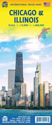
Wegenkaart - landkaart Chicago & Illinois | ITMB

0
The USA continues to be a country of great interest to travelers. Chicago is the third largest city in the USA and home to many attractions and museums. This map covers the bulk of the city proper, stretching from Wrigley Ville (yes, the site of baseball's Wrigley Field) south to Chinatown and the junctions of Interstates 90 and 55. The core is we...

Verkopers met dit product

Verkoper
Bezorging
Prijs
DeZwerver.nl logo
DeZwerver.nl
2,95
13,95

Anderen bekeken ook

Wegenkaart - landkaart Chicago & Illinois | ITMB
The USA continues to be a country of great interest to travelers. Chicago is the third largest city in the USA and home to many attractions and museums. This map covers the bulk of the city proper, stretching from Wrigley Ville (yes, the site of baseball's Wrigley Field) south to Chinatown and the junctions of Interstates 90 and 55. The core is well-presented, with particular attention being paid to pathways in parks, locators for the start of Route 66, and showing all transit lines by colour. In addition, there are two inset maps (one on the back cover) showing the transit system , another of the overall urban area, and a small one for historic Oak Park.
13,95
Wegenkaart - landkaart Egypt & Cairo | ITMB
Following the so-called Arab spring of a few years ago, northern Africa experienced much turbulence. Egypt experienced the overthrow of the government, the installation of a radical religious-oriented replacement, and the installation of military governance. Tourism plummeted. Most map publishers discontinued their maps of the country. Five years later, Egypt has stabilized and tourism is growing. We feel that the time is right to re-introduce our ITMB map of Egypt. This version focuses on the portions of the country that have been re-opened for tourism, which means from the Mediterranean coastline south to the Aswan Dam. The portion further south remains closed for the moment, as is the border crossing with Sudan. We have also been forced to leave off the Great Sand Sea and the Western Desert portions for the same reason of unrest, as the border areas with Libya remain very unstable. However, we have provided a large inset map of Egypt, covering everything, in the area of desert. We …
13,95
Wegenkaart - landkaart Idaho, Montana & Wyoming | ITMB
Een degelijke kaart met aanduidingen van o.a. nationale parken, vliegveld, benzinepompen. The northern mountain states of the USA are now the most recent portion of ITMB’s re-mapping of the USA for travel. We had to include a small portion of Washington State and Oregon, due to the shape of Idaho, but the double-sided sheet covers the three states with very little room left over. Side 1 stretches from the Alberta border to Salt Lake City, in Utah, and from west of Spokane to Helena, MT. The 2nd side covers from the Canadian border south to Cheyanne, and is essentially a map of Montana and Wyoming. As such, this is the most detailed map of this region of the USA ever published, and pretty much completes our mapping of the western half of the continental USA. We have also added a new feature – a list of the most popular sites – for those with limited time, showing such well-known features as Glacier National Park and the Buffalo Bill Center of the West. We would be happy to expand this …
13,95
Wegenkaart - landkaart Lissabon & Zuid-Portugal | ITMB
The city of Lisbon is one of the most attractive in Europe. It is an ancient city, but most of its architecture dates from the Victorian era. It has a fascinating number of tram lines, and the trams tend to be an experience worth the trip. One graces our cover. There is no cheaper way to explore this city than to climb aboard and let the rails decide your destination! Coverage extends from the northern and western motorways to the southerly Rio Tejo and the national museum, so shows the city quite comprehensively. Almost half of the map area is of the massive Monsanto Park, one of the largest urban parks in the world. The reverse side is equally important, in that it presents our first-ever map dedicated to showing the charms of the entire country of Portugal. A bit of western Spain is included due to the unevenness of the border, but the map goes from the northernmost tipoff Castelo to the southernmost expanse of the Costa Do Algarve, showing touristic attractions, historic sites, be…
13,95
Wegenkaart - landkaart Tahiti - French Polynesia | ITMB
Anyone who has visited Tahiti retains fond memories of a wonderful Polynesian paradise. This map shows the major islands of French Polynesia as a series of large insets on Side 1. An overall inset map showing the many islands is also shown, but for showing detail, one must expand the individual islands. The largest one is the volcanic Tahiti Nui, with the capital city of Pape’ete (or Papeete in English), for which a detailed inset map is included. Most visitors stay in the vicinity of Papeete, along the coast. We show several popular resorts. There is a good circular road around the island’s shoreline, but no roads in the interior. The island is joined to another, called Tahiti Iti, or Little Tahiti, and roads extend partway around this less-developed part of the combined island. Most of the other islands are rarely visited, although they have resorts, beaches, and a lifestyle of their own. Names like Huahine, Riatea, Tahaa, and Maiao may not be as familiar as they should be, but all …
14,95
Wegenkaart - landkaart England & Wales - Engeland | ITMB
Een degelijke kaart met aanduidingen van o.a. nationale parken, vliegveld, benzinepompen. ITMB publishes a map of Great Britain, but each portion of GB needs its own map to show roads and attractions in more detail. This is a brilliant map of both England and Wales, showing the entire 'country' in a double-sided format. The place names index is formidable, but England in particular is a series of little villages, so it has been very difficult to decide what to include and what to leave out. This map is showing motorways, divided carriageways, all A & B highways, railway lines, airports, historic sites and touristic attractions, parks and gardens, and just about everything that we could fit on to the page to provide users with a detailed, usable map. We have been able to fit all of southern England/Wales as far north as Chester/Lincoln on side A and with a little overlap, from those cities north to the well over the Scottish border, up to Perth/Dundee filling side B. The Isle of Man an…
13,95
Wegenkaart - landkaart Québec | ITMB
Een degelijke kaart met aanduidingen van o.a. nationale parken, vliegvelden en grote wegen. Als overzichtskaart goed te gebruiken. Tweezijdig. La Belle Province is historically rich, linguistically unique in North America, and attractive for tourism. It is a very large area of land, forcing us to portray the northern portion at a different scale than the more populated southern portion. The map extends to Ottawa in the west and includes most of New Brunswick in the east, as well as all the border areas with the USA to the south. Due to the size of Quebec, the focus of this map is concentrated on providing road information to get around, parks and geographic features, and symbols portraying ski resort areas, urban areas, and road numbers. A basic inset showing the major routes around Montreal is an added feature.   Legend Includes: Roads by classification, Points of Interest, Mines, Museums, Airports, National Parks, Rivers, Lakes, Mountain Peaks, Waterfalls, Border Crossings, Rest Are…
13,95
Wegenkaart - landkaart Utah & Colorado | ITMB
Een degelijke wegenkaart met aanduidingen van o.a. nationale parken, vliegveld, benzinepomp, dirt-roads. Als overzichtskaart goed te gebruiken. ITMB is gradually mapping the entire USA in appropriate scales. Most States fit fairly well into the 1:500 to 1:750T scale, and Utah is perfect for mapping. It is also a perfectly nice place to visit, so we are pleased to add it to our program. This map shares a sheet with Colorado, so please note that the ordering information is the same. Utah is Mormon country and the temple in Salt Lake City is a sight to see. The Great Salt Lake to its west is interesting to view, but more popular is the Bonneville Salt Flats at its western edge, where so many speed records have been won. Utah also has two of Americas most scenic national parks: Zion in the southwest and Canyonlands in the southeast. Combined with Colorado to its east and to Idaho in the north (ITMBs Pacific Northwest regional map) and ITMBs companion maps of Arizona and New Mexico, this m…
13,95
Wegenkaart - landkaart - Stadsplattegrond Toronto & Southern Ontario - Ontario zuid | ITMB
Overzichtskaart van het zuiden van Ontario - schaal 1:600.000 - met op de andere kant een grote plattegrond van Toronto op schaal 1:12.000 Legend Includes: Roads by classification, Accomodations, Museum, Churches, Buildings, Points of tourist, Public Interests, Post Offices, Police Stations, Schools, Live Theatres, Cinemas, Ruins, Bus Terminals, Ferry Terminals, Service Areas, Hospitals, Ports, Mines, RCMP, Major Airports, Secondary Airports, Camp Grounds, National Park and Equivalent Reserves, Ski, Picnic Sites, and much more.   Toronto is the largest city in Canada by far. Touristically, its attraction rests with its central core, from High Park in the west to the Don River in the east, and from the park-like islands in Lake Ontario to Bloor Street in the north. In this area, one finds remnants of the oldest portion of ‘muddy York’, the original fort built to deter American raiders (close to the exhibition grounds), Campbell House (at Queen & University), and the first public schoo…
13,95
Wegenkaart - landkaart Laos | ITMB
Een degelijke kaart van Laos met aanduidingen van o.a. nationale parken, vliegveld, benzinepomp, dirt-roads en kleine plattegronden van Vientiane, Luang Prabang we're very pleased to introduce you to this new, double-sided, map at a great scale, with fantastic detail. To me, the north side is the most interesting, covering the portion of Laos from Vientiane, the capital, to the Chinese border. Detailed inset maps of Vientiane and Louang Prabang, the temple city, are included on this side, as are bits of both Thailand and Vietnam. The south portion fills the other side of the sheet, including a goodly portion of Vietnam, showing all border crossings. Much of Thailand has had to be obscured, unfortunately, to make room for the place names index, but the immediate border areas are shown, including the rail line south from Vientiane. In an interesting departure from previous ITMB maps, the back cover consists of a detailed inset map of Vientiane at 1:16,000 scale, making it easy to use in…
13,95

Klanten-reviews van Wegenkaart - landkaart Chicago & Illinois | ITMB

Er zijn nog geen beoordelingen voor dit productBen jij de eerste die een review plaatst?

Meer over Wegenkaart - landkaart Chicago & Illinois | ITMB

Productomschrijving

The USA continues to be a country of great interest to travelers. Chicago is the third largest city in the USA and home to many attractions and museums. This map covers the bulk of the city proper, stretching from Wrigley Ville (yes, the site of baseball's Wrigley Field) south to Chinatown and the junctions of Interstates 90 and 55. The core is well-presented, with particular attention being paid to pathways in parks, locators for the start of Route 66, and showing all transit lines by colour. In addition, there are two inset maps (one on the back cover) showing the transit system , another of the overall urban area, and a small one for historic Oak Park.

Productinformatie

    Verken gerelateerde categorieën

    Webshop.nl maakt gebruik van cookies. Ga je verder op onze website, ga dan akkoord met het plaatsen van cookies en de verwerking van deze data door ons en vermelde partners.