webshop.nl
Categorieën
  Sluiten

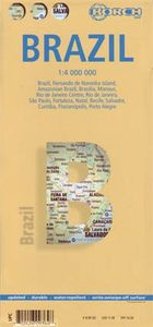
Wegenkaart - landkaart Brazilië - Brazil | Borch

Mooie geplasticieerde kaart van het Brazilië. Deze kaart biedt een goed overzicht van het land met detailkaarten. Our soft-laminated map of Brazil in the 5th edition includes: Brazil 1:4 000 000, Fernando de Noronha Island 1:4 000 000, Brazil Amazon 1:8 000 000, Brasíiia 1:60 000, Manaus 1:15 000, Rio de Janeiro Center 1:15 000, Rio de Janeiro 1:17...
11,50

Webshops met dit product

Webshop
Bezorging
Prijs

Anderen bekeken ook

Stadsplattegrond Rio de Janeiro | Borch
Geplastificeerde wegenkaart van Rio de Janeiro voor toeristisch gebruik. Met stadsplattegrond en inclusief index. Met kaarten van de omgeving van Rio, 30 bezienswaardigheden en openbaar vervoer in Rio de Janeiro.   Our soft-laminated folded map of Rio de Janeiro shows: Rio de Janeiro Centre 1:13 000, Quinta da Boa Vista 1:13 000, Corcovado 1:13 000, Ipanema, Leblon 1:13 000, Greater Rio de Janeiro 1: 175 000, Rio de Janeiro and Sao Paulo 1:4 000 000, Public Transport Rio de Janeiro, Brazil administrative and time zones and Top 30 sights. Borch maps are easy to fold, durable and water-repellent with a wipeable surface. Borch Maps show hotels, museums, monuments, markets, public transport, top sights and points of interest, useful statistics, conversion charts for temperatures, weights and measurements, climate charts showing temperatures, sunshine hours, precipitation and humidity, overview maps, time zones, and much more...   The city of Rio de Janeiro ("January River") is located in t…
10,25
Wegenkaart - landkaart Buenos Aires | Borch
Borch Buenos Aires is een duidelijke, geplastificeerde plattegrond van het centrum met informatie over openbaar vervoer en bezienswaardigheden. Inclusief straatnamenregister.   Our soft-laminated folded map of Buenos Aires in the 7th edition shows: Buenos Aires Centre 1:15 000, Isla Martín Garcia 1:18 000, Núnez 1:15 000, Boca 1:15 000, Buenos Aires 1:75 000, Greater Buenos Aires 1:530 000, Argentina Central 1:3 000 000, Public Transport Buenos Aires, Argentina administrative and time zones, Top 30 Sights. Borch Maps are easy to fold, durable and water-repellent with a wipeable surface. Borch Maps show hotels, museums, monuments, markets, public transport, top sights and points of interest, useful statistics, conversion charts for temperatures, weights and measurements, climate charts showing temperatures, sunshine hours, precipitation and humidity, overview maps, time zones, and much more...   Buenos Aires, located on the Rio de la Plata inlet on the southeastern side of the South Ame…
10,25
Wegenkaart - landkaart Brazilië | ITMB
Een degelijke kaart met aanduidingen van o.a. nationale parken, vliegveld, benzinepomp, dirt-roads en kleine plattegrond van hoofdstad. Als overzichtskaart goed te gebruiken. Brazil, or more properly, Brasil, is a difficult country to map as a country, in that most of the developed areas are in the relatively small extreme south of the country. The vast region of the Amazon Basin is lightly populated and is not easy to access. Our solution has been to portray the south portion on one side at a detailed scale, to enable such locations as Rio and Sao Paulo a better scale to help travellers, while mapping the north at a respectable but more limited scale on the That said, one still needs both sides of the map, as Brasilia, the capital, falls on the north side other side of the sheet. I should also note that roads north of Brasilia tend to be less well-paved than those in the south. The  shape of the country also presents mapping difficulties, in that little room is available for inset map…
13,95
Wegenkaart - landkaart Duitsland | Borch
Mooie geplasticieerde kaart van Duitsland. Deze kaart biedt een goed overzicht van het land met detailkaarten.   Our soft-laminated folded map of Germany shows: Germany North 1:800 000, Germany South 1:800 000, Germany administrative, Europe time zones. Borch Maps are easy to fold, durable and water-repellent with a wipeable surface. Borch Maps show hotels, museums, monuments, markets, public transport, top sights and points of interest, useful statistics, conversion charts for temperatures, weights and measurements, climate charts showing temperatures, sunshine hours, precipitation and humidity, overview maps, time zones, and much more...   The Federal Republic of Germany is situated in Central Europe and is a parliamentary federal republic of 16 states, among them the capital city Berlin counting as a city-state. Germany was a founding member of the European Union, is the largest country of the Union according to population, is counted as one of the modern world powers, is one of the…
11,50
Wegenkaart - landkaart 3401 Adventure Map Brazil - Brazilië | National Geographic
Wegenkaart van Brazilië met vermelding van veel bezienswaardigheden, nationale parken en attrakties. Watervast en scheurvast. Juist door deze vermeldingen onderscheidt de kaart zich van andere wegenkaarten. National Geographic s Brazil AdventureMap is designed to meet the unique needs of adventure travelers detailed, durable, and accurate. Brazil includes the locations of thousands of major cities and towns with an index for easily locating them, plus a clearly marked road network complete with distances and designations for major highways, limited access highways, tollways, and more.    What sets National Geographic AdventureMaps apart from traditional road maps are the hundreds of points-of-interest that highlight the diverse, unique, and exotic destinations within Brazil including national parks and reserves, World Heritage sites, archeological sites, indigenous areas, churches, zoos, and museums.    The front side of the Brazil map includes the western half of the country and featu…
17,50
Wegenkaart - landkaart Frankrijk | Borch
Mooie geplasticieerde kaart van Frankrijk. Deze kaart biedt een goed overzicht van het land met detailkaarten. Our soft-laminated folded map of France shows: France North 1:875 000, France South 1:875 000, Corsica 1: 875 000, France administrative, Europe time zones. Borch Maps are easy to fold, durable and water-repellent with a wipeable surface. Borch Maps show hotels, museums, monuments, markets, public transport, top sights and points of interest, useful statistics, conversion charts for temperatures, weights and measurements, climate charts showing temperatures, sunshine hours, precipitation and humidity, overview maps, time zones, and much more...   France, one of the largest countries in Western Europe, is bordered by the English Channel, the North Sea and the Benelux countries to the north. To the East the Rhine river creates a natural border, as do the mountains toward Switzerland and Italy down to the shores and picturesque fishing villages of the Mediterranean coast. The maj…
11,50
Reisgids Brazil - Brazilië | Eyewitness
Prachtig geillustreerde reisgids met o.a. 3D tekeningen, fraaie kaarten en geweldige foto’s. Daarnaast uitgebreide achtergrondbeschrijvingen. Echt om in de stemming te komen! Groot formaat gids. Engelstalig. Your journey starts here. Featuring DK's much-loved maps and illustrations, walks and information, plus all new, full-color photography, this 100% updated guide to Brazil brings you the best of this captivating country in a brand-new, lightweight format. What's inside? - full-color photography, hand-drawn illustrations, and maps throughout - easy-to-follow walks, tours, and itineraries - our pick of Brazil's must-sees, top experiences, and hidden gems - insider tips and information: when to visit, how to avoid the crowds, where to capture the perfect photo, and more - the best spots to eat, drink, shop, and stay - an area-by-area guide covering each corner of Brazil, from São Paulo to Salvador, Rio de Janeiro to the Amazon rainforest - expert advice: get ready, get around, and st…
27,95
Wegenkaart - landkaart Nieuw - Zeeland | Borch
Mooie geplasticieerde kaart van Nieuw - Zeeland. Deze kaart biedt een goed overzicht van het land met detailkaarten.   Our soft-laminated map of New Zealand includes: North Island 1:1 300 000, South Island 1:1 300 000, Auckland 1:20 000, Christchurch 1:20 000, Dunedin 1:15 000,  Nelson 1:15 000, Rotorua 1:15 000, Queenstown 1:15 000, Wellington 1:20 000, New Zealand administrative & time zones, interesting statistics, conversion chart for temperatures, weights and measures, climate chart with temperatures, sunshine hours, precipitation and humidity and much more.   "4 million inhabitants and 60 million sheep" does not do justice to the charm and natural diversity of this beautiful country. Lush meadows and fertile soils are only some of the natural resources with which New Zealand is endowed, the real natural wealth of this island state in the middle of the South Pacific lies in its incredibly diverse landscape: snow-covered mountains, dense forests, lush green lowlands, crystal-clear …
11,50
Wegenkaart - landkaart Chile - Chili | Borch
Mooie geplasticieerde kaart van Chili. Deze kaart biedt een goed overzicht van het land met detailkaarten. Our soft-laminated folded map of Chile shows: Northern Chile, Central Chile, Southern Chile & Patagonia 1:2 000 000, Torres del Paine National Park 1:240 000, Robinson Crusoe Island 1:200 000, Easter Island (Rapa Nui) 1:160 000, Punta Arenas, Antofagasta, Iquique 1:15 000, Valparaiso 1:10 000, Arica 1:16 000, La Serena 1:13 000, Vina del Mar 1:22 000, Santiago 1:20 000 and Chile administrative & time zones. Borch Maps are easy to fold, durable and water-repellent with a wipeable surface. Borch Maps show hotels, museums, monuments, markets, public transport, top sights and points of interest, useful statistics, conversion charts for temperatures, weights and measurements, climate charts showing temperatures, sunshine hours, precipitation and humidity, overview maps, time zones, and much more...   The Republic of Chile is a long and narrow coastal strip on the western side of the So…
11,50
Wegenkaart - landkaart Europa - Europe | Borch
Mooie geplasticieerde kaart van Europa. Deze kaart biedt een goed overzicht van dit continent met detailkaarten.   Our soft-laminated folded map of Europe shows: Europe 1:4 000 000, Europe North 1:5 000 000, the cities of London and Paris 1:15 000, Rome 1:13 000 and their Regions each in 1:700 000. In addition you find the Top 15 sights and airports of this three cities and a map of the European Union with time zones. Borch Maps are easy to fold, durable and water-repellent with a wipeable surface. Borch Maps show hotels, museums, monuments, markets, public transport, top sights and points of interest, overview maps, time zones, and much more...   Covering only 2% of the earth’s surface, Europe is home to almost 740 million people and currently represents the world’s largest economy. About 503 million Europeans reside in the 27 EU member states. Europe is one of the seven continents, even though it is actually just a peninsula of Eurasia. The Ural Mountains and River and the Caspian Se…
11,50

Klanten-reviews van Wegenkaart - landkaart Brazilië - Brazil | Borch

Er zijn nog geen beoordelingen voor dit productBen jij de eerste die een review plaatst?

Meer over Wegenkaart - landkaart Brazilië - Brazil | Borch

Productomschrijving

Mooie geplasticieerde kaart van het Brazilië. Deze kaart biedt een goed overzicht van het land met detailkaarten. Our soft-laminated map of Brazil in the 5th edition includes: Brazil 1:4 000 000, Fernando de Noronha Island 1:4 000 000, Brazil Amazon 1:8 000 000, Brasíiia 1:60 000, Manaus 1:15 000, Rio de Janeiro Center 1:15 000, Rio de Janeiro 1:175 000, Sao Paulo 1:20 000, Fortaleza 1:15 000, Natal 1:22 000, Recife 1:15 000, Salvador 1:14 000, Curitiba, Florianópolis, Porto Alegre each 1: 15 000, Brazil administrative & time zones; interesting statistics: conversion chart for temperatures, weights and measures; climate chart with temperatures, sunshine hours, precipitation and humidity; hotels, museums, markets and much more.   The Federative Republic of Brazil is the fifth largest country in the world, the largest and most populous country and largest economy in South America and the seventh largest economy in the world. Bordered by the Atlantic Ocean to the east, the remaining border is formed by all the other South American countries except for Chile and Ecuador. Because Brazil was colonized by the Portuguese in 1500 it is the only South American country in which the official languag is Portoguese. Although it has a very large population (193 million) with urban centres concentrated primarily along the coast, there are vast uninhabited areas in the interior of the country. Both the Equator and the Tropic of Capricorn traverse Brazil. Due to the climate ranging from tropical to sub-tropical, the flora and fauna here are lush, colourful and plentiful. Natural resources are found in abundance. Besides the magnificent natural attractions the country has to offer "The Carnival de Brazil" and the endless beaches of Rio de Janeiro attract tourists the year round.
Webshop.nl maakt gebruik van cookies. Ga je verder op onze website, ga dan akkoord met het plaatsen van cookies en de verwerking van deze data door ons en vermelde partners.