Wegenkaart - landkaart Banff, Yoho & Kootenay national parks | Clark Geomatics

0
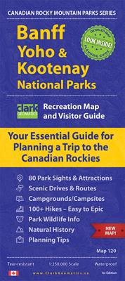
Handige geplastificeerde overzichtskaart van Banff, Yaho & Kootenay Nationaal Park in west Canada. Een duidelijk leesbare kaart die goed te gebruiken is voor het plannen van de route en het bezoek aan dit gebied. Op de achterzijde vindt u veel informatie over de wandelmogelijkheden, campings & de natuur.   Information on 80 Sights & Park Attractio...

Verkopers met dit product

Verkoper
Bezorging
Prijs
DeZwerver.nl logo
DeZwerver.nl
2,95
14,95

Anderen bekeken ook

Wegenkaart - landkaart Banff, Yoho & Kootenay national parks | Clark Geomatics
Handige geplastificeerde overzichtskaart van Banff, Yaho & Kootenay Nationaal Park in west Canada. Een duidelijk leesbare kaart die goed te gebruiken is voor het plannen van de route en het bezoek aan dit gebied. Op de achterzijde vindt u veel informatie over de wandelmogelijkheden, campings & de natuur.   Information on 80 Sights & Park Attractions Popular Scenic Drives & Routes Campgrounds & Backcountry Campsites 100+ Hikes – From Easy to Epic Wildlife Info – Where and When to Watch Awesome Planning Tips – Your Time is Precious
14,95
Wegenkaart - landkaart Banff - Jasper national parks | ITMB
Gedetailleerde wegenkaart van deze 2 bekende nationale parken in Canada. Naast toerischtische informatie zjn de belangrijkste wandelpaden schetsmatig ingetekend en worden de campings weergegeven, hogtelijnen geven een goed beeld van de hoogteverschillen en bergern in het gebied.. Jasper staat op de ene kant en Banff op de andere zijde.  Banff is the first national park declared anywhere in the world, done at a time when the idea of reserving huge tracts of land for the enjoyment of future generations was an admirable, though unheard of, concept. The park in the Rocky Mountains of western Alberta remains as lovely and as enjoyable as it must have seemed to the early CPR railway surveyors searching for a route through the mountains to join the then-colony of British Columbia to Canada. Nowadays, the park is laced with roads and hiking trails, and the town of Banff within the park is severely pressed to maintain a balance between serving the needs of the millions of visitors each year an…
13,95
Topografische kaart 82 N&K Canadian Rockies Banff, Kootenay, Yoho Parks | ITMB
1:250,000 scale, 1st Edition, 2008 – This is a fabulous map. The artwork consists of four complete Govt. of Canada Topographic maps (82J, K, N, and O) overprinted with hundreds of touristic attractions – camping sites, hiking trails, canoeing areas, wilderness lodges, youth hostels, golf courses – you name it, it's there. Coverage is from the 50th parallel, just north of the American border, to Saskatchewan Crossing in Jasper National Park, and from Calgary in the east to Mount Revelstoke in the west. This map is a 'must have' for every map retailer. All the big names are included: Banff, Lake Louise, Maligne Lake, Columbia Icefield, Yoho, Kootenay, Kicking Horse Pass, the CPR spiral tunnels, Radium Hot Springs, Upper Arrow Lake – this is THE definitive map of the one and only Rockies (actually, the Rocky Mountain Range stretches from the Yukon down to New Mexico, but this is hype, so let's forget reality for the moment). Printed double-sided on ITM plastic paper.
13,95
Wandelkaart 901 Banff North National Park | National Geographic
Prachtige geplastificeerde kaart van het bekende nationaal park. Met alle recreatieve voorzieningen als campsites, maar ook met topografische details en wandelroutes ed. Door uitgekiend kleurgebruik zeer prettig in gebruik. Scheur en watervast! The front side of the Banff North map details the south side of the national park, from Siffleur Wilderness Area to the north, to Kootenay National Park to the south. This side also covers survival tips, area trails, entry fees and details both Kootenay and Yoho Nationals Parks. The reverse side of the map details the north side of the park, extending from Siffleur Wilderness area to the south, to White Goat Wilderness to the North. Insets show safe travel in Bear Country, and all the recreation the park has to offer with backpacking, camping, biking, hiking and horseback riding.  National Geographic's Trails Illustrated map of Banff North is a two-sided, waterproof map designed to meet the needs of outdoor enthusiasts with unmatched durability…
17,95
Wegenkaart - landkaart 02 Canadian Rockies Banff & Jasper | Gem Trek Maps
Goede wegenkaart van Banff & Jasper met bezienswaardigheden, Overnachtingsmogelijkheden, Campings en hete bronnen. This is our most popular driving (touring) map and the map most recommended as an overview for anyone planning a trip to the Canadian Rocky Mountain Parks - Banff, Jasper, Yoho and Kootenay. It also covers Mount Revelstoke and Glacier national parks, the Bugaboos and the Purcell Mountains further west.  29 of the best points of interest in the Rocky Mountain Parks are numbered and described. Mountain lodges, campgrounds, hostels, hot springs, golf courses, ski areas, picnic sites, visitor centres and highway viewpoints are labelled. The mountains are also labelled with their name and elevation, if available, and glaciers are easy to pick out because they are shown in a different colour.  On the back, you will find a map of Western Canada showing all the major highways, as well as maps showing the major arteries in the cities of Edmonton and Calgary. There are also town ma…
13,95
Wandelkaart 17 Banff - Egypt Lake | Gem Trek Maps
Mooie, gedetailleerde kaart uit de serie van Gem Trek Hiking map-guides. Helder kleurgebruik en met de beste / mooiste wandelroutes, hikes en interessante plaatsen erop aangegeven. Gem Trek’s 1:50,000-scale BANFF–EGYPT LAKE MAP covers the most popular hiking trails in the immediate area of the town of Banff in more detail than our Banff & Mount Assiniboine Map.   The Banff–Egypt Lake Map features detailed cartography, accurate hiking trails with distances, and details such as side trips and backcountry campgrounds. For road travellers, it includes viewpoints, picnic areas, and campgrounds.   On the back of the map are trail descriptions of 17 recommended day hikes and four classic multi-day trips, all referenced to the map on the front. Also on the back is a list of trails recommended for early season, birdwatching, wildflowers, waterfalls, expansive views, awe-inspiring scenery, alpine meadows and rainy days. Included are contact numbers for visitor centres and backcountry booki…
17,95
Wandelkaart 900 Banff South National Park | National Geographic
Prachtige geplastificeerde kaart van het bekende nationaal park. Met alle recreatieve voorzieningen als campsites, maar ook met topografische details en wandelroutes ed. Door uitgekiend kleurgebruik zeer prettig in gebruik. Scheur en watervast!   Banff & Kootenay National Parks Alberta/British Columbia, Canada Trail distances, Mount Assiniboine Provincial Park, Radium Hot Springs, Lake Minnewanka, Castle Mountain, Bow Valley Parkway Waterproof and tear-resistant Clearly marked trails for hiking, biking, horseback riding, ATV, and more Detailed topography and clearly defined, color-coded boundaries of state parks, national recreation areas, wilderness areas, marine sanctuaries, and wildlife refuges
17,95
Reisgids Banff National Park | Moon Travel Guides
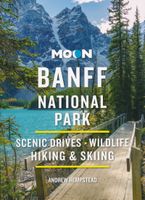
Uitstekende Amerikaanse reisgids van uitgever Moon. De gids is vergelijkbaar met Lonely Planet en Rough guide en is voor de backpacker - zelfstandige reiziger geschreven; toch is deze door de grote mate van details en achtergronden geschikt voor alle reizigers! De gids onderscheidt zich door gedegen en uitgebreide achtergrondinformatie over bijvoorbeeld natuur en cultuur. Banff sparkles as the crown jewel of Canada's national parks. Explore the best of it with Moon Banff National Park. Inside you'll find: Strategic, flexible itineraries, including the Best of Banff and highlights for a day trip The Best Hikes in Banff: Find the right trek for you with details on length, elevation gains, difficulty levels, and trailheads Experience the Outdoors: Ride over the snow in a horse-drawn sleigh or through the sky in a mountain gondola. Follow the vast network of hiking trails along glacial valleys and discover alpine lakes and spectacular vistas. Soak in a natural hot spring, treat yoursel…
16,50
Wandelkaart 10 Kootenay National Park | Gem Trek Maps
Kootenay National Park Wandelkaart – Gem Trek   Pluspunten & Minpunten Waterdicht en scheurvast – Ideaal voor gebruik in alle weersomstandigheden Zeer gedetailleerde cartografie – Inclusief hoogtelijnen, reliëfschaduw en hydrologische kenmerken Actuele en duidelijke wandelroutes – Met afstanden, namen en moeilijkheidsgraden Bevat populaire én minder bekende trails – Inclusief de volledige Rockwall Trail Extra informatie op de achterzijde – Trailbeschrijvingen, foto's, dagtochten, fietsroutes en contactgegevens Compact en praktisch formaat – Eén kaart dekt het hele park Inclusief Radium Hot Springs inzetkaart – Met wandelverbindingen naar bezienswaardigheden Geschikt voor zowel wandelaars als mountainbikers Kaart is Engelstalig – Niet alle gebruikers vinden dat prettig Bevat geen GPS-coördinaten – Minder geschikt voor gebruik met digitale navigatieapparatuur Schaal minder geschikt voor micro-navigatie – Voor zeer precieze terreinoriëntatie is aanvullend materiaal nodig On…
17,95
Wegenkaart - landkaart Planning Map Zion - Bryce Canyon National Parks | Lonely Planet
Handige kaart van dit Nationale Park. Goed te gebruiken als overzichtskaart en planningskaart om voor te bereiden wat je waar kunt doen. Op de ene kant een kaart van het park en op de andere zijde een globale kaart met inzetten van de hoogtepunten.   Durable and waterproof, with a handy slipcase and an easy-fold format, Lonely Planet’s Zion & Bryce Canyon National Parks Planning Map helps you get around with ease.   Get more from your map and your trip with images and information about top attractions, itinerary suggestions, a transport guide, planning information, themed lists and practical travel tips.   Durable and waterproof Easy-fold format and convenient size Handy slipcase Full color and easy to use Before-you-go info Beautiful imagery Tailored itineraries Can’t-miss regional highlights Detailed town index Transport planner Themed lists Covers Zion Canyon, Zion National Park, Angels Landing, The Narrows, Emerald Pools, Zion Canyon Scenic Drive, Bryce National Park, Navajo Loop …
10,95

Klanten-reviews van Wegenkaart - landkaart Banff, Yoho & Kootenay national parks | Clark Geomatics

Er zijn nog geen beoordelingen voor dit productBen jij de eerste die een review plaatst?

Meer over Wegenkaart - landkaart Banff, Yoho & Kootenay national parks | Clark Geomatics

Productomschrijving

Handige geplastificeerde overzichtskaart van Banff, Yaho & Kootenay Nationaal Park in west Canada. Een duidelijk leesbare kaart die goed te gebruiken is voor het plannen van de route en het bezoek aan dit gebied. Op de achterzijde vindt u veel informatie over de wandelmogelijkheden, campings & de natuur.   Information on 80 Sights & Park Attractions Popular Scenic Drives & Routes Campgrounds & Backcountry Campsites 100+ Hikes – From Easy to Epic Wildlife Info – Where and When to Watch Awesome Planning Tips – Your Time is Precious

Productinformatie

    Verken gerelateerde categorieën

    Webshop.nl maakt gebruik van cookies. Ga je verder op onze website, ga dan akkoord met het plaatsen van cookies en de verwerking van deze data door ons en vermelde partners.