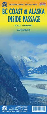
Wegenkaart - landkaart Alaska's Inside Passage | ITMB

0

Verkopers met dit product

Verkoper
Bezorging
Prijs
DeZwerver.nl logo
DeZwerver.nl
2,95
13,95

Anderen bekeken ook

Wegenkaart - landkaart Ushuaia to Antarctica - Drake Passage | Zagier & Urruty
Deze kaart is geschikt voor bootreizen van Ushuaia naar Antarctica. De kaart bevat behalve dieptemeters en stromingen ook de plaatsen van scheepswrakken en andere interessante plekken. The ship voyage from South America to the Antarctic Peninsula is a travel of a lifetime. After two days navigating on a sea of miles deep with the strongest and wildest currents and winds, the traveler arrives to a paradise for people looking for nature, history and adventure. This map is based in the Argentine Hydrographic Survey and the Ushuaia Maritime Museum charts and includes historic sites in the area as well as place for stamps and signatures from the ship and stations crew. A certificate for having crossed the Drake Passage is printed, too. afmeting 65 x 95 cm
17,95
Wegenkaart - landkaart Guatemala | ITMB
Een degelijke kaart met aanduidingen van o.a. nationale parken, vliegveld, benzinepomp, dirt-roads en kleine plattegrond van hoofdstad. Als overzichtskaart goed te gebruiken. Guatemala has emerged as a major touristic destination, and this detailed map shows touristic sites, historic towns, and remote roads to good advantage. Insets of Guatemala City and of Antigua are included; printed double-sided on durable ITM plastic paper. Roads by classification, parks, points of interest, airports, archaeological sites, waterfalls, lighthouses, gas stations, border crossing points, and other information
13,95
Wegenkaart - landkaart Venezuela | ITMB
Wegenkaart met tevens aanduidingen van Nationale Parken en reservaten. Stadsplattegrond van Caracas 1:25.000 en kaart 1:500.000 van omgeving Caracas. This is another one of our brand new maps. The artwork has been digitally-prepared, and this time printed double-sided to achieve a MUCH better scale. We have included a regional inset map of the Caracas area, and insets of the Roraima Mountains region, but the size of Venezuela is such that the rest of the paper consists solely of the country itself. The southern portion remains relatively unexplored and undeveloped, with few roads and only the occasional settlement, and the northern coastal region shows the road network very well. This is the first new map of Venezuela in many years. Legend Includes: Roads by classification, Railways, Rivers, Rapids, Lakes, Swamps, Points of Interest, Airports, Harbours, Archaeological Sites, Museums, Churches, Car Ferries, Oilfields, Heights in meters, Beaches, Hospitals, Hotels, Universities, Gas Sta…
13,95
Wegenkaart - landkaart Colombia | ITMB
Goede wegenkaart waarbij naast de gebruikelijke zaken als wegen en plaatsen ook veel aandacht is voor de natuurkundige aspecten van het land. Door het kleurgebruik wordt goed duidelijk waar bos, oerwoud, rivieren, meren liggen. Hoogtes zijn zichtbaar door gebruik van verschillende kleuren. Vaak is op de kaart nog een kleine plattegrond van het centrum van de belangrijkste stad te vinden. Colombia is growing in popularity as a travel destination. It is also changing quickly as peace and stability return to a lovely country. We have updated the map to the best of our ability and now have detailed inset maps of Bogota, Medellin, and Cartagena. The border to Ecuador is now an improved crossing. We have printed this updated edition on plastic paper, another improvement, in line with our policy of converting most hot, humid, country maps to plastic.  Legend Includes: Roads by classification, Rivers and Lakes, National Park, Airports, Points of Interests, Mining, Archaeological sites, Beach …
13,95
Wegenkaart - landkaart India | ITMB
Een degelijke kaart met aanduidingen van o.a. nationale parken, vliegveld, benzinepomp, dirt-roads en kleine plattegrond van Delhi. Kleine overzichtskaarten van de regio's rondom Mumbai en Kolkata. Als overzichtskaart goed te gebruiken. Gedrukt op watervast papier wat de levensduur van deze kaart ten goede komt! In spite of the current turmoil, India is not just an important Asian country, it is a dynamic powerhouse of the continent, vying with China for dominance in the emerging world order. It is also an ancient society, home of Buddhism, Hinduism, and the Sikh faith. It is also a very complicated country to map and we have spent a lot of time and effort into adding new roads and extra towns. India evokes for me the days of the Rajasthan, the pink city of Jaipur, the deserted city of Fathepur Sikri, the Red Fort at Delhi, and the Residency at Lucknow. India is huge, it is beautiful, and it is – well, India. It is unique. Legend Includes: Main roads, Tourism information, historic pla…
13,95
Wegenkaart - landkaart Laos | ITMB
Een degelijke kaart van Laos met aanduidingen van o.a. nationale parken, vliegveld, benzinepomp, dirt-roads en kleine plattegronden van Vientiane, Luang Prabang we're very pleased to introduce you to this new, double-sided, map at a great scale, with fantastic detail. To me, the north side is the most interesting, covering the portion of Laos from Vientiane, the capital, to the Chinese border. Detailed inset maps of Vientiane and Louang Prabang, the temple city, are included on this side, as are bits of both Thailand and Vietnam. The south portion fills the other side of the sheet, including a goodly portion of Vietnam, showing all border crossings. Much of Thailand has had to be obscured, unfortunately, to make room for the place names index, but the immediate border areas are shown, including the rail line south from Vientiane. In an interesting departure from previous ITMB maps, the back cover consists of a detailed inset map of Vientiane at 1:16,000 scale, making it easy to use in…
13,95
Wegenkaart - landkaart Ontario | ITMB
Een degelijke kaart voor Ontario met aanduidingen van o.a. nationale parken, vliegveld, benzinepomp, dirt-roads en kleine plattegrond van Toronto, Sault Ste. Marie. Als overzichtskaart goed te gebruiken. Ontario and Quebec form the portion of Canada known as Central Canada. Ontario is the industrial heartland of the country, and the southern portion is the most densely-populated and urbanized part of Canada. Toronto is a city of 2.8M people and the heartland of an economic region serving 100,000,000 people in two countries. Southern Ontario is also home for six million residents, some of the most historic sites in the country, and major recreational land masses (Algonquin Park, Bruce Trail, Muskoka/Haliburton). Northern Ontario, on the other side of the map, occupies the bulk of the land area of the province, and is dominated by the Canadian Shield (a pre-Cambrian rock formation that is the oldest land on earth, rich in mineral wealth). The North is dominated by recreational activitie…
13,95

Klanten-reviews van Wegenkaart - landkaart Alaska's Inside Passage | ITMB

Er zijn nog geen beoordelingen voor dit productBen jij de eerste die een review plaatst?

Meer over Wegenkaart - landkaart Alaska's Inside Passage | ITMB

Productinformatie

    Verken gerelateerde categorieën

    Webshop.nl maakt gebruik van cookies. Ga je verder op onze website, ga dan akkoord met het plaatsen van cookies en de verwerking van deze data door ons en vermelde partners.