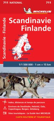
Wegenkaart - landkaart 711 Scandinavië & Finland | Michelin

0
Zoals je van Michelin mag verwachten is deze kaart zeer overzichtelijk en heeft een duidelijk helder kaartbeeld. De kaart geeft uitgebreid toeristische informatie weer. Natuurlijk vanwege het grote gebied een behoorlijk grove schaal. Scandinavia and Finland map at 1:1,500,000 from Michelin, including the whole of Denmark, Norway, and Sweden, with ...

Verkopers met dit product

Verkoper
Bezorging
Prijs
DeZwerver.nl logo
DeZwerver.nl
2,95
11,95

Anderen bekeken ook

Wegenkaart - landkaart 711 Scandinavië & Finland | Michelin
Zoals je van Michelin mag verwachten is deze kaart zeer overzichtelijk en heeft een duidelijk helder kaartbeeld. De kaart geeft uitgebreid toeristische informatie weer. Natuurlijk vanwege het grote gebied een behoorlijk grove schaal. Scandinavia and Finland map at 1:1,500,000 from Michelin, including the whole of Denmark, Norway, and Sweden, with enlargements showing in greater detail road networks around Helsinki, the Copenhagen - Malmo area, Oslo, Bergen, Stockholm and Gothenburg. Road network is presented graded according to the width and the number of lanes, indicating full/limited interchanges, toll barriers, driving distances, steep sections, seasonal closures, etc. The map also highlights scenic roads and tourist routes. Railway lines and ferry routes are included and local airports are marked. Symbols highlight various places of interest and mark locations of campsites. Within each country the map also shows internal administrative boundaries with names of the provinces. Topog…
11,95
Wegenkaart - landkaart 3300 Adventure Map Finland & Northern Scandinavia - Finland en noord Scandinavië | National Geographic
Wegenkaart van Finland en noord Scandinavië met vermelding van veel bezienswaardigheden, nationale parken en attrakties. Watervast en scheurvast. Juist door deze vermeldingen onderscheidt de kaart zich van andere wegenkaarten. National Geographic's Finland and Northern Scandinavia Adventure Map is designed to meet the unique needs of adventure travelers with its detail, durability, and accuracy. Scandinavia North includes the locations of thousands of cities and towns with an index for easily locating them, plus a clearly marked road network complete with distances and designations for expressways, motorways, and more. What sets National Geographic Adventure Maps apart from traditional road maps are the hundreds of points of interest that highlight the diverse and unique destinations within northern Scandinavia. World Heritage sites, museums, amusement parks, zoos, castles, archeological sites, churches, and more are included, making it invaluable to travelers hoping to experience all…
17,50
Wegenkaart - landkaart 754 Finland | Michelin
Zoals je van Michelin mag verwachten is deze kaart zeer overzichtelijk en heeft een duidelijk helder kaartbeeld. De kaart geeft uitgebreid toeristische informatie weer. Met register, afstanden en reistijden.   Wegen worden naar verschillende klasse ingedeeld en - mooi van Michelin - de interessante mooie routes worden gemarkeerd met een groene streep. Hindernissen voor automobilsiten met caravans zijn gemarkeerd: steile hellingen, bergpassen of een anderzins moeilijke route. Bezienswaardigheden als een kasteel, religieus gebouw, ruine of grot is door een symbool goed te vinden.   The Michelin National road map of Finland at 1:1,250,000 scale is ideal for route planning. The map gives comprehensive coverage of national road networks showing all major motorways, dual carriageways, national & regional main roads and some single-lane roads. Also shows unsurfaced roads. The map is divided by grid showing latitude and longitude.   Distances between major locations are marked along roads, wi…
11,95
Wegenkaart - landkaart Scandinavia - Scandinavië | ITMB
Een degelijke wegenkaart met aanduidingen van o.a. nationale parken, vliegveld. Als overzichtskaart goed te gebruiken. This is a new title for ITMB, providing detailed coverage of almost all of what most of us consider to be the Scandinavian countries. Only the southernmost portions of Denmark had to be left off. The map is double-sided, with Denmark and most of Norway and Sweden on one side and their balances and Finland on the reverse side. The road network, particularly the motorways and A-type roads shown up very well. Secondary roads show well and also are easy to see. Rail lines are present as well as ferry routes, of which there are many. The area of Scandinavia is so large in the European context that little attention has been paid to the region. When mapping a large area such as this is, it is difficult to show every detail. We have done our best and included all world heritage sites, major churches, castles, some campsites, and as many touristic attractions as could be fitte…
13,95
Wegenkaart - landkaart 732 Hongarije | Michelin
Zoals je van Michelin mag verwachten is deze kaart zeer overzichtelijk en heeft een duidelijk helder kaartbeeld. De kaart geeft uitgebreid toeristische informatie weer. Met register, afstanden en reistijden. Wegen worden naar verschillende klasse ingedeeld en - mooi van Michelin - de interessante mooie routes worden gemarkeerd met een groene streep.    Hindernissen voor automobilisten met caravans zijn gemarkeerd: steile hellingen, bergpassen of een anderzins moeilijke route. Bezienswaardigheden als een kasteel, religieus gebouw, ruine of grot is door een symbool goed te vinden.   The Michelin National road map of Hungary at 1:400,000 scale is ideal for route planning. The map gives comprehensive coverage of national road networks showing all major motorways, dual carriageways, national & regional main roads and some single-lane roads. [[Also shows unsurfaced roads and tracks and major footpaths.   Distances between major locations are marked along roads, with total distance and sever…
11,95
Wegenkaart - landkaart 738 Roemenië - Roemenie | Michelin
Zoals je van Michelin mag verwachten is deze kaart zeer overzichtelijk en heeft een duidelijk helder kaartbeeld. De kaart geeft uitgebreid toeristische informatie weer. Met register, afstanden en reistijden. Wegen worden naar verschillende klasse ingedeeld en - mooi van Michelin - de interessante mooie routes worden gemarkeerd met een groene streep.    Hindernissen voor automobilisten met caravans zijn gemarkeerd: steile hellingen, bergpassen of een anderzins moeilijke route. Bezienswaardigheden als een kasteel, religieus gebouw, ruine of grot is door een symbool goed te vinden.   The Michelin national road map of Romania at 1:750,000 scale is best suited to trip & route planning. The map gives comprehensive coverage of national road networks showing major motorways, dual carriageways, national & regional main roads and some smaller local roads. Unsurfaced roads and tracks and some major footpaths are also shown. The map shows useful motoring information for motorways and major roads …
11,95
Wegenkaart - landkaart 720 Polen | Michelin
Zoals je van Michelin mag verwachten is deze kaart zeer overzichtelijk en heeft een duidelijk helder kaartbeeld. De kaart geeft uitgebreid toeristische informatie weer. Met stadsplattegrond van de hoofdstad. The Michelin National road map of Poland at 1:700,000 scale is ideal for route planning. The map gives comprehensive coverage of national road networks showing all major motorways, dual carriageways, national & regional main roads and some single-lane roads. Distances between major locations are marked along roads, with total distance and several intermediate distances shown. A quick-reference chart of distances & driving times between major locations is also included. The map also includes a grid-referenced index of principal place names.   Clear, easy-to read cartography shows roads in reds, yellows and white with black outlines. Major topography is indicated with relief shading. Woodland & forest is marked with green shading. Built-up urban areas are clearly marked in yellow. A…
11,95
Wegenkaart - landkaart 544 Thuringen - Sachsen | Michelin
Zoals je van Michelin mag verwachten is deze kaart zeer overzichtelijk en heeft een duidelijk helder kaartbeeld. De kaart geeft uitgebreid toeristische informatie weer. Part of the orange regional series from Michelin, this Germany Mideast map shows this part of Germany in excellent detail. Primary & secondary road networks are clearly marked out with indications of the number of lanes, intermediate distances and various possible road obstacles or things you should know including steep hills, height limits, toll barriers, prohibited roads and roads subject to restrictions.   The map also includes small insets with street plans of Dresden, Leipzig and Erfurt, showing road names, one way streets and various places of interest (tourist sights, hospitals, parking, railway stations, etc.). Scenic routes on the map are marked out in green and an extensive index of place names is included.   The map also features:   Administrative boundaries Railways, Airports and Ferry Services Important si…
11,95
Wegenkaart - landkaart 755 Tsjechië | Michelin
Zoals je van Michelin mag verwachten is deze kaart zeer overzichtelijk en heeft een duidelijk helder kaartbeeld. De kaart geeft uitgebreid toeristische informatie weer. Met register, afstanden en reistijden. Wegen worden naar verschillende klasse ingedeeld en - mooi van Michelin - de interessante mooie routes worden gemarkeerd met een groene streep. Hindernissen voor automobilsiten met caravans zijn gemarkeerd: steile hellingen, bergpassen of een anderzins moeilijke route. Bezienswaardigheden als een kasteel, religieus gebouw, ruine of grot is door een symbool goed te vinden.   The Michelin National road map of the Czech Republic at 1:450,000 scale is ideal for route planning and touring. The map gives comprehensive coverage of national road networks showing all major motorways, dual carriageways, national & regional main roads and most single-lane roads. The map is divided by grid showing latitude and logitude.   Distances between major locations are marked along roads, with total di…
11,95
Wegenkaart - landkaart 717 Gr. H. Luxemburg 2025 | Michelin
Zoals je van Michelin mag verwachten is deze kaart zeer overzichtelijk en heeft een duidelijk helder kaartbeeld. De kaart geeft uitgebreid toeristische informatie weer. Met stadsplattegrond van de hoofdstad.   The Michelin National road map of the Grand Duchy of Luxembourg at 1:150,000 scale is ideal for trip & route planning and touring. The map gives comprehensive coverage of national road networks showing all major motorways, dual carriageways, national & regional main roads and some single-lane roads. Also shows unsurfaced roads, tracks, and major footpaths. The map is divided by grid showing latitude and longitude.   Distances between major locations are marked along roads, with total distance and several intermediate distances shown. A quick-reference chart of distances & driving times between major locations is also included. The map also includes a grid-referenced index of principal place names.   Clear, easy-to read cartography shows roads in reds, yellows and white with blac…
11,95

Klanten-reviews van Wegenkaart - landkaart 711 Scandinavië & Finland | Michelin

Er zijn nog geen beoordelingen voor dit productBen jij de eerste die een review plaatst?

Meer over Wegenkaart - landkaart 711 Scandinavië & Finland | Michelin

Productomschrijving

Zoals je van Michelin mag verwachten is deze kaart zeer overzichtelijk en heeft een duidelijk helder kaartbeeld. De kaart geeft uitgebreid toeristische informatie weer. Natuurlijk vanwege het grote gebied een behoorlijk grove schaal.

Scandinavia and Finland map at 1:1,500,000 from Michelin, including the whole of Denmark, Norway, and Sweden, with enlargements showing in greater detail road networks around Helsinki, the Copenhagen - Malmo area, Oslo, Bergen, Stockholm and Gothenburg.

Road network is presented graded according to the width and the number of lanes, indicating full/limited interchanges, toll barriers, driving distances, steep sections, seasonal closures, etc. The map also highlights scenic roads and tourist routes. Railway lines and ferry routes are included and local airports are marked. Symbols highlight various places of interest and mark locations of campsites. Within each country the map also shows internal administrative boundaries with names of the provinces. Topography is indicated by relief shading with colouring for the forested areas. National parks are highlighted. Latitude and longitude lines are drawn at intervals of 1°. The index, arranged by country, is next to the map. Multilingual map legend includes English.   Insets show in greater detail road networks around Helsinki, the Copenhagen - Malmo - Helsingborg area, Oslo, Bergen, Stockholm and Gothenburg. Also included are a distance table, basic traffic regulations, plus a seasonal chart indicating the length of daylight.   Finlande, Norvège, Suéde

Productinformatie

    Verken gerelateerde categorieën

    Webshop.nl maakt gebruik van cookies. Ga je verder op onze website, ga dan akkoord met het plaatsen van cookies en de verwerking van deze data door ons en vermelde partners.