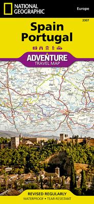
Wegenkaart - landkaart 3307 Adventure Map Spain & Portugal - Spanje en Portugal | National Geographic

0
Wegenkaart van Spanje en Portugal met vermelding van veel bezienswaardigheden, nationale parken en attracties. Watervast en scheurvast. Juist door deze vermeldingen onderscheidt de kaart zich van andere wegenkaarten.   National Geographic's Spain and Portugal Adventure Map is designed to meet the unique needs of adventure travelers—detailed, durab...

Verkopers met dit product

Verkoper
Bezorging
Prijs
DeZwerver.nl logo
DeZwerver.nl
2,95
17,50

Anderen bekeken ook

Wegenkaart - landkaart 3306 Adventure Map Spain Northern - Noord Spanje | National Geographic
Wegenkaart van Noord Spanje met vermelding van veel bezienswaardigheden, nationale parken en attrakties. Watervast en scheurvast. Juist door deze vermeldingen onderscheidt de kaart zich van andere wegenkaarten. National Geographic's Northern Spain Adventure Map is designed to meet the unique needs of adventure travelers—detailed, durable, and accurate. Northern Spain includes the locations of thousands of major cities and towns with an index for easily locating them, plus a clearly marked road network complete with distances and designations for expressways, motorways, and more. St. James Way, one of the most important Christian pilgrimages during medieval times, is noted for travelers seeking to retrace to route to the Cathedral of Santiago de Compostela in Galicia where the remains of the apostle Saint James are believed to be buried.   What sets National Geographic Adventure Maps apart from traditional road maps are the hundreds of points of interest that highlight the diverse and …
17,50
Wegenkaart - landkaart 3308 Adventure Map Pyrenees & Andorra - Pyreneeën en Andorra | National Geographic
Wegenkaart van de Pyreneeën en Andorra met vermelding van veel bezienswaardigheden, nationale parken en attrakties. Watervast en scheurvast. Juist door deze vermeldingen onderscheidt de kaart zich van andere wegenkaarten. National Geographic's Pyrenees and Andorra Adventure Map is designed to meet the unique needs of adventure travelers—detailed, durable, and accurate. Pyrenees/Andorra includes the locations of thousands of major cities and towns with an index for easily locating them, plus a clearly marked road network complete with distances and designations for expressways, motorways, scenic routes, and more.   What sets National Geographic AdventureMaps apart from traditional road maps are the hundreds of points of interest that highlight the diverse and unique destinations within the Pyrenees and Andorra. National parks, World Heritage sites, scenic viewpoints, antiquity sites, museums, places of worship, zoos, castles and more are included, making it invaluable to travelers hopi…
17,50
Wegenkaart - landkaart 3024 Adventure Map Cambodia - Cambodja | National Geographic
Mooie, heldere kaart van Cambodja,  gedrukt op scheurvast en watervast papier. National Geographic's Cambodia Adventure Map is designed to meet the needs of adventure travelers with its durability and detailed, accurate information. This map includes the locations of cities and towns with a user-friendly index, a clearly marked road network complete with distances and designations for roads/highways, plus secondary routes for those seeking to explore off the beaten path. Adventure Maps differ from a traditional road map because of the specialty content they include. Each map contains hundreds of diverse and unique recreational, ecological, cultural, and historic destinations — outside of the major tourist hubs. National Geographic Adventure Maps are the perfect companion to a guidebook, yet far easier to pack!   Cambodia is perhaps best know to international travelers as the home of the Angkor empire for six hundred years. Angkor Wat and Angkor Thom are part of the vast temple complex…
17,50
Wegenkaart - landkaart 3315 Adventure Map Corsica | National Geographic
Wegenkaart van Corsica met vermelding van veel bezienswaardigheden, nationale parken en attrakties. Watervast en scheurvast. Juist door deze vermeldingen onderscheidt de kaart zich van andere wegenkaarten. National Geographic's Corsica Adventure Map is designed to meet the unique needs of adventure travelers with its durability and accurate information. Each folded map provides global travelers with the perfect combination of detail and perspective, highlighting the area’s terrain and best locations for adventure activities like snorkeling, surfing, fishing, and more. Adventure Maps include hundreds of points of interest that highlight diverse and unique destinations within the country.   The map includes the locations of thousands of cities and towns with a user-friendly index, plus a clearly marked road network complete with distances and designations for major highways, main roads, and tracks and trails for those seeking to explore more remote regions. The front side of the Corsica…
17,50
Wegenkaart - landkaart 3203 Adventure Map Morocco - Marokko | National Geographic
Wegenkaart van Marokko met vermelding van veel bezienswaardigheden, nationale parken en attrakties. Watervast en scheurvast. Juist door deze vermeldingen onderscheidt de kaart zich van andere wegenkaarten. National Geographic's Morocco Adventure Map is designed to meet the unique needs of adventure travelers—detailed, durable, and accurate. Morocco includes the locations of thousands of cities and towns with an index for easily locating them, plus a clearly marked road network complete with distances and designations for motorways, dual carriageways, major roadways, and more. Transportation within and beyond the country is made easier with the location of airports, airfields, railroads, ferry routes, river crossings, lighthouses, harbors, border crossings, and petrol stations. What sets National Geographic Adventure Maps apart from traditional road maps are the hundreds of points of interest that highlight the diverse, unique, and exotic destinations within Morocco. In addition to typ…
17,50
Wegenkaart - landkaart 3202 Adventure Map Egypt - Egypte | National Geographic
Wegenkaart van Egypte met vermelding van veel bezienswaardigheden, nationale parken en attrakties. Watervast en scheurvast. Juist door deze vermeldingen onderscheidt de kaart zich van andere wegenkaarten. National Geographic's Egypt Adventure Map is designed to meet the unique needs of adventure travelers with its detail, durability, and accuracy. The map includes the locations of thousands of cities and towns with an index for easily locating them, plus a clearly marked road network complete with distances and designations for expressways, major roadways, and more. Transportation within and beyond the country is made easier with the locations of airports, airfields, railroads, ferry routes, lighthouses, harbors, border crossings, and police control points.   What sets National Geographic Adventure Maps apart from traditional road maps are the hundreds of points of interest that highlight the diverse, unique, and exotic destinations within Egypt. In addition to typical sites of intere…
17,50
Wegenkaart - landkaart 3403 Adventure Map Ecuador & Galapagos | National Geographic
Wegenkaart van Galapagos en Ecuador met vermelding van veel bezienswaardigheden, nationale parken en attrakties. Watervast en scheurvast. Juist door deze vermeldingen onderscheidt de kaart zich van andere wegenkaarten. National Geographic's Ecuador and Galapagos Adventure Map is designed to meet the unique needs of adventure travelers—detailed, durable, and accurate. Ecuador and Galapagos includes the locations of thousands of towns and villages, plus a clearly marked road network complete with distances and designations for highways, roads and more.   What sets National Geographic Adventure Maps apart from traditional road maps are the hundreds of points of interest that highlight the diverse, unique, and exotic destinations within Ecuador and the Galapagos islands including national parks and reserves, World Heritage sites, archeological sites, churches, spas, and more.   The front side of the map shows the southern half of Ecuador including the provinces of Zamora, Chinchipe, Loja,…
17,50
Wegenkaart - landkaart 3327 Adventure Map Western Balkans - Westelijke Balkan | National Geographic
Wegenkaart van de Westelijke Balkan met vermelding van veel bezienswaardigheden en attrakties. Watervast en scheurvast. Juist door deze vermeldingen onderscheidt de kaart zich van andere wegenkaarten. Landen: Slovenië, Kroatië, Bosnië Herzegovina, Montenegro, Albanië, Servië,  Kosovo, and Macedonië.   The Western Balkans region, an adventure playground and rising star of Europe, is loaded with Old World traditions, slow food culture, ancient towns, and rarely visited villages. The area stretches from the Adriatic Sea in the west, up and over mountain ranges, raging rivers, tectonic lakes, steep gorges, and thousands of miles of paths, trails, and routes. Discover eight countries—all with their special brand of Balkan magic: Slovenia, Croatia, Bosnia and Herzegovina, Montenegro, Albania, Serbia, Kosovo, and Macedonia.   National Geographic's Western Balkans Adventure Map will meet the needs of travelers with its detailed and accurate information. The map includes the locations of UNESC…
17,50
Wegenkaart - landkaart 3008 Adventure Map China East - Oost | National Geographic
Wegenkaart van Oost China  met vermelding van veel bezienswaardigheden, nationale parken en attrakties. Watervast en scheurvast.   National Geographic's China East Adventure Map is designed to meet the unique needs of adventure travelers with its durability and detailed, accurate information. The map includes the locations of thousands of cities and towns with a user-friendly index, plus a clearly marked road network complete with distances and designations for major highways, major routes and secondary roads. The China Adventure Map is printed in the United States on a durable synthetic paper, making it waterproof, tear-resistant and tough—capable of withstanding the rigors of international travel.   The China East Adventure Map differs from a traditional road map for it includes hundreds of points of interest that highlight diverse and unique destinations in the region. UNESCO World Heritage sites, national parks and reserves, archaeological sites, temples, caves and points of …
17,50
Wegenkaart - landkaart 3314 Adventure Map Southern France - Zuid Frankrijk | National Geographic
Wegenkaart van Frankrijk Zuid met vermelding van veel bezienswaardigheden, nationale parken en attrakties. Watervast en scheurvast. Juist door deze vermeldingen onderscheidt de kaart zich van andere wegenkaarten. National Geographic's Southern France Adventure Map is designed to meet the unique needs of adventure travelers with its durability and accurate information. Each folded map provides global travelers with the perfect combination of detail and perspective, highlighting the area’s terrain and best locations for adventure activities like snorkeling, surfing, fishing, and more. Adventure Maps include hundreds of points of interest that highlight diverse and unique destinations within the region. The map includes the locations of thousands of cities and towns with a user-friendly index, plus a clearly marked road network complete with distances and designations for major highways, main roads, and tracks and trails for those seeking to explore more remote regions.   The front side …
17,50

Klanten-reviews van Wegenkaart - landkaart 3307 Adventure Map Spain & Portugal - Spanje en Portugal | National Geographic

Er zijn nog geen beoordelingen voor dit productBen jij de eerste die een review plaatst?

Meer over Wegenkaart - landkaart 3307 Adventure Map Spain & Portugal - Spanje en Portugal | National Geographic

Productomschrijving

Wegenkaart van Spanje en Portugal met vermelding van veel bezienswaardigheden, nationale parken en attracties. Watervast en scheurvast. Juist door deze vermeldingen onderscheidt de kaart zich van andere wegenkaarten.   National Geographic's Spain and Portugal Adventure Map is designed to meet the unique needs of adventure travelers—detailed, durable, and accurate. Spain/Portugal includes the locations of thousands of major cities and towns with an index for easily locating them, plus a clearly marked road network complete with distances and designations for expressways, motorways, and more.   What sets National Geographic Adventure Maps apart from traditional road maps are the hundreds of points of interest that highlight the diverse and unique destinations within Spain/Portugal. National parks, World Heritage sites, caves, scenic viewpoints, archeological sites, museums, castles, churches, monasteries, and ruins are included, making it invaluable to travelers hoping to experience all the history, art, and culture the countries have to offer. Additional aids including the location of airports and airfields, hotels, campsites, lighthouses, ferry routes, and border crossings with checkpoints make travel within and beyond the countries easier.   The front side of the Spain/Portugal map shows the eastern half of Spain from its northern borders with France and Andorra south along its Mediterranean coastline to Almería. Portugal and the western half of Spain including the Canary Islands are covered on the reverse side of the map.

Verken gerelateerde categorieën

Webshop.nl maakt gebruik van cookies. Ga je verder op onze website, ga dan akkoord met het plaatsen van cookies en de verwerking van deze data door ons en vermelde partners.