webshop.nl
Categorieën
  Sluiten

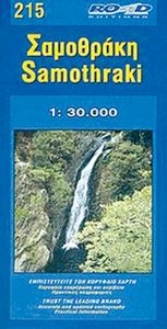
Wegenkaart - landkaart 215 Samothraki - Samothraki | Road Editions

Gedetailleerde wegenkaart met aanduiding van de wandelwegen, lijst van hotels en toeristische informatie. Voor alle doeleinden een zeer geschikte kaart. At last, a reliable and accurate map of Samothraki island is available to the demanding traveler! Although Samothraki (located in the the northeastern corner of the Aegean Sea) is not a popular tou...
8,25

Webshops met dit product

Webshop
Bezorging
Prijs

Anderen bekeken ook

Wegenkaart - landkaart 216 Skyros | Road Editions
Gedetailleerde wegenkaart met aanduiding van de wandelwegen, lijst van hotels en toeristische informatie. Voor alle doeleinden een zeer geschikte kaart. At last, a reliable and accurate map of Skyros island is available to the demanding traveler! Although Skyros(located in the central Aegean Sea, 22 nautical miles east of Evia Prefecture) is not a popular touristic destination, ROAD Editions published this map to contribute to the touristic development of this beautiful greek island. This Skyros island map incorporates the new specifications of ROAD Editions' Greek Islands Map Series: the backside of the map is a mini travel guide in full color, with many images and all the nessesary information on the touristic sights and the individual character of this island. It also includes a complete list of the hotels and rooms to let in the island, many usefull telephone numbers, and a note on the island's history. The map of Skyros presents the complete road network of the island, against a g…
8,95
Wegenkaart - landkaart 107 Serifos | Road Editions
Gedetailleerde wegenkaart met aanduiding van de wandelwegen, lijst van hotels en toeristische informatie. Voor alle doeleinden een zeer geschikte kaart. The features that make this and every other ROAD island map unique are: *The coastline, hydrography and precision geophysical background based on data provided by the Hellenic Military Geographic Service and electronically processed by us for clarity and legibility. We have highlighted the mountain masses in shades of brown between the contour lines (at 20m intervals on this map) to outline clearly the relief of the island. *The beaches are indicated by a special symbol next to which we have noted their names, as well as all the roads and footpaths leading to them (since most people primarily visit the islands for the beaches!). We have even included a short text in which the island’s best beaches are concisely referred to, to save you going on a wild goose hunt in search of them. *The road network is mapped out with impressive and exe…
8,25
Wegenkaart - landkaart 109 Sifnos | Road Editions
Gedetailleerde wegenkaart met aanduiding van de wandelwegen, lijst van hotels en toeristische informatie. Voor alle doeleinden een zeer geschikte kaart. The features that make this and every other ROAD island map unique are: *The coastline, hydrography and precision geophysical background based on data provided by the Hellenic Military Geographic Service and electronically processed by us for clarity and legibility. We have highlighted the mountain masses in shades of brown between the contour lines (at 20m intervals on this map) to outline clearly the relief of the island. *The beaches are indicated by a special symbol next to which we have noted their names, as well as all the roads and footpaths leading to them (since most people primarily visit the islands for the beaches!). We have even included a short text in which the island’s best beaches are concisely referred to, to save you going on a wild goose hunt in search of them. *The road network is mapped out with impressive and exe…
8,95
Wegenkaart - landkaart 105 Tzia - Kea | Road Editions
Gedetailleerde wegenkaart met aanduiding van de wandelwegen, lijst van hotels en toeristische informatie. Voor alle doeleinden een zeer geschikte kaart. Scheur- en watervast! The features that make this and every other ROAD island map unique are: *The coastline, hydrography and precision geophysical background based on data provided by the Hellenic Military Geographic Service and electronically processed by us for clarity and legibility. We have highlighted the mountain masses in shades of brown between the contour lines (at 100m intervals on this map) to outline clearly the relief of the island. *The beaches are indicated by a special symbol next to which we have noted their names, as well as all the roads and footpaths leading to them (since most people primarily visit the islands for the beaches!). We have even included a short text in which the island’s best beaches are concisely referred to, to save you going on a wild goose hunt in search of them. *The road network is mapped out …
8,95
Wegenkaart - landkaart Jersey - Guernsey - Sark - Alderney (Kanaaleilanden) | ITMB
Goede detailkaart van alle kanaaleilanden. Het is zo gedetailleerd dat zelfs straatnamen er op staan. De kaart is ook nog eens geplastificeerd en daarmee scheur- en watervast.  ITMB is pleased to re-introduce the Channel Islands map area after a lengthy hiatus of preparing new artwork. The first version of this part of Europe was licensed artwork by a local firm in Jersey, and upon running out of copies of the printed map, we opted to prepare fresh artwork of our own to continue this interesting corner of the continent to continue to be available. The islands, collectively known in English as the Channel Islands, are one of those anomalies that make Europe so attractive. They are part of Great Britain, but not part of the UK; hence, they are not part of the EU. They are self-governing entities ‘owned’ by the Queen in her role of being Duchess of Normandy. This is, of course, merely a hereditary situation, but the islands were the personal possessions of William the Conqueror in 1066, a…
13,95
Wandelkaart 217 Skiathos | Road Editions
Gedetailleerde wegenkaart met aanduiding van de wandelwegen, lijst van hotels en toeristische informatie. Voor alle doeleinden een zeer geschikte kaart.   The features that make this and every other ROAD island map unique are: *The coastline, hydrography and precision geophysical background based on data provided by the Hellenic Military Geographic Service and electronically processed by us for clarity and legibility. We have highlighted the mountain masses in shades of brown between the contour lines (at 20m intervals on this map) to outline clearly the relief of the island. *The beaches are indicated by a special symbol next to which we have noted their names, as well as all the roads and footpaths leading to them (since most people primarily visit the islands for the beaches!). We have even included a short text in which the island’s best beaches are concisely referred to, to save you going on a wild goose hunt in search of them. *The road network is mapped out with impressive and e…
8,95
Wegenkaart - landkaart Botswana | Infomap
Goede betrouwbare kaart van Botswana. Met GPS coordinaten. Easy to read in a vehicle Practical, user-friendly scale Extensive countrywide accommodation listing and contact details Experienced-based tips and route comments Includes many off-road tracks GPS co-ordinates of intersections Border post information Many points of interest Distances, fuel points, airports Booking details for national parks Roads and tracks in the national park and reserves Inset of Tuli Block A classic. Our Botswana map, now in its 14th edition, is one of our top sellers. From more frequented destinations such as the country’s famous game parks to other lesser known ones like Tsodilo Hills – Botswana’s World Heritage site with over 4000 rock paintings – this map is a one-stop resource for both self-drive travellers and fly-in tourists alike. Use it to navigate your way from Gaborone to Maun, from Kasane down the Hunters Road to Khubu Island, from Twee Rivieren to the Kalahari, or simply use it as a…
15,95
Wegenkaart - landkaart Tasmania & Victoria | ITMB
Een degelijke wegenkaart van Tasmanie & Victoria, schaal 1:1.800.000, en Tasmanië, schaal 1:800.000 met aanduidingen van o.a. nationale parken, vliegveld, benzinepomp, dirt-roads. Als overzichtskaart goed te gebruiken. The island of Tasmania is Australia’s smallest state, but is packed with touristic delights. Hobart is the capital and a charming Victorian city in the south of the island. Much of the west coast is a large nature preserve with limited access and most development is close to the northern shore, centred on Devonport and its ferry connections with Melbourne, in Victoria State. Tasmania also administers several offshore islands, such as King, Flinders, and Bruny. We have included a Top Attractions listing for the reader to enjoy. The other side of the sheet is the Australian mainland state of Victoria, best known as the home of Melbourne and the beautiful coastal highway to Adelaide. A basic inset map of Melbourne is included, but the focus of the map is on the recreational…
13,95
Wegenkaart - landkaart Indonesië - Indonesia | ITMB
Een degelijke landkaart van Indonesië met aanduidingen van o.a. nationale parken, vliegvelden en grote wegen. Als overzichtskaart goed te gebruiken. De nadruk ligt echter vooral op de natuurkundige aspecten. Scheur- en watervast! Met een kleine kaart van Jakarta. The hundreds of islands making up the island nation of Indonesia make a double-sided map inevitable in order to show any significant amount of detail. Side 1 shows the western half, starting with Sumatra in the upper left and including Java and most of the island of Borneo (Kalimantan Province to the Indonesians). This side also includes a large inset map of central Jakarta (for better detail see our separate map of the city); ditto for Sumatra, Java, and Borneo. Bali, Lombok, and Sumbawa islands are in the lower right portion of the map, and most of Malaysia and all of Singapore are included, simply because they are there. The infamous volcanic island of Krakatoa is located just to the west of Java. The other side of the map …
13,95
Wegenkaart - landkaart - Fietskaart Vanouver Island south - Victoria | ITMB
ITMB wegenkaarten en wandelkaarten kenmerken zich door het kleurgebruik waarbij zo de nadruk wordt gelegd op de natuurkundige aspecten van het land of de streek. Het soort landschap en de hoogte worden hierdoor zeer duidelijk zichtbaar. Natuurlijk vind je ook de 'gewone' zaken als wegennet, spoorwegen, vliegvelden, ferrys, toeristische bezienswaardigheden en nationale parken er op terug.. Vaak - maar niet op alle kaarten - staat op de achterzijde een stadsplattegrond van hoofdstad of belangrijkste stad in de regio.  Voorzijde: Vancouver Island zuidelijk gedeelte met schaal 1:270.000 Achterzijde: stadsplattegrond Victoria met schaal 1:10.000 Victoria is a brand new title for ITMB. The city is the capital of British Columbia (each of Canada’s provinces and territories has its own capital, in addition to Ottawa for the entire country). Located at the southern tip of Vancouver Island, Victoria was established as the colonial capital after the Oregon Treaty of 1846 forced the British to aba…
13,95

Klanten-reviews van Wegenkaart - landkaart 215 Samothraki - Samothraki | Road Editions

Er zijn nog geen beoordelingen voor dit productBen jij de eerste die een review plaatst?

Meer over Wegenkaart - landkaart 215 Samothraki - Samothraki | Road Editions

Productomschrijving

Gedetailleerde wegenkaart met aanduiding van de wandelwegen, lijst van hotels en toeristische informatie. Voor alle doeleinden een zeer geschikte kaart. At last, a reliable and accurate map of Samothraki island is available to the demanding traveler! Although Samothraki (located in the the northeastern corner of the Aegean Sea) is not a popular touristic destination, ROAD Editions published this map to contribute to the touristic development of this beautiful greek island. This Samothraki island map (first edition: July 2005) incorporates the new specifications of ROAD Editions' Greek Islands Map Series: the backside of the map is a mini travel guide in full color, with many images and all the nessesary information on the touristic sights and the individual character of this island. It also includes a complete list of the hotels and rooms to let in the island, many usefull telephone numbers, and a note on the island's history. The map of Samothraki presents the complete road network of the island, against a geophysical background of high accuracy (Map Datum ED50)with contour intervals of 20 meters. In cooperation with the local mountaineering club, all major footpaths are clearly marked on the map. With clear symbols, bright colors and easy to read lettersets, you can see all the touristic sights of the island, castles, archaeological sites, beaches, country churches, fountains, gorges, and many more. Samothraki island map is available without hard cover, well protected in a rigid plastic folder. This allows the user to fold the map in a pattern other than the preselected, or fold it in a much smaller final size to fit in a pocket etc.

Verken gerelateerde categorieën

Webshop.nl maakt gebruik van cookies. Ga je verder op onze website, ga dan akkoord met het plaatsen van cookies en de verwerking van deze data door ons en vermelde partners.