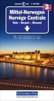
Wegenkaart - landkaart 1 Sud-Norwegen Oslo - Stavanger - Bergen | Kümmerly & Frey

0
Uitstekende wegenkaart met een helder, duidelijk kaartbeeld van Noorwegen van de bekende Noorse kaartenmaker Cappelen Kart. Met toeristische informatie. The maps have bold, effective relief shading with numerous spot heights and names of geographical features such as mountain ranges, glaciers, valleys, waterfalls, etc, to indicate the country’s mo...

Verkopers met dit product

Verkoper
Bezorging
Prijs
DeZwerver.nl logo
DeZwerver.nl
2,95
14,75

Anderen bekeken ook

Wegenkaart - landkaart 2 Mittel-Norwegen, Oslo, Bergen, Alesund | Kümmerly & Frey
Uitstekende wegenkaart met een helder, duidelijk kaartbeeld van Noorwegen van de bekende Noorse kaartenmaker Cappelen Kart. Met toeristische informatie. The maps have bold, effective relief shading with numerous spot heights and names of geographical features such as mountain ranges, glaciers, valleys, waterfalls, etc, to indicate the country’s mountainous terrain. Colours show the vast forested areas and national parks are highlighted. Road network includes minor local roads, cart tracks, tolls, winter closures, steep gradients, etc. Railways, ferry connections and, in remote areas, hiking trails with walking times are also shown and local administrative boundaries are marked. The maps are particularly good at highlighting accommodation facilities, with an extensive range of symbols showing hotels, motels, campsites, youth hostels, etc., indicating different standards and categories. Other symbols show places of interest, viewpoints, bird colonies, etc. Latitude and longitude lines a…
14,75
Wegenkaart - landkaart 4 Mittel-Norwegen, Lofoten, Narvik, Broennoeysund | Kümmerly & Frey
Uitstekende wegenkaart met een helder, duidelijk kaartbeeld van Noorwegen van de bekende Noorse kaartenmaker Cappelen Kart. Met toeristische informatie. The maps have bold, effective relief shading with numerous spot heights and names of geographical features such as mountain ranges, glaciers, valleys, waterfalls, etc, to indicate the country’s mountainous terrain. Colours show the vast forested areas and national parks are highlighted. Road network includes minor local roads, cart tracks, tolls, winter closures, steep gradients, etc. Railways, ferry connections and, in remote areas, hiking trails with walking times are also shown and local administrative boundaries are marked. The maps are particularly good at highlighting accommodation facilities, with an extensive range of symbols showing hotels, motels, campsites, youth hostels, etc., indicating different standards and categories. Other symbols show places of interest, viewpoints, bird colonies, etc. Latitude and longitude lines a…
14,75
Wegenkaart - landkaart 3 Mittel-Norwegen, Alesund, Trondheim, Namsos | Kümmerly & Frey
Uitstekende wegenkaart met een helder, duidelijk kaartbeeld van Noorwegen van de bekende Noorse kaartenmaker Cappelen Kart. Met toeristische informatie. The maps have bold, effective relief shading with numerous spot heights and names of geographical features such as mountain ranges, glaciers, valleys, waterfalls, etc, to indicate the country’s mountainous terrain. Colours show the vast forested areas and national parks are highlighted. Road network includes minor local roads, cart tracks, tolls, winter closures, steep gradients, etc. Railways, ferry connections and, in remote areas, hiking trails with walking times are also shown and local administrative boundaries are marked. The maps are particularly good at highlighting accommodation facilities, with an extensive range of symbols showing hotels, motels, campsites, youth hostels, etc., indicating different standards and categories. Other symbols show places of interest, viewpoints, bird colonies, etc. Latitude and longitude lines a…
14,75
Wegenkaart - landkaart 5 Noord Noorwegen (Tromsö - Nordkapp - Kirkenes) | Kümmerly & Frey
Uitstekende wegenkaart met een helder, duidelijk kaartbeeld van Noorwegen van de bekende Noorse kaartenmaker Cappelen Kart. Met toeristische informatie. The maps have bold, effective relief shading with numerous spot heights and names of geographical features such as mountain ranges, glaciers, valleys, waterfalls, etc, to indicate the country’s mountainous terrain. Colours show the vast forested areas and national parks are highlighted. Road network includes minor local roads, cart tracks, tolls, winter closures, steep gradients, etc. Railways, ferry connections and, in remote areas, hiking trails with walking times are also shown and local administrative boundaries are marked. The maps are particularly good at highlighting accommodation facilities, with an extensive range of symbols showing hotels, motels, campsites, youth hostels, etc., indicating different standards and categories. Other symbols show places of interest, viewpoints, bird colonies, etc. Latitude and longitude lines a…
14,75
Wegenkaart - landkaart Cordillera Cantabrica - Asturias y provincias limitrofes | Adrados Ediciones
Gedetailleerde wegenkaart an de Cordillera Cantabrica met hoogtelijnen, hoogte verschillen in kleur en schaduw en UTM coördinaten. Met plaatsnamen index! Cordillera Cantabrica on a detailed road map from the Oviedo based Adrados Ediciones, presenting this mountainous region with contours at 100m intervals, altitude coluring, relief shading and UTM coordinates. Since the publishers specialize in detailed hiking maps, including the best coverage of the Picos de Europa, the map includes an exceptionally large number of names of peaks, passes, etc. Symbols highlight best rock and ice climbing areas, huts and refuges, campsites, mountain rescue posts and information centres. Along the coast numerous beaches are named. Road network includes small country roads and tracks. Local railway lines are shown, although not very easy to see on the base map filled with so much information. The map has a 10km UTM grid. Map legend is in Spanish only. On the reverse is a panorama drawing of the area, lo…
14,95
Wegenatlas IJsland met stadsplattegronden | Ferdakort
Super handige kleine wegenatlas van IJsland (schaal 1:500.000) met vooral een enorme hoeveelheid plattegronden van steden en dorpen, enkele themakaarten en een groot register. De kaarten zijn uitstekend leesbaar en de atlas in in een mooie ringband uitgevoerd.  Road Atlas of Iceland at 1:500,000 from Ferðakort, published in a handy 15x25cm spiral-bound format, with an index of over 3,000 entries, a comprehensive distance table, 46 street plans including Reykjavik and several thematic map sincluding cultural heritage and geology.   The whole of Iceland is covered at 1:500,000 with the road network distinguishing between paved and gravel roads, and showing which small local roads are maintained by the country’s government. Fords, locations of petrol stations, driving distances and car ferry routes are marked. National parks and other protected areas are highlighted and symbols mark locations of various places of interest: different types of tourist accommodations including campsites, re…
30,95
Wegenkaart - landkaart Sudan and South Sudan | Gizi Map
Sudan and South Sudan as separate countries on an excellent indexed map at 1:2,500,000 from Gizi Maps with detailed presentation of the topography, administrative divisions, street plans of Khartoum and Juba, etc. Excellent presentation of the terrain in the publisher’s characteristic style provides a vivid picture of the region’s geography: bold altitude colouring with plenty of spot heights and names of peaks, mountain ranges, etc, plus additional graphics for flood plains, swamps, salt flats, deserts, lava fields, wadis and water wells. National parks or other protected areas and interesting natural sites are highlighted. The map indicates the boundary of the disputed Abyei area and shows the internal administrative boundaries and names of the provinces. Within North Sudan names of larger towns and of the provinces are also given in Arabic. Where appropriate, alternative versions of town names are provided (Khartoum/Al Khartum, Omdurman/Umm Durman, etc). The map shows the road n…
15,95
Wegenkaart - landkaart Sahara | ITMB
Een degelijke overzichtskaart met aanduidingen van o.a. nationale parken, vliegveld, benzinepomp, dirt-roads.Waterproof. Double-sided, waterproof and tear-resistant map, extending east to just beyond 25°(the border of Libya and Egypt) , and roughly to 15° degrees (Bamako and Niamey) on its western half, and slightly further south on the other side (beyond Kano and Ndjamena). Elevation colouring indicates the topography, with landscape feature such as calderas, scarps and cliffs, lava fields, dunes, serir, marches, seasonal rivers, and salt pans. Oases and numerous wells/waterholes are also marked, most of them with names. International boundaries are shown with, where appropriate, border crossings. Road network includes rough tracks, and indicates location of petrol stations. Railways within the coastal areas of the covered countries are marked, and the map also shows small local airfields. A range of symbols indicate selected accommodation including rest houses and campsites, hospita…
13,95
Wegenkaart - landkaart Savannah Way - Cairns to Broome | Hema Maps
Detailkaart van een deel van Australië. Zeer goed leesbaar, met naast de topografische details veel symbolen waarmee allerhande toeristische zaken worden aangeduid als campsites, nationale parken, attracties, wandelmogelijkheden etc. Find out all you need to know about travelling the Savannah Way between Cairns and Broome. As well as providing a detailed road map for the entire length of the Savannah Way, this map includes handy advice on road conditions, average rainfall and safe driving tips. The useful information also highlights the features you pass in Queensland, Northern Territory and Western Australia. Routes between Cairns and Broome in Hema’s range of very popular touring maps showing roads connecting Australia’s main centres of population along some of the most spectacular routes such as the Great Ocean Road or the Savannah Way. The maps highlight 24-hour fuel supplies, roadside rest areas, camping facilities, places of interest, etc., and include distance charts and, in so…
17,50
Wandelkaart 16 Greyerz - Gruyère | Kümmerly & Frey
Zeer duidelijke wandelkaart van een deel van Zwitserland. Deze kaart - gemaakt op scheur en watervast papier - is bedoeld voor de gewone en gemiddelde bergwandelaar. Ook voor huttentochten is deze zeker geschikt. Slechts voor de gevorderde wandelaar die glesjers gaat overschrijden zijn de 25.000 topografische kaarten aan te raden.   Op deze 1:60.000 kaarten staan de wandelroutes in 3 soorten weergegeven: Wanderweg, Bergweg en Alpine route. De routes staan goed ingetekend en werken prima naast de vele markingen in het veld. Hoogteverschillen, overnachtingsmogelijkheden, bus routes en gps-informatie ontbreken allemaal niet op deze landkaarten.   The maps have contours at 50m or 25m intervals according to the terrain, enhanced by graphic relief and shading. An overprint distinguishes between sign-posted hiking paths, mountain path where proper walking shoes are necessary, and alpine paths requiring special equipment. Mountain huts are marked, plus various types of accommodation: campsite…
22,50

Klanten-reviews van Wegenkaart - landkaart 1 Sud-Norwegen Oslo - Stavanger - Bergen | Kümmerly & Frey

Er zijn nog geen beoordelingen voor dit productBen jij de eerste die een review plaatst?

Meer over Wegenkaart - landkaart 1 Sud-Norwegen Oslo - Stavanger - Bergen | Kümmerly & Frey

Productomschrijving

Uitstekende wegenkaart met een helder, duidelijk kaartbeeld van Noorwegen van de bekende Noorse kaartenmaker Cappelen Kart. Met toeristische informatie.

The maps have bold, effective relief shading with numerous spot heights and names of geographical features such as mountain ranges, glaciers, valleys, waterfalls, etc, to indicate the country’s mountainous terrain. Colours show the vast forested areas and national parks are highlighted. Road network includes minor local roads, cart tracks, tolls, winter closures, steep gradients, etc. Railways, ferry connections and, in remote areas, hiking trails with walking times are also shown and local administrative boundaries are marked.

The maps are particularly good at highlighting accommodation facilities, with an extensive range of symbols showing hotels, motels, campsites, youth hostels, etc., indicating different standards and categories. Other symbols show places of interest, viewpoints, bird colonies, etc. Latitude and longitude lines are drawn at 15’ and 30’ respectively. There is no index of place names. Map legend includes English.

Productinformatie

    Verken gerelateerde categorieën

    Webshop.nl maakt gebruik van cookies. Ga je verder op onze website, ga dan akkoord met het plaatsen van cookies en de verwerking van deze data door ons en vermelde partners.