webshop.nl
Categorieën
  Sluiten

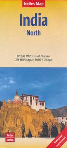
Wegenkaart - landkaart 1 India - North Noord | Nelles Verlag

Goede kaart van een deel van India. Aan beide kanten bedrukt. Met veel toeristische aanduidingen als nationale parken en culturele bezienswaardigheden. Prima leesbare kaart. Detailkaart: Ladakh / Zanskar 1 : 650.000 Stadsplattegronden van Agra, Delhi en Srinagar. the area north of Delhi, Agra and Jaipur, extending to cover the whole of Kashmir, but...
11,95

Webshops met dit product

Webshop
Bezorging
Prijs

Anderen bekeken ook

Wegenkaart - landkaart India: Ladakh - Zanskar | Nelles Verlag
Ladakh and Zanskar at 1:350,000 from Nelles including a street plan of Leh, supplementing the publisher’s coverage of the whole of India on five double-sided maps with their slightly smaller size offering a convenient format for use when travelling.    The map shows the region’s mountainous topography by contours at 200m intervals with very effective relief shading, plus spot heights and mountain passes. In addition to roads and local cart tracks, trekking trails are marked. Symbols indicate various places of interest including campsites, temples, hot springs and waterfalls, etc. Coverage extends from Kulu in the south to the Baltoro Range and the Nubra Valley in the north, with an inset extending the map westwards to include Srinagar, Jammu and Pathankot.    The street plan of Leh shows location of numerous hotels and includes an enlargement for the old town. NEW to Nelles Maps range. 1 : 350,000 scale. Detailed, relief shading clearly shows spot heights and mountain ranges giving a r…
11,95
Wegenkaart - landkaart India Noord | Borch
Mooie geplasticieerde kaart van het noorden van India. Deze kaart biedt een goed overzicht van het land met detailkaarten.   Our soft-laminated folded map of India North shows: India North 1:3 000 000, Delhi 1:30 000, Mumbai 1:30 000, Kolkata 1:30 000, Jaipur 1:30 000, Agra 1:30 000, Varanasi 1:30 000, Amritsar 1:30 000, Jodhpur 1:30 000, Udaipur 1:30 000, Bodhgaya 1:15 000 and India administrative and time zones. Borch maps are easy to fold, durable and water-repellent with a wipeable surface. Borch Maps show hotels, museums, monuments, markets, public transport, top sights and points of interest, useful statistics, conversion charts for temperatures, weights and measurements, climate charts showing temperatures, sunshine hours, precipitation and humidity, overview maps, time zones, and much more...   Northern India is bordered by Pakistan to the west, China, Nepal and Bhutan to the north, and Bangladesh and Myanmar to the east. Hindi and English are the two official languages. After …
11,50
Wegenkaart - landkaart 2 India - West | Nelles Verlag
Goede kaart van een deel van India. Aan beide kanten bedrukt. Met veel toeristische aanduidingen als nationale parken en culturele bezienswaardigheden. Prima leesbare kaart. Detailkaart: Mumbai (Bombay) 1 : 300.000 Stadsplattegrond: Delhi 1 : 50.000 one of five maps in a series covering India at 1:1 500 000 scale. Folded road and tourist map of western India, including edge of Pakistan to the west, Chandigarh to the north, Pune to the south and Bhopal and Delhi to the east. Points of interest, national parks, and railways are all highlighted and shaded-relief colouring clearly depicts the topography.  The map includes insets showing central Delhi at 1:50 000 and Mumbai (Bombay) region at 1:300 000. The legend is in English, French and German. The other titles in the series are India East, India North, India North East, and India South. Nelles also produces a map of the whole Indian Subcontinent at a scale of 1:4 500 000.   For over 20 years Nelles maps have been renowned throughout the…
11,95
Wegenkaart - landkaart India North & West | ITMB
Een degelijke kaart met aanduidingen van o.a. nationale parken, vliegveld, benzinepomp, dirt-roads en kleine plattegrond van hoofdstad. Als overzichtskaart goed te gebruiken. Northern and western India on a double-sided, indexed map from ITMB, providing on each side useful coverage of some of the country’s most visited areas. Each side of the map has a separate index of localities. The northern side is centred on Delhi and extends north to the Line of Control dividing Jammu and Kashmir. Coverage east along the Ganges extends beyond Varanasi; west to Jodhour, the outskirts of Ahmadabad and to Vadodara (Baroda); and south to Nagpur, the geographical centre of India. The western side of the map extends from Delhi to Bangalore and Mysore, and inland beyond Hyderabad, so includes Mumbai and Goa. The map has altitude colouring (in feet) and shows the country’s road and rail networks and local airports. Symbols highlight various places of interest including historic or scenic sites, hill stat…
13,95
Wegenkaart - landkaart India | Nelles Verlag
Goede overzichtskaart van India - Nepal en Sri Lanka. Aan beide kanten bedrukt. Met veel toeristische aanduidingen als culturele bezienswaardigheden en nationale parken. Prima leesbare kaart. Included in this Nelles Verlag map are detailed, relief shading clearly shows spot heights and mountain ranges giving a real sense of the terrain with distances provided for major routes.   This map also shows inset maps of Greater Kathmandu, Kolkata (Calcutta), Mumbia (Bombay) as well as street plans of Delhi and Colombo, with numerous points of interest highlighted. Greater Kathmandu 1 : 100.000 Kolkata (Calcutta) 1 : 300.000 Mumbai (Bombay) 1 : 300.000 Colombo 1 : 12.500 Delhi 1 : 50.000  
11,95
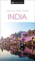
Reisgids India | Eyewitness
Discover the soaring Himalayas, explore fantastic forts and the rich cultural heritage of India Whether you want to be awed by the scenic landscapes, relax on the beaches of Goa, or marvel at the majestic Taj Mahal, your DK Eyewitness travel guide makes sure you experience all that India has to offer. India is a treasure trove of things to see and experience. Packed full of ancient palaces and temples, museums and historic monuments, it has been captivating visitors since time immemorial.   Beyond the architectural wonders, the country abounds with picturesque sights and has an array of excellent restaurants and atmospheric bars. Our updated 2023 travel guide brings India to life,transporting you there like no other travel guide does with expert-led insights, trusted travel advice, detailed breakdowns of all the must-see sights, photographs on practically every page, and our hand-drawn illustrations which place you inside the country's iconic buildings and neighbourhoods. DK Eyewitness…
27,95
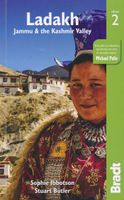
Reisgids Ladakh - Jammu - Kashmir | Bradt Travel Guides
Voor vele landen net zo goed, zo niet beter dan de Planet. Beduidend soberder uitgevoerd, maar ook met veel informatie voor backpackers en met veel kaartmateriaal. Een aanrader!. Bradt's Ladakh, Jammu and Kashmir remains the only standalone guide in English available to this stunning region of mountain wilderness and lush valleys. Although Ladakh is becoming an ever more popular destination, Zanskar, the Kashmir Valley and Jammu are still off the beaten path and full of wonders waiting to be discovered. This book is the ideal companion to these contrasting and spellbinding regions whether you want to white-water raft on the Indus, travel in a jeep along nerve- wracking mountain roads, relax on a houseboat, explore Buddhist culture in tucked away Ladakhi monasteries or hike over the high passes.   Fully updated, this new edition includes chapters on background and practical information and a dedicated chapter on trekking, with nine easy-to-follow chapters covering the whole area, includ…
24,95
Wegenkaart - landkaart Planning Map India | Lonely Planet
Durable and waterproof, with a handy slipcase and easy-fold format, Lonely Planet’s India Planning Map helps you get around with ease.   Get more from your map and your trip with images and information about top country attractions, itinerary suggestions, a transport guide, planning information, themed lists and practical travel tips.   With this easy-to-use, full-colour map in your back pocket, you can truly get to the heart of India.   Durable and waterproof Easy-fold format and convenient size Handy slipcase Full colour and easy-to-use Before-you-go info Beautiful imagery Tailored itineraries Can’t-miss regional highlights Detailed town index Transport planner Themed lists Covers Rajasthan, Jaipur, Jaisalmer, Ranthambhore National Park, Udaipur, Delhi, Agra, Varanasi, Lucknow, Himachal Pradesh, Ladakh, Shimla, Leh, McLeod Ganj, Manali, Kolkata, Sundarbans, Darjeeling, Assam, Mumbai, Goa, Ajanta & Ellora Caves, Kerala, Hampi, Mysuru, Chennai Looking for more in-dept…
10,95
Wegenkaart - landkaart Japan | Nelles Verlag
Goede wegenkaart van Japan. Aan beide kanten bedrukt. Met veel toeristische aanduidingen als nationale parken en culturele bezienswaardigheden. Prima leesbare kaart. The map divides the country north/south with Tokyo shown on both sides. On one side is southern part of Honshu and Kyushu Island, plus the smaller groups of islands including Okinawa and the Sakishima Archipelago shown on separate panels. Insets show the environs of Osaka and Nagoya in greater detail. On the reverse is the northern part of Honshu and Hokkaido, plus an enlargement for the environs of Tokyo.  Nagoya Environs 1 : 400.000 Osaka Environs 1 : 400.000 Tokyo Environs 1 : 555.000
11,95
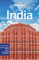
Reisgids India | Lonely Planet
De perfecte reisgids voor zowel de georganiseerde als de zelfstandige reiziger. Naast een algemene inleiding van het land / streek vol met praktische informatie over hoe je er het beste kunt reizen: slapen, eten, vervoer, excursies ... alles kun je er in vinden. Engelstalig.  With its sumptuous mix of traditions, spiritual beliefs, festivals, architecture and landscapes, your memories of India will blaze bright long after you’ve left its shores. Lonely Planet is your passport to India, with amazing travel experiences and the best planning advice.   Admire the detailed decoration of the Taj Mahal, explore Hampi’s ruined temples, or trek in the cool air of Ladakh; all with your trusted travel companion. Get to the heart of India and begin your journey now!   Inside Lonely Planet’s India Travel Guide:   Colour maps and images throughout Highlights and itineraries help you tailor your trip to your personal needs and interests Insider tips to save time and money and get around l…
28,95

Klanten-reviews van Wegenkaart - landkaart 1 India - North Noord | Nelles Verlag

Er zijn nog geen beoordelingen voor dit productBen jij de eerste die een review plaatst?

Meer over Wegenkaart - landkaart 1 India - North Noord | Nelles Verlag

Productomschrijving

Goede kaart van een deel van India. Aan beide kanten bedrukt. Met veel toeristische aanduidingen als nationale parken en culturele bezienswaardigheden. Prima leesbare kaart. Detailkaart: Ladakh / Zanskar 1 : 650.000 Stadsplattegronden van Agra, Delhi en Srinagar. the area north of Delhi, Agra and Jaipur, extending to cover the whole of Kashmir, but without including the far eastern part of the Indian Himalaya around Nanda Devi and the Pindari Glacier. An enlarged enlargement shows Ladakh and Zanskar at 1:650,000. Also included are basic street plans of central Delhi, Agra and Srinagar.  
Webshop.nl maakt gebruik van cookies. Ga je verder op onze website, ga dan akkoord met het plaatsen van cookies en de verwerking van deze data door ons en vermelde partners.