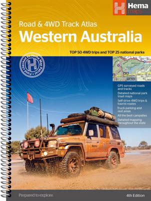
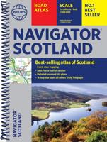
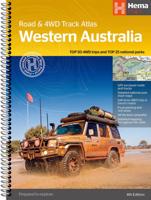
Wegenatlas Western Australia 4WD Track atlas | A4 | Ringband | Hema Maps

0

Verkopers met dit product

Verkoper
Bezorging
Prijs
DeZwerver.nl logo
DeZwerver.nl
2,95
43,95

Anderen bekeken ook

Nieuw
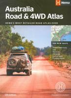
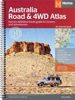
Wegenatlas Australia Road & 4WD Easy Read Atlas | A3 | Ringband | Hema Maps
Deze gloednieuwe editie van Hema's best verkopende wegenatlas van Australië telt nu 188 pagina's en is opgemaakt met een prachtige cartografie in een nieuwe stijl. Elke atlas in de reeks bevat nu ook kaarten voor 4WD en touring bestemmingen zoals Cape York, Fraser Island, Top End, Kimberley, Pilbara, Central Australia, High Country Victoria en de Flinders Ranges. Extra kaarten geven de drukke kuststroken in meer detail weer. De atlas is nog steeds de ultieme bron van informatie om Australië te verkennen, met de omvangrijke kartering van Hema en veel relevante tourinformatie. Op de kaarten worden campings, overnachtingsplaatsen, stopplaatsen, benzinestations, erkende informatiediensten en interessante bezienswaardigheden weergegeven met icoontjes. Een handig raster om afstanden af te lezen, een gids van de nationale parken, een lijst van de erkende informatiediensten en een volledig plaatsnamenregister zijn inbegrepen en helpen bij de planning en tijdens de reis. Featuring trusted He…
48,95
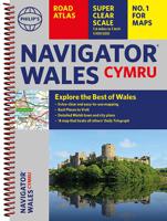
Wegenatlas Wales Navigator | A4 | Ringband | Philip's Maps
Ideaal voor fietsers! Explore the many attractions of Wales with this easy-to-use road atlas showing all the top spots. Easy-to-read mapping, superb extra detail, and a great lie-flat format make this the ultimate Welsh road trip companion. – Unrivalled level of detail from motorways to country lanes. – Exceptional clarity at a scale of 1.6 miles to 1 inch (1:100,000). – Ideal for explorers: heritage sites, spectacular sights, and the best walks around Snowdonia, the Brecon Beacons, the Pembrokeshire Coast and more. – Tourist attractions and places of interest clearly highlighted, from Caernarfon Castle to St David’s Cathedral. – Indexed town plans for all major centres, including Aberystwyth, Bangor, Cardiff, Holyhead, Llandudno, Llanelli, Merthyr Tydfil, Newport, Newtown, Swansea, and Wrexham. – Packed with hundreds of individually named farms, houses, and hamlets, alongside airports, airfields, stations, ferries, canals, and harbours. – Key to map symbols are clearly indexed and sh…
14,95
Wegenatlas California Road & Recreation Atlas | A3 Formaat | Ringband | Benchmark Maps
"California is rich in geographical diversity and natural beauty, from its verdant mountains and vast deserts to its seemingly endless Pacific coastline. Get to know the best of California with this recently updated and improved atlas. Now freeway exit numbers are shown and the Landscape Maps™ are clearer and brighter. The comprehensive Recreation Guide and accompanying California Road Map are the perfect resources to plan your Golden State adventure.   Landscape Maps 1:300,000. Recreation Maps 1:863,000. Metro Maps 1:158:000
39,95
Nieuw
Wegenatlas Philip's Handy Atlas Britain: | Ringband | A5-Formaat | Philip's Maps
The perfect atlas for planning a trip anywhere in the UK and Ireland"The essential handy road atlas for planning a trip in Britain and Ireland. Keep it in the glove box or your travel bag for quick and easy reference. This gem of a glove-box sized atlas has all the core information you need for driving around the British Isles.   It includes all the motorways, primary roads and A Roads and they are clearly shown - ideal for route planning. There is a separate 4-page road map of Ireland for easy use. Alongside that, this handy atlas includes a key map, a distance table and useful counties map.   All the towns and villages listed within are indexed and all the information comes in a handy glove-box size format with practical, lie-flat spiral binding. With the scale at a user-friendly 8 miles to 1 inch / 1:500,000 (Ireland 19 miles to 1 inch /1:1,200,000) and fully up-to-date using Philip's clear mapping, you will never be at a loss to establish the best route. Keep in the car or sling i…
11,95
Wegenatlas Big Atlas Britain & Ireland 2025 | A3-Formaat | Ringband | Philip's Maps
Goede gedetailleerde wegenatlas van Groot-Brittannië, schaal 1:200.000 met een overzichtskaart van Ierland, schaal 1:1.000.000. Groot formaat, A3, en in ringband. 'Good balance between detail and clarity with excellent town maps' What Car? PHILIP'S is No. 1 in the UK for clear maps. The latest 2025 Philip's Big Road Atlas of Britain and Ireland, in a supersize large format, has fully updated mapping from the Philip's digital database alongside all the detail and information needed for successful travel.   * Top driving tips for safety and skill including how to parallel park * The best scenic routes, natural features and landscape highlighted for enhanced travelling * Practical 'more to view per page' A3 size * Main scale of maps: 3 miles to 1 inch = 1:200,000 for ease of use * Route-planning section for the easiest navigation * Special wide-vehicle access indicators for rural areas * 64 fully indexed and detailed town and city plans * City approach maps with named roads fo…
22,50
Wegenatlas Philip's Easy to Read Road Atlas of Britain 2025 | A4-Formaat | Ringband | Philip's Maps
"The detail you need at a size you can read". The latest 2025 Philip's Easy to Read Road Atlas of Britain from the best-selling Road Atlas range has over 350 pages packed with exceptionally clear mapping and everything you need for exploring Britain. Practical A4-size with lie-flat spiral binding, it will enhance any journey.   · Clear maps packed with extra details for a better journey · Huge 1:150,000 scale (approx 2.4 miles to 1 inch) · Large print place names · Large print index · Super-clear 10-page route planner to create the best journeys · Thousands of attractions clearly mapped, including castles, theme parks, gardens, zoos and more. · Lie-flat spiral binding for easy use and planning   At last, a road atlas that everyone can read easily, in or out of the car, no matter what the conditions. With up-to-date mapping technology, your travels have never been easier to plan. This edition contains a wealth of useful information, including tourist attractions, to ensure the best pos…
27,50

Klanten-reviews van Wegenatlas Western Australia 4WD Track atlas | A4 | Ringband | Hema Maps

Er zijn nog geen beoordelingen voor dit productBen jij de eerste die een review plaatst?

Meer over Wegenatlas Western Australia 4WD Track atlas | A4 | Ringband | Hema Maps

Verken gerelateerde categorieën

Webshop.nl maakt gebruik van cookies. Ga je verder op onze website, ga dan akkoord met het plaatsen van cookies en de verwerking van deze data door ons en vermelde partners.