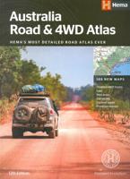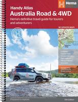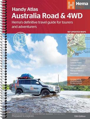

Wegenatlas Australia Road & 4WD Handy Atlas B5 | Hema Maps

0
Wegenatlas Australie met toeristische informatie, uitgevoerd in handige spiraalbinding. Geweldige kaarten, goed leesbaar (beetje kleine letters wellicht voor sommigen) met veel toegevoegde waarde als het gaat om details als Nationale Parken, campsites, stranden en afstanden. De schaal varieert per bladzijde Featuring trusted Hema mapping for all ...

Alle aanbiedingen van dit product

Verkoper
Bezorging
Prijs
DeZwerver.nl logo
DeZwerver.nl
2,95
29,95

Anderen bekeken ook

Wegenatlas Australia Road & 4WD Handy Atlas B5 | Hema Maps
Wegenatlas Australie met toeristische informatie, uitgevoerd in handige spiraalbinding. Geweldige kaarten, goed leesbaar (beetje kleine letters wellicht voor sommigen) met veel toegevoegde waarde als het gaat om details als Nationale Parken, campsites, stranden en afstanden. De schaal varieert per bladzijde Featuring trusted Hema mapping for all of Australia, the Hema Road & 4WD Handy Atlas is the definitive travel guide for tourers and adventurers. Hema atlases feature more information useful to travellers, including 4WD tracks, campsites, caravan parks, rest areas, 24-hour fuel and points of interest.   This edition in a handy size contains more mapping than ever before, which is enhanced by a striking new cartographic style that?s incredibly easy to read. Included in this is up-to-date mapping for Australia's biggest 4WD destinations: Cape York, Fraser Island, the Top End, the Kimberley, the Pilbara, Central Australia, High Country Victoria and the Flinders Ranges.   A handy d…
29,95
Wegenatlas Australia Road & 4WD Touring Atlas A4 | Hema Maps
Uitstekende wegenatlas van heel Australië met goed leesbare kaarten, met stadsplattegronden en afstandstabel. A4-formaat in ringband, Engelstalig. Featuring trusted Hema mapping for all of Australia, the Hema Road & 4WD Touring Atlas is the definitive travel guide for tourers and adventurers. Hema atlases feature more information useful to travellers, including 4WD tracks, campsites, caravan parks, rest areas, 24-hour fuel and points of interest.   This edition contains more mapping than ever before, which is enhanced by a striking new cartographic style that's incredibly easy to read. Included in this is up-to-date mapping for Australia's biggest 4WD destinations: Cape York, Fraser Island, the Top End, the Kimberley, the Pilbara, Central Australia, High Country Victoria and the Flinders Ranges.   A handy distance grid, national park guide, list of accredited information centres and a complete index are also included to assist with trip planning and navigation, making it the perf…
39,95
Wegenkaart - landkaart Western Australia - West Australië state handy map | Hema Maps
Duidelijke, handzame kaart van Western Australia. Zeer goed leesbaar, met naast de topografische details veel symbolen waarmee allerhande toeristische zaken worden aangeduid als campsites, nationale parken, attracties, wandelmogelijkheden etc. Great for using in the car, Hema's Western Australia Handy Map clearly shows highways, minor and secondary roads, national and state routes and fully-indexed cities, towns and localities. Detailed road distances are also shown.    The map splits the state in two, with half on one side of the map and half on the other. This results in a much smaller piece of paper which is far easier to manage in your car.   The map features:   Camping Areas Rest Areas 24 Hour Fuel Outback Fuel Caravan Parks National Parks Fully Indexed Points of Interest Distance Grid   All of the state handy maps are double-sided and come in an easy-to-fold format.
14,95
Wegenkaart - landkaart Australië - natuurkundig -Australia Road & Terrain | Hema Maps
Landkaart van heel Australië met nadruk op de natuurkundige aspecten, toch zijn ook de wegen goed zichtbaar. Hema’s iconic large map of Australia is coloured to reflect the country's climate zones. Marked on the map are localities, the major road network, distances and major national parks. The visual appeal makes it perfect as a decorative map or an educational tool. On the reverse side is an overview of Australia's iconic touring regions featuring history, geology and landforms, nature, bucket-list attractions and iconic 4WD tracks.   Key Features Full road and terrain hillshade map Major road networks & distances Overview of Australia's iconic touring regions Climate zones National parks Aboriginal Land Distance grid Locality Index
17,95
Wegenatlas Victoria High Country Atlas & Guide | Hema Maps
The definitive guidebook for discovering the Victorian High Country, featuring the Top 30 4WD Trips written by Ron and Viv Moon, in combination with topographic atlas mapping for the region.   40 atlas pages at a scale of 1:150 000 Top 30 4WD Trips Best campsites Adventure activities Trip planning tips This brand new edition of Hema’s best-selling outdoor guidebook for discovering the Victorian High Country now features 40 atlas pages at a large scale of 1:150 000 in a stunning new cartographic style. The guide now features the Top 30 4WD Trips for the High Country, which has been written by off-road legends Ron and Viv Moon. Also included is an introduction to the region, as well as information sections on planning the trip and what to see and do. There are detailed touring sections on the distinct regions of the High Country, including the Great Alpine Road, Alpine National Park as well as Snowy River and Baw Baw national parks. The Top 30 4WD Trips are broken into their respe…
46,95
Wegenatlas Cape York Atlas & Guide | Hema Maps
A4 formaat, verschillende schalen / spiraal uitvoering With detailed coverage of The Tip, the coast from Cairns to Cooktown, Rinyirru (Lakefield) National Park, the Peninsula Developmental Road, Old Telegraph Track, Torres Strait and the Savannah Way, it ensures you won’t miss the ‘must-see’ attractions, but it also describes some of the lesser known areas favoured by the experts. Whether you just want to make it to The Tip or are looking for a serious 4WD adventure, this informative book is an indispensable companion.   The book features 15 4WD trips, explored and revised by travel journalist Ian Glover, with photography by Matt Williams. Each trip has a detailed map, plus all the information you need to plan the trip including trip grading, longest distance without fuel, permits and contact details.   This brand new edition of Hema’s best-selling outdoor guidebook for discovering Cape York now features 22 atlas pages in a stunning new cartographic style and also incorporates c…
45,95
Wegenatlas The Kimberley Atlas & Guide | Hema Maps
A4 formaat, spiraal gebonden, verschillende schalen This guide is jam-packed with information on what to do and see in the Kimberley. Travel writer Denis O'Byrne gives information on the Kimberley's amazing 'must see' landmarks as well as expert favourites that often go unseen. Hema's guide helps you make the most of your visit to the remarkable corner of Australia. With detailed coverage of the Gibb River Road, Broome, Kununurra, Purnululu, (The Bungle Bungles) and many other famous destinations, it ensures you won't miss the 'must-see' attractions, but it also describes some of the lesser known areas favoured by the experts.    Features:   New larger A4 format - easy-to-read Town and locatlities GPS index When to go and how to prepare Handy atlas for navigation, plus detailed maps of the Gibb River Road, Great Northern Highway, Broome and Kununurra regions, and national parks Where to go for the best outdoor experiences Where to stay, from luxurious resorts to the best bush camping …
47,95
Wegenkaart - landkaart South Australia state handy map | Hema Maps
Duidelijke, handzame kaart van South Australia.  Great for using in the car, Hema's South Australia Handy Map clearly shows highways, minor and secondary roads, national and state routes and fully-indexed cities, towns and localities. Detailed road distances are also shown. The map splits the state in two, with half on one side of the map and half on the other. This results in a much smaller piece of paper which is far easier to manage in your car.   The map features:   Camping Areas Rest Areas 24 Hour Fuel Outback Fuel Caravan Parks National Parks Fully Indexed Points of Interest Distance Grid
14,95
Wegenkaart - landkaart Iconic Map Central Australia - Centraal Australië | Hema Maps
Detailkaart van een deel van Australië. Zeer goed leesbaar, met naast de topografische details veel symbolen waarmee allerhande toeristische zaken worden aangeduid als campsites, nationale parken, attracties, wandelmogelijkheden etc. This waterproof map of the Central Australia region is ideal for discovering some of Australia's most iconic landscapes. The main map covers the area around Alice Springs, including Uluru, Kata Tjuta, West MacDonnell Range, as well as the Simpson Desert and popular tracks such as the Canning Stock Route.   It also features additional information relating to permits, useful contacts and historical context surrounding some of the area's most popular tourist destinations.    PRODUCT FEATURES   GPS surveyed roads and tracks Fuel stops 4WD tracks Camping areas Historic sites Detailed inset maps
17,95
Wegenkaart - landkaart South West Western Australia | Hema Maps
Hema's South West Western Australia Map features unequalled road and track information for this picturesque corner in Australia's largest state. A regional map for discovering South West Western Australia (WA). On the reverse side of the map are detailed inset maps of Nambung National Park, Avon Valley National Park, Lane Poole Reservation, the South West Corner, Stirling Range National Park, D, Entrecastreaux National Park and Albany Coast. Also included is tourist information for the Coral Coast, Perth, Avon Valley, the Great Southern Region, Peel, Blackwood River Valley, the Southern Forests, the Margaret River region and the Southern Coast.   The southwestern portion of Western Australia has a spectacular coastline, great surfing beaches, flowing rivers, tall forests, wineries, farms, quaint towns, bustling cities and numerous other attractions. While forest communities remain quiet, the coastal area from Bunbury to Margaret River and Augusta bursts at the seams on long weekend…
17,95

Klanten-reviews van Wegenatlas Australia Road & 4WD Handy Atlas B5 | Hema Maps

Er zijn nog geen beoordelingen voor dit productBen jij de eerste die een review plaatst?

Meer over Wegenatlas Australia Road & 4WD Handy Atlas B5 | Hema Maps

Productomschrijving

Wegenatlas Australie met toeristische informatie, uitgevoerd in handige spiraalbinding. Geweldige kaarten, goed leesbaar (beetje kleine letters wellicht voor sommigen) met veel toegevoegde waarde als het gaat om details als Nationale Parken, campsites, stranden en afstanden. De schaal varieert per bladzijde

Featuring trusted Hema mapping for all of Australia, the Hema Road & 4WD Handy Atlas is the definitive travel guide for tourers and adventurers. Hema atlases feature more information useful to travellers, including 4WD tracks, campsites, caravan parks, rest areas, 24-hour fuel and points of interest.   This edition in a handy size contains more mapping than ever before, which is enhanced by a striking new cartographic style that?s incredibly easy to read. Included in this is up-to-date mapping for Australia's biggest 4WD destinations: Cape York, Fraser Island, the Top End, the Kimberley, the Pilbara, Central Australia, High Country Victoria and the Flinders Ranges.   A handy distance grid, national park guide, list of accredited information centres and a complete index are also included to assist with trip planning and navigation, making it the perfect tool for guiding tourers, campers, road trippers and off-roaders throughout Australia.   Key Features
  • Detailed 4WD tracks
  • Fuel
  • Points of interest
  • National parks
  • Campsites
  • Caravan parks
  • Rest areas
  • Road distances
  • Fully indexed


Productinformatie

    Verken gerelateerde categorieën

    Webshop.nl maakt gebruik van cookies. Ga je verder op onze website, ga dan akkoord met het plaatsen van cookies en de verwerking van deze data door ons en vermelde partners.