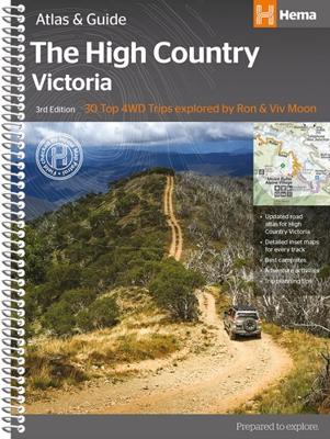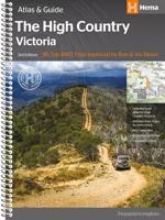
Wegenatlas Victoria High Country Atlas & Guide | Hema Maps

0
The definitive guidebook for discovering the Victorian High Country, featuring the Top 30 4WD Trips written by Ron and Viv Moon, in combination with topographic atlas mapping for the region.   40 atlas pages at a scale of 1:150 000 Top 30 4WD Trips Best campsites Adventure activities Trip planning tips This brand new edition of Hema’s best-s...

Verkopers met dit product

Verkoper
Bezorging
Prijs
DeZwerver.nl logo
DeZwerver.nl
2,95
46,95

Anderen bekeken ook

Nieuw
Wegenatlas Tasmania atlas & guide - Tasmanië | Hema Maps
The definitive guidebook for discovering Tasmania, featuring the Top 15 4WD Trips of the State and 5 of the best walking tracks.   This first edition Tasmania Atlas & Guide contains 40 atlas pages at a large scale of 1:150 000 in a stunning cartographic style. The guide features the Top 15 4WD Trips for Tassie, which has been field checked by Hema's Map Patrol. Also included is an introduction to the region, as well as information sections on planning the trip and what to see and do. There are detailed touring sections on the distinct regions of Tasmania. The Top 15 4WD Trips are broken into their respective localities, with each trip containing comprehensive trip information including gradings, distances, relevant travel information and drive coverage from start to finish.   Key Features 40 atlas pages at a scale of 1:150 000 Top 15 4WD Trips Top 5 Walking tracks Best campsites Adventure activities Trip planning tips
45,95
Nieuw
Wegenatlas Cape York Atlas & Guide | Hema Maps
A4 formaat, verschillende schalen / spiraal uitvoering With detailed coverage of The Tip, the coast from Cairns to Cooktown, Rinyirru (Lakefield) National Park, the Peninsula Developmental Road, Old Telegraph Track, Torres Strait and the Savannah Way, it ensures you won’t miss the ‘must-see’ attractions, but it also describes some of the lesser known areas favoured by the experts. Whether you just want to make it to The Tip or are looking for a serious 4WD adventure, this informative book is an indispensable companion.   The book features 15 4WD trips, explored and revised by travel journalist Ian Glover, with photography by Matt Williams. Each trip has a detailed map, plus all the information you need to plan the trip including trip grading, longest distance without fuel, permits and contact details.   This brand new edition of Hema’s best-selling outdoor guidebook for discovering Cape York now features 22 atlas pages in a stunning new cartographic style and also incorporates c…
45,95
Nieuw
Wegenatlas Australië - Australia Road and 4WD Atlas - | Hema Maps
Deze wegenatlas (met ringband) is als volgt ingedeeld: in de omslag vindt u de legenda. Daarna volgt per staat een overzicht van de Nationale Parken en de voorzieningen. Aansluitend vindt u de wegenkaarten en stadsplattegronden per staat. Achterin de atlas een aparte sectie met kaarten voor de 4WD liefhebbers. Tot slot een afstandentabel.   Op de kaarten staan d.m.v. symbolen voorzieningen aangegeven zoals campings, 'lookouts', benzinestations, visitor information centers, picnic area enz.   Featuring trusted Hema mapping for all of Australia, the Hema Road & 4WD Atlas is the definitive travel guide for tourers and adventurers. Hema atlases feature more information useful to travellers, including 4WD tracks, campsites, caravan parks, rest areas, 24-hour fuel and points of interest.   This edition contains more mapping than ever before, which is enhanced by a striking new cartographic style that's incredibly easy to read. Included in this is up-to-date mapping for Australia's bigges…
40,95
Nieuw
Wegenatlas Australia - Road en 4WD Atlas - Australie | Hema Maps
Gebonden versie, geen spriraalbinding leverbaar van deze atlas.  Schaal is variabel per kaart. Deze editie bevat meer kaarten dan ooit tevoren,met t verneiuwd klerugebruik en daardor nog beter leesbaar.. Met detailkaarten voor Australië's belangrijkstre 4WD bestemmingen: Cape York, Fraser Island, de Top End, de Kimberley, de Pilbara, Centraal-Australië, High Country Victoria en de Flinders Ranges. Zeer volledig met een handig coördinatenstelsel, afstandstabel, een gids voor de nationale parken, een lijst met geaccrediteerde informatiecentra en een volledige index zijn ook opgenomen om te helpen bij de planning extra excursies.  Featuring trusted Hema mapping for all of Australia, the perfect bound Hema Road & 4WD Atlas is the definitive travel guide for tourers and adventurers. Hema atlases feature more information useful to travellers, including 4WD tracks, campsites, caravan parks, rest areas, 24-hour fuel and points of interest.   The new edition contains more mapping than ever bef…
30,95
Nieuw
Wegenatlas Australia Road & 4WD Easy Read Atlas | A3 | Ringband | Hema Maps
Deze gloednieuwe editie van Hema's best verkopende wegenatlas van Australië telt nu 188 pagina's en is opgemaakt met een prachtige cartografie in een nieuwe stijl. Elke atlas in de reeks bevat nu ook kaarten voor 4WD en touring bestemmingen zoals Cape York, Fraser Island, Top End, Kimberley, Pilbara, Central Australia, High Country Victoria en de Flinders Ranges. Extra kaarten geven de drukke kuststroken in meer detail weer. De atlas is nog steeds de ultieme bron van informatie om Australië te verkennen, met de omvangrijke kartering van Hema en veel relevante tourinformatie. Op de kaarten worden campings, overnachtingsplaatsen, stopplaatsen, benzinestations, erkende informatiediensten en interessante bezienswaardigheden weergegeven met icoontjes. Een handig raster om afstanden af te lezen, een gids van de nationale parken, een lijst van de erkende informatiediensten en een volledig plaatsnamenregister zijn inbegrepen en helpen bij de planning en tijdens de reis. Featuring trusted He…
48,95
Nieuw
Wegenatlas Australia Road & 4WD Touring Atlas A4 | Hema Maps
Uitstekende wegenatlas van heel Australië met goed leesbare kaarten, met stadsplattegronden en afstandstabel. A4-formaat in ringband, Engelstalig. Featuring trusted Hema mapping for all of Australia, the Hema Road & 4WD Touring Atlas is the definitive travel guide for tourers and adventurers. Hema atlases feature more information useful to travellers, including 4WD tracks, campsites, caravan parks, rest areas, 24-hour fuel and points of interest.   This edition contains more mapping than ever before, which is enhanced by a striking new cartographic style that's incredibly easy to read. Included in this is up-to-date mapping for Australia's biggest 4WD destinations: Cape York, Fraser Island, the Top End, the Kimberley, the Pilbara, Central Australia, High Country Victoria and the Flinders Ranges.   A handy distance grid, national park guide, list of accredited information centres and a complete index are also included to assist with trip planning and navigation, making it the perf…
39,95
Nieuw
Wegenatlas Australia Road & 4WD Handy Atlas B5 | Hema Maps
Wegenatlas Australie met toeristische informatie, uitgevoerd in handige spiraalbinding. Geweldige kaarten, goed leesbaar (beetje kleine letters wellicht voor sommigen) met veel toegevoegde waarde als het gaat om details als Nationale Parken, campsites, stranden en afstanden. De schaal varieert per bladzijde Featuring trusted Hema mapping for all of Australia, the Hema Road & 4WD Handy Atlas is the definitive travel guide for tourers and adventurers. Hema atlases feature more information useful to travellers, including 4WD tracks, campsites, caravan parks, rest areas, 24-hour fuel and points of interest.   This edition in a handy size contains more mapping than ever before, which is enhanced by a striking new cartographic style that?s incredibly easy to read. Included in this is up-to-date mapping for Australia's biggest 4WD destinations: Cape York, Fraser Island, the Top End, the Kimberley, the Pilbara, Central Australia, High Country Victoria and the Flinders Ranges.   A handy d…
29,95
Accommodatiegids Namibia Self-Drive Guide | Tracks4Africa
So, what is so special about the Tracks4Africa guide books? These are not guides written by armchair travellers or the personal experience of one person, but the combined experiences of a whole community of travellers. The T4A community travel far and wide – not by luxury bus or safari vehicle but on their own wheels. Sometimes they travel in groups and sometimes as lone rangers, but they always travel by motorbike, sedan or 4WD, therefore this guide is specifically aimed at self-drive travellers.   If you are a self-drive tourist, there are five things that you need to know when you are on the road: 1. Where to sleep. 2. Where to get fuel. 3. What to see and do. 4. Where to buy supplies. 5. Where to go in case of an emergency.   If you have the Tracks4Africa Self-Drive Guide as your travel companion, the answers to all these and many more questions will be at hand. If you are well prepared and well informed, you can really enjoy the unspoilt beauty of Africa! The Tracks4Afr…
52,50
Nieuw
Wegenatlas The Kimberley Atlas & Guide | Hema Maps
A4 formaat, spiraal gebonden, verschillende schalen This guide is jam-packed with information on what to do and see in the Kimberley. Travel writer Denis O'Byrne gives information on the Kimberley's amazing 'must see' landmarks as well as expert favourites that often go unseen. Hema's guide helps you make the most of your visit to the remarkable corner of Australia. With detailed coverage of the Gibb River Road, Broome, Kununurra, Purnululu, (The Bungle Bungles) and many other famous destinations, it ensures you won't miss the 'must-see' attractions, but it also describes some of the lesser known areas favoured by the experts.    Features:   New larger A4 format - easy-to-read Town and locatlities GPS index When to go and how to prepare Handy atlas for navigation, plus detailed maps of the Gibb River Road, Great Northern Highway, Broome and Kununurra regions, and national parks Where to go for the best outdoor experiences Where to stay, from luxurious resorts to the best bush camping …
47,50
Nieuw
Wegenatlas - Campinggids 4WD + Camping Escapes - Perth & the South West | Hema Maps
4WD + Camping Escapes – Perth & the South West is a guide to the best four-wheel driving and camping locations in South West Western Australia. Each regional section outlines the area’s 4WD Tracks and Featured Camping Areas, with a Camping Directory at the end to provide comprehensive coverage of other camping areas.   The complete atlas contains Hema’s new South West Western Australia map, featuring 24hr fuel, information centres, rest areas and points of interest.   The guide features 15 4WD tracks, each with its own detailed inset map showing the route taken. The range of trips includes some suitable for first-timers as well as others for the more experienced looking for something new to tackle. All of the tracks are colour-coded to make it simple to find the tracks that suit your type of vehicle and handy symbols show towing suitability too.   The featured camping area descriptions help you find a site to suit your requirements, whether you want a 2WD-accessible spot with toilets …
34,95

Klanten-reviews van Wegenatlas Victoria High Country Atlas & Guide | Hema Maps

Er zijn nog geen beoordelingen voor dit productBen jij de eerste die een review plaatst?

Meer over Wegenatlas Victoria High Country Atlas & Guide | Hema Maps

Productomschrijving

The definitive guidebook for discovering the Victorian High Country, featuring the Top 30 4WD Trips written by Ron and Viv Moon, in combination with topographic atlas mapping for the region.  
  • 40 atlas pages at a scale of 1:150 000
  • Top 30 4WD Trips
  • Best campsites
  • Adventure activities
  • Trip planning tips
  • This brand new edition of Hema’s best-selling outdoor guidebook for discovering the Victorian High Country now features 40 atlas pages at a large scale of 1:150 000 in a stunning new cartographic style. The guide now features the Top 30 4WD Trips for the High Country, which has been written by off-road legends Ron and Viv Moon. Also included is an introduction to the region, as well as information sections on planning the trip and what to see and do. There are detailed touring sections on the distinct regions of the High Country, including the Great Alpine Road, Alpine National Park as well as Snowy River and Baw Baw national parks. The Top 30 4WD Trips are broken into their respective localities, with each trip containing comprehensive trip information including gradings, distances, relevant travel information and drive coverage from start to finish.
Webshop.nl maakt gebruik van cookies. Ga je verder op onze website, ga dan akkoord met het plaatsen van cookies en de verwerking van deze data door ons en vermelde partners.