webshop.nl
Categorieën
  Sluiten

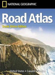
Wegenatlas USA Canada Mexico Road Atlas | A4-Formaat | National Geographic

National Geographic's Road Atlas: Scenic Drives Edition, is the ideal companion for the next time you hit the road for an unforgettable road trip. Includes up-to-date road maps for all 50 U.S. States, plus Canada, Mexico, and Puerto Rico. Major cities and metropolitan areas are shown in detail with inset maps that include popular attractions, infra...
17,95

Webshops met dit product

Webshop
Bezorging
Prijs

Anderen bekeken ook

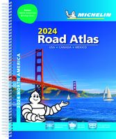
Wegenatlas Road Atlas USA Canada Mexico 2024 | A4-Formaat | Ringband | Michelin
De beroemde wegenatlas van Rand McNally nu als Michelin atlas. Super handige atlas van Michelin in A4 formaat met stevige ringband. Let op: Canada en Mexico staan er zeer beperkt in. For inspiring road trips and scenic drives, Michelin's updated, spiral-bound North America Road Atlas 2024 suggests 52 routes. The tiled atlas, with its clear, accurate mapping, complements online navigation while its big picture and road details aid in advance planning and en route decisions. For outdoor fun and adventure, look for inspiration among the highlights from national and provincial parks, including the parks' GPS coordinates.   Rely with confidence on Michelin's deluxe atlas to get you there. Covers USA, Canada and Mexico. Scale 1:625,000 - 1:9,018,000.   Spiral bound for lay-flat convenience. More than 240 large-scale city maps for navigating in and around urban areas. Bonus Northeast Corridor maps provide extra detail between Boston and Washington DC for easier driving.   Six-page trav…
20,95
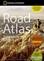
Wegenatlas Adventure Edition USA - Amerika - Canada - Mexico - Puerto Rico | A3-Formaat | Ringband | National Geographic
Duidelijk leesbare wegenatlas van de USA, Mexico, Canada, en Puerto Rico, met groot register en ook kleine plattegronden van centra van belangrijke steden. Ook met informatie over nationale parken en avontuurlijke bestemmingen. Duidelijke kaarten in stevig ringband model.   National Geographic's Road Atlas: Adventure Edition, is the ideal companion for the next time you hit the road. Includes up-to-date road maps for all 50 U.S. States, plus Canada, Mexico, and Puerto Rico. Major cities and metropolitan areas are shown in detail with inset maps that include popular attractions, infrastructure and points-of-interest.   Setting this atlas apart from all other road atlases are the inclusion of detailed maps and guidebook-like recommendations on the top 100 destinations for adventure, plus the top 24 most visited National Parks. An additional resources section provides contact information for local tourism offices, plus a place name index to help easily locate a specific city.   The R…
32,95
Reisgids Best Road Trips Southwest USA | Lonely Planet
Naast de gewone Lonely Planet hebben ze ook een titel uitgegeven met de mooiste rondritten in deze regio. De tochten gaan door mooie landschappen, over rustige wegen en doen 's lands meest bezienswaardige plaatsen aan. Natuurlijk met de nodige praktsche informatie voor onderweg omtrent eten, drinken en slapen.  Discover the freedom of the open road with Lonely Planet's Southwest USA's Best Road Trips. This trusted travel companion features 32 amazing drives, from 2-day escapes to 2-week adventures. Marvel at the Grand Canyon, soak up the beauty of Sedona, and stop off in Moab for some rafting. Get to Southwest USA, rent a car, and hit the road!           Inside Lonely Planet's Southwest USA's Best Road Trips:   Itineraries for classic road trips plus other lesser-known drives with expert advice to pick the routes that suit your interests and needs Full-color route maps - easy-to-read, detailed directions Detours - delightful diversions to see the USA's highlights along the w…
23,95
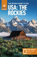
Reisgids Usa: The Rockies | Rough Guides
Zeer goede reisgids voor zowel de georganiseerde maar vooral voor de zelfstandige reiziger. Boordevol informatie over reizen, slapen, eten, maar ook musea en cultuur.  Practical travel guide to The Rockies with a free eBook featuring points-of-interest structured lists of all sights and off-the-beaten-track treasures, with detailed colour-coded maps, practical details about what to see and to do in The Rockies, how to get there and around, pre-departure information, as well as top time-saving tips, like a visual list of things not to miss in The Rockies, expert author picks and itineraries to help you plan your trip. The Rough Guide to THE ROCKIES covers: Colorado, Wyoming, Montana and Idaho. Inside this travel guide you'll find: RECOMMENDATIONS FOR EVERY TYPE OF TRAVELLER Experiences selection for every kind of trip to The Rockies, from off-the-beaten-track adventures in Wyoming to family activities in child-friendly places, like Yellowstone National Park or chilled-out breaks in p…
13,95
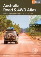
Wegenatlas Australia - Road en 4WD Atlas - Australie | Hema Maps
Gebonden versie, geen spriraalbinding leverbaar van deze atlas.  Schaal is variabel per kaart. Deze editie bevat meer kaarten dan ooit tevoren,met t verneiuwd klerugebruik en daardor nog beter leesbaar.. Met detailkaarten voor Australië's belangrijkstre 4WD bestemmingen: Cape York, Fraser Island, de Top End, de Kimberley, de Pilbara, Centraal-Australië, High Country Victoria en de Flinders Ranges. Zeer volledig met een handig coördinatenstelsel, afstandstabel, een gids voor de nationale parken, een lijst met geaccrediteerde informatiecentra en een volledige index zijn ook opgenomen om te helpen bij de planning extra excursies.  Featuring trusted Hema mapping for all of Australia, the perfect bound Hema Road & 4WD Atlas is the definitive travel guide for tourers and adventurers. Hema atlases feature more information useful to travellers, including 4WD tracks, campsites, caravan parks, rest areas, 24-hour fuel and points of interest.   The new edition contains more mapping than ever befo…
30,95
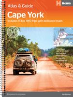
Wegenatlas Cape York Atlas & Guide | Hema Maps
A4 formaat, verschillende schalen / spiraal uitvoering With detailed coverage of The Tip, the coast from Cairns to Cooktown, Rinyirru (Lakefield) National Park, the Peninsula Developmental Road, Old Telegraph Track, Torres Strait and the Savannah Way, it ensures you won’t miss the ‘must-see’ attractions, but it also describes some of the lesser known areas favoured by the experts. Whether you just want to make it to The Tip or are looking for a serious 4WD adventure, this informative book is an indispensable companion.   The book features 15 4WD trips, explored and revised by travel journalist Ian Glover, with photography by Matt Williams. Each trip has a detailed map, plus all the information you need to plan the trip including trip grading, longest distance without fuel, permits and contact details.   This brand new edition of Hema’s best-selling outdoor guidebook for discovering Cape York now features 22 atlas pages in a stunning new cartographic style and also incorporates co…
45,95
Wegenatlas Australië - Great Desert Tracks Atlas & Guide | Hema Maps
Whether you're a desert lover or just looking to tackle some of Australia's favourite 4WD destinations, the Hema Great Desert Tracks Atlas & Guide - Edition 5 is an indispensable companion to this country's arid centre. The complete atlas contains Hema's entire Great Desert Tracks map series. The guide features 25 4WD tracks, each with its own detailed map inset showing the route taken, with GPS location and points of interest featured. All of the tracks are colour-coded to make it simple to find the treks that suit your type of vehicle and handy symbols show towing suitability also! The track descriptions are written by some of Australia's top four-wheel driving enthusiasts and experienced travel writers. Each track's notes contain all the information you need to plan for the trip, including permits and contact details. There's also plenty of essential pre-trip reading on how to prepare for your trek, safety in the outback and driving techniques!   Features Contains Hema's entire G…
55,95
Reisgids USA National Parks | Moon Travel Guides
They've been dubbed America's best idea for a reason: get inspired, get outdoors, and discover the wild beauty of the United States with Moon USA National Parks. Inside you'll find: Coverage of all 63 national parks, from the misty mountains of the east and the redwoods of the west to the glaciers of Alaska and volcanoes of Hawaii, organized by region Strategic lists and itineraries: Choose from lists of the best parks for hiking, wildlife, families, and scenic drives or make your way down the list of the top ten national parks experiences across the country The best outdoor adventures in every park, including backpacking, biking, climbing, kayaking, rafting, and more, plus detailed hike descriptions and trail maps marked with distance, duration, effort level, and trailheads National parks road trips with driving times and advice for linking multiple parks, interesting stops between them, and nearby attractions and state parks Comprehensive planning resources: With maps and transp…
24,50
Wegenatlas Traveller's Atlas Southern Africa - Zuidelijk Afrika | A3-Formaat | Ringband | Tracks4Africa
Deze atlas omvat tien landen in zuidelijk Afrika en is speciaal gericht op reizigers die zelf rijden. De betrokken landen zijn: Angola, Botswana, Lesotho, Malawi, Mozambique, Namibië, Zuid-Afrika, Swaziland, Zambia en Zimbabwe.   De Atlas bevat 223 kaartpagina's met hetzelfde vertrouwde kaartdetail waarvoor Tracks4Africa bekend is.   De wegenatlas is afgedrukt in A3 formaat, weegt 2750g, heeft een stevige omslag, spiraal gebonden en de pagina's zijn afgedrukt op dik papier.   Bigger coverage than ever before: 1:4m maps for Southern and Eastern Africa – ideal for macro planning. 1:1m maps for Southern Africa, covering the following countries: Angola, Botswana, eSwatini, Lesotho, Malawi, Mozambique, Namibia, South Africa, Zambia and Zimbabwe. 1:500k maps for South Africa, Malawi, most part of Zambia and the area around Moremi/Chobe in Botswana. Road coverage: This Atlas is designed for overland travel and compiled from the same data used on our famous GPS maps. Use it for trip pl…
79,95
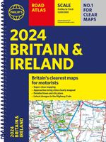
Wegenatlas Road Atlas Britain and Ireland 2024 | Philip's Maps
PHILIP'S - Market leaders and No. 1 in the UK for clear maps'Good balance between detail and clarity with excellent town maps' What Car? * Super-clear mapping at a scale of 3 miles to 1 inch = 1:200,000* Includes the latest highway code requirements* Completely updated and revised for 2024* New map showing Smart Motorways- Practical spiral bound, lie-flat format- 160 pages of fully updated super-clear road maps - 10 pages of detailed route-planning maps - plan your route in advance - 88 indexed town-centre maps - 14 pages of city approach maps with named arterial roads - 2 page road map of Ireland- Map of scenic Britain and a map highlighting railways, airports and ferry ports Philip's 2024 Road Atlas Britain and Ireland is the top-of-the-range spiral road atlas featuring the latest maps from the Philip's digital database. Voted Britain's clearest and most detailed in an independent consumer survey, the mapping is super-clear.   Philip's 2024 Road Atlas Britain and Ireland contains 160…
23,95

Klanten-reviews van Wegenatlas USA Canada Mexico Road Atlas | A4-Formaat | National Geographic

Er zijn nog geen beoordelingen voor dit productBen jij de eerste die een review plaatst?

Meer over Wegenatlas USA Canada Mexico Road Atlas | A4-Formaat | National Geographic

Productomschrijving

National Geographic's Road Atlas: Scenic Drives Edition, is the ideal companion for the next time you hit the road for an unforgettable road trip. Includes up-to-date road maps for all 50 U.S. States, plus Canada, Mexico, and Puerto Rico. Major cities and metropolitan areas are shown in detail with inset maps that include popular attractions, infrastructure and points-of-interest. Setting this atlas apart from all others is the inclusion of selection of 20 carefully researched scenic drives to help you plan the road trip of a lifetime. A map and guide section is also included for the 20 most popular National Parks. Take the guesswork out of traveling and trip planning with a comprehensive index, mileage charts, and cross-referenced pages. The Road Atlas: Scenic Drives Edition is printed in North America and it is a convenient letter-size format that fits comfortably into glove compartments or car side door pockets.
Webshop.nl maakt gebruik van cookies. Ga je verder op onze website, ga dan akkoord met het plaatsen van cookies en de verwerking van deze data door ons en vermelde partners.