webshop.nl
Categorieën
  Sluiten

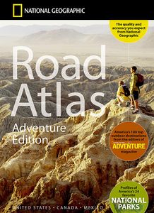
Wegenatlas Adventure Edition USA - Amerika - Canada - Mexico - Puerto Rico | A3-Formaat | Ringband | National Geographic

Duidelijk leesbare wegenatlas van de USA, Mexico, Canada, en Puerto Rico, met groot register en ook kleine plattegronden van centra van belangrijke steden. Ook met informatie over nationale parken en avontuurlijke bestemmingen. Duidelijke kaarten in stevig ringband model.   National Geographic's Road Atlas: Adventure Edition, is the ideal companio...
32,95

Webshops met dit product

Webshop
Bezorging
Prijs

Anderen bekeken ook

Wegenatlas USA Canada Mexico Road Atlas | A4-Formaat | National Geographic
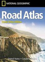
National Geographic's Road Atlas: Scenic Drives Edition, is the ideal companion for the next time you hit the road for an unforgettable road trip. Includes up-to-date road maps for all 50 U.S. States, plus Canada, Mexico, and Puerto Rico. Major cities and metropolitan areas are shown in detail with inset maps that include popular attractions, infrastructure and points-of-interest. Setting this atlas apart from all others is the inclusion of selection of 20 carefully researched scenic drives to help you plan the road trip of a lifetime. A map and guide section is also included for the 20 most popular National Parks. Take the guesswork out of traveling and trip planning with a comprehensive index, mileage charts, and cross-referenced pages. The Road Atlas: Scenic Drives Edition is printed in North America and it is a convenient letter-size format that fits comfortably into glove compartments or car side door pockets.
17,95
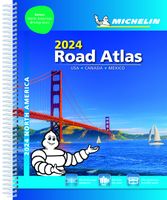
Wegenatlas Road Atlas USA Canada Mexico 2024 | A4-Formaat | Ringband | Michelin
De beroemde wegenatlas van Rand McNally nu als Michelin atlas. Super handige atlas van Michelin in A4 formaat met stevige ringband. Let op: Canada en Mexico staan er zeer beperkt in. For inspiring road trips and scenic drives, Michelin's updated, spiral-bound North America Road Atlas 2024 suggests 52 routes. The tiled atlas, with its clear, accurate mapping, complements online navigation while its big picture and road details aid in advance planning and en route decisions. For outdoor fun and adventure, look for inspiration among the highlights from national and provincial parks, including the parks' GPS coordinates.   Rely with confidence on Michelin's deluxe atlas to get you there. Covers USA, Canada and Mexico. Scale 1:625,000 - 1:9,018,000.   Spiral bound for lay-flat convenience. More than 240 large-scale city maps for navigating in and around urban areas. Bonus Northeast Corridor maps provide extra detail between Boston and Washington DC for easier driving.   Six-page trav…
20,95
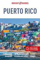
Reisgids Puerto Rico | Insight Guides
This Insight Guide is a lavishly illustrated inspirational travel guide to Puerto Rico and a beautiful souvenir of your trip. Perfect for travellers looking for a deeper dive into the destination's history and culture, it's ideal to inspire and help you plan your travels. With its great selection of places to see and colourful magazine-style layout, this Puerto Rico guidebook is just the tool you need to accompany you before or during your trip.   Whether it's deciding when to go, choosing what to see or creating a travel plan to cover key places like Old San Juan, El Yunque National Forest, it will answer all the questions you might have along the way. It will also help guide you when you'll be exploring Rio Camuy Cave Park or discovering Rio Abajo Forest Reserve on the ground. Our Puerto Rico travel guide was fully-updated post-COVID-19.   The Insight Guide PUERTO RICO covers: Old San Juan, Metropolitan San Juan, The Northeast, The Southeast, The North, The West, The South, Cordiller…
23,95
Wegenkaart - landkaart 3107 Adventure Map Puerto Rico | National Geographic
Wegenkaart van Puerto Rico met vermelding van veel bezienswaardigheden, nationale parken en attrakties. Watervast en scheurvast. Juist door deze vermeldingen onderscheidt de kaart zich van andere wegenkaarten. Like all Adventure maps, Puerto Rico contains detailed topographic information, plus useful traveling tips, and regional information. Printed on the same waterproof, tear-resistant material as our Trails Illustrated maps—our adventure series maps will stand up to rigorous travel, and contain the navigation aids necessary for backcountry use with GPS or compass.
17,50
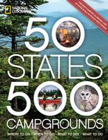
Campinggids - Campergids 50 States - 500 Campgrounds USA en Canada | National Geographic
Plan your next getaway to the great outdoors with this one-of-a-kind resource for campgrounds across North America. In this comprehensive sequel to the best-selling 50 States, 5,000 Ideas, you'll discover the top tent and cabin campsites, as well as RV resorts and glamping destinations around the United States and Canada. Along with destination information--location, contact info, open seasons, and amenities--along with expert recommendations for activities including hiking, biking, and water sports; the best restaurants for days you need a break from the camp stove; and nearby attractions--from sights within nearby national and state parks to local museums. Choose from 10 sites in each state, Western and Eastern Canada, the U.S. Virgin Islands, and Puerto Rico, including a cabin at Yogi Bear's Delaware Beaches Jellystone Park Camp Resort; a tent near the stunning waterfall at the Grand Canyon's Havasupai Campground; or a cozy yurt in the Rocky Mountains of Colorado. Whatever your camp…
29,95
Wegenkaart - landkaart 3113 Adventure Map Canada West | National Geographic
Wegenkaart van Canada west met vermelding van veel bezienswaardigheden, nationale parken en attrakties. Watervast en scheurvast. Juist door deze vermeldingen onderscheidt de kaart zich van andere wegenkaarten.   National Geographic's Canada West Adventure Map is designed to meet the unique needs of adventure travelers with its durability and accurate information. Each folded map provides global travelers with the perfect combination of detail and perspective, highlighting the area’s terrain and best locations for adventure activities like snorkeling, surfing, fishing, and more. Adventure Maps include hundreds of points of interest that highlight diverse and unique destinations within the country.   The map includes the locations of thousands of cities and towns with a user-friendly index, plus a clearly marked road network complete with distances and designations for major highways, main roads, and tracks and trails for those seeking to explore more remote regions.   Key Features: Wat…
17,50
Wegenkaart - landkaart 3114 Adventure Map Canada Central | National Geographic
Wegenkaart van centraal Canada met vermelding van veel bezienswaardigheden, nationale parken en attrakties. Watervast en scheurvast. Juist door deze vermeldingen onderscheidt de kaart zich van andere wegenkaarten. National Geographic's Canada Central Adventure Map is designed to meet the unique needs of adventure travelers with its durability and accurate information. Each folded map provides global travelers with the perfect combination of detail and perspective, highlighting the area’s terrain and best locations for adventure activities like snorkeling, surfing, fishing, and more. Adventure Maps include hundreds of points of interest that highlight diverse and unique destinations within the country.   The map includes the locations of thousands of cities and towns with a user-friendly index, plus a clearly marked road network complete with distances and designations for major highways, main roads, and tracks and trails for those seeking to explore more remote regions.   Key Features:…
17,50
Wegenkaart - landkaart 3115 Adventure Map Canada East - Oost | National Geographic
Wegenkaart van oost Canada met vermelding van veel bezienswaardigheden, nationale parken en attrakties. Watervast en scheurvast. Juist door deze vermeldingen onderscheidt de kaart zich van andere wegenkaarten. National Geographic's Canada East Adventure Map is designed to meet the unique needs of adventure travelers with its durability and accurate information. Each folded map provides global travelers with the perfect combination of detail and perspective, highlighting the area’s terrain and best locations for adventure activities like snorkeling, surfing, fishing, and more. Adventure Maps include hundreds of points of interest that highlight diverse and unique destinations within the country.   The map includes the locations of thousands of cities and towns with a user-friendly index, plus a clearly marked road network complete with distances and designations for major highways, main roads, and tracks and trails for those seeking to explore more remote regions.   Key Features: Water…
17,50
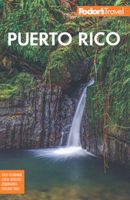
Reisgids Puerto Rico | Fodor's Travel
Ready to experience Puerto Rico? The experts at Fodor’s are here to help. Fodor’s Puerto Rico travel guide is packed with customizable itineraries with top recommendations, detailed maps of Puerto Rico, and exclusive tips from locals. Whether you want to stroll the atmospheric streets of Old San Juan, lounge on the island's beautiful beaches, or escape to Vieques or Culebra, this up-to-date guidebook will help you plan it all out.   This new edition has been FULLY-REDESIGNED with a new layout and beautiful images for more intuitive travel planning! Fodor’s Puerto Rico includes:   • AN ULTIMATE EXPERIENCE GUIDE that visually captures the top highlights of Puerto Rico. • SPECTACULAR COLOR PHOTOS AND FEATURES throughout, including special features on walking in Old San Juan, bioluminescent Bays, and salsa. • INSPIRATIONAL “BEST OF” LISTS identify the best things to see, do, eat, drink, and more. • MULTIPLE ITINERARIES for various trip lengths help you maximize your time. • 25 DETAILED MAP…
20,95
Wegenkaart - landkaart 3402 Adventure Map Chile - Chili | National Geographic
Wegenkaart van Chili met vermelding van veel bezienswaardigheden, nationale parken en attrakties. Watervast en scheurvast. Juist door deze vermeldingen onderscheidt de kaart zich van andere wegenkaarten.   National Geographic's Chile Adventure Map is designed to meet the unique needs of adventure travelers—detailed, durable, and accurate. Chile includes the locations of thousands of major cities and towns with an index for easily locating them, plus a clearly marked road network complete with distances and designations for major highways, toll roads, limited access highways and more.   What sets National Geographic Adventure Maps apart from traditional road maps are the hundreds of points-of-interest that highlight the diverse, unique, and exotic destinations within Chile including National Parks and Preserves, World Heritage Sites, Archeological sites, ski areas, beaches, waterfalls, natural points of interest and important travel aids like airports, airstrips, rail lines, lighthouses…
17,50

Klanten-reviews van Wegenatlas Adventure Edition USA - Amerika - Canada - Mexico - Puerto Rico | A3-Formaat | Ringband | National Geographic

Er zijn nog geen beoordelingen voor dit productBen jij de eerste die een review plaatst?

Meer over Wegenatlas Adventure Edition USA - Amerika - Canada - Mexico - Puerto Rico | A3-Formaat | Ringband | National Geographic

Productomschrijving

Duidelijk leesbare wegenatlas van de USA, Mexico, Canada, en Puerto Rico, met groot register en ook kleine plattegronden van centra van belangrijke steden. Ook met informatie over nationale parken en avontuurlijke bestemmingen. Duidelijke kaarten in stevig ringband model.   National Geographic's Road Atlas: Adventure Edition, is the ideal companion for the next time you hit the road. Includes up-to-date road maps for all 50 U.S. States, plus Canada, Mexico, and Puerto Rico. Major cities and metropolitan areas are shown in detail with inset maps that include popular attractions, infrastructure and points-of-interest.   Setting this atlas apart from all other road atlases are the inclusion of detailed maps and guidebook-like recommendations on the top 100 destinations for adventure, plus the top 24 most visited National Parks. An additional resources section provides contact information for local tourism offices, plus a place name index to help easily locate a specific city.   The Road Atlas: Adventure Edition is printed in the United States and features a heavy duty spiral binding and Travel Tough plastic cover for durability and lay-flat reading.  
Webshop.nl maakt gebruik van cookies. Ga je verder op onze website, ga dan akkoord met het plaatsen van cookies en de verwerking van deze data door ons en vermelde partners.