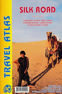
Wegenatlas Travel Atlas Silk Road - Zijderoute | ITMB

0
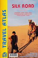
Kleine, handzame wegenatlas van de oorspronkelijke zijderoute van Libanon tot en met het westen van China. Handig met index, stadsplattegronden, goede legenda en behoorlijk gedetaillerde kaarten. A5 formaat, gebonden. De schaal van de kaarten verschilt per land. The Great Silk Road has been the traditional trading route between Europe and China fo...

Verkopers met dit product

Verkoper
Bezorging
Prijs
DeZwerver.nl logo
DeZwerver.nl
2,95
16,50

Anderen bekeken ook

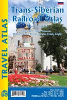
Wegenatlas Trans-Siberian Railroad | ITMB
Klein formaat wegenatlas (A5) van de Trans-Siberische spoorlijn, uitgebracht door ITMB. It is not often that one can publish a map that has never been done before. I seem to say that rather frequently! The Trans Siberian is one of the great railway trips of all time, crossing vast areas of steppe land and tundra as it wends its way from Moscow to Vladivostok. There are actually two routes for much of the western portion, and branch off lines to Mongolia and northern China in the east, as well as a very unusual route across the top of Lake Baikal called the Amur, or BAM, line. The only effective way to show east west rail networks this diverse is via an atlas and that is just what we have done. The entire route, with an extra page for those starting in St. Petersburg is covered nicely, with inset pages showing St. Petersburg, Moscow, and the heritage cities of Sergiev Posad and Suzdal. Both branches of the Trans-Siberian are shown and most of the Baikal Amur (BAM) line. This type of ma…
16,50
Wegenatlas Travel Atlas Indian Subcontinent | ITMB
Handzame wegenatlas op A5 formaat, helaas geen spiraalbinding. Maar voor deze regio is er op dit moment geen andere atlas beschikbaar.   This is our biggest atlas ever, with 152 pages of maps and 51 pages of place names indexing. The Indian Sub-Continent consists of Pakistan, India, Nepal, Bhutan, Bangladesh, Sri Lanka and Kashmir. Each country (Kashmir being considered shared) is presented as an entity, so Pakistan occupies 30 pages at 1:1,200,000 scale, and Nepal occupies 32 pages at 1:530,000 scale. In short, each country is shown in detail, but at scales appropriate for each country. The amount of detail on each page is impressive; equal to buying six maps at $12.95 each. The market is the traveller to the region, visiting several of these areas and wanting a compact way to have detailed mapping without having to carry half a dozen maps or spend a large amount of money on maps. Eleven city inset maps are included, as well as basic insets for the Andaman and Nicobar island chains. …
16,50
Wegenkaart - landkaart 3008 Adventure Map China East - Oost | National Geographic
Wegenkaart van Oost China  met vermelding van veel bezienswaardigheden, nationale parken en attrakties. Watervast en scheurvast.   National Geographic's China East Adventure Map is designed to meet the unique needs of adventure travelers with its durability and detailed, accurate information. The map includes the locations of thousands of cities and towns with a user-friendly index, plus a clearly marked road network complete with distances and designations for major highways, major routes and secondary roads. The China Adventure Map is printed in the United States on a durable synthetic paper, making it waterproof, tear-resistant and tough—capable of withstanding the rigors of international travel.   The China East Adventure Map differs from a traditional road map for it includes hundreds of points of interest that highlight diverse and unique destinations in the region. UNESCO World Heritage sites, national parks and reserves, archaeological sites, temples, caves and points of …
17,50
Reisgids Silk Road (China) - Monks, Warriors & Merchants | Odyssey
To the modern reader, the Silk Road conjures up images of fabled cities and exotic lands, of long-gone empires and great conquerors. Place names such as Samarkand, Bukhara, Khotan or Chang'an continue to fascinate with the richness of their past. In this authoritative book, Luce Boulnois explores the encounter between East and West across the vast continental expanse that separates the Mediterranean world from the Chinese one. She unravels in a clear and compelling way the complex threads that make up the history of these great overland trade routes, which allowed the transmission across the world of ideas and beliefs, techniques and works of art, helping to shape the civilizations that flourished along the way. How did the Romans, following in the footsteps of the Greeks, discover these far-flung regions? What did the Chinese know of the European world? How did they manage to keep the secret of silk manufacture safe for centuries? Did Marco Polo really go to China, or was he just a c…
25,50
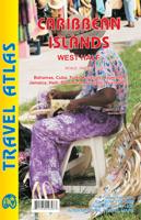
Wegenatlas Travel Atlas Caribbean Island West Half | ITMB
  Wegenatlas voor de westelijke Caraïbische eilanden - verschillende schalen : Bahamas, Turks- en Caicoseilanden, Cuba, Kaaimaneilanden, Jamaica, Dominikaanse Republiek, Puerto Rico. Met inzetjes van Freeport, Nassau, Havana, Varadero, Georgetown, Kingston, Port-au-Prince, Santo Domingo, San Juan   The Caribbean is a particularly difficult part of the world to map effectively. It is a combination of larger islands in the west and a string of small islands in the east. Some can be shown as separate maps, but others are too small (or too lacking in market appeal) to be mapped adequately as folded paper maps. This atlas covers the Bahamas and the Turks and Caicos Islands in the north with Cuba, the Cayman Islands, Jamaica, the Dominican Republic, and Puerto Rico in scales ranging from 1:18,000 for Puerto Rico to 1:600,000 for Cuba The atlas is the same size as all ITM atlases (8''x5'' or 21x13.5cm) and has a straight spine edge with title for displaying spine outwards on store shelves, i…
16,50
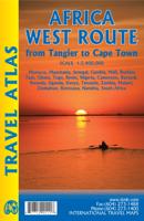
Wegenatlas Travel Atlas Afrika Africa Overland: Cairo to Cape Town | ITMB
Handzame wegenatlas, formaat A5, van de hele route van Cairo naar Kaapstad langs de oostelijke kant van Afrika. Naast de wegenkaarten bevat deze atlas ook een aantal centrumkaarten van de belangrijkste steden die je onderweg tegenkomt.  There are three possible routes to traverse Africa top to bottom. From the east, the only route is via Egypt and Sudan to Ethiopia and East Africa. The route through Algeria, known as the Hoggar (or Haager) route is next, with the route through Morocco to West Africa third. Traversing Africa is one of the great adventure trips in the world. I did it in 1969/70 in an epic journey that took a year and proved to be one of those fundamental acts shaping ones life. None of the routes are completely safe. That applied in the 1960s and it applies equally now, but life consists of determining acceptable risks and doing ones best not to be hit by a Number 10 bus by liking the wrong way when crossing a London street. This atlas portrays the eastern route from Ca…
16,50
Wegenatlas Travel Atlas Mayan World | ITMB
  Wegenatlas op diverse schaal voor het gebied van de Maya's in Mexico, Guatemala, Belize, Honduras en El Salvador.   Mayan World Travel Atlas - ITMB The Mayas occupied the Yucatan Peninsula and spread inland through modern-day Belize, Guatemala, and Honduras all the way to El Salvador. This atlas covers all these areas: Mexico from Tabasco and Chiapas, through the Yucatan provinces of Campeche, Quintana Roo and Yucatan (1:500,000), all of Belize at 1:250,000, all of Guatemala at 1:470,000, all of Honduras at 1:750,000, and all of El Salvador at 1:250,000. Each known Mayan site is marked and named (there are more than 400) in magenta City maps of Antigua Guatemala, Guatemala City, San Salvador, Tegucigalpa, and Belize City are included in this comprehensive atlas.   Legend : International Airports Roads by classification,Time Zone Border,Points of interest Historic site, Hotels, Museums,Golf course,Restaurants,Caves/Grotto,Lighthouses, Gas Stations, Waterfalls, Hotsprings,Hospitals, H…
16,50
Wegenatlas Road Atlas 2025 USA - Canada - Mexico - Verenigde Staten groot formaat | Michelin
De beroemde wegenatlas van Rand McNally nu als Michelin atlas op groot formaat, bijna dubbel A4. Elke staat een eigen, of soms zelfs twee pagina's. Uitgebreid register. Zoals de Amerikanen zelf zeggen: America's number 1 Road Atlas! Canada en Mexico staan er zeer beperkt in. Highlighting 51 road trips and scenic drives the Michelin's updated Large Format North America Road Atlas 2025 helps you enjoy the planning and the journey. Large-format maps and larger lettering for towns and sites (compared to the midsize atlas) make for easier reading while the tiled format flows maps from page to page—the ideal complement to GPS and online directions. Four jam-packed pages highlight selected US and Canadian national parks, with points of interest, hikes and drives.   Covers US, Canada & Mexico. Large grid map to quickly locate atlas pages. Easy-read text and mapping. Map pages are 36% larger than midsize atlas. Inspired ideas for outdoor fun and road trip adventures in the US and Canada…
19,95
Reisgids De zijderoute - Silk Road | Insight Guides
Een rijk geillustreerde reisgids met diepgaande teksten: één van de beste reisgidsen die er bestaan. Eerste deel bestaat uit een beschrijving van de unieke aspecten van de regio, daarna een deel echte reisgids en als afsluiting een deel met praktische informatie. De uitstekende informatie wordt vergezeld van prachtige foto's en heldere kaarten. Niet alleen om mee te nemen, maar ook om vooraf en zelfs achteraf weer in de stemming te komen. This Silk Road guidebook is ideal for travellers seeking inspirational guides and planning a more extended trip. It provides interesting facts about the Silk Road's people, history and culture and detailed coverage of the best places to see. This Silk Road travel book has the style of an illustrated magazine to inspire you and give a taste of the Silk Road. The book is printed on paper from responsible sources, and verified to meet FSC's strict environmental and social standards.   This Silk Road guidebook covers: China (Shaanxi, Ginsu, Xinjiang),…
25,95
Wegenatlas Travel Atlas Thailand, Vietnam, Laos & Cambodia | ITMB
  Atlas, gebonden, A5 formaat The Indochina Region consists of five countries, including that portion of Burma that sweeps down the western part of the Malay Peninsula. The four other countries form a cohesive entity for travel, especially now that border and visa requirements for travel have been reduced. Thailand itself is definitely the Number One reason for visiting the region. The first portion of the atlas is devoted to Thailand, including detailed page-size maps of Bangkok, Chiang Mai, and Pattaya. Vietnam is the next most-popular destination and is shown in great detail, with inset maps of Hanoi, Hoi An, Hue, Da Nang, Da Lat, Can Tho, and the central Saigon portion of Ho Chi Minh City. Laos and Cambodia are shown with the same degree of attention to detail, including insets of Vientiane, Phnom Penh, and two maps concentrating on Angkor Wat. This is a compact and convenient way for visitors to the region to have everything they need in one format - easy to catty, easy to use Le…
16,50

Klanten-reviews van Wegenatlas Travel Atlas Silk Road - Zijderoute | ITMB

Er zijn nog geen beoordelingen voor dit productBen jij de eerste die een review plaatst?

Meer over Wegenatlas Travel Atlas Silk Road - Zijderoute | ITMB

Productomschrijving

Kleine, handzame wegenatlas van de oorspronkelijke zijderoute van Libanon tot en met het westen van China. Handig met index, stadsplattegronden, goede legenda en behoorlijk gedetaillerde kaarten. A5 formaat, gebonden.

De schaal van de kaarten verschilt per land.

The Great Silk Road has been the traditional trading route between Europe and China for two thousand years. Starting in Xi’an in the east and ending at Antioch in the west. Much of the Silk Road still exists and can be visited.   This 73-page atlas follows the route from west to east, starting in ancient Tyre (now Sour, in southern Lebanon) and in Samandag in Turkey, heading eastward through Syria and Iraq (with a two-page inset map of Damascus and a six-page spread for fabled Baghdad) before heading north of the Kavir Desert to Tehran (another four-page spread) and eastward into Afghanistan to follow either the northern or southern routes through modern-day Samarkand and Tashkent (more insets) before moving on to the Urumqi region of far-western China and eventually ending at Xi’an. The atlas is fully indexed and can be used east to west as easily as west to east. 

Verken gerelateerde categorieën

Webshop.nl maakt gebruik van cookies. Ga je verder op onze website, ga dan akkoord met het plaatsen van cookies en de verwerking van deze data door ons en vermelde partners.