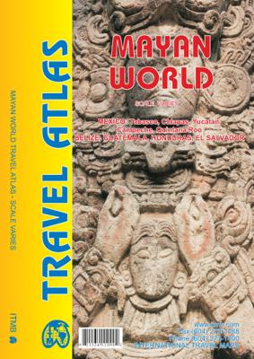
Wegenatlas Travel Atlas Mayan World | ITMB

0
  Wegenatlas op diverse schaal voor het gebied van de Maya's in Mexico, Guatemala, Belize, Honduras en El Salvador.   Mayan World Travel Atlas - ITMB The Mayas occupied the Yucatan Peninsula and spread inland through modern-day Belize, Guatemala, and Honduras all the way to El Salvador. This atlas covers all these areas: Mexico from Tabasco and Ch...

Verkopers met dit product

Verkoper
Bezorging
Prijs
DeZwerver.nl logo
DeZwerver.nl
2,95
16,50

Anderen bekeken ook

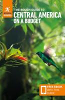
Reisgids Central America on a Budget - Midden-Amerika | Rough Guides
Zeer goede reisgids voor zowel de georganiseerde maar vooral voor de zelfstandige reiziger. Boordevol informatie over reizen, slapen, eten, maar ook musea en cultuur. Voor veel landen meestal completer en beter dan de Lonely Planet ! Met Belize, Guatemala, San Salvador, Honduras, Nicaragua, Costa Rica & Panama. Ideal for independent travellers, this guidebook to the Central America on a Budget, written by destination experts, combines must-see sights with hidden gems and offers essential tips for both planning and on-the-ground adventures. It's sustainably printed to ensure environmental responsibility. Inside this Central America on a Budget travel book, you'll find: Regional deep dive – coverage of key regions, offering a rich selection of places and experiences, and honest reviews of each one Itinerary samples – designed for various durations and interests Practical information – tips on how to get there and get around, use public transport, beat the crowds, save time and mo…
27,95
Reisgids Best of Central America | Lonely Planet
De nieuwste reisgidsen-serie van Lonely Planet: een luxe uitgave met als titel 'the Best of ... ' waarin aandacht voor de belangrijkste niet te missen hoogtepunten van het land. Ook hier wordt het kort en bondig geschreven met veel praktische informatie erbj als eten-drinken en vervoer. De lijst met accommodaties - zoals bij de gewone Planets - hebben ze weggelaten. Wel weer met veel plattegronden en kaartjes, rijkelijk geillustreerd met mooie foto's. Lonely Planet’s Best of Central America is your passport to the most relevant, up-to-date advice on what to see and skip, and what hidden discoveries await you. Laze over dinner in a beachfront thatched hut on Bocas del Toro, Panama; explore remarkable jungle temples in Tikal, Guatemala; and stroll the picture-perfect cobblestone streets of Granada, Nicaragua. All with your trusted travel companion. Discover the best of Central America and begin your journey now!   Inside Lonely Planet’s Best of Central America:   Full-color images throu…
23,95
Wegenatlas Travel Atlas Indian Subcontinent | ITMB
Handzame wegenatlas op A5 formaat, helaas geen spiraalbinding. Maar voor deze regio is er op dit moment geen andere atlas beschikbaar.   This is our biggest atlas ever, with 152 pages of maps and 51 pages of place names indexing. The Indian Sub-Continent consists of Pakistan, India, Nepal, Bhutan, Bangladesh, Sri Lanka and Kashmir. Each country (Kashmir being considered shared) is presented as an entity, so Pakistan occupies 30 pages at 1:1,200,000 scale, and Nepal occupies 32 pages at 1:530,000 scale. In short, each country is shown in detail, but at scales appropriate for each country. The amount of detail on each page is impressive; equal to buying six maps at $12.95 each. The market is the traveller to the region, visiting several of these areas and wanting a compact way to have detailed mapping without having to carry half a dozen maps or spend a large amount of money on maps. Eleven city inset maps are included, as well as basic insets for the Andaman and Nicobar island chains. …
16,50
Wegenkaart - landkaart Planning Map Central America | Lonely Planet
From Lonely Planet: The world's number one travel guide publisher* Durable and waterproof, with a handy slipcase and an easy-fold format, Lonely Planet's Central America Planning Map helps you explore with ease. Get more from your map and your trip with images and information about top attractions, itinerary suggestions and themed lists. With this easy-to-use, full-color map in your back pocket, you can truly get to the heart of Central America - so begin your journey now! Easy-fold format Handy slipcase Full color and easy to use Beautiful imagery Tailored itineraries Can't-miss highlights Detailed town index Themed lists Covers Guatemala, Belize, El Salvador, Honduras, Nicaragua, Costa Rica, Panama, Yucatan (Mexico), Chiapas (Mexico), Quintana Roo (Mexico) Looking for more extensive coverage? Check out Lonely Planet's Central America guidebook, our most comprehensive guidebook to Central America, covering the top sights and most authentic offbeat experiences. Or check out …
10,95
Reisgids Central America | Insight Guides
Een rijk geillustreerde reisgids met diepgaande teksten: één van de beste reisgidsen die er bestaan. Eerste deel bestaat uit een beschrijving van de unieke aspecten van de regio, daarna een deel echte reisgids en als afsluiting een deel met praktische informatie. De uitstekende informatie wordt vergezeld van prachtige foto's en heldere kaarten. Niet alleen om mee te nemen, maar ook om vooraf en zelfs achteraf weer in de stemming te komen. This Central America guidebook is ideal for travellers seeking inspirational guides and planning a more extended trip. It provides interesting facts about Central America's people, history and culture and detailed coverage of the best places to see. This Central America travel book has the style of an illustrated magazine to inspire you and give a taste of Central America. The book is printed on paper from responsible sources, and verified to meet FSC's strict environmental and social standards.   This Central America guidebook covers: Southern Me…
26,50
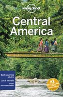
Reisgids Central America | Lonely Planet
De perfecte reisgids voor zowel de georganiseerde als de zelfstandige reiziger. Naast een algemene inleiding van het land / streek vol met praktische informatie over hoe je er het beste kunt reizen: slapen, eten, vervoer, excursies ... alles kun je er in vinden. Engelstalig. Lonely Planet   With turquoise seas and lush forests, magnificent Maya ruins, bustling markets and flourishing farms, Central America is packed with opportunities to chill out – or thrill out. Lonely Planet will get you to the heart of Central America on a Shoestring, with amazing travel experiences and the best planning advice.   Lonely Planet Central America on a shoestring is your passport to the most relevant, up-to-date advice on what to see and skip, what hidden discoveries await you, and how to optimise your budget for an extended continental trip. Scale the Maya temples of Tikal, surf the smoothest and most uncrowded waves in Latin America, or explore the colonial charms of Granada; all with your truste…
24,95
Wegenkaart - landkaart El Salvador - Guatemala south | ITMB
Een degelijke kaart met aanduidingen van o.a. nationale parken, vliegveld, benzinepomp, dirt-roads en kleine plattegrond van hoofdstad. Als overzichtskaart goed te gebruiken. This is a double-sided map with the El Salvador (1:270.000) on one side, along with a detailed inset map of San Salvador. The maps also shows the country's World Heritage city of Chalchuapa, dating back 3,200 years. The other side of the sheet is a completely separate maps of neighbouring Guatemala, being a detailed map of the central southern portion (1:457.000)of this important country. The highlights shown on this map are Quetzaltenango, Antigue Guatemala, and the Mayan ruins of Quirigua, dating from 200ad. The border crossings with El Salvador are clearly shown and are easily crossed.
13,95
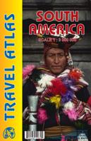
Wegenatlas Travel Atlas South America - Zuid Amerika | ITMB
De eerste gedegen wegenatlas van Zuid Amerika: handig boekje met slappe kaft op A5 formaat. This is unique! ALL of the continent of South America is now available in an easy-to-read, easy-to-use, easy-to-store road atlas at a superb scale. In addition to showing each country systematically, logically, and in great detail, physical features, points of interest, beaches, reefs, parks and reserves, major airports, and roads are shown. The atlas is 5 1/2" wide by 8 1/2" high (15cmx22cm), the same size as our Mexico Road Atlas. This atlas is 112 pages in length, is fully indexed, and has a hard card cover, and a spine. The advantage of this book format is that visitors to more than one country can save money and gain ease of use through a conveniently-sized and attractively presented book format. There is nothing equivalent to this in the world!
16,50
Vogelgids Birds of Central America | Princeton University Press
Birds of Central America is the first comprehensive field guide for the entire region’s avifauna, including the birds of Belize, Guatemala, Honduras, El Salvador, Nicaragua, Costa Rica, and Panama. Handy and compact, the book presents text and illustrations for nearly 1,200 resident and migrant species, and information on all rare vagrants. 260 detailed plates on convenient facing-page spreads depict differing ages and sexes for each species, with a special focus on geographic variation. The guide also contains up-to-date range maps and concise notes on distribution, habitat, behavior, and voice. An introduction provides a brief overview on the landscape and climate of the region and its biogeography.   The culmination of more than a decade of research and field experience, Birds of Central America is an indispensable resource for all those interested in the bird life of this part of the world.
62,95
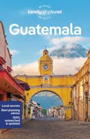
Reisgids Guatemala | Lonely Planet
De perfecte reisgids voor zowel de georganiseerde als de zelfstandige reiziger. Naast een algemene inleiding van het land / streek vol met praktische informatie over hoe je er het beste kunt reizen: slapen, eten, vervoer, excursies ... alles kun je er in vinden. Engelstalig. Lonely Planet Lonely Planet's Guatemalais our most comprehensive guide that extensively covers all the country has to offer, with recommendations for both popular and lesser-known experiences. Vistsit Tika's monumental restored temples, admire picture-postcard vistas in Antigua or hike Lago de Atitlan's lake shore trails; all with your trusted travel companion.         Inside Lonely Planet's Guatemala Travel Guide:   Lonely Planet's Top Picks - a visually inspiring collection of the destination's best experiences and where to have them   Itineraries help you build the ultimate trip based on your personal needs and interests Local insights give you a richer, more rewarding travel experience - whether it'…
22,50

Klanten-reviews van Wegenatlas Travel Atlas Mayan World | ITMB

Er zijn nog geen beoordelingen voor dit productBen jij de eerste die een review plaatst?

Meer over Wegenatlas Travel Atlas Mayan World | ITMB

Productomschrijving


Wegenatlas op diverse schaal voor het gebied van de Maya's in Mexico, Guatemala, Belize, Honduras en El Salvador.   Mayan World Travel Atlas - ITMB The Mayas occupied the Yucatan Peninsula and spread inland through modern-day Belize, Guatemala, and Honduras all the way to El Salvador. This atlas covers all these areas: Mexico from Tabasco and Chiapas, through the Yucatan provinces of Campeche, Quintana Roo and Yucatan (1:500,000), all of Belize at 1:250,000, all of Guatemala at 1:470,000, all of Honduras at 1:750,000, and all of El Salvador at 1:250,000. Each known Mayan site is marked and named (there are more than 400) in magenta City maps of Antigua Guatemala, Guatemala City, San Salvador, Tegucigalpa, and Belize City are included in this comprehensive atlas.   Legend : International Airports Roads by classification,Time Zone Border,Points of interest Historic site, Hotels, Museums,Golf course,Restaurants,Caves/Grotto,Lighthouses, Gas Stations, Waterfalls, Hotsprings,Hospitals, Historical Sites, Tourist information, Mountain Peaks, Churches,Schools, Embassies,Shipping Centers, Banks,Railway Stations, Bus Terminals, Police Station,Universities, Post Offices,Ferries, Parkings, Stadium and much more

Productinformatie

    Verken gerelateerde categorieën

    Webshop.nl maakt gebruik van cookies. Ga je verder op onze website, ga dan akkoord met het plaatsen van cookies en de verwerking van deze data door ons en vermelde partners.