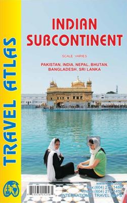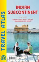
Wegenatlas Travel Atlas Indian Subcontinent | ITMB

0
Handzame wegenatlas op A5 formaat, helaas geen spiraalbinding. Maar voor deze regio is er op dit moment geen andere atlas beschikbaar.   This is our biggest atlas ever, with 152 pages of maps and 51 pages of place names indexing. The Indian Sub-Continent consists of Pakistan, India, Nepal, Bhutan, Bangladesh, Sri Lanka and Kashmir. Each country (K...

Verkopers met dit product

Verkoper
Bezorging
Prijs
DeZwerver.nl logo
DeZwerver.nl
2,95
16,50

Anderen bekeken ook

Wegenatlas Road Atlas Britain 2025 - A4 | AA Publishing
Wegenatlas, met spiraal,  van Groot-Brittannie, Engeland, Wales en Schotland, met toeristische informatie This top-selling road atlas showcases Britain’s clearest mapping from the experts at the AA at a large 3.2 miles to 1 inch scale. Each page has been titled with its geographical location so you can turn to the page you need more easily. Wide and narrow minor roads, National Trust, English and World Heritage sites and hard-to-find places are shown. There are 112 city, town, port and airport plans, full colour country, unitary and administrative area map and a comprehensive 31,500 entry index with airports, top tourist sites and motorway services listed. Plus, scenic routes, over 1,800 golf courses and the top 300 AA-Inspected caravan and camping sites symbolised on the mapping. Motorway maps, ferry planning information and 5 district maps provide the essential motoring content for travelling the country. 10 pages of central London street mapping with index. District maps of Birm…
24,95
Nieuw
Wegenatlas Travel Atlas Mayan World | ITMB
  Wegenatlas op diverse schaal voor het gebied van de Maya's in Mexico, Guatemala, Belize, Honduras en El Salvador.   Mayan World Travel Atlas - ITMB The Mayas occupied the Yucatan Peninsula and spread inland through modern-day Belize, Guatemala, and Honduras all the way to El Salvador. This atlas covers all these areas: Mexico from Tabasco and Chiapas, through the Yucatan provinces of Campeche, Quintana Roo and Yucatan (1:500,000), all of Belize at 1:250,000, all of Guatemala at 1:470,000, all of Honduras at 1:750,000, and all of El Salvador at 1:250,000. Each known Mayan site is marked and named (there are more than 400) in magenta City maps of Antigua Guatemala, Guatemala City, San Salvador, Tegucigalpa, and Belize City are included in this comprehensive atlas.   Legend : International Airports Roads by classification,Time Zone Border,Points of interest Historic site, Hotels, Museums,Golf course,Restaurants,Caves/Grotto,Lighthouses, Gas Stations, Waterfalls, Hotsprings,Hospitals, H…
16,50
Atlas The Times Mini Atlas of the World | Collins
De kleinste uitvoering van de beste atlas ter wereld! Ook deze mini uitvoering is mooi van kleur en uiterlijk: een leuke kado voor een schappelijke prijs. A pocket-sized Times Atlas of the World packed with the essentials. Fully revised and improved to take account of all recent changes from around the world. Complete map coverage of the world is provided with the accuracy and authority for which Times atlases are renowned. This new edition of The Times Mini Atlas of the World has been fully revised to bring all the maps and geographical information completely up to date. As with all the atlases in the Times range it offers great authority, outstanding quality and attention to detail. FULLY UPDATED The 117 pages of reference maps have been completely updated to provide accurate, accessible and attractive coverage of the whole world. The introductory section covers major world geographical themes -- from climate and environment to population and urbanization -- giving a global snapshot…
13,95
Reisgids Senegal | Bradt Travel Guides
Voor vele landen net zo goed, zo niet beter dan de Planet. Beduidend soberder uitgevoerd, maar ook met veel informatie voor backpackers en met veel kaartmateriaal. Een aanrader! This new, thoroughly updated edition of Bradt's Senegal continues to offer far and away the greatest depth of coverage for this increasingly popular part of West Africa. With over 350 pages of detailed description and 40 maps, this remains the definitive source of information to a country that is often described as the whole of West Africa in microcosm.    This new edition includes details of the rapidly changing transport situation, notably the opening of the new international airport and the first bridge to span the Gambia River. All regions of the country are covered, including detailed information on access to Senegal's national parks, with detailed maps, itineraries, and practical information on transport, accommodation and eating for each region.   Senegal boasts a variety of landscapes and cultures that…
27,95
Reisgids De zijderoute - Silk Road | Insight Guides
Een rijk geillustreerde reisgids met diepgaande teksten: één van de beste reisgidsen die er bestaan. Eerste deel bestaat uit een beschrijving van de unieke aspecten van de regio, daarna een deel echte reisgids en als afsluiting een deel met praktische informatie. De uitstekende informatie wordt vergezeld van prachtige foto's en heldere kaarten. Niet alleen om mee te nemen, maar ook om vooraf en zelfs achteraf weer in de stemming te komen. This Silk Road guidebook is ideal for travellers seeking inspirational guides and planning a more extended trip. It provides interesting facts about the Silk Road's people, history and culture and detailed coverage of the best places to see. This Silk Road travel book has the style of an illustrated magazine to inspire you and give a taste of the Silk Road. The book is printed on paper from responsible sources, and verified to meet FSC's strict environmental and social standards.   This Silk Road guidebook covers: China (Shaanxi, Ginsu, Xinjiang),…
25,95
Atlas The Phantom Atlas | Simon & Schuster
Een fascinerend boekwerk met de grootste mythes, leugens en blunders die ooit op kaart zijn verschenen. In een luxe hardcover uitgave met mooie stofomslag. The Phantom Atlas is an atlas of the world not as it ever existed, but as it was thought to be. These marvellous and mysterious phantoms - non-existent islands, invented mountain ranges, mythical civilisations and other fictitious geography - were all at various times presented as facts on maps and atlases. This book is a collection of striking antique maps that display the most erroneous cartography, with each illustration accompanied by the story behind it. Exploration, map-making and mythology are all brought together to create a colourful tapestry of monsters, heroes and volcanoes; swindlers, mirages and murderers. Sometimes the stories are almost impossible to believe, and remarkably, some of the errors were still on display in maps published in the 21st century. Throughout much of the 19th century more than 40 different mapma…
34,95
Wegenatlas Big Atlas Britain & Ireland 2025 | A3-Formaat | Ringband | Philip's Maps
Goede gedetailleerde wegenatlas van Groot-Brittannië, schaal 1:200.000 met een overzichtskaart van Ierland, schaal 1:1.000.000. Groot formaat, A3, en in ringband. 'Good balance between detail and clarity with excellent town maps' What Car? PHILIP'S is No. 1 in the UK for clear maps. The latest 2025 Philip's Big Road Atlas of Britain and Ireland, in a supersize large format, has fully updated mapping from the Philip's digital database alongside all the detail and information needed for successful travel.   * Top driving tips for safety and skill including how to parallel park * The best scenic routes, natural features and landscape highlighted for enhanced travelling * Practical 'more to view per page' A3 size * Main scale of maps: 3 miles to 1 inch = 1:200,000 for ease of use * Route-planning section for the easiest navigation * Special wide-vehicle access indicators for rural areas * 64 fully indexed and detailed town and city plans * City approach maps with named roads fo…
22,50
Wegenatlas Road Atlas 2025 USA - Canada - Mexico - Verenigde Staten groot formaat | Michelin
De beroemde wegenatlas van Rand McNally nu als Michelin atlas op groot formaat, bijna dubbel A4. Elke staat een eigen, of soms zelfs twee pagina's. Uitgebreid register. Zoals de Amerikanen zelf zeggen: America's number 1 Road Atlas! Canada en Mexico staan er zeer beperkt in. Highlighting 51 road trips and scenic drives the Michelin's updated Large Format North America Road Atlas 2025 helps you enjoy the planning and the journey. Large-format maps and larger lettering for towns and sites (compared to the midsize atlas) make for easier reading while the tiled format flows maps from page to page—the ideal complement to GPS and online directions. Four jam-packed pages highlight selected US and Canadian national parks, with points of interest, hikes and drives.   Covers US, Canada & Mexico. Large grid map to quickly locate atlas pages. Easy-read text and mapping. Map pages are 36% larger than midsize atlas. Inspired ideas for outdoor fun and road trip adventures in the US and Canada…
19,95
Atlas The Travel Atlas | Lonely Planet
This is the ultimate world atlas for globetrotters. Combining our extensive mapping experience and unrivalled destination insight and knowledge, our first dedicated altas makes it easy for you to plan adventures and discover remarkable places around the planet. With Lonely Planet's The Travel Atlas in your hands, you can explore every part of the world and plan upcoming trips with one simple and easy-to-use resource.   Inside, you'll find detailed maps to every country on Earth, with popular regions and destinations presented at greater scale. Each large page of mapping is accompanied with the area's top sights and activities, while our themed itineraries, ranging from two days to two weeks, will ensure you don't miss the best sights. You'll also find trip planning tools like climate information and transport hubs to help you get there and away.   About Lonely Planet: Lonely Planet is a leading travel media company and the world's number one travel guidebook brand, providing both insp…
64,95
Reisgids India | Eyewitness
Discover the soaring Himalayas, explore fantastic forts and the rich cultural heritage of India Whether you want to be awed by the scenic landscapes, relax on the beaches of Goa, or marvel at the majestic Taj Mahal, your DK Eyewitness travel guide makes sure you experience all that India has to offer. India is a treasure trove of things to see and experience. Packed full of ancient palaces and temples, museums and historic monuments, it has been captivating visitors since time immemorial.   Beyond the architectural wonders, the country abounds with picturesque sights and has an array of excellent restaurants and atmospheric bars. Our updated 2023 travel guide brings India to life,transporting you there like no other travel guide does with expert-led insights, trusted travel advice, detailed breakdowns of all the must-see sights, photographs on practically every page, and our hand-drawn illustrations which place you inside the country's iconic buildings and neighbourhoods. DK Eyewitnes…
27,95

Klanten-reviews van Wegenatlas Travel Atlas Indian Subcontinent | ITMB

Er zijn nog geen beoordelingen voor dit productBen jij de eerste die een review plaatst?

Meer over Wegenatlas Travel Atlas Indian Subcontinent | ITMB

Productomschrijving

Handzame wegenatlas op A5 formaat, helaas geen spiraalbinding. Maar voor deze regio is er op dit moment geen andere atlas beschikbaar.   This is our biggest atlas ever, with 152 pages of maps and 51 pages of place names indexing. The Indian Sub-Continent consists of Pakistan, India, Nepal, Bhutan, Bangladesh, Sri Lanka and Kashmir. Each country (Kashmir being considered shared) is presented as an entity, so Pakistan occupies 30 pages at 1:1,200,000 scale, and Nepal occupies 32 pages at 1:530,000 scale. In short, each country is shown in detail, but at scales appropriate for each country. The amount of detail on each page is impressive; equal to buying six maps at $12.95 each. The market is the traveller to the region, visiting several of these areas and wanting a compact way to have detailed mapping without having to carry half a dozen maps or spend a large amount of money on maps. Eleven city inset maps are included, as well as basic insets for the Andaman and Nicobar island chains. This completes our network of atlases that started with Japan and China, and now includes South East Asia and the Middle East in a series of detailed travel atlases covering almost all of Asia.   Legend Includes: Road by classification, Motorways, Main Roads, Ferry Routes, Railways, Lakes, Deserts, Swamps, Hospitals, Walterfalls, Motels, Hotels, Beaches and much more...

Verken gerelateerde categorieën

Webshop.nl maakt gebruik van cookies. Ga je verder op onze website, ga dan akkoord met het plaatsen van cookies en de verwerking van deze data door ons en vermelde partners.