Wegenatlas Trans-Siberian Railroad | ITMB

0
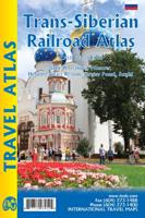
Klein formaat wegenatlas (A5) van de Trans-Siberische spoorlijn, uitgebracht door ITMB. It is not often that one can publish a map that has never been done before. I seem to say that rather frequently! The Trans Siberian is one of the great railway trips of all time, crossing vast areas of steppe land and tundra as it wends its way from Moscow to ...

Verkopers met dit product

Verkoper
Bezorging
Prijs
DeZwerver.nl logo
DeZwerver.nl
2,95
16,50

Anderen bekeken ook

Treinreisgids Trans-Siberian Handbook - Trans Siberië | Trailblazer Guides
De meest uitgebreide en beste reisgids van de Trans - Siberische spoorlijn door rusland, China en Mongolië. Zeer complete gids vol met informatie en plattegronden en kaarten. Het maakt het leven in en rondom de trein heel eenvoudig en zeer interessant. Zo ongeveer voor elke plek waar je kunt stoppen vind je informatie. Een echte aanrader!   A trip across Siberia on the longest continuous railway track in the world is undoubtedly the journey of a lifetime. It’s also a convenient way to reach China, Mongolia or Japan. Tickets are not expensive or difficult to arrange.   Russia is changing fast and it’s now no more difficult to arrange a ticket for the journey of a lifetime on the Trans-Siberian Railway than it is to book an Easyjet flight online, as the new edition of this acclaimed guide shows. The Trans-Siberian Handbook includes everything from how to arrange the trip, where to go and what to see along the way.   Kilometre-by-kilometre route guides covering the entire routes of the T…
24,50
Wegenkaart - landkaart Kamchatka Peninsula & Russia Far east | ITMB
Een degelijke kaart met aanduidingen van o.a. nationale parken, vliegveld, benzinepomp, dirt-roads en kleine plattegrond van hoofdstad. Als overzichtskaart goed te gebruiken. Schaal: Kamchatka 1 : 1,700.000 & Eastern Siberia 1 : 3.600.000 This is the most recently released title in our Russia series. In this revised edition, we have expanded the area of coverage to include the portion of Russia known as the Far East Republic and the eastern portions of Siberia (in January, we released Siberia itself). Lets start with the Kamchatka peninsula itself. This is a very interesting adventure travel destination, famous for its geothermal geysers and its isolation from the rest of Russia. There is only one city of any size, Petropavlovsk Kamchatsky (which I genuinely hope is colloquially known as PK), the capital and location of the peninsula only significant airport. We have included an inset map of the city. We also include a map of the famous Valley of Geysers (south of Klyuchi). Interestin…
13,95
Wegenkaart - landkaart Siberia - Siberië | ITMB
Een degelijke kaart met aanduidingen van o.a. nationale parken, vliegveld, benzinepomp, dirt-roads en kleine plattegrond van hoofdstad. Als overzichtskaart goed te gebruiken. Can you name anyone who has published a detailed map of Siberia? I cannot! This is one of the largest geographical regions on earth, comparable in magnitude to the Sahara or Gobi desert areas, or the vast Prairie regions of Canada, but it has never had a travel map. Well, now it does and the last frontier of mapping the world has been breached. The part of Russia east of the Ural Mountains is vast; there is no other word to describe the enormity of this region of grassland and tundra. Technically, it does not extend all the way to the Pacific Ocean, but it does go from the Arctic Ocean to the Chinese and Mongolian borders. This is not a part of the world well travelled, but it could become so with a good, detailed map. We start in the west at Omsk on the Irtysh River, where the northern and southern branches of t…
13,95
Wegenkaart - landkaart Russia west & St. Petersburg | ITMB
Overzichtskaart van West Rusland tot aan de Oeral op schaal 1:3,2m - Moskou in het midden van de kaart met stadsplattegrond van Sint Petersburg, schaal 1:14.000, en een centrumskaartje van Moskou. Wegenkaart met veel plaatsen en wegen, spoorlijnen en rivieren, hoogten, lengte- en breedtegraden.   Russia West Travel Reference Map 1:3,200,000 - ITMB ITMB has prepared a map that is centred on Moscow and radiates outwards. Due to the projection necessary for a map close to the North Pole, St. Petersburg and Murmansk are at the top of the map, Rostov and the Black Sea are in the southwest corner, and the Ural Mountains bless the southeast portion of the map. The front side has an excellent inset of Moscow and the reverse a city centre map of St. Petersburg, along with the remaining portion of western Russia and the place names index.   Legend includes: Roads by classification, Boundaries, Highways, Major Roads, Secondary and other Roads,Volcanic Cultural Centres, Restaurants, Museums, Citi…
13,95
Reisverhaal The Amur River | Colin Thubron
'Thubron on top form. Richly detailed, immaculately written and full of insights and encounters that bring a complex corner of the world to life' Michael Palin *As serialised on BBC Radio 4 Book of the Week* *Winner of the 2022 Edward Stanford Travel Writing Awards* *Shortlisted for 2021 Duff Cooper Prize* **A FINANCIAL TIMES, SUNDAY TELEGRAPH AND SPECTATOR BOOK OF THE YEAR** **ONE OF THE DAILY TELEGRAPH'S BEST 75 BOOKS OF 2021** ________________________ A dramatic and ambitious new journey from our greatest travel writer. The Amur River is almost unknown. Yet it is the tenth longest river in the world, rising in the Mongolian mountains and flowing through Siberia to the Pacific to form the tense, highly fortified border between Russia and China. In his eightieth year, Colin Thubron takes a dramatic 3,000-mile long journey from the Amur's secret source to its giant mouth. Harassed by injury and by arrest from the local police, he makes his way along both the Russian and Chinese shores…
15,50
Reisgids Pocket Moscow - St. Petersburg - Moskou | Lonely Planet
Pocket reisgidsen van Lonely Planet zijn een kleinere versie dan de 'echte' Planets. Vaak echter van bijzondere bestemmingen binnen een bepaald land waardoor er meer aandacht is en uitgebreidere tips zijn voor die bepaalde streek i.v.m. de grote Planets. Handzaam formaat, makkelijk in de binnenzak! Tcoh ook deze vol met praktische informatie. Lonely Planet Pocket Moscow & St Petersburg is your passport to the most relevant, up-to-date advice on what to see and skip, and what hidden discoveries await you. Gawk at Red Square and St Basil’s Cathedral, lose yourself in a performance at the Bolshoi, or be dazzled by the wealth of imperial art at the State Hermitage Museum; all with your trusted travel companion. Get to the heart of Moscow & St Petersburg and begin your journey now!   Inside Lonely Planet Pocket Moscow & St Petersburg Travel Guide:    Colour maps and images throughout   Highlights and itineraries help you tailor your trip to your personal needs and interests   Insider tips …
12,95
Reisgids Russia - Rusland | Lonely Planet
De perfecte reisgids voor zowel de georganiseerde als de zelfstandige reiziger. Naast een algemene inleiding van het land / streek vol met praktische informatie over hoe je er het beste kunt reizen: slapen, eten, vervoer, excursies ... alles kun je er in vinden. Lonely Planet Russia is your passport to the most relevant, up-to-date advice on what to see and skip, and what hidden discoveries await you. Brush up on your Soviet and imperial history in Moscow and St Petersburg, explore European Russia and its gingerbread cottages and golden domes, or lose yourself in the wilds of Siberia and the east; all with your trusted travel companion. Get to the heart of Russia and begin your journey now!   Inside Lonely Planet’s Russia Travel Guide:   Colour maps and images throughout Highlights and itineraries help you tailor your trip to your personal needs and interests Insider tips to save time and money and get around like a local, avoiding crowds and trouble spots Essential info at your finge…
27,95
Reisgids Eyewitness Travel Russia - Rusland | Dorling Kindersley
Prachtig geillustreerde reisgids met o.a. 3D tekeningen, fraaie kaarten en geweldige foto’s. Daarnaast uitgebreide achtergrondbeschrijvingen. Echt om in de stemming te komen! Groot formaat gids. Engelstalig. Discover the fascinating cities and vast landscapes of the world's largest country - from stunning imperial palaces to remote lakes and soaring mountains - with the DK Eyewitness Travel Guide: Russia. Explore the cultural treasure troves of St Petersburg and Moscow, relax in the balmy seaside resort of Sochi, or venture further east to Siberia to discover the mysteries of Lake Baikal and marvel at the Valley of the Geysers in Kamchatka. DK Eyewitness Travel Guide: Russia includes fantastic photography and illustrations, full-colour maps, detailed reviews of all the main attractions, background information on Russia's history and culture, and reviews of the most authentic hotels, bars and restaurants to help you plan the perfect trip.
16,50
Wegenkaart - landkaart Canada | ITMB
Een degelijke kaart met aanduidingen van o.a. nationale parken, vliegveld, benzinepomp, dirt-roads en kleine plattegrond van hoofdstad. Well, it’s about time, eh?!? ITMB, after only thirty years on the go, finally gets around to publishing a map of Canada. When we first started mapping, there was a pressing need for good maps of Central and South America, then of Africa, then etc etc and we never found time to concentrate on our own country until fairly recently. This map was prepared by Natural Resources Canada and is, as a result, as accurate a map as one could hope to have. We are very proud of it, and very pleased to be able to use such top-rate cartography. The map covers all of the land mass of Canada, from its southernmost point to the top of Ellesmere Island and from the Atlantic coast to the Pacific. It’s an excellent map, but I’m going to give one proviso. Canada is the second-largest country on the face of the planet and there is no way that a single-sided sheet can portray…
13,95
Wegenkaart - landkaart Tofino & Southern Vancouver Island | ITMB
Vancouver Island is one of the marvels of tourism in Canada. It is, in fact, so big that it needs to be explored in sections to reach its full potential. Tofino is the westernmost town on the island and is home to the great Pacific fleet of fishing boats. It is also the westernmost leg of the ten thousand kilometer-long Trans-Canada Highway, and the beginning of the Trans-Canada National Hiking Trail. Side 1 concentrates on the immediate surrounds of Tofino, Seven-Mile Beach, and Kennedy Lake. Side 2 covers the southern half of the large island, from Victoria north to Courtenay, and includes the Broken Islands region off the west coast, the West Coast Hiking Trail, Cathedral Grove old growth forest, the Gulf Islands, and all the ferry connections with Vancouver and various islands, as well as all the Backroads logging roads that are the main way to explore the interior of wonderful Vancouver Island.   Legend Includes: Roads by classification, Rivers and Lakes, National Park, Airports,…
13,95

Klanten-reviews van Wegenatlas Trans-Siberian Railroad | ITMB

Er zijn nog geen beoordelingen voor dit productBen jij de eerste die een review plaatst?

Meer over Wegenatlas Trans-Siberian Railroad | ITMB

Productomschrijving

Klein formaat wegenatlas (A5) van de Trans-Siberische spoorlijn, uitgebracht door ITMB.

It is not often that one can publish a map that has never been done before. I seem to say that rather frequently! The Trans Siberian is one of the great railway trips of all time, crossing vast areas of steppe land and tundra as it wends its way from Moscow to Vladivostok. There are actually two routes for much of the western portion, and branch off lines to Mongolia and northern China in the east, as well as a very unusual route across the top of Lake Baikal called the Amur, or BAM, line. The only effective way to show east west rail networks this diverse is via an atlas and that is just what we have done. The entire route, with an extra page for those starting in St. Petersburg is covered nicely, with inset pages showing St. Petersburg, Moscow, and the heritage cities of Sergiev Posad and Suzdal. Both branches of the Trans-Siberian are shown and most of the Baikal Amur (BAM) line. This type of map has never been attempted before, so we are anxious to receive feedback.

Verken gerelateerde categorieën

Webshop.nl maakt gebruik van cookies. Ga je verder op onze website, ga dan akkoord met het plaatsen van cookies en de verwerking van deze data door ons en vermelde partners.