webshop.nl
Categorieën
  Sluiten

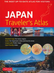
Wegenatlas Japan Traveler's Atlas | Tuttle Publishing

Finding your way around the various regions of Japan is a breeze with this handy Tuttle Japan Traveler's Atlas. Designed for the adventurous traveler and containing all the maps you'll need on your explorations, this atlas includes many views that are not available anywhere else.   The atlas is conveniently divided into the major regions of Japan: ...
19,95

Webshops met dit product

Webshop
Bezorging
Prijs

Anderen bekeken ook

Wegenatlas Japan Atlas - a Bilingual Guide | Kodansha
This title features: 21 large-scale maps of the regions of Japan, whichnclude all the officially registered cities, towns and villages.   The only atlas of its kind to feature place-names in both English and Japanese, Kodansha's perennial favorite has been newly revised to reflect the many changes that have resulted from the government's policy of consolidating Japanese cities, towns and villages. The volume includes: -- 21 large-scale maps of the regions of Japan, including Greater Tokyo and the Kanto area, the Greater Osaka area, and almost all of the officially registered Japanese municipalities; -- 10 maps of the major metropolitan areas, from Naha in Okinawa to Hiroshima, Kyoto, Nagoya, Tsukuba, Sapporo and many others; -- 7 maps featuring notable tourist and resort areas, including Fuji-Hakone, Nara, Kamakura, Nikko, etc.; -- 9 transportation maps, including road and intercity railway maps, Tokyo and Osaka subway and rail maps, and major domestic airline routes; -- 12 thematic ma…
27,95
Atlas The Times Mini Atlas of the World | Collins
De kleinste uitvoering van de beste atlas ter wereld! Ook deze mini uitvoering is mooi van kleur en uiterlijk: een leuke kado voor een schappelijke prijs. A pocket-sized Times Atlas of the World packed with the essentials. Fully revised and improved to take account of all recent changes from around the world. Complete map coverage of the world is provided with the accuracy and authority for which Times atlases are renowned. This new edition of The Times Mini Atlas of the World has been fully revised to bring all the maps and geographical information completely up to date. As with all the atlases in the Times range it offers great authority, outstanding quality and attention to detail. FULLY UPDATED The 117 pages of reference maps have been completely updated to provide accurate, accessible and attractive coverage of the whole world. The introductory section covers major world geographical themes -- from climate and environment to population and urbanization -- giving a global snapshot …
13,95
Wegenatlas Travel Atlas Africa West Route: from Tangier to Cape Town | ITMB
Handzame wegenatlas, formaat A5, van de hele route van Tanger naar Kaapstad langs de westelijke kant van Afrika. Naast de wegenkaarten bevat deze atlas ook een aantal centrumkaarten van de belangrijkste steden die je onderweg tegenkomt.  There are three routes one can follow on an overland expedition from Europe to Cape Town (or the reverse). Last year, ITMB published the eastern route, via Cairo and Sudan to Ethiopia and Kenya. This year, we are pleased to announce the publication of a more practical route to follow, via Tangier, Morocco, Mauritania, Senegal, Mali and Ghana, through the Congo to Uganda, and then south over a variety of options to Namibia and South Africa. The advantage of this route is that it avoids the conflict-ridden countries closest to infection from the extremist Islam movement. It also avoids the current difficulties of the central route through Algeria (the Hoggar route) and Niger. We do have to caution that all routes through Africa contain risks. Routes are …
16,50
Wegenatlas Traveller's Atlas Southern Africa - Zuidelijk Afrika | A3-Formaat | Ringband | Tracks4Africa
Deze atlas omvat tien landen in zuidelijk Afrika en is speciaal gericht op reizigers die zelf rijden. De betrokken landen zijn: Angola, Botswana, Lesotho, Malawi, Mozambique, Namibië, Zuid-Afrika, Swaziland, Zambia en Zimbabwe.   De Atlas bevat 223 kaartpagina's met hetzelfde vertrouwde kaartdetail waarvoor Tracks4Africa bekend is.   De wegenatlas is afgedrukt in A3 formaat, weegt 2750g, heeft een stevige omslag, spiraal gebonden en de pagina's zijn afgedrukt op dik papier.   Bigger coverage than ever before: 1:4m maps for Southern and Eastern Africa – ideal for macro planning. 1:1m maps for Southern Africa, covering the following countries: Angola, Botswana, eSwatini, Lesotho, Malawi, Mozambique, Namibia, South Africa, Zambia and Zimbabwe. 1:500k maps for South Africa, Malawi, most part of Zambia and the area around Moremi/Chobe in Botswana. Road coverage: This Atlas is designed for overland travel and compiled from the same data used on our famous GPS maps. Use it for trip pl…
79,95
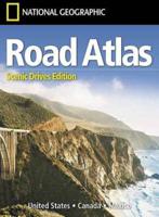
Wegenatlas USA Canada Mexico Road Atlas | A4-Formaat | National Geographic
National Geographic's Road Atlas: Scenic Drives Edition, is the ideal companion for the next time you hit the road for an unforgettable road trip. Includes up-to-date road maps for all 50 U.S. States, plus Canada, Mexico, and Puerto Rico. Major cities and metropolitan areas are shown in detail with inset maps that include popular attractions, infrastructure and points-of-interest. Setting this atlas apart from all others is the inclusion of selection of 20 carefully researched scenic drives to help you plan the road trip of a lifetime. A map and guide section is also included for the 20 most popular National Parks. Take the guesswork out of traveling and trip planning with a comprehensive index, mileage charts, and cross-referenced pages. The Road Atlas: Scenic Drives Edition is printed in North America and it is a convenient letter-size format that fits comfortably into glove compartments or car side door pockets.
17,95
Reisgids Eyewitness Travel Japan | Dorling Kindersley
Prachtig geillustreerde reisgids met o.a. 3D tekeningen, fraaie kaarten en geweldige foto’s. Daarnaast uitgebreide achtergrondbeschrijvingen. Echt om in de stemming te komen! Groot formaat gids. Engelstalig.   Whether you want to see cherry blossoms in Kyoto, speed through the countryside aboard a shinkansen, or shop til you drop in futuristic Shibuya, your DK Eyewitness travel guide makes sure you experience all Japan has to offer. Japan is a land of contrast - think tranquil zen gardens and peaceful pagodas, neon-lit cities and robot restaurants. Cities might be the first things that spring to mind when you think of Japan, but the countryside is just as epic.   There's the iconic Mount Fuji, bubbling hot springs, unspoiled beaches and adrenaline-packed ski resorts. And if that wasn't enough to entice you to visit, there's the food - unctuous noodles, delicate sushi and warming hotpots. Our updated guide brings Japan to life, transporting you there like no other travel guide does …
23,95
Reisgids Japan | Rough Guides
Zeer goede reisgids voor zowel de georganiseerde maar vooral voor de zelfstandige reiziger. Boordevol informatie over reizen, slapen, eten, maar ook musea en cultuur. Uitputtende bron van informatie, veelal nog completer dan de Lonely Planet. Inleidende informatie over land en cultuur is zeer goed. This Japan guidebook is perfect for independent travellers planning a longer trip. It features all of the must-see sights and a wide range of off-the-beaten-track places. It also provides detailed practical information on preparing for a trip and what to do on the ground. And this Japan travel guidebook is printed on paper from responsible sources, and verified to meet the FSC's strict environmental and social standards.   This Japan guidebook covers: Tokyo (and around); Northern Honshu; Hokkaido; Central Honshu; Kyoto and Nara; Kansai; Western Honshu; Shikoku; Kyushu; Okinawa.   Inside this Japan travel book, you'll find:   - A wide range of sights - Rough Guides experts have hand-picked pl…
31,95
Wegenatlas Australië - Great Desert Tracks Atlas & Guide | Hema Maps
Whether you're a desert lover or just looking to tackle some of Australia's favourite 4WD destinations, the Hema Great Desert Tracks Atlas & Guide - Edition 5 is an indispensable companion to this country's arid centre. The complete atlas contains Hema's entire Great Desert Tracks map series. The guide features 25 4WD tracks, each with its own detailed map inset showing the route taken, with GPS location and points of interest featured. All of the tracks are colour-coded to make it simple to find the treks that suit your type of vehicle and handy symbols show towing suitability also! The track descriptions are written by some of Australia's top four-wheel driving enthusiasts and experienced travel writers. Each track's notes contain all the information you need to plan for the trip, including permits and contact details. There's also plenty of essential pre-trip reading on how to prepare for your trek, safety in the outback and driving techniques!   Features Contains Hema's entire G…
55,95
Wegenatlas Travel Atlas Polynesian Islands - Polynesië | ITMB
Wegenatlas op diverse schaal voor Polynesië. This is the only way we could think of to portray hundreds of relatively small islands efficiently. The atlas covers the Cook Islands, Easter Island, Hawaiian Islands, Nauru, Samoa, Solomon Islands, Tahiti/French Polynesia, and Tonga. It is not complete for all of what might be considered Polynesia, in that Vanuatu, Kiribati, Tuvalu, and New Caledonia were left out because we do not have artwork for these areas, but this is as good as it gets for now! Hawaii occupies 44 pages of the atlas; the Solomons 11 pages, tiny Nauru one, Samoa 15, the Cook Islands an amazing 20 pages, and Tahiti 20. Easter Island is included because the evidence is that the original settlers migrated from Polynesia, not Peru, and occupies another 18 pages. Maps of the South Pacific islands are difficult to prepare, being small land masses in a vast ocean. This atlas is an attempt to combine as many such islands together into a comprehensive whole to ensure continued m…
16,50
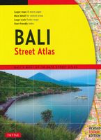
Wegenatlas Bali Street Atlas | Periplus
Finding your way around Bali has never been easier! This newly revised Street Atlas from Periplus, Asia's leading book and map Publisher, is designed for Bali residents and visitors. It is the first and only atlas of Bali produced to world-class cartographic standards.   All roads are color-coded with major arteries in bright yellow and orange. All key landmarks are highlighted — including beaches, temples, hotels, shops, restaurants, shopping malls, consulates, government offices, hospitals, clinics, police stations, schools, parks, banks, and golf courses.   Towns and tourist areas are shown at scales of 1:10,000 to 1:15,000 to provide detailed coverage of these important areas. Other parts of the island are shown at scales of 1:60,000 or 1:75,000 for ease of reference and minimum page-flipping. User-friendly indexes at the back list all streets, towns, villages, and buildings for quick reference.    COMPREHENSIVE: Covers every major town and tourist area in Bali.    INFORMATIVE: Giv…
21,50

Klanten-reviews van Wegenatlas Japan Traveler's Atlas | Tuttle Publishing

Er zijn nog geen beoordelingen voor dit productBen jij de eerste die een review plaatst?

Meer over Wegenatlas Japan Traveler's Atlas | Tuttle Publishing

Productomschrijving

Finding your way around the various regions of Japan is a breeze with this handy Tuttle Japan Traveler's Atlas. Designed for the adventurous traveler and containing all the maps you'll need on your explorations, this atlas includes many views that are not available anywhere else.   The atlas is conveniently divided into the major regions of Japan: Tokyo Mt. Fuji & Around Tokyo Central Honshu Kyoto Kansai Hiroshima & Western Honshu Northern Honshu Hokkaido Shikoku Kyushu Okinawa & the Southwest Islands   Each of the 148 maps in this atlas is presented in a logical, easy-to-follow manner, with emphasis on the most frequently-visited areas. All cities, towns, villages, places of interest including nature reserves are indexed for quick reference.   Comprehensive: detailed insets are given for all the major cities, travel destinations and business hubs in Japan. Informative: Precise locations are indicated for all popular sights, hotels, restaurants, temples, shopping malls and other essential locations. Practical: The handy size, well-designed key maps and comprehensive index help you find any place you are looking for quickly. Reliable: No need to worry about cell service or battery—the maps in this atlas are thoroughly researched and regularly updated by the leading publisher of Asia Pacific maps.
Webshop.nl maakt gebruik van cookies. Ga je verder op onze website, ga dan akkoord met het plaatsen van cookies en de verwerking van deze data door ons en vermelde partners.