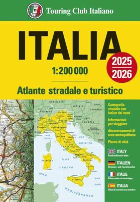
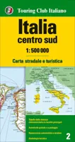
Wegenatlas Italië atlas - atlante stradale 2025/2026 | Paperback | A4-Formaat | Touring Club Italiano

0

Verkopers met dit product

Verkoper
Bezorging
Prijs
DeZwerver.nl logo
DeZwerver.nl
niet bekend
2,95
25,95

Anderen bekeken ook

Wegenatlas Atlante Stradale d'Italia Nord | Touring Club Italiano
Atlas van de Italiaanse ANWB, goed kaartbeeld. Wel met omgevingskaarten van belangrijke steden en stadsplattegronden. Kaarten tot aan Florence. Kaartbeeld met veel schaduwwerking waarbij hoogteverschillen sterk uitkomen. Zachte kaft, register, iets groter dan A4 formaat Wegenatlas met gedetaileerde wegenkaarten van noord Italië tot Bologna, snelwegkaarten met afritten, toeristische informatie, plattegronden van steden, de kaarten zijn ook geschikt om op te fietsen
24,95
Wegenatlas Atlante Stradale d'Italia Centro | Touring Club Italiano
Atlas van de Italiaanse ANWB, goed kaartbeeld. Wel met omgevingskaarten van belangrijke steden en stadsplattegronden. Kaarten van Bologna tot net boven Napels. Kaartbeeld met veel schaduwwerking waarbij hoogteverschillen sterk uitkomen. Zachte kaft, register, A4 formaat Cartografia stradale 1:200 000 9 attraversamenti di aree metropolitane 1:80 000 47 piante di città con stradario e principali punti di interesse Indice dei nomi Distanze stradali fra capoluoghi di provincia 9 route maps 1:80 000 / 47 town plans with street guide and places of interest marked / Index of place-names / Road distances between provincial capitals 9 Durchfahrtspläne 1:80 000 / 47 Stadtpläne mit Strassenverzeichnis und wichtigen interessanten Punkten / Ortsregister / Strassenentfernungen zwischen den Provinzhauptstädten Insostituibile per pianificare il tuo viaggio!   È l’atlante Touring per eccellenza, il più autorevole, il più diffuso, di facile e immediato utilizzo! Suddiviso in 3 volumi è indispensabile p…
24,95
Wegenatlas Atlante Stradale d'Italia Sud | Touring Club Italiano
Atlas van de Italiaanse ANWB, goed kaartbeeld. Wel met omgevingskaarten van belangrijke steden en stadsplattegronden. Kaarten vanaf Rome naar het zuiden. Wegenatlas met gedetaileerde wegenkaarten van zuidelijk Italië, ten zuiden van Rome en met Sicilie, snelwegkaarten met afritten, toeristische informatie, plattegronden van steden, de kaarten zijn ook geschikt om op te fietsen Southern Italy at 1:200,000 in a series of three excellent road atlases from the Touring Club Italiano, each with enlargements of the environs of main cities, numerous superb indexed street plans, plus a very comprehensive distance table.   The atlases are in a paperback format, slightly larger than A4. Cartography is the same as in TCI’s 1:200,000 series of regional maps, with subtle but very effective relief shading plus spot heights to present the topography. Numerous names of mountain ranges, valleys, peaks, etc. are shown and national parks and other protected areas are prominently highlighted.   Road n…
24,95
Wateratlas - Wegenatlas Wegenatlas France - Frankrijk | A4-Formaat | Paperback | 2026 | Michelin
Michelin's France luxurious tourist and motoring atlas is super resistant and easy to use thanks to its fold-out multiflex binding. In addition of Michelin's clear and accurate mapping, this atlas will give you an enhanced view of your journey thanks to its scale 1/200,000. The route planner as well as the time distance charts will help you plan and optimise journey. Michelin's new safety alerts warn you about dangerous driving areas and zones subjet to tighter speed checks. This atlas also includes 40 cities plans with QR codes linking to your smartphone for an easy navigation in urban areas. Information on tourist sights, leisure facilities, scenic routes, as well as service areas will add pleasure and comfort to your journey Michelin's France multiflex tourist and motoring atlas features: * Scale: 1/200,000: for an enhanced view of your journey * Fold flat making it easier to read your journey as you go along * Key to map pages: to quickly access the region of your interest * A com…
27,95
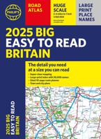
Wegenatlas Philip's Easy to Read Road Atlas of Britain 2025 | A3-Formaat | Paperback | Philip's Maps
With the detail you need at a size you can read, the latest edition of 2025 Philip's Big Easy to Read Road Atlas of Britain is super-clear, super-sized and bang up-to-date in a large paperback format.   · Huge 1:150,000 scale (approx 2.4 miles to 1 inch) · Large super-sized pages (A3) · Large print place names, and large scale maps · 88 detailed town plans for easy navigation · Clear road colours, which are easier to read in the dark · Thousands of attractions clearly mapped · Special route planner section for arranging the best trips · Large print approach maps for all major cities · Durable paperback format   At last, a road atlas that everyone can read easily in or out of the car, no matter what the conditions. Restricted motorway information, a distance chart, and clearly labelled places of interest are just some of the features within this bestselling road atlas of Britain. Whether it's getting dark, or you just can't find your glasses, 2025 Philip's Big Easy to Read Road Atlas o…
23,95
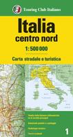
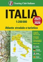
Wegenkaart - landkaart 2 Italië Centraal | Touring Club Italiano
Central Italy at 1:400,000 from the Touring Club Italiano, printed on light, waterproof and tear-resistant plastic paper; one of the titles in a series of three touring maps conveniently grouping together several popular holiday areas. The maps very effectively present the country’s topography with attractive altitude colouring, supplemented by names of numerous hill and mountain ranges, valleys, etc, plus spot heights for selected peaks. National parks and scenic routes are highlighted. National parks and scenic routes are highlighted. Grading according to the degree of importance and interest is given not only to towns, villages and historical or architectural sites, but also to holiday resorts and natural curiosities. Symbols highlight churches, monasteries, castles, palaces, ruins and archaeological sites, caves and waterfalls, etc. The maps also provide some information on accommodation, indicating selected isolated hotels, refuges, tourist villages and campsites, Road network st…
13,95
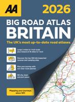
Wegenatlas Big Road Atlas Britain 20256 - A3 | Paperback | AA Publishing
This A3 format atlas is available in two binding styles; softback and spiral bound. Each page has been titled with its  geographical location so you can turn to the page you need more easliy. Wide minor roads (more than and less than  4m wide), National Trust, English and World Heritage sites, crematorium locations and other hard-to-find places are indicated on the mapping.   There are 68 city, town and port plans including central London and a list of tourist sites  with satnav friendly post codes. Plus scenic routes, caravan and camping sites and over 240 service areas.  
20,95

Klanten-reviews van Wegenatlas Italië atlas - atlante stradale 2025/2026 | Paperback | A4-Formaat | Touring Club Italiano

Er zijn nog geen beoordelingen voor dit productBen jij de eerste die een review plaatst?

Meer over Wegenatlas Italië atlas - atlante stradale 2025/2026 | Paperback | A4-Formaat | Touring Club Italiano

Productinformatie

    Verken gerelateerde categorieën

    Webshop.nl maakt gebruik van cookies. Ga je verder op onze website, ga dan akkoord met het plaatsen van cookies en de verwerking van deze data door ons en vermelde partners.