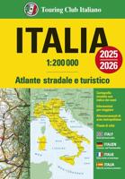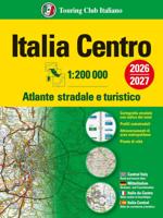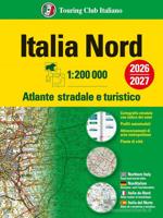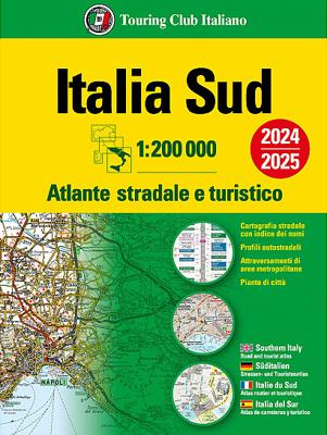

Wegenatlas Atlante Stradale d'Italia Sud | Touring Club Italiano

0
Atlas van de Italiaanse ANWB, goed kaartbeeld. Wel met omgevingskaarten van belangrijke steden en stadsplattegronden. Kaarten vanaf Rome naar het zuiden. Wegenatlas met gedetaileerde wegenkaarten van zuidelijk Italië, ten zuiden van Rome en met Sicilie, snelwegkaarten met afritten, toeristische informatie, plattegronden van steden, de kaarten zijn...

Alle aanbiedingen van dit product

Verkoper
Bezorging
Prijs
DeZwerver.nl logo
DeZwerver.nl
5,95
24,95

Anderen bekeken ook

Wegenatlas Atlante Stradale d'Italia Sud | Touring Club Italiano
Atlas van de Italiaanse ANWB, goed kaartbeeld. Wel met omgevingskaarten van belangrijke steden en stadsplattegronden. Kaarten vanaf Rome naar het zuiden. Wegenatlas met gedetaileerde wegenkaarten van zuidelijk Italië, ten zuiden van Rome en met Sicilie, snelwegkaarten met afritten, toeristische informatie, plattegronden van steden, de kaarten zijn ook geschikt om op te fietsen Southern Italy at 1:200,000 in a series of three excellent road atlases from the Touring Club Italiano, each with enlargements of the environs of main cities, numerous superb indexed street plans, plus a very comprehensive distance table.   The atlases are in a paperback format, slightly larger than A4. Cartography is the same as in TCI’s 1:200,000 series of regional maps, with subtle but very effective relief shading plus spot heights to present the topography. Numerous names of mountain ranges, valleys, peaks, etc. are shown and national parks and other protected areas are prominently highlighted.   Road n…
24,95
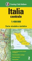
Wegenkaart - landkaart 2 Italië Centraal | Touring Club Italiano
Central Italy at 1:400,000 from the Touring Club Italiano, printed on light, waterproof and tear-resistant plastic paper; one of the titles in a series of three touring maps conveniently grouping together several popular holiday areas. The maps very effectively present the country’s topography with attractive altitude colouring, supplemented by names of numerous hill and mountain ranges, valleys, etc, plus spot heights for selected peaks. National parks and scenic routes are highlighted. National parks and scenic routes are highlighted. Grading according to the degree of importance and interest is given not only to towns, villages and historical or architectural sites, but also to holiday resorts and natural curiosities. Symbols highlight churches, monasteries, castles, palaces, ruins and archaeological sites, caves and waterfalls, etc. The maps also provide some information on accommodation, indicating selected isolated hotels, refuges, tourist villages and campsites, Road network st…
14,95
Wegenatlas Letland noord - Vidzeme | Jana Seta
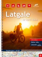
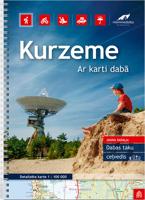
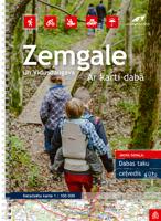
Bijzonder gedetailleerde wegenatlas van een deel van Letland. Uitvoering in ringband en op geplastificeerd papier. Inclusief stadplattegronden van Aluksne, Cesis, Gulbene, Limbai, Madona, Ogre, Sigulda, Valka, en Valmiera.   Jana Seta’s adventure atlases in this series have topography shown by contour lines at 10m intervals, with colouring and/or graphics for orchards, forests, swamps, etc; boundaries of national parks and other protected area are clearly marked. The mapping provides a very detail presentation of the road network, from main roads to “difficult to travel” unsurfaced local roads. Locations of petrol stations are marked and driving distances are shown on many local routes. The atlases also show cycling routes. Railway lines are shown with stations. Interesting locations are highlighted and symbols indicate campsites and other tourist accommodation, museums, etc. In each title a selection of best sights is cross-referenced to their descriptions (in Latvian only). Latitude…
37,50
Wegenatlas Peloponnese | Anavasi
Paperback, 237-page road atlas of the Peloponnese with detailed contoured mapping at 1;50,000 showing place names in Greek and Roman alphabets and providing a 2km UTM grid for GPS use. The main section of the atlas has 178 pages of detailed maps with contours at 100m intervals, altitude colouring and relief shading to provide a vivid representation of the terrain. Nearly all names: town and villages, geographical features, etc., are given in both Greek and Roman alphabets, with just minor local churches shown in Greek only. Names of most archeological sites and many other places of interest are given in Greek and in English. Road classification has 10 different grades, from toll motorways to minor dirt roads in poor condition and 4WD tracks. Intermediate driving distances are shown on main and secondary roads. The maps also indicate locations of petrol stations (with names of oil companies) and tire repairs facilities. Local footpaths are also marked, with the E4 trans-European long-d…
26,95
Wegenatlas Australia Road & 4WD Touring Atlas A4 | Hema Maps
Uitstekende wegenatlas van heel Australië met goed leesbare kaarten, met stadsplattegronden en afstandstabel. A4-formaat in ringband, Engelstalig. Featuring trusted Hema mapping for all of Australia, the Hema Road & 4WD Touring Atlas is the definitive travel guide for tourers and adventurers. Hema atlases feature more information useful to travellers, including 4WD tracks, campsites, caravan parks, rest areas, 24-hour fuel and points of interest.   This edition contains more mapping than ever before, which is enhanced by a striking new cartographic style that's incredibly easy to read. Included in this is up-to-date mapping for Australia's biggest 4WD destinations: Cape York, Fraser Island, the Top End, the Kimberley, the Pilbara, Central Australia, High Country Victoria and the Flinders Ranges.   A handy distance grid, national park guide, list of accredited information centres and a complete index are also included to assist with trip planning and navigation, making it the perf…
39,95
Wegenatlas Navigator Scotland | A4-Formaat | Ringband | Philip's Maps
Duidelijke en gedetailleerde atlas van Schotland met enkele stadsplattegronden en register. Zuid Schotland is van schaal 1:100.000 en het noorden met schaal 1:200.000   Philip's Navigator Scotland is part of the Navigator brand, the UK's best-selling road atlases. The Navigator maps provide highly detailed coverage of the Scotland's road network, including minor country lanes and rural tracks. Most of the Central Lowlands and Scottish Borders are shown at the unique Navigator scale of 1.5 miles to 1 inch, Northern Scotland at 3 miles to 1 inch.   Navigator Scotland offers so much more than road maps: hundreds of individually named farms, houses and hamlets, airports, airfields, stations, ferries, canals, marinas, tourist information centres, and a wide range of places of interest. The atlas has a comprehensive index and includes indexed town plans of major regional centres. The front of the atlas contains a 15-page guide to regional leisure facilities and listings of a wide variety…
15,95
Wegenatlas Ireland Comprehensive Road Atlas - Ierland | Collins
Duidelijke en gedetailleerde atlas voor Ierland in A4-formaat met ringband.   Clear, detailed road atlas of Ireland in a handy A4 spiral-bound format. This comprehensive, general purpose road atlas of the whole of Ireland is ideal for both business and pleasure use. The atlas contains a range of mapping scales: • 9 miles to 1 inch route planning map • Main maps at 3.2 miles to 1 inch, which are ideal for navigation. • A wide selection of detailed town centre street plans.   This edition boasts road mapping packed with detail showing colour classified road network, toll roads, land heights, the location of safety cameras, Blue Flag and Green Coast beaches, tourist information centres and a wide range of tourist attractions. There is also comprehensive guide information for visitors to Belfast, Cork, Dublin and Limerick. The locations of Speed Enforcement Zones, which highlight roads that have a high risk of accidents as identified by the Garda and the National Roads Authority, are incl…
14,95
Wegenatlas Australia Road & 4WD Handy Atlas B5 | Hema Maps
Wegenatlas Australie met toeristische informatie, uitgevoerd in handige spiraalbinding. Geweldige kaarten, goed leesbaar (beetje kleine letters wellicht voor sommigen) met veel toegevoegde waarde als het gaat om details als Nationale Parken, campsites, stranden en afstanden. De schaal varieert per bladzijde Featuring trusted Hema mapping for all of Australia, the Hema Road & 4WD Handy Atlas is the definitive travel guide for tourers and adventurers. Hema atlases feature more information useful to travellers, including 4WD tracks, campsites, caravan parks, rest areas, 24-hour fuel and points of interest.   This edition in a handy size contains more mapping than ever before, which is enhanced by a striking new cartographic style that?s incredibly easy to read. Included in this is up-to-date mapping for Australia's biggest 4WD destinations: Cape York, Fraser Island, the Top End, the Kimberley, the Pilbara, Central Australia, High Country Victoria and the Flinders Ranges.   A handy d…
29,95
Wegenatlas Cape York Atlas & Guide | Hema Maps
A4 formaat, verschillende schalen / spiraal uitvoering With detailed coverage of The Tip, the coast from Cairns to Cooktown, Rinyirru (Lakefield) National Park, the Peninsula Developmental Road, Old Telegraph Track, Torres Strait and the Savannah Way, it ensures you won’t miss the ‘must-see’ attractions, but it also describes some of the lesser known areas favoured by the experts. Whether you just want to make it to The Tip or are looking for a serious 4WD adventure, this informative book is an indispensable companion.   The book features 15 4WD trips, explored and revised by travel journalist Ian Glover, with photography by Matt Williams. Each trip has a detailed map, plus all the information you need to plan the trip including trip grading, longest distance without fuel, permits and contact details.   This brand new edition of Hema’s best-selling outdoor guidebook for discovering Cape York now features 22 atlas pages in a stunning new cartographic style and also incorporates c…
45,95
Wegenatlas Touring Atlas New Zealand - roadatlas - Nieuw Zeeland | A4 Ringband | Hema Maps
Uitstekende wegenatlas van zowel Noord als Zuid eiland met goed leesbare kaarten, met stadsplattegronden en afstandstabel. In ringband, A4 formaat / Engelstalig. Met 80 pagina's wegenkaarten, 26 stadsplattegronden, volledig ge-updated, met campings en veel ingetekende details.  Tour the land of the long white cloud with New Zealand’s clearest and most up-to-date maps – the hard work's all taken care of. There's something for every kind of traveller among these meticulously crafted maps and guides, with more than 1500 motorhome parks, adventure activity locations, camping grounds and additional city and national park maps. All presented in an easy to read, easy to store format – finally putting an end to back-road map rage. With so much to see and do you'll be glad to have this comprehensive travel companion at your side, helping you cut down the planning time so you have time to explore!   Product Features   • 80 pages of touring maps   • 10 “Great Walks” tracks   • 25 must-s…
34,95

Klanten-reviews van Wegenatlas Atlante Stradale d'Italia Sud | Touring Club Italiano

Er zijn nog geen beoordelingen voor dit productBen jij de eerste die een review plaatst?

Meer over Wegenatlas Atlante Stradale d'Italia Sud | Touring Club Italiano

Productomschrijving

Atlas van de Italiaanse ANWB, goed kaartbeeld. Wel met omgevingskaarten van belangrijke steden en stadsplattegronden. Kaarten vanaf Rome naar het zuiden.

Wegenatlas met gedetaileerde wegenkaarten van zuidelijk Italië, ten zuiden van Rome en met Sicilie, snelwegkaarten met afritten, toeristische informatie, plattegronden van steden, de kaarten zijn ook geschikt om op te fietsen

Southern Italy at 1:200,000 in a series of three excellent road atlases from the Touring Club Italiano, each with enlargements of the environs of main cities, numerous superb indexed street plans, plus a very comprehensive distance table.   The atlases are in a paperback format, slightly larger than A4. Cartography is the same as in TCI’s 1:200,000 series of regional maps, with subtle but very effective relief shading plus spot heights to present the topography. Numerous names of mountain ranges, valleys, peaks, etc. are shown and national parks and other protected areas are prominently highlighted.   Road network is presented in great detail, from motorways to dirt tracks navigable only with difficulty. Minor roads are very clear and easy to read and, where necessary, are drawn without generalizing their course, showing the twists and turns across the mountainous terrain. Steep roads are annotated with three levels of gradient markings. Motorways have the usual features such as toll barriers, services, etc. Scenic routes are highlighted. Railway network shows stations and level crossings and, where appropriate, ferry routes are marked. In mountainous areas refuges, cable car lines, chair lifts, etc, are included. Towns, villages and other places of particular interest are highlighted, with symbols indicating various monuments, castes, churches, etc. The maps have no geographical co-ordinates.    Each volume includes enlargements at 1:80,000 for environs of main cities, plus numerous superb street plans, each with an index of sights and streets.


Productinformatie

    Verken gerelateerde categorieën

    Webshop.nl maakt gebruik van cookies. Ga je verder op onze website, ga dan akkoord met het plaatsen van cookies en de verwerking van deze data door ons en vermelde partners.