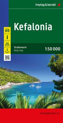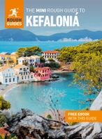
Wandelkaart - Wegenkaart - landkaart Kefallonia - Kefalonia | Freytag & Berndt

0
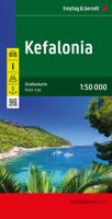
Goede wegenkaart van Kefallonia / Kefalonia, waarbij ook de kleinere wegen nog goed te lezen zijn. Gedetailleerde schaal van 1:50.000. Veel toeristische symbolen voor bezienswaardigheden als grotten, tempels, opgravingen maar ook mooie stranden etc. Ook handig is de Nederlandstalige Reisgids van Kefalonia "Ontdek Kefalonia" "Ontdek Kefalonia" Expl...

Verkopers met dit product

Verkoper
Bezorging
Prijs
DeZwerver.nl logo
DeZwerver.nl
2,95
14,95

Anderen bekeken ook

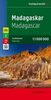
Wegenkaart - landkaart Madagascar - Madagaskar | Freytag & Berndt
Uitstekende, dubbelzijdige kaart van Madagascar. Met index, Nationale parken en afstanden in kilometers. Met Mauritius en Réunion er ook nog op. Explore Madagascar with this Freytag & Berndt double-sided road map. The best way to plan your trip, prepare your itinerary, and to travel independently in this country. As with all Freytag & Berndt maps the cartography is clear and detailed with the topography shown by relief shading with plenty of spot heights.   The map also includes an inset showing the Comoros Islands and Mayotte at the same scale as the main map.   Tourist information and places of interest are clearly marked by a range of icons, including:    railways, local airports and ferry routes campsites beaches diving and windsurfing sites UNESCO sites spas, wells and caves   Distances between points are shown as well as indications of steep gradients, all distances are in kilometres. The legend is in several languages inlcuding English.    
14,95
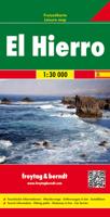
Wandelkaart - Wegenkaart - landkaart El Hierro | Freytag & Berndt
Freytag & Berndt kaarten op schaal 1:50.000 (of kleiner) zijn zeer overzichtelijk, wandelpaden werden erop ingekleurd, ze bevatten voldoende details om een wandeltocht in te schatten. Overigens vinden wij dat de Freytag & Berndt kaarten van de Spaanse en Portugese eilanden iets meer gericht zjin op algemeen toerisme en iets minder op wandelen; voor wandelen raden we toch de Kompass - kaarten serie aan die van de meest eilanden ook voor handen is. The island of Hierro at 1:30,000 on a contoured, GPS compatible tourist map from Freytag & Berndt highlighting various places of interest, as well as waymarked hiking routes. Contours at 50m intervals are enhanced by bold relief shading and names of numerous peaks to provide a very clear picture of the island’s topography.  Road network includes local roads and country tracks, indicating locations of petrol stations and driving distances on main routes. Picturesque towns and villages or sites are clearly highlighted, and symbols mark other pl…
14,95
Wegenkaart - landkaart Ierland | Freytag & Berndt
Goede tweezijdige wegenkaart van het hele land. Met register en enkele stadsplattegronden.   De berijdbare wegen zijn goed weergeven, zowel de hoofdwegen als provinciale en lokale wegen; wegnummers worden vermeld. Afstanden tussen plaatsen zijn in kilometers op de kaart ingetekend, daarnaast worden ook op belangrijke plekken benzinepompen gemarkeerd.   In het kaartbeeld wordt door middel van schaduw het reliëf weergegeven en soms enkele punten in het landschap met de daadwerkelijke hoogte. Provinciegrenzen zijn goed terug te vinden, nationale parken en reservaten ook. Met allerhande symbolen worden toeristische bezienswaardigheden weergegeven als monumenten, historisch belangrijke plekken en uitzichtpunten. In bepaalde plaatsen zijn hotels en campings te vinden, luchthavens, treinverbindingen en havens vindt u er ook op!Explore Ireland with this Freytag & Berndt double-sided road map. The best way to plan your trip, prepare your itinerary, and to travel independently in this country. …
14,95
Wegenkaart - landkaart Corfu - Korfoe | Freytag & Berndt
Goede wegenkaart van Corfu, die ook behoorlijk veel detail weergeeft als het gaat om wandelpaden, fietsbare wegen en met veel symbolen voor toeristische bezienswaardigheden. De berijdbare wegen zijn goed weergeven, zowel de hoofdwegen als provinciale en lokale wegen; wegnummers worden vermeld. Afstanden tussen plaatsen zijn in kilometers op de kaart ingetekend, daarnaast worden ook op belangrijke plekken benzinepompen gemarkeerd. In het kaartbeeld wordt door middel van schaduw het reliëf weergegeven en soms enkele punten in het landschap met de daadwerkelijke hoogte. Provinciegrenzen zijn goed terug te vinden, nationale parken en reservaten ook. Met allerhande symbolen worden toeristische bezienswaardigheden weergegeven als monumenten, historisch belangrijke plekken en uitzichtpunten. In bepaalde plaatsen zijn hotels en campings te vinden, luchthavens, treinverbindingen en havens vindt u er ook op! Explore Corfu, the second largest of the Ionian Islands located in Greece; with this Fr…
14,95
Wegenkaart - landkaart Azoren - Azores | Freytag & Berndt
Uitstekende wegenkaart van de Azoren. Met index, toeristische informatie, Autoveerboten en jachthavens. Elk eiland op een aparte inzet. Gedetailleerde landkaart, ook te gebruiken als wandelkaart of fietskaart van de Azoren (Acores, Portugal) schaal 1:50.000 met uitgebreide legenda en plaatsnamenregister. This large double-sided road map of the Azores, at 1:50,000 from Freytag & Berndt, shows the islands both individually and as a group and comes with an attached index and concise leisure guide booklet.    This map shows main and minor roads, motorways and toll roads, sections under construction or closed to traffic. Conveniently highlighted are scenic routes, gradients on steep roads, driving distances in kilometres, petrol and service stations etc. Railway lines are marked and international and local airports are indicated as well as ferry connections to the other islands.    Relief shading, spot heights and colouring and/or graphics provide a good presentation of the islands topogra…
14,95
Wegenkaart - landkaart Rusland - Russia | Freytag & Berndt
Uitstekende landkaart van Rusland. Met index, toeristische informatie en afstanden in kilometers. Het westen op een schaal van 1 op 2 miljoen en na de Oeral wordt het een grove schaal van 1 op 8 miljoen. Toch een van de betere kaarten van Rusland! Explore Russia and the other members of the Commonwealth of Independent States (C.I.S) with this Freytag & Berndt double-sided road map. The best way to plan your trip, prepare your itinerary, and to travel independently on this region. As with all Freytag & Berndt maps, the cartography is clear and detailed with the topography shown with relief shading with plenty of spot heights.   One side of the map features a 1: 200 000 scale map of Eastern Europe, while the other side features a large scale 1: 8 000 000 map showing the members of the C.I.S. Names of townships in former Soviet countries are listed in both English and the Cyrillic script.   A icon system is used to show tourist information. Icons are displayed for:   Railways and canal s…
14,95
Stadsplattegrond Barcelona | Freytag & Berndt
Stadsplattegrond met register. Helder kaartbeeld waarbij de naamgeving goed leesbaar is weergegeven. Met de toeristische bezienswaardigheden in symbolen weergeven: monumenten, musea, stadions e.a. Daarnaast handige zaken als postkantoren, parkeergarages en stations. Veelal ook met een openbaar vervoer of metro kaart als inzet. Explore Barcelona with this Freytag & Berndt map. The best way to plan your trip, prepare your itinerary, and to travel independently in this country. As with all Freytag & Berndt maps the cartography is clear and detailed with the topography shown by relief shading with plenty of spot heights.   One side features a detailed map of the city of Barcelona, as well as an inset of the greater area around the city in Spain. The flipside features the index for the map.    Freytag & Berndt maps make good use of an icon system. Icons show tourist information such as:   Places of interest Churches, museums and theatres Parks and gardens   Distances between points are sho…
13,95
Wegenkaart - landkaart Corsica - Korsika | Freytag & Berndt
Deze bijzonder gedetailleerde Freytag & Berndt Wegenkaart van Corsica is aan één kant geprint en heeft een schaal van 1:150.000. Op deze kaart staan o.a. fietsroutes, lange afstandswandelpaden, toeristische wegen en bezienwaardigheden aangegeven. In de omslag van de kaart is een apart boekje geniet met een korte beschrijving van de TOP 10 van bezienswaardigheden, een uitgebreide index en plattegrondjes van enkele toeristische plaatsen. Explore the Mediterranean island of Corsica with this Freytag & Berndt single-sided road and leisure map. The best way to plan your trip, prepare your itinerary, and to travel independently on this region. As with all Freytag & Berndt maps, the cartography is clear and detailed with the topography shown with relief shading with plenty of spot heights.   This map features a full map of the island. Using Freytag & Berndt's icon system, important tourist information is shown. You will see icons for tourist information such as:   Picturesque towns and panor…
14,95
Wandelkaart - Wegenkaart - landkaart Liparische eilanden | Freytag & Berndt
Gedetailleerde wegenkaart en wandelkaart (géén wandelroutes ingetekend!) met uitgebreide legenda en plaatsnamenregister. Meer wegenkaart dan wandelkaart. Aeolian (Lipari) Islands at 1:20,000 from Freytag & Berndt on a double-sided map which presents on the reverse coverage of Italy south of Rome at 1:600,000 and shows ferry access to the islands from the mainland or Sicily.   On one side the islands are shown in a series of panels, with the three largest: Salina, Lipari and Vulcano together, and Alicudi, Filicudi, Panarea and Basiluzzo plus Stromboli as separate insets. Topography is shown by contours at 50m intervals enhanced by relief shading, with names of peaks, valleys, etc. All place names are in large, easy to read print.   Road network includes country tracks and a selection of hiking paths. Various places of interest and facilities are highlighted, including beaches, marinas, campsites, etc. Each individual inset has latitude and longitude lines at intervals of 1’.   Ferry po…
14,95
Wegenkaart - landkaart Italie - Italien | Freytag & Berndt
Gedetailleerde, tweezijdige landkaart van Italië, prima geschikt voor planning en rondtrekken. De berijdbare wegen zijn goed weergeven, zowel de hoofdwegen als provinciale en lokale wegen; wegnummers worden vermeld. Afstanden tussen plaatsen zijn in kilometers op de kaart ingetekend, daarnaast worden ook op belangrijke plekken benzinepompen gemarkeerd. In het kaartbeeld wordt door middel van schaduw het reliëf weergegeven en soms enkele punten in het landschap met de daadwerkelijke hoogte. Provinciegrenzen zijn goed terug te vinden, nationale parken en reservaten ook. Met allerhande symbolen worden toeristische bezienswaardigheden weergegeven als monumenten, historisch belangrijke plekken en uitzichtpunten. In bepaalde plaatsen zijn hotels en campings te vinden, luchthavens, treinverbindingen en havens vindt u er ook op! Explore Italy with this Freytag & Berndt double-sided road map. The best way to plan your trip, prepare your itinerary, and to travel independently in this country. A…
14,95

Klanten-reviews van Wandelkaart - Wegenkaart - landkaart Kefallonia - Kefalonia | Freytag & Berndt

Er zijn nog geen beoordelingen voor dit productBen jij de eerste die een review plaatst?

Meer over Wandelkaart - Wegenkaart - landkaart Kefallonia - Kefalonia | Freytag & Berndt

Productomschrijving

Goede wegenkaart van Kefallonia / Kefalonia, waarbij ook de kleinere wegen nog goed te lezen zijn. Gedetailleerde schaal van 1:50.000. Veel toeristische symbolen voor bezienswaardigheden als grotten, tempels, opgravingen maar ook mooie stranden etc.

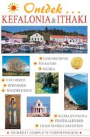
Ook handig is de Nederlandstalige Reisgids van Kefalonia "Ontdek Kefalonia" "Ontdek Kefalonia"

Explore Kefallonia, the largest of the Ionian Islands located in Greece; with this Freytag & Berndt single-sided road and leisure map. The map will allow you to travel independently, and plan your journey well.   The map also features full colour photographs of some of the scenery to be found on Kefallonia, as well as an inset showing Kefallonia's position within the nation of Greece. An inset is also provided showing a city plan of the main township on Kefallonia, Argostoli. The topography is clear, with shading showing land gradients.    As with all Freytag & Berndt maps, icons and markings are used to denote tourist information and points of interest. These include:   Roads, both surfaced and unsurfaced and foot paths Important facilities such as petrol stations, yacht supply stations, car ferries, ports and lighthouses Places to see such as churches, monasteries, castles, museums, ruins and archaeological sites Caves, spas and camp sites   Distances between points are shown in kilometres. The legend is in Greek, German, English, French, Italian, Dutch, Spanish, Czech, Slovak and Hungarian.

Verken gerelateerde categorieën

Webshop.nl maakt gebruik van cookies. Ga je verder op onze website, ga dan akkoord met het plaatsen van cookies en de verwerking van deze data door ons en vermelde partners.