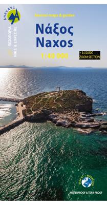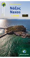
Wandelkaart - Wegenkaart - landkaart 10.28 Naxos | Anavasi

0
Zeer goede kaart van Naxos. Topografische details zijn goed uitgewerkt, zeer leesbare kaart met ook nog eens alle toeristisch interessante punten.   The few and relatively recent asphalt roads on Naxos have not been laid over the old network of byways, leaving much of it intact for visitors to use. The footpaths are well - marked and one can trave...

Verkopers met dit product

Verkoper
Bezorging
Prijs
DeZwerver.nl logo
DeZwerver.nl
2,95
10,95

Anderen bekeken ook

Wandelkaart - Wegenkaart - landkaart 10.28 Naxos | Anavasi
Zeer goede kaart van Naxos. Topografische details zijn goed uitgewerkt, zeer leesbare kaart met ook nog eens alle toeristisch interessante punten.   The few and relatively recent asphalt roads on Naxos have not been laid over the old network of byways, leaving much of it intact for visitors to use. The footpaths are well - marked and one can travel the whole island on foot.   Many paths are added to this new edition of the very detailed maps of Naxos and the 5 Small Cyclades (Irakleia, Schinousa, Pano Koufonisi, Kato Koufonisi and Donousa). Several proposed hiking routes and the course of Naxos Trail
10,95
Wandelkaart - Wegenkaart - landkaart 10.30 Tinos | Anavasi
Goede wandelkaart van Tinos. Tinos island landscape is like a hand made embroidery. Rural huts, dovecotes, churches, terraces and villages are woven into a net of trails. In the first edition of the map, along with my partner Charles Merlin we had recorded several dozens of kilometers of footpaths. From then until the present second edition, Charles made a bet and target to enrich the map in paths, - and put in the game and his friend George Kennedy. Actually the recorded paths, doubled, and plenty of churches, bridges, huts, dovecotes were added beside the paths. Along with the improvements in topographic background and color palette, the map of Tinos has reached very high standards - because we don't like the easy path. On the back side there are several proposed hiking trails with short descriptions and updated information for marking of the paths.
10,95
Wandelkaart - Wegenkaart - landkaart 10.51 Ikaria | Anavasi
The new Anavasi map of Ikaria on a scale of 1:35.000 figures dozens of footpaths, the complete road network and all the beaches of the island, which is also well known for its summer feasts (panigiria) and the longevity of its inhabitants. The island was named after the mythical Icarus, the young man who flew too close to the sun and plunged into the sea, close to Ikaria.   Ikaria has a well-marked network of hiking trails. The island is indeed perfect for days of hiking pleasure with lots of vegetation, deep river valleys with plenty of hidden, refreshingly cold (and clean) water pools, relatively level top plateaus and a ridge line that climbs up to about 900-1000m above sea level with amazing views and nice beaches to end the walks. Printing on waterproof, rip-proof polyart paper
10,95
Wandelkaart - Wegenkaart - landkaart 10.24 Santorini | Anavasi
As you enter the caldera of Santorini by ferry sheer cliffs rise up dramatically, exposing richly coloured rock strata, crowned by the colored houses of the cliff-top settlements. Equally magnificent is the sunset from the heights of the caldera towards the sea and the remnants of prehistoric rounded island Strogyli, Thirasia, the New and Old Kameni. However, there is more than the visual excitement to discover and if you don’t take the time to walk the island you will have learnt little of Santorini.   The new Anavasi map will take hiking in every corner, beach and hill top of Santorini and Thirassia to discover landscapes with visible signs of the traditional rural culture, with orchards stonewalls, threshing floors, huts, chapels, inland villages with a well preserved medieval core (called Castelo), routes with wonderful vistas, lost beaches quiet even in the heart of summer.   On the reverse side of the map, there is a brief description of the 25 proposed hiking routes and a short…
10,95
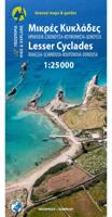
Wandelkaart 10.36 Lesser Cyclades | Anavasi
GPS-compatible map of the island of Naxos and 5 small Cyclades (Irakleia, Schinousa, Pano Koufonisi, Kato Koufonisi and Donousa). This map is printed on light, waterproof and tear-resistant laminated paper. The map presents a plan of the most important cities. The suggestions for hiking are indicated. The road network indicates the undeveloped minor routes and the tracks in poor condition The road distances are indicated on the main roads and the locations of the service stations are indicated. A series of symbols highlight the various places of interest, including archaeological sites, beaches, etc. All the names are in Greek and Latin alphabet.   The Lesser or Small Cyclades are made up of more than 30 islands and rocks. The main inhabited islands are Iraklia, Schinousa, Donousa, Pano Koufonisi. The waters around them are very attractive and walking is inevitable as there are few roads. Donoussa has the best combination of paths and beaches, Iraklia is more suitable for hikers, Schi…
10,95
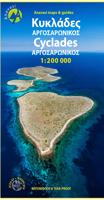
Wegenkaart - landkaart 1 Cyclades - Argosaronic islands | Anavasi
Gedetailleerde tweetalige (Grieks/Engels) topografische wegenkaart van de Cycladen met relief, gedetailleerd wegennet met wegnummers, campings en hutten.   Cyclades - Argosaronic islands  [R1] is a new map covering the areas of Attica with the Argosaronic islands of Salamina, Aegina, Ydra and Poros and all the Cyclades islands, printed on 2 sides with overlap. A very useful map, especially for island-hoppers, with short text for each island presenting the main monuments, outstanding beaches and hiking trails on each island. Printed on waterproof, polyart paper
11,95
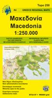
Wegenkaart - landkaart 4 Macedonia | Anavasi
Gedetailleerde tweetalige (Grieks/Engels) topografische wegenkaart van Griekse Macedonië met hoogtelijnen, relief, gedetailleerd wegennet met wegnummers, campings en hutten. Met ingetekende Europese en nationale lange afstandswandelpaden. Anavasi Regional Maps series (Topo250), covering half of the mainland from Konitsa to Katerini in the north and from Messolongi to Thiva in the south. The map comprises all the new highways, the protected areas and Natura sites, the european and national long distance trails and a 84 pages index of settlements, mountains and mountain refuges. Double-sided roadmap and place name index, GPS compatible regional road maps printed on waterproof and tear-resistant plastic paper
11,95
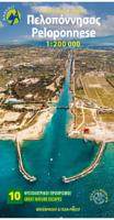
Wegenkaart - landkaart 2 Peloponnese - Peloponnesos | Anavasi
De nieuwe editie van de kaart van de Peloponnesus komt met veel verbeteringen. De grotere schaal maakt het veel leesbaarder en laat gedetailleerde informatie van de kaart zien: Uitgebreid weg- en vestigingsnetwerk. Tal van archeologische sites die voor het eerst op een kaart worden gepubliceerd. Stranden, kamperen, jachthavens, berghutten en de loop van de E4 en de belangrijkste nationale paden 31, 32 en 33. En een innovatie: 10 suggesties voor unieke sites om te bezoeken aan de zijkant van de kaart. Road and touring map of the Peloponnese in scale 1:200 000. On the map find ideas for 10 top nature destinations. Planning a road trip in the Peloponnese? This is the map to take with you. It shows all road categories, to the last dirt road. Every settlement, stating their original name, when known. Plenty of archaeological sites published for the first time on a map. Beaches, camping, marinas, mountain refuges and the course of the E4 and the major national paths 31, 32 and 33. Map corre…
11,95
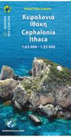
Wandelkaart - Wegenkaart - landkaart 9.3 Kefalonia - Ithaca | Anavasi
Kefalonia staat bekend om haar prachtige stranden. Het eiland heeft grote bergen en ongerepte gebieden die het een ideale bestemming maken voor wandeltochten. Alle afgebeelde paden zijn in de afgelopen twee jaar opgenomen. De kaart is dubbelzijdig met Kefalonia op een schaal van 1: 65.000 aan de ene kant en Ithaca op een schaal van 1: 25.000 aan de andere kant. De kaarten van Anavasi zijn zeer gedetailleerd, beschikken over een helder kaartbeeld en zijn uitstekende kaarten voor diverse activiteiten. Ze beschikken over vele interessante punten voor wandelaars, fietsers of andere toeristen die het gebied bezichtigen. De wandelkaarten bevatten ook een uitzonderlijke reliefaanwijzing, verschillende vormen van gewassen en andere topografische details. Inclusief hoogtelijnen, wandelpaden, toeristische informatie en UTM grid, de kaart is geschikt voor gebruik met GPS.
10,95
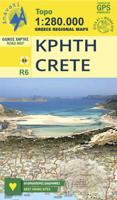
Wegenkaart - landkaart 6 Crete - Kreta | Anavasi
Handige kleine wegenkaart van Kreta.   Crete is a big island, and a general map is necessary to plan your travel. But to better discover Crete you need to leave the car behind, and go hiking in the wild side of the island. There are here 7 hiking destinations with pictures, map and descriptions, to inspire you to explore the Cretan countryside. Crete R6 is a simple and inexpensive road map, ideal for short visits or planning long routes.   Printed on plain paper.
7,95

Klanten-reviews van Wandelkaart - Wegenkaart - landkaart 10.28 Naxos | Anavasi

Er zijn nog geen beoordelingen voor dit productBen jij de eerste die een review plaatst?

Meer over Wandelkaart - Wegenkaart - landkaart 10.28 Naxos | Anavasi

Productomschrijving

Zeer goede kaart van Naxos. Topografische details zijn goed uitgewerkt, zeer leesbare kaart met ook nog eens alle toeristisch interessante punten.   The few and relatively recent asphalt roads on Naxos have not been laid over the old network of byways, leaving much of it intact for visitors to use. The footpaths are well - marked and one can travel the whole island on foot.   Many paths are added to this new edition of the very detailed maps of Naxos and the 5 Small Cyclades (Irakleia, Schinousa, Pano Koufonisi, Kato Koufonisi and Donousa). Several proposed hiking routes and the course of Naxos Trail

Productinformatie

    Verken gerelateerde categorieën

    Webshop.nl maakt gebruik van cookies. Ga je verder op onze website, ga dan akkoord met het plaatsen van cookies en de verwerking van deze data door ons en vermelde partners.