webshop.nl
Categorieën
  Sluiten

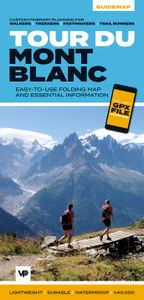
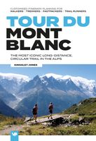
Wandelkaart Tour du Mont Blanc Guidemap | Vertebrate Publishing

The white dome of Mont Blanc looms over France, Italy and Switzerland, and it is no wonder that the 169-kilometre Tour du Mont Blanc (TMB) has captured the public imagination to become one of Europe's most popular long-distance trails. The TMB appeals to people who have different levels of experience and travel at all speeds, and this Vertebrate Pu...
24,50

Webshops met dit product

Webshop
Bezorging
Prijs

Anderen bekeken ook

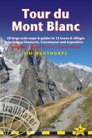
Wandelgids Tour du Mont Blanc | Vertebrate Publishing
Tour du Mont Blanc is the definitive guidebook for one of the most famous long-distance treks in the world. This trek circles the entire Mont Blanc massif, passing through spectacular scenery in France, Italy and Switzerland. You’ll traverse high mountain passes, see stunning glaciers, pass azure lakes, wander through tranquil green valleys and alpine pastures, with snow-capped peaks visible above.   Written by Tour du Mont Blanc expert Kingsley Jones, this guidebook includes unique customised timings to enable accurate itinerary planning for walkers, trekkers, fastpackers and trail runners, allowing you to plan your Tour du Mont Blanc at a pace to suit you.   You’ll find everything that you need to plan and undertake your Tour du Mont Blanc, including travel information, navigation, accommodation options, equipment and safety, food and drink, as well as useful extra information such as wild swimming locations and trekking tips.   Together with amazing photography, the route includes c…
24,95
Wandelgids Tour Du Mont Blanc | Trailblazer Guides
Goede wandelgids van deze beroemde route. Veel informatie vooraf en een zeer gedegen duidelijke beschrijving van de te volgen route. Opvallend blijft dat deze uitgever geen gebruik van gewone detailkaarten, maar van getekende schetskaarten waarbij ze de nadruk kunnen leggen op opvallende details langs de route als een markant punt van een boom of rots. At 4810m (15,781ft), Mont Blanc is the highest mountain in western Europe, and one of the most famous mountains in the world. The trail (105 miles, 168km) that circumnavigates the massif, passing through France, Italy and Switzerland, is the most popular long distance walk in Europe.   62 maps – 12 town and village plans and 50 large-scale walking maps – at 1:20,000 – showing route times, gradients, where to stay, interesting features   Itineraries for all walkers – whether walking the 105 mile (168km) route in its entirety, or sampling the highlights on day walks and short breaks   Practical information for all budgets – where to stay (…
23,95
Wandelgids Tour of Mont Blanc | Cicerone
Uitstekende wandelgids die in etappes de route nauwkeurig beschijft; ook de zijtakken en alternatieve routes koman aan bod. Kaarten zijn schetsmatig en in onze ogen onvoldoende bij slechte weersomstandigheden. Wij raden dan ook om er losse kaarten bij te kopen. This guidebook contains in-depth route description and mapping for both the classic 11 day anti-clockwise circuit and an alternative 10 day clockwise TMB circuit. This well-signed but demanding 170km route, starting from Les Houches or Champex, is suitable for fit walkers.   The guidebook comes with a map booklet containing official 1:25,000 IGN mapping for the TMB route, and urban maps for the major centres of Chamonix, Courmayeur, Les Contamines, Les Houches and Champex.   Complete with a French-English glossary, comprehensive notes about accommodation, facilities and transport, this guide provides all the information needed for planning and completing your trek. The Tour of Mont Blanc is one of the world's classic treks. Visi…
24,95
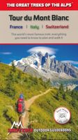
Wandelgids Tour Du Mont Blanc | Knife Edge Outdoor
Overzichtelijke routegids van deze prachtige wandelroute. Per etappe vind je een hoogteprofiel, goede beschrijvingen van de wandelroute, een topografische kaart op gedetailleerde schaal. Voor en achterin de gids staat aanvullende praktische informatie zoals adressen van campings, andere accommodaties en bijvoorbeeld een paar pagina's over de flora en fauna.    Complete guidebook for planning and trekking the Tour du Mont Blanc, the world's most famous trek   Real maps for each stage: 1:25,000. No need to buy a separate map!   Unique Itinerary Planner: plan a bespoke itinerary to match your ability and vacation schedule. All difficult calculations of time, distance and altitude gain are done for you   Everything the trekker needs to know: route descriptions, costs, budget, difficulty, weather, how to get there, and more   Full accommodation listings: spectacularly situated mountain huts, villages and hamlets   Full section on camping: a complete list of camping locations   10 exciting v…
20,95
Wegenkaart - landkaart Mont Blanc & Alpen | ITMB
As far as mountains go, Mont Blanc in France and Italy, forming the border between the two countries, with Switzerland nearby, is the best known and most attractive mountain in the Alps. The peak itself is far too challenging for most climbers to attempt, but the region is dotted with ski lifts, hiking trails in the lower regions, and fascinating scenic villages. Mont Blanc tops out at 4,807.81 metres and is protected by Monte Bianco National Park in Italy. There is a long tunnel underneath the mountain joining France (near Chamonix) and Italy (near Courmayeur) and a beautiful highway along its western side (the D1506) and in Italy along its south side (SS26). There is also a Grande Route long-distance hiking trail that surrounds the mountain. We show it in its entirety, including numerous overnight stopping areas, either in towns or in mountain refuges. Naturally, skiing is a huge draw, and we include several ski lifts, all rail lines in the region, including the fabulous cog line fro…
14,95
Wandelkaart Hadrian's Wall Path | Vertebrate Publishing
The 138-kilometre Hadrian's Wall Path traces a grey line along Great Whin Sill, the dolerite ridge chosen by the Romans for their historic wall. The route, one of Britain's most popular National Trails, is dotted with milecastles and forts, and attracts trail runners and walkers all year round due to its sweeping views. Beginning in Newcastle, the trail passes through rolling grassy paths and grey-green crags to reach Bowness-on-Solway on the Cumbrian Coast.   Hadrian's Wall Path appeals to people who have different levels of experience and travel at all speeds, and this Vertebrate Publishing Guidemap is unique in that it caters for four categories of user, providing custom itineraries for walkers, trekkers, fastpackers and trail runners. This lightweight, waterproof, durable and easy-to-use folding map features all the essential information for a successful Hadrian's Wall Path, including 1:40,000-scale mapping for the linear route starting in Wallsend and finishing in Bowness-on-Solwa…
24,50
Wandelkaart West Highland Way | Vertebrate Publishing
The 153-kilometre West Highland Way encompasses the variety of Scotland's wild places. The route, which begins in Milngavie and finishes in Fort William, passes from Glasgow, Scotland's friendliest city, through lochs and forests, and across wild moors in the shadows of Munros. Offering panoramic views and clear waymarking, it is no wonder this is one of Scotland's most popular long-distance routes.   The West Highland Way appeals to people who have different levels of experience and travel at all speeds, and this Vertebrate Publishing Guidemap is unique in that it caters for four categories of user, providing custom itineraries for walkers, trekkers, fastpackers and trail runners. This lightweight, waterproof, durable and easy-to-use folding map features all the essential information for a successful West Highland Way, including 1:40,000-scale mapping for the linear route starting in Milngavie and finishing in Fort William. It also includes a detailed elevation profile and route plann…
24,50
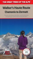
Wandelgids Walker's Haute Route: Chamonix to Zermatt | Knife Edge Outdoor
Overzichtelijke routegids van deze prachtige wandelroute. Per etappe vind je een hoogteprofiel, goede beschrijvingen van de wandelroute, een topografische kaart op gedetailleerde schaal. Voor en achterin de gids staat aanvullende praktische informatie zoals adressen van campings, andere accommodaties en bijvoorbeeld een paar pagina's over de flora en fauna.  The only guidebook for the Walker's Haute Route with Real Maps: 1:25,000/1:50,000 mapping included for each stage. This makes navigation easy and saves you money: no need to buy additional maps. Also includes:* Unique Itinerary Planner: plan a bespoke itinerary to match your ability and vacation schedule. All difficult calculations of time, distance and altitude gain are done for you* 6 Proposed Itineraries of between 10 and 14 days* Everything the trekker needs to know to plan the route: route descriptions, costs, budget, difficulty, weather, how to get there, and more* Full accommodation listings: spectacularly situated mountain …
20,95
Wandelkaart South Downs Way | Vertebrate Publishing
The 162-kilometre South Downs Way begins in Winchester and traces a ridgeline along the rolling, green South Downs to the coast at Eastbourne. It is rightly regarded as one of the finest long-distance trails in England. Predominantly bridleway, the trail is generally wide and hard-surfaced and can be walked at any time of year.   The South Downs Way appeals to people who have different levels of experience and travel at all speeds, and this Vertebrate Publishing Guidemap is unique in that it caters for four categories of user, providing custom itineraries for walkers, trekkers, fastpackers and trail runners. This lightweight, waterproof, durable and easy-to-use folding map features all the essential information for a successful South Downs Way, including 1:40,000-scale mapping for the linear route starting in Winchester and finishing in Eastbourne. It also includes a detailed elevation profile and route planner, safety advice, terrain information and an accommodation directory, and a l…
24,50
Wandelkaart Tour du Mont Blanc | IGN - Institut Géographique National
Goede, handzame, tweezijdig bedrukte kaart van de Tour du Mont Blanc Tour (TMB) met hoogte profielen en ingetekende route. 3 landen: Frankrijk, Italië en Zwitserland totale lengte 170 kilometer Inclusief 10.000 meter hoogteverschil Schaal 1: 50.000 (1 cm = 500 m) Een onmisbare hulp bij de voorbereiding van de route: de etappen, accommodaties, Veiligheid, advies, trailomstandigheden Hoogteprofiel van de routes Van de uitgever Une carte à l’échelle du 1 : 50 000 (1cm = 500m) incontournable pour parcourir le mythique GR TMB® Tour du Mont Blanc.   Le Tour du Mont Blanc est une randonnée spectaculaire qui se développe autour du massif du Mont-Blanc et qui traverse 3 pays (l'Italie, la Suisse et la France), 170 kilomètres de randonnée cumulant 10 000 mètres de dénivelé.   En plus du parcours représenté de façon très précise, cette carte est également une aide précieuse dans la planification des étapes grâce aux informations et liens touristiques (ou manger, ou dormir, quoi visiter…)…
11,95

Klanten-reviews van Wandelkaart Tour du Mont Blanc Guidemap | Vertebrate Publishing

Er zijn nog geen beoordelingen voor dit productBen jij de eerste die een review plaatst?

Meer over Wandelkaart Tour du Mont Blanc Guidemap | Vertebrate Publishing

Productomschrijving

The white dome of Mont Blanc looms over France, Italy and Switzerland, and it is no wonder that the 169-kilometre Tour du Mont Blanc (TMB) has captured the public imagination to become one of Europe's most popular long-distance trails. The TMB appeals to people who have different levels of experience and travel at all speeds, and this Vertebrate Publishing Guidemap is unique in that it caters for four categories of user, providing custom itineraries for walkers, trekkers, fastpackers and trail runners. This lightweight, waterproof, durable and easy-to-use folding map features all the essential information for a successful TMB, including 1:40,000-scale mapping for the anticlockwise route starting and finishing in the town of Les Houches, south of Chamonix.   It also includes nine route variations, a detailed elevation profile and route planner, safety advice, terrain information and an accommodation directory, and a link to a GPX file download.
Webshop.nl maakt gebruik van cookies. Ga je verder op onze website, ga dan akkoord met het plaatsen van cookies en de verwerking van deze data door ons en vermelde partners.