webshop.nl
Categorieën
  Sluiten

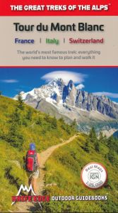
Wandelgids Tour Du Mont Blanc | Knife Edge Outdoor

Overzichtelijke routegids van deze prachtige wandelroute. Per etappe vind je een hoogteprofiel, goede beschrijvingen van de wandelroute, een topografische kaart op gedetailleerde schaal. Voor en achterin de gids staat aanvullende praktische informatie zoals adressen van campings, andere accommodaties en bijvoorbeeld een paar pagina's over de flora ...
20,95

Webshops met dit product

Webshop
Bezorging
Prijs

Anderen bekeken ook

Wandelgids Walker's Haute Route: Chamonix to Zermatt | Knife Edge Outdoor
Overzichtelijke routegids van deze prachtige wandelroute. Per etappe vind je een hoogteprofiel, goede beschrijvingen van de wandelroute, een topografische kaart op gedetailleerde schaal. Voor en achterin de gids staat aanvullende praktische informatie zoals adressen van campings, andere accommodaties en bijvoorbeeld een paar pagina's over de flora en fauna.  The only guidebook for the Walker's Haute Route with Real Maps: 1:25,000/1:50,000 mapping included for each stage. This makes navigation easy and saves you money: no need to buy additional maps. Also includes:* Unique Itinerary Planner: plan a bespoke itinerary to match your ability and vacation schedule. All difficult calculations of time, distance and altitude gain are done for you* 6 Proposed Itineraries of between 10 and 14 days* Everything the trekker needs to know to plan the route: route descriptions, costs, budget, difficulty, weather, how to get there, and more* Full accommodation listings: spectacularly situated mountain …
20,95
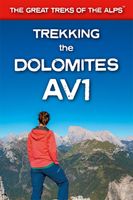
Wandelgids Trekking the Dolomites Av1 | Knife Edge Outdoor
Superhandige wandelgids voor de Alta Via 1 in de Dolomieten. Met deze gids heb je verder niks nodig: alle benodigde Tabacco wandelkaarten zitten in deze gids! The only guidebook exclusively for the AV1.Everything you need to know to plan and walk Italy's most popular long distance route.Real maps inside (Tabacco 1:25,000): the finest maps available for the Dolomites. This makes navigation easy and there is no need to carry additional maps. Also includes:* Numbered waypoints linking maps to text* Unique Itinerary Planner: plan a bespoke itinerary to match your ability and vacation schedule. All difficult calculations of time, distance and altitude gain are done for you* 7 Proposed Itineraries of between 6 and 11 days* Everything the trekker needs to know to plan the route: route descriptions, costs, budget, difficulty, weather, how to get there, and more* Full accommodation listings: spectacularly situated mountain huts* Section on Camping* Exciting variants to the main route* Informati…
19,95
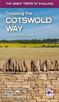
Wandelgids Trekking the Cotswold Way | Knife Edge Outdoor
The definitive two-way guide to the Cotswold Way: both southbound and northbound routes are described in full. Real Maps: Full Ordnance Survey mapping inside (1:25,000). All accommodation is numbered and marked on the maps. 18 different itineraries: schedules of 4, 5, 6, 7, 8, 9, 10, 11 and 12 days for hikers and runners. Includes both southbound and northbound itineraries. Difficult calculations of time, distance and altitude gain/loss are done for you. Also includes: - Detailed information on equipment and travelling light - Everything the trekker needs to know: route, costs, difficulty, weather, travel, and more - Full accommodation listings: the best inns, B&Bs and hotels - Detailed section on camping - What to see in the City of Bath - Essential info for both self-guided and guided trekkers - Information on history, plants and wildlife - Numbered waypoints linking the Real Maps to our clear descriptions The Cotswold Way travels 102 miles through the sublime scenery of the Cotsw…
22,50
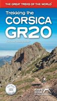
Wandelgids Trekking the Corsica GR20 | Knife Edge Outdoor
The definitive guidebook to the Corsica GR20, one of the world''s great treks. . The only two-way guidebook to the GR20: both northbound and southbound routes are described in full. . Real IGN Maps included (1:25,000): no need to carry separate maps. . 15 different itineraries: schedules of 9, 10, 11, 12, 13, 14, 15 and 16 days. Includes both northbound and southbound itineraries. Difficult calculations of time, distance and altitude gain are done for you. Also includes: . Detailed information on equipment and travelling light . Detailed information on getting to/from all trail-heads . Everything the trekker needs to know: route, costs, difficulty, weather, travel, and more . Full accommodation listings: spectacularly situated mountain huts and campsites . Information for both self-guided and guided trekkers . Numbered waypoints linking the Real Maps to our clear descriptions . Information on Wildlife and Plants
19,50
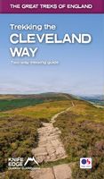
Wandelgids Trekking the Cleveland Way | Knife Edge Outdoor
The definitive two-way guide to the Cleveland Way, one of England's epic National Trails: both eastbound and westbound routes are described in full.   Real Maps: Full Ordnance Survey mapping inside (1:25,000). All accommodation is numbered and marked on the maps. 20 different itineraries: schedules of 5, 6, 7, 8, 9, 10 and 11 days for hikers and runners. Includes both eastbound and westbound itineraries. Difficult calculations of time, distance and altitude gain/loss are done for you.   Also includes: - Detailed information on equipment and travelling light - Full accommodation listings: the best pubs, B&Bs and hotels - Detailed section on camping, including wild camping - Everything the trekker needs to know: route, costs, difficulty, weather, travel, and more - Essential info for both self-guided and guided trekkers - Information on plants and wildlife - Numbered waypoints linking the Real Maps to our clear descriptions   Yorkshire's Cleveland Way is one of the most beautiful long-di…
23,95
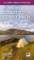
Wandelgids Trekking the Coast to Coast Path | Knife Edge Outdoor
The definitive two-way guide to the Coast to Coast Path: both eastbound and westbound routes are described in full. Real Maps: Full Ordnance Survey mapping inside (1:25,000). All accommodation is numbered and marked on the maps. 19 different itineraries: schedules of 11, 12, 13, 14, 15, 16, 17, 18 and 19 days for hikers and runners. Includes both eastbound and westbound itineraries. Difficult calculations of time, distance and altitude gain/loss are done for you. Also includes: - Detailed information on equipment and traveling light - Full accommodation listings: the best pubs, B&B's and hotels - Detailed section on camping, including wild camping - Everything the trekker needs to know: route, costs, difficulty, weather, travel, and more - Essential info for both self-guided and guided trekkers - Information on plants and wildlife - Numbered way points linking the Real Maps to our clear descriptions The Coast to Coast Path is the most popular and aspirational long-distance walking r…
21,95
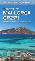
Wandelgids Trekking the Mallorca GR221 | Knife Edge Outdoor
Goede wandelgids met duidelijke routekaarten en praktische informatie.   The definitive two-way guide to the Mallorca GR221 (the Drystone Way): both northbound and southbound routes are described in full.   The GR221 is one of Europe’s most beautiful and aspirational treks in Europe. It travels the length of Mallorca’s rugged mountain range, the Serra de Tramuntana. Along the way, you find a textbook Mediterranean landscape of azure waters, sandy beaches, rocky coves, all overlooked by rugged limestone peaks. As you pass the numerous drystone structures on the trail, you will learn plenty of the island’s fascinating history and you will spend the night in some of its finest villages. This is Spain at its best and it will be an adventure that you will never forget.   Real Maps: Full mapping inside (1:25,000) by Editorial Alpina. All accommodation is numbered and marked on the maps.   12 different itineraries: schedules of 7, 8, 9, 10 and 11 days for hikers and runners. Includes both nor…
21,95
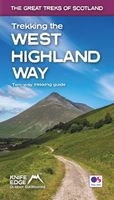
Wandelgids Trekking the West Highland Way: Two-Way Trekking Guide | Knife Edge Outdoor
The definitive two-way guide to the West Highland Way: both northbound and southbound routes are described in full. Real Maps: Full Ordnance Survey Explorer mapping inside (1:25,000). All accommodation is numbered and marked on the maps. 17 different itineraries: schedules of 3, 4, 5, 6, 7, 8, 9, 10 and 11 days for hikers and runners. Includes both southbound and northbound itineraries. Difficult calculations of time, distance and altitude gain are done for you. Also includes: - Detailed information on equipment and travelling light - Everything the trekker needs to know: route, costs, difficulty, weather, travel, and more - Full accommodation listings: the best inns, B&Bs and hotels - Detailed section on camping - Essential info for both self-guided and guided trekkers - Information on geology, history, plants and wildlife - Numbered waypoints linking the Real Maps to our clear descriptions The West Highland Way, which is one of 'Scotland's Great Trails', travels 96 miles through …
19,50
Wandelgids Tour du Mont Blanc | Vertebrate Publishing
Tour du Mont Blanc is the definitive guidebook for one of the most famous long-distance treks in the world. This trek circles the entire Mont Blanc massif, passing through spectacular scenery in France, Italy and Switzerland. You’ll traverse high mountain passes, see stunning glaciers, pass azure lakes, wander through tranquil green valleys and alpine pastures, with snow-capped peaks visible above.   Written by Tour du Mont Blanc expert Kingsley Jones, this guidebook includes unique customised timings to enable accurate itinerary planning for walkers, trekkers, fastpackers and trail runners, allowing you to plan your Tour du Mont Blanc at a pace to suit you.   You’ll find everything that you need to plan and undertake your Tour du Mont Blanc, including travel information, navigation, accommodation options, equipment and safety, food and drink, as well as useful extra information such as wild swimming locations and trekking tips.   Together with amazing photography, the route includes c…
24,95
Wandelatlas Tour du Mont Blanc | Cicerone
A booklet of all the mapping needed to complete the Tour du Mont Blanc (TMB), a spectacular circuit around Mont Blanc, Western Europe's highest mountain. Covering 170km (105 miles), the TMB takes around 11 days to walk from its official start at Les Houches (France), passing through Courmayeur (Italy) and Champex (Switzerland) before returning to France via the Chamonix valley. A well-serviced introduction to high-level mountain trekking for walkers with good levels of fitness, it can also be run, fastpacked or hiked in 5–9 days.   The full route line is shown on 1:25,000 IGN maps The map booklet can be used to walk the TMB in either direction Handy facilities planner, route summary tables and accommodation listings help you plan your itinerary Includes urban maps of Les Houches, Les Contamines, Courmayeur, Champex and Chamonix Alternative stages via Col de Tricot (Stage 1A) and Fenêtre d'Arpette (Stage 8A) are also provided An accompanying Cicerone guidebook – Trekking the Tour du Mon…
21,95

Klanten-reviews van Wandelgids Tour Du Mont Blanc | Knife Edge Outdoor

Er zijn nog geen beoordelingen voor dit productBen jij de eerste die een review plaatst?

Meer over Wandelgids Tour Du Mont Blanc | Knife Edge Outdoor

Productomschrijving

Overzichtelijke routegids van deze prachtige wandelroute. Per etappe vind je een hoogteprofiel, goede beschrijvingen van de wandelroute, een topografische kaart op gedetailleerde schaal. Voor en achterin de gids staat aanvullende praktische informatie zoals adressen van campings, andere accommodaties en bijvoorbeeld een paar pagina's over de flora en fauna.    Complete guidebook for planning and trekking the Tour du Mont Blanc, the world's most famous trek   Real maps for each stage: 1:25,000. No need to buy a separate map!   Unique Itinerary Planner: plan a bespoke itinerary to match your ability and vacation schedule. All difficult calculations of time, distance and altitude gain are done for you   Everything the trekker needs to know: route descriptions, costs, budget, difficulty, weather, how to get there, and more   Full accommodation listings: spectacularly situated mountain huts, villages and hamlets   Full section on camping: a complete list of camping locations   10 exciting variants to the main route!   Information for both self-guided and guided trekkers
Webshop.nl maakt gebruik van cookies. Ga je verder op onze website, ga dan akkoord met het plaatsen van cookies en de verwerking van deze data door ons en vermelde partners.