webshop.nl
Categorieën
  Sluiten

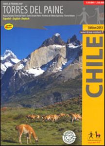
Wandelkaart Torres del Paine | Viachile Editores

Topografische wandelkaart met hoogtelijnen en toeristische informatie van het nationaal park Torres del Paine (Patagonie) in het zuiden van Chili. The most complete map to explore the world famous Torres del Paine National Park, in the Chilean Patagonia. With pictures of the most beautiful attractions and drawings of the local fauna. Information in...
18,95

Webshops met dit product

Webshop
Bezorging
Prijs

Anderen bekeken ook

Wandelgids Trekking Torres del Paine - Chili | Cicerone
Guidebook to trekking in the heart of Patagonia, with routes in Torres del Paine National Park (Chile) and Los Glaciares National Park (Argentina). While the region is primarily a remote and mountainous glaciated wilderness, walking is easily accessible with clear trails, good public transport and regular mountain huts and campsites. The centrepiece of this dramatic area is the 10-11 day Torres del Paine Circuit (also known as the 'O' Circuit), while the shorter Half Circuit (the 'W') visits much of the same sights in 4-5 days.   The guidebook also includes four shorter day walks, a multi-day trek in Argentina's Los Glaciares national park, and several excursions from Puerto Natales and El Calafate. This guidebook includes advice on getting to and around the regions, languages, visa, currency, accommodation and facilities in the National Parks, as well as useful guidance on what to take and expect on the treks. Also featured is background information on the geology, history, wildlife, …
26,50
Wandelkaart 01 Jasper National Park & Maligne Lake | Gem Trek Maps
Scheur- en Watervast papier Gem Trek’s JASPER AND MALIGNE LAKE MAP map is designed for outdoor enthusiasts looking to explore the section of Jasper National Park near the town and out to Maligne Lake. Whether you are touring along the roads or heading into the backcountry, you’ll find the waterproof and tear-resistant Jasper & Maligne Lake Map to be an invaluable tool.   This map features detailed cartography, accurate hiking trails with distances, and details such as campgrounds, equestrian routes, picnic areas, and fire lookouts. On the back of the map are trail descriptions and photos of 18 recommended day hikes, four overnight or multi-day trips, and six classic mountain bike rides. Each of these described trails is referenced and colour-coded to the map on the front. Also on the back is contact information for Jasper National Park, as well for as the three backcountry lodges located in the Tonquin Valley and on the Skyline Trail.   Jasper & Maligne Lake Map Coverage The Jasp…
16,95
Wandelkaart Banff - Egypt Lake | Gem Trek Maps
Mooie, gedetailleerde kaart uit de serie van Gem Trek Hiking map-guides. Helder kleurgebruik en met de beste / mooiste wandelroutes, hikes en interessante plaatsen erop aangegeven. Gem Trek’s 1:50,000-scale BANFF–EGYPT LAKE MAP covers the most popular hiking trails in the immediate area of the town of Banff in more detail than our Banff & Mount Assiniboine Map.   The Banff–Egypt Lake Map features detailed cartography, accurate hiking trails with distances, and details such as side trips and backcountry campgrounds. For road travellers, it includes viewpoints, picnic areas, and campgrounds.   On the back of the map are trail descriptions of 17 recommended day hikes and four classic multi-day trips, all referenced to the map on the front. Also on the back is a list of trails recommended for early season, birdwatching, wildflowers, waterfalls, expansive views, awe-inspiring scenery, alpine meadows and rainy days. Included are contact numbers for visitor centres and backcountry bookin…
17,95
Wandelkaart 02 Columbia Icefield | Gem Trek Maps
Waterproof and tear-resistant hiking and recreation map for the Columbia Icefield region of the Canadian Rockies.   Updated with the latest satellite imagery of the icefield extent, Gem Trek's Columbia Icefield Map is designed for visitors looking to explore North America s largest icefield south of Alaska. Located beside the Icefields Parkway in Jasper National Park, the icefield is both spectacular and accessible. Whether you are touring along the parkway and taking an Ice Explorer out onto the Athabasca Glacier or heading off to explore the surrounding wilderness on foot, you'll find the waterproof and tear-resistant Columbia Icefield an invaluable tool for making the most of your visit.   The Columbia Icefield Map features detailed cartography, accurate hiking trails with distances, and details such as glacier flow direction and drainage routes. Campgrounds and highway viewpoints are also marked.   In addition to the map, this product is a user-friendly guide to the Columbia Icefie…
14,95
Wandelkaart Torres del Paine - Chili | Compass Chile
Goede kaart van Torres del Paine nationaal park in het zuiden van Chili. Geeft een goed overizcht van trekkings en wandelroutes.   Dubbelzijdige kaart Reliëf weergegeven door satellietbeelden en contourlijnen - intervallen van 50 meter Wandelroutes met afstanden en tijden Toevluchtsoorden, bivakken, restaurants en veerdiensten Op de voorkant een mini-verklarende gids over de belangrijkste bezienswaardigheden van het klimaat, de flora en fauna van het park en de kaart van Puerto Natales Engels/Spaanse legende GPS-compatibel
14,95
Wandelkaart 04 Lake Louise & Yoho | Gem Trek Maps
Gedetailleerde kaart van dit prachtige gebied; deze kaart is geplastificeerd, scheur- en watervast. Gem Trek’s LAKE LOUISE & YOHO MAP is designed for visitors looking to explore one of North America’s premier day hiking destinations. Whether you are new to hiking or experienced in backcountry travel, you’ll find the waterproof and tear-resistant Lake Louise & Yoho Map to be an invaluable tool.   This map features detailed cartography, accurate hiking trails with distances, and details such as campgrounds, lodges, huts, teahouses, and picnic areas. On the reverse side of  the map are photos and trail descriptions of 11 recommended day hikes covered on the main map, ranging from easy lakeshore walks to more demanding hikes into alpine country. Four overnight or multi-day trips are also featured, along with contact information for two backcountry lodges, Skoki Lodge and Twin Falls Chalet.   Lake Louise & Yoho Map Coverage The Lake Louise & Yoho Map centres on Lake Louise, but also …
17,95
Wandelkaart Wanderkarte Schweiz - Zwitserland overzichtskaart | Kümmerly & Frey
Vanwege de schaal vooral geschikt als overzichtskaart. Hiking map with the official routes "Hiking in Switzerland" with hiking times and distances. More than 750 additional hiking routes. With index and a regional approach map. Water- and rip-proof map. Switzerland’s national and regional long-distance hiking paths on a waterproof and tear-resistant indexed map at 1:301,000 from Kümmerly + Frey, with numerous local trails, plus a list of all the long-distance routes. The departure and arrival points of each long-distance route are clearly marked, and each route is divided into stages by highlighting intermediate locations, with the distances and hiking times in both directions indicated for the individual sections. Symbols show mountain huts, campsites, youth hostels, Friends of Nature Houses and selected local hotels. On the reverse an extensive index includes lists of geographical features (peaks, passes, rivers, etc), huts, places of interest, etc. Also provided is a list of the six…
16,95
Wandelkaart 03 Bow Lake and Saskatchewan Crossing | Gem Trek Maps
This map covers the trails departing from the southern section of the Icefields Parkway from Rampart Creek south to Hector Lake. A 1:100 000-scale inset map on the back of the map increases coverage to the adjoining Mosquito Creek/Fish Lakes area.   The area covered on this map is prime hiking terrain with scenery as superb as the rest of Banff National Park, but with the trails less busy than those in the Banff townsite and Lake Louise areas. Besides spotting marmots in the boulders near Helen Lake, you also have an excellent chance of seeing moose.   On the back of the map are trail descriptions and photos of 16 recommended day hikes, ranging from short and easy to long and strenuous, as well as descriptions of five overnight trips. Classic trails covered include Bow Glacier Falls, Helen Lake, Bow Summit Lookout, Sunset Pass, and Cirque, Chephren and and Glacier Lake trails. All trails are referenced to the front. Contact numbers for parks and info on lodges, campgrounds and hostels …
16,95
Wegenkaart - landkaart - Wandelkaart Jasper National Park (Alberta) | Gem Trek Maps
Waterproof and tear-resistant map for Jasper National Park in the Canadian Rockies.   Whether you are a first-time visitor or a long-time local, you’ll find Gem Trek’s Jasper National Park Map to be an invaluable tool. Researched and designed by locals, and printed in Canada, this map features accurate cartography and subtly colored relief that puts the mountainous region in perspective. The map is printed on high-quality synthetic waterproof paper that can be folded and refolded hundreds of times.   The 1:250,000 scale is ideal for discovering the very best of Jasper National Park. Highlights and our recommended hiking trails are marked by numbered stars, then cross-referenced on the reverse side with descriptions. Also included are all mountains and their elevations, along with natural features such as waterfalls, hot springs, and glaciers.   In addition to descriptions for the top highlights and most popular hiking trails, the reverse side has inset maps for the town of Jasper…
16,95
Wegenkaart - landkaart The Andes | ITMB
Een degelijke wegenkaart van de hele Andes met aanduidingen van o.a. nationale parken, vliegveld, Als overzichtskaart goed te gebruiken. We are pleased to be able to re-introduce this important title into our publishing range after a lapse caused by Covid. The Andes mountain chain is the southern extension of the Sierra Nevada chain through Mexico and Central America, which is, in turn the southern extension of the Rocky Mountain chain from Alaska to the Mexican border. The Andes is a magnificent series of high mountains that enters Colombia and spreads southwards through Ecuador and Peru all the way to southern Patagonia. The map is double-sided, with the Northern Andes on one side and the other side divided into two side-by-side maps portraying the Central Andes and the Southern Andes. Thus, the map coverage focuses on the Andes themselves, rather than on all of South America. All of Colombia and Peru are shown, most of Bolivia, all of Chile, and the Patagonian portion of Argentina e…
13,95

Klanten-reviews van Wandelkaart Torres del Paine | Viachile Editores

Er zijn nog geen beoordelingen voor dit productBen jij de eerste die een review plaatst?

Meer over Wandelkaart Torres del Paine | Viachile Editores

Productomschrijving

Topografische wandelkaart met hoogtelijnen en toeristische informatie van het nationaal park Torres del Paine (Patagonie) in het zuiden van Chili. The most complete map to explore the world famous Torres del Paine National Park, in the Chilean Patagonia. With pictures of the most beautiful attractions and drawings of the local fauna. Information in three languages (English-German-Spanish). Map 1:100,000: Covers the whole National Park, with hiking routes (distances in km), lodgings, campings, boat connections etc. Map 1:50,000: The Paine massif in the center of the park, with Paine Circuit, W hike, hiking trails (distances in km), huts, hotels, campings etc. Map 1:500.000: Overview map of the Ultima Esperanza county between Puerto Natales and the Torres del Paine National Park City map Puerto Natales: With hotels, restaurants, bus terminals, supermarkets etc.
Webshop.nl maakt gebruik van cookies. Ga je verder op onze website, ga dan akkoord met het plaatsen van cookies en de verwerking van deze data door ons en vermelde partners.