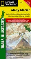
Wandelkaart - Topografische kaart 314 Many Glacier - Glacier and Waterton Lakes National Parks | National Geographic

0
Prachtige geplastificeerde kaart van het bekende nationaal park. Met alle recreatieve voorzieningen als campsites, maar ook met topografische details en wandelroutes ed. Door uitgekiend kleurgebruik zeer prettig in gebruik. Scheur en watervast!   Located just north of Kalispell in Montana's northwest corner, Glacier National contains an abundance ...

Verkopers met dit product

Verkoper
Bezorging
Prijs
DeZwerver.nl logo
DeZwerver.nl
2,95
14,95

Anderen bekeken ook

Wandelkaart - Topografische kaart 314 Many Glacier - Glacier and Waterton Lakes National Parks | National Geographic
Prachtige geplastificeerde kaart van het bekende nationaal park. Met alle recreatieve voorzieningen als campsites, maar ook met topografische details en wandelroutes ed. Door uitgekiend kleurgebruik zeer prettig in gebruik. Scheur en watervast!   Located just north of Kalispell in Montana's northwest corner, Glacier National contains an abundance of recreational opportunities for outdoor enthusiasts of all interests.   This detailed topographic recreation map contains carefully researched trails, campsites, forest service roads, and points-of-interests, for the Many Glacier section of the park. Two additional maps for the North Fork and the Two Medicine regions of the park along with a comprehensive Glacier National Park Trails Illustrated map are also available. An enhanced scale of 1:50,000, useful UTM and Latitude/Longitude grids, mileage charts, and other navigation features make the North Fork sectional the best map available for the western side of the park.   The North Side of …
14,95
Wandelkaart - Topografische kaart 215 Glacier - Waterton Lakes National Park | National Geographic
Prachtige geplastificeerde kaart van het bekende nationaal park. Met alle recreatieve voorzieningen als campsites, maar ook met topografische details en wandelroutes ed. Door uitgekiend kleurgebruik zeer prettig in gebruik. Scheur en watervast! Waterton Lakes National Park, Canada includes Waterton Park, Upper and Middle Waterton Lakes, The Border Ranges, Akamina Kishinena Provincial Park, Blood Timber Reserve, and more. Glacier National Park, Montana includes the entire national park area, with detailed trails, and topographic information. Includes the Lewis and Clark Range, Many Glacier, Lake McDonald, Great Bear Wilderness, Flathead National Forest, Columbia Falls, Horse Reservoir, St. Mary Lake, and much more. Includes UTM grids for use with your GPS unit.
16,95
Wandelkaart - Topografische kaart 255 Glacier Bay National Park & Preserve | National Geographic
Prachtige geplastificeerde kaart van het nationaal park. Met alle recreatieve voorzieningen als campsites, maar ook met topografische details en wandelroutes ed. Door uitgekiend kleurgebruik zeer prettig in gebruik. Scheur en watervast! This Trails Illustrated map for Glacier Bay National Park, Glacier Bay National Preserve, and surrounding area and surrounding area in Alaska's panhandle is perfect for hiking, camping, boating, paddling, and wildlife viewing in this scenic, rugged frontier.   This two-sided map includes Glacier Bay National Park, Glacier Bay National Preserve, Glacier Bay Wilderness, portions of Tongass National Forest, Chicagof Island, Endicott River Wilderness, Haines State Forest and Resource Management Area, Chilkat State Park, Chilkat Islands, Sullivan Island State Marine Park, Pleasant Island, Lemesurier Island, Inian Islands, and Tatshenshini Alsek Park. Waterways include the Gulf of Alaska, Glacier Bay, Cross Sound, Icy Strait, Lynn Canal, Geikie Inlet, Muir I…
16,95
Wandelkaart 223 North Cascades National Park | National Geographic
Prachtige geplastificeerde kaart van het bekende nationaal park. Met alle recreatieve voorzieningen als campsites, maar ook met topografische details en wandelroutes ed. Door uitgekiend kleurgebruik zeer prettig in gebruik. Scheur en watervast!   Explore the alpine forests, wild rivers, jagged peaks, and abundant glaciers of North Cascades National Park with National Geographic’s Trails Illustrated map. Expertly researched and created in partnership with local land management agencies, this map features key points of interest including Baker Lake; Rockport State Park; Chelan and Ross Lake National Recreation Areas; Stephen Mather, Mount Baker, and Pasayten Wilderness Areas; Snoqualmie and Okanogan Wenatchee National Forests; and portions of the Sauk, Skagit, and Suiattle rivers.   With miles of clearly marked trails including the popular Pacific Crest and Pacific Northwest trails, this map can guide you off the beaten path and back again. Mileages between intersections are shown and t…
16,95
Reisgids Banff, Jasper and Glacier National Park | Lonely Planet
Uitgebreide beschrijving van alle recreatieve mogelijkheden van deze nationale parken. De perfecte reisgids voor zowel de georganiseerde als de zelfstandige reiziger. Naast een algemene inleiding van het land / streek vol met praktische informatie over hoe je er het beste kunt reizen: slapen, eten, vervoer, excursies ... alles kun je er in vinden. Engelstalig. Lonely Planet Lonely Planet's Banff, Jasper and Glacier National Parks is your passport to the most relevant, up-to-date advice on what to see and skip. Hike the Skyline Trail, watch for bears, and ride the rapids; all with your trusted travel companion. Get to the heart of Banff, Jasper and Glacier National Parks and begin your journey now!   Inside the Lonely Planet's Banff, Jasper and Glacier National Parks Travel Guide:   User-friendly highlights and itineraries help you tailor your trip to your personal needs and interests   Insider tips to save time and money and get around like a local, avoiding crowds and troubl…
23,95
Reisgids - Wandelgids Glacier National Park | Moon Travel Guides
Through lush green parkland and up to the top of jagged summits, forge your own path with Moon Glacier National Park. Flexible Itineraries: Unique and adventure-packed ideas for day trips, a week on the road, families with kids, wildlife enthusiasts, and more The Best Hikes in Glacier: Individual trail maps, mileage and elevation gains, and backpacking options Experience the Outdoors: Trek through fields of alpine wildflowers and walk beneath waterfalls. Go whitewater rafting, cast a line into the Flathead River for wild trout, or hop on a guided horseback ride. Drive or bike the Going-to-Sun Road, take in views of snowy peaks and glaciers, and spot wild moose or grizzlies roaming the mountainside How to Get There: Up-to-date information on gateway towns, park entrances, park fees, and tours Where to Stay: Spend a night in a historic lakeside lodge, or sleep under the stars with campgrounds, resorts, and more both inside and outside the park Planning Tips: When to go, what to pa…
23,95
Wandelkaart 16 Waterton Lakes NP | Gem Trek Maps
The Waterton Lakes National Park map is one of our most popular trail map-guides for the Canadian Rockies. This map covers all of Waterton Lakes National Park, the eastern end of Akamina-Kishinena Provincial Park, and the Goat Haunt or northern area of Glacier National Park, Montana, at the south end of Upper Waterton Lake. The front of the map covers all of the hiking and biking trails departing from Waterton townsite, Red Rock Parkway, Akamina Parkway, and the Goat Haunt region of Glacier National Park. Popular trails covered include Carthew-Alderson, Crypt Lake, Goat Lake, Twin Lakes, Forum and Wall lakes, and the Tamarack Trail. Also on the front is an inset map (1:35,000) of Waterton townsite, with accommodation and services marked for your convenience. On the back of the map are trail descriptions of more than 20 of the best day hikes in the area, ranging from short interpretive walks to strenuous hikes up to alpine meadows. There are also trail descriptions of four classic bike…
17,95
Wandelkaart - Topografische kaart 201 Trails Illustrated Yellowstone National Park | National Geographic
Prachtige geplastificeerde kaart van het bekende nationaal park. Met alle recreatieve voorzieningen als campsites, maar ook met topografische details en wandelroutes ed. Door uitgekiend kleurgebruik zeer prettig in gebruik. Scheur en watervast! National Geographic's Trails Illustrated map of Yellowstone National Park is designed to meet the needs of outdoor enthusiasts by combining valuable information with unmatched detail of America's first national park. Expertly researched and created in partnership with local land management agencies, this map features key points of interest including Mammoth Hot Springs, Canyon Village, Yellowstone Lake, Yellowstone Falls, Grant Village, and Old Faithful geyser area.   With over 1,000 miles of mapped trails, the Yellowstone National Park map can guide you off the beaten path and back again. The clearly marked trails include mileages between intersections. Trail summaries provide elevation, duration, and difficulty for a variety of suggested hike…
16,95
Reisgids Road Trip USA Yellowstone to Glacier National Park | Moon Travel Guides
From stunning waterfalls, glaciers, and geysers to wide open spaces, answer the call of the wild with Moon Yellowstone to Glacier National Park Road Trip. Inside you'll find: Flexible itineraries: Drive the entire two-week route or explore the region on shorter trips to Glacier, Yellowstone, or Grand Teton Eat, sleep, stop and explore: With lists of the best hikes, views, places for wildlife-watching, and more, you can watch Old Faithful from Observation Point, drive the 50-mile Going-to-the-Sun Road, spot everything from bighorn sheep to bears on a wildlife tour of Yellowstone's Lamar and Hayden valleys, and kick back with a craft beer in Bozeman Outdoor adventures: Hike the trails in Glacier or ski in Whitefish. Admire the reflection of the Grand Tetons as you kayak Jenny Lake or set up camp and stargaze late into the night The best hikes: Detailed descriptions, trail maps, mileage and elevation gains, and backpacking options Maps and driving tools: Easy-to-use maps keep you or…
23,95
Wandelkaart - Topografische kaart 243 Everglades National Park | National Geographic
Prachtige geplastificeerde kaart van het nationaal park. Met alle recreatieve voorzieningen als campsites, maar ook met topografische details en wandelroutes ed. Door uitgekiend kleurgebruik zeer prettig in gebruik. Scheur en watervast! This Trails Illustrated topographic map for Everglades National Park and surrounding area is the perfect map for hiking, boating, paddling, biking, fishing, exploring, camping, and sightseeing in this unique national treasure.   This two-sided map includes the Key Largo, Everglades City, Chokoloskee, Everglades National Park, portions of Big Cypress National Preserve, Fakahatchee Strand State Preserve, Cape Romano Ten Thousand Islands Aquatic Preserve, Shark Valley Tram Road, Old Ingraham highway and campsite, North Nest Key, West Lake Canoe Trail, Snake Bight Trail, backcountry campsites, beach sites, ground sites, and chickees, and detailed insets of Flamingo, Whitewater Bay, Pineland Trails of the Long Pine Key area, and Nine Mile Pond. The map also…
16,95

Klanten-reviews van Wandelkaart - Topografische kaart 314 Many Glacier - Glacier and Waterton Lakes National Parks | National Geographic

Er zijn nog geen beoordelingen voor dit productBen jij de eerste die een review plaatst?

Meer over Wandelkaart - Topografische kaart 314 Many Glacier - Glacier and Waterton Lakes National Parks | National Geographic

Productomschrijving

Prachtige geplastificeerde kaart van het bekende nationaal park. Met alle recreatieve voorzieningen als campsites, maar ook met topografische details en wandelroutes ed. Door uitgekiend kleurgebruik zeer prettig in gebruik. Scheur en watervast!   Located just north of Kalispell in Montana's northwest corner, Glacier National contains an abundance of recreational opportunities for outdoor enthusiasts of all interests.   This detailed topographic recreation map contains carefully researched trails, campsites, forest service roads, and points-of-interests, for the Many Glacier section of the park. Two additional maps for the North Fork and the Two Medicine regions of the park along with a comprehensive Glacier National Park Trails Illustrated map are also available. An enhanced scale of 1:50,000, useful UTM and Latitude/Longitude grids, mileage charts, and other navigation features make the North Fork sectional the best map available for the western side of the park.   The North Side of the Map Includes: Waterton Lakes National Park, Lower, Middle, and Upper Waterton Lakes, Blakiston Falls, Prince of Wales Hotel, Upper Kintla Lake, Continental Divide Trail, Goat Haunt, Pacific Northwest Trail, and more..   The South Side of the Map Includes: Cosley Lake, Glenns Lake, Ipasha Glacier, Chaney Glacier, Lake Josephine, Lake Sherburne, St Mary Lake, Many Glacier Hotel, Swiftcurrent Pass, Continental Divide Trail, Pacific Northwest Trail, and more...   Like all Trails Illustrated Maps, the Glacier Sectionals are printed on a highly durable waterproof, tear-resistant material designed to stand up to elements.

Productinformatie

    Verken gerelateerde categorieën

    Webshop.nl maakt gebruik van cookies. Ga je verder op onze website, ga dan akkoord met het plaatsen van cookies en de verwerking van deze data door ons en vermelde partners.