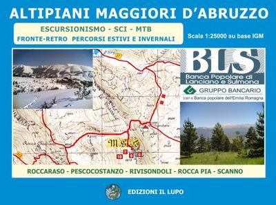
Wandelkaart - Topografische kaart 10 Abruzzen - Altipiani maggiori d`Abruzzo | Edizione il Lupo

0
Topografische kaart schaal 1:25.000 met opdruk van wandelroutes, skiroutes en mountainbike routes, gebied omvat Roccaraso, Pescocostanzo, Rivisondoli, Rocca Pia-Scanno  Tweezijdige kaart van het gebied net ten oosten van het Nationale park Abruzzen - Parco National d'Abruzzo.  ...

Verkopers met dit product

Verkoper
Bezorging
Prijs
DeZwerver.nl logo
DeZwerver.nl
2,95
14,25

Anderen bekeken ook

Wandelkaart - Topografische kaart 147 OS Explorer Map Sevenoaks and Tonbridge | Ordnance Survey
Met zijn 4cm voor 1 km (2 ½ cm voor 1 mijl) schaal, is de OS Explorer kaartenserie de ideale en meest gedetailleerde kaartenreeks voor mensen die graag outdoor-activiteiten zoals fietsen, wandelen, paardrijden, klimmen en watersporten. Deze kaart is nog gedetailleerder dan de 'gewone' Landranger maps. Voor- en achterzijde bedrukt! Zeker op de moors en andere natuurgebieden van onschatbare waarden met echt alle aspecten van het landschap op de kaart ingetekend. Zeer goede detailkaart met topografische ondergrond. Hierop zijn toeristische symbolen van bezienswaardigheden ingetekend, daarnaast staan bijvoorbeeld campings en jeugdherbergen vermeld en - voor wandelaars het belangrijkst - alle right of way paden en Lange afstands Wandelpaden zijn er op te vinden. De ideale kaart voor het wandelen in Engeland, Wales of Schotland.   These highly detailed maps show all the administrative boundaries, settlements as small as isolated farms, the road network down to unfenced roads and country tra…
19,50
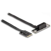
Delock 64217 M.2 Key A+E naar PCIe x1 NVMe Adapter haaks met 20cm kabel
BeschrijvingDeze adapter van Delock kan worden gebruikt om een PCI Express-kaart op een M.2-slot aan te sluiten. De flexibele kabel maakt een ruimtebesparende installatie in de computerkast mogelijk. De extra voedingsconnector kan de PCIe-kaart indien nodig van 12 V-spanning voorzien.Technische detailsConnectoren:1 x M.2 sleutel A+E mannetje1 x PCI Express x1, V4.0 vrouwelijk1 x 4-pins voedingsconnectorInterface: PCIe / NVMe (1 baan)Vormfactor: M.2 2230Kabeldikte: 30 AWGOpstartbaar, ex UEFI versie 2.3.1Ondersteunt NVM Express (NVMe)Lengte zonder connectoren: ca. 20 cm Systeem vereistenEen vrije M.2-poort met sleutel A of sleutel E PakketinhoudAdapterSchroevendraaierBevestigingsmateriaalVoedingskabel 4-pins naar SATA, lengte ca. 15 cmHandleiding PakketDoos- EAN: 4043619642175 - Vendorcode: 64217
49,95
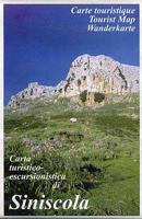
Wandelkaart A06 Siniscola | Abies
Siniscola area at 1:25,000 in a series of contoured maps from Ed. Abies. Overprint highlights campsites and agriturismo accommodation, climbing sites, wild sheep and bird watching sites and archaeological remains. This title has no UTM grid. Main series at 1:60,000 (Nos. 1 to 12) The maps have contours at 100m intervals and colouring for woodlands and maquis shrubland. Local trails are highlighted, with additional overprint for selected hiking, mountain bike and kayaking routes listed on the reverse of the maps with brief notes and grading for the degree of difficulty. All the maps have a UTM grid for GPS users. Very extensive range of symbols highlight numerous places of interest and tourist facilities, including campsites and caravan parks, beaches, sport and recreational sites, archaeological remains and nuraghi, etc. The maps also indicate places where typical local products can be purchased. On the reverse each title has descriptions of its main places of interest, beaches, etc…
12,95
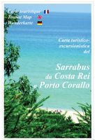
Wandelkaart A15 Sarrabus da Costa Rei a Porto Corallo | Abies
Sarrabus is a territory that is not known by everybody yet. Here lies its charm and this has made possible to keep this environmental area out of big building speculations and also out of history. In fact it preserves little traces of the past, and paradoxically the remains from the prehistoric age are more meaningful than those back to more recent times. We can find traces from the most remote past not far from the State Road SS125, that from Muravera goes to Costa Rei, by visiting the nuraghe Murtas, the nuraghe S’Aqua Secis and the megalithic complexes of Scalas and Cuili Piras. They are about ten menhirs, almost fully intact, arranged in groups and fixed in the ground in the original orthostatic position. They have been put in relation with the position of the sun and the moon, at dawn and at sunset. In fact they were used as a very precise astronomic calendar but also for religious purposes since they represented both the masculine divinity and the fertility according to the wors…
12,95
Wegenkaart - landkaart 131 Forêt Noire, Alsace, Vallée du Rhin | Michelin
Speciale toeristische kaart, gemaakt voor een goed bezocht gebied en uitvergroot. Daardoor zeer prettig leesbaar met een hoog nivo wat we van Michelin al veel langer gewend zijn. Alle wegen staan er op, met verschillende kleuren voor de aparte soorten wegen. Verder veel aandacht met symbolen voor de bezienswaardigheden in de regio, de bekende groene stroken naast de mooie wegen en ingetekende doorgaande wandelroutes als grande randonnees. Part of Michelin's Zoom series covering major towns and popular holiday areas throughout France, this map of the Black Forest, Alsace and the Rhine Valley covers both sides of the Rhine Valley, extending from northern Switzerland to Saarland and Heidelberg, with the Black Forest on the German side and the Vosges mountains in France. The map shows road detail from motorways to rough tracks and footpaths, with intermediate road distances shown on most roads, toll and toll-free sections of motorways are indicated and various road obstacles such as stee…
10,95
Wandelkaart - Wegenkaart - landkaart 9.3 Kefalonia - Ithaca | Anavasi
Kefalonia staat bekend om haar prachtige stranden. Het eiland heeft grote bergen en ongerepte gebieden die het een ideale bestemming maken voor wandeltochten. Alle afgebeelde paden zijn in de afgelopen twee jaar opgenomen. De kaart is dubbelzijdig met Kefalonia op een schaal van 1: 65.000 aan de ene kant en Ithaca op een schaal van 1: 25.000 aan de andere kant. De kaarten van Anavasi zijn zeer gedetailleerd, beschikken over een helder kaartbeeld en zijn uitstekende kaarten voor diverse activiteiten. Ze beschikken over vele interessante punten voor wandelaars, fietsers of andere toeristen die het gebied bezichtigen. De wandelkaarten bevatten ook een uitzonderlijke reliefaanwijzing, verschillende vormen van gewassen en andere topografische details. Inclusief hoogtelijnen, wandelpaden, toeristische informatie en UTM grid, de kaart is geschikt voor gebruik met GPS.
10,95
Wandelkaart 43 Iti | Road Editions
Mt Oiti/Iti at 1:50,000 in a series of contoured maps from Road Editions covering popular hiking areas of Greece. All the maps have altitude coloring and spot heights - contour interval varies, as indicated in the descriptions of individual titles. Local footpaths are marked and, for road users the maps show picturesque routes, intermediate driving distances on minor roads, and locations of petrol stations and tyre repairs workshops. Boundaries of national parks and administrative regions are marked, and symbols show campsites, hotels and mountain refuges, and various landmarks and places of interest, e.g. archaeological sites, churches, etc. All place names are in both Greek and Latin alphabet. All the titles have latitude and longitude margin ticks, many also show GPS waypoints. Some maps come with a booklet or notes on the reverse side giving further information about the area and/or descriptions of hiking routes. Map legends include English. In this title: Mount Oiti (Iti) and t…
9,95
Wandelkaart 37 Mount Agrafa | Road Editions
Mt Agrafa at 1:50,000 in a series of contoured maps from Road Editions covering popular hiking areas of Greece. All the maps have altitude coloring and spot heights - contour interval varies, as indicated in the descriptions of individual titles. Local footpaths are marked and, for road users the maps show picturesque routes, intermediate driving distances on minor roads, and locations of petrol stations and tyre repairs workshops. Boundaries of national parks and administrative regions are marked, and symbols show campsites, hotels and mountain refuges, and various landmarks and places of interest, e.g. archaeological sites, churches, etc. All place names are in both Greek and Latin alphabet. All the titles have latitude and longitude margin ticks, many also show GPS waypoints. Some maps come with a booklet or notes on the reverse side giving further information about the area and/or descriptions of hiking routes. Map legends include English. In this title: the Agrafa region, on th…
9,95
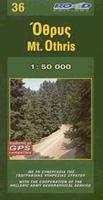
Wandelkaart 36 Mount Othris | Road Editions
Mt Othris at 1:50,000 in a series of contoured maps from Road Editions covering popular hiking areas of Greece. All the maps have altitude coloring and spot heights - contour interval varies, as indicated in the descriptions of individual titles. Local footpaths are marked and, for road users the maps show picturesque routes, intermediate driving distances on minor roads, and locations of petrol stations and tyre repairs workshops. Boundaries of national parks and administrative regions are marked, and symbols show campsites, hotels and mountain refuges, and various landmarks and places of interest, e.g. archaeological sites, churches, etc. All place names are in both Greek and Latin alphabet. All the titles have latitude and longitude margin ticks, many also show GPS waypoints. Some maps come with a booklet or notes on the reverse side giving further information about the area and/or descriptions of hiking routes. Map legends include English. In this title: the Othris region in cen…
9,95

Klanten-reviews van Wandelkaart - Topografische kaart 10 Abruzzen - Altipiani maggiori d`Abruzzo | Edizione il Lupo

Er zijn nog geen beoordelingen voor dit productBen jij de eerste die een review plaatst?

Meer over Wandelkaart - Topografische kaart 10 Abruzzen - Altipiani maggiori d`Abruzzo | Edizione il Lupo

Productomschrijving

Topografische kaart schaal 1:25.000 met opdruk van wandelroutes, skiroutes en mountainbike routes, gebied omvat Roccaraso, Pescocostanzo, Rivisondoli, Rocca Pia-Scanno 

Tweezijdige kaart van het gebied net ten oosten van het Nationale park Abruzzen - Parco National d'Abruzzo.


Productinformatie

    Verken gerelateerde categorieën

    Webshop.nl maakt gebruik van cookies. Ga je verder op onze website, ga dan akkoord met het plaatsen van cookies en de verwerking van deze data door ons en vermelde partners.