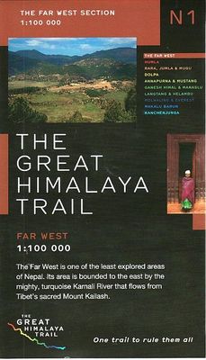
Wandelkaart The Great Himalaya Trail | GHT

0
  Prachtige kaartenserie van één van 'swerelds mooiste wandeltochten.   The Far West is one of the least explored areas of Nepal. Its area is bounded to the east by mighty, turquoise Karnali river which flows from Tibet’s sacred Mount Kailash.   Myth and superstition remain part of the fabric of life here. Though the Nepali language originated her...

Alle aanbiedingen van dit product

Verkoper
Bezorging
Prijs
DeZwerver.nl logo
DeZwerver.nl
2,95
26,95

Anderen bekeken ook

Wandelkaart The Great Himalaya Trail | GHT
  Prachtige kaartenserie van één van 'swerelds mooiste wandeltochten.   The Far West is one of the least explored areas of Nepal. Its area is bounded to the east by mighty, turquoise Karnali river which flows from Tibet’s sacred Mount Kailash.   Myth and superstition remain part of the fabric of life here. Though the Nepali language originated here, it seems a distant world from ‘modern’ Nepal. One Nepali visitor described his visit as “fascinating, like travelling back to the 18th century.”   Along the trails you may meet a turbaned Dhami, a shaman, with silver-bangled limbs and gold-ringed ears, who are still depended on for treating sickness.   Organised tourism has so far been limited to Khaptad National Park, the only national park in the mid-hills of Nepal and held dearly by conservationists. Gentle hills, pristine forests and abundant wildlife with a snow-covered backdrop of the Nampa, Api and Saipal peaks make for beautiful trekking.   It’s also a holy place associated with Kh…
26,95
Wandelgids Nepal Trekking and the Great Himalaya Trail: A Route and Planning Guide | Trailblazer Guides
With extensive sections to help you choose your trekking region, this is a route and planning guide for anyone organising a trekking holiday in Nepal. It includes the most popular routes as well as the newest trekking areas plus the most extreme route of all, the Great Himalaya Trail. There are route guides to the following regions: Kanchenjunga, Makalu, Rolwaling, Solu-Khumbu (Everest Region), Helambu & Langtang, Ganesh & Manaslu Annapurna, Naar & Phu, Mustang Dolpo, The Far West The guide covers: Visas, permits, fees and equipment Choosing a trek – independent tea-house trekking or guided treks arranged through trekking agencies; choosing a guide and crew; when to go; trekking grades and duration Kathmandu & Pokhara city guides – hotels, restaurants, what to see Nepal background – people, religions, festivals and etiquette Health, safety and responsible tourism Colour mapping – showing the main trekking routes in Nepal The Great Himalaya Trail Running the entire 4500 km length of th…
23,50
Wandelkaart NP108 Mustang - Nepal | Himalayan Maphouse
  Zeer gedetailleerde topografische wandelkaart. Dit is een nieuwe serie kaarten die de Great Himalaya Trail (GHT) in Nepal volgt. Kaart 1 begint in het oosten van Nepal, de volgende kaarten lopen richting noordwest  tot India.    Watervaste trekkingkaart met ingetekende GHT High route en andere belangrijke trekkingroutes in de omgeving: GHT Cultural Trail, Main Trekking Route. Geeft wandelwegen weer, hoogtelijnen, nederzetingen, campings, tempels en kloosters, tourist infos, hotels etc.   The Far West is one of the least explored areas of Nepal. Its area is bounded to the east by mighty, turquoise Karnali river which flows from Tibet's sacred Mount Kailash. Myth and superstition remain part of the fabric of life here. One Nepali visitor described his visit as “fascinating, like travelling back to the 18th century.”   Humla, the Hidden Himalaya, is also known as the Gateway to Mt. Kailash and many pilgrims make their way along the turquoise Karnali river, 'the pulse of the earth', …
19,95
Wandelkaart Mount Everest - Himalaya | ITMB
Deelkaart van het Everest gebied: niet altijd even makkelijk kleurgebruik. Op de andere kant een grove kaart van de hele Himalaya! Roads by classification, check points, viewpoints, points of interest, camps, monasteries, lodging, stupas, airports, waterfalls, glaciers, health posts and other information. Mt Everest region at 1:90,000 from ITMB on a contoured map with tourist information but with somewhat unusual choice of colouring which makes the whole area appear more like a desert rather the highest mountain range covered in glaciers! Coverage extends from Lukla to beyond the North Base Camp on the Tibetan side. The map has contour lines at 100m intervals, plus additional altitude colouring and graphics for glaciers, moraine, scree, rock and vegetation. Numerous mountain ranges, glaciers, peaks and passes are named. Main Everest trekking routes are marked and symbols highlight various places of interest and tourist facilities. The map has latitude and longitude lines at intervals …
14,95
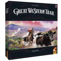
Great Western Trail Argentina
Great Western Trail Argentina In Great Western Trail Argentina , you own a vast estancia in Argentina at the end of the 19th century, and you will need to travel the plains of the Pampas with your cattle to deliver them to the main train station in Buenos Aires. Great Western Trail Argentina features gameplay elements similar to Great Western Trail such as deck management, the rondel mechanism, and the ability to upgrade your player board, along with twists on these elements and new features.The player board features a new type of worker - farmers - and different paths await on the game board to confront you with more choices. Will you take the road with buildings or a path past farmers?Maybe you'll have the chance to use your cows - well, the strength on your cow cards - to help farmers, getting them on your side and adding grain, a new type of resource, to your income, with grain being used for boat and city tiles.Perhaps you can unlock shortcuts that allow you to deliver your herd t…
46,95
Wandelkaart NS504 Upper and Lower Dolpa - Dolpo | Himalayan Maphouse
Goede duidelijk leesbare  map voor trekkings in Dolpo. Van Juphal en Jejargaon in het westen tot Kagbeni in Mustang aan de oostkant van de kaart. De trekkingroutes staat goed ingetekend. Shey Phoksundo National Park staat er ook geheel op.  Large area centred on Dho Tarap, lying between the Upper and Lower Dolpa regions, in the Nepa Maps series which provides extensive coverage of trekking areas of Nepal on detailed contoured maps with trekking routes and hiking trails, huts and camp sites, local places of interest and other tourist information.   Cartography is based on the country’s topographic survey, with contours usually at 40m or 50m intervals, enhanced by relief shading, colouring and graphics to show various features of the terrain, including glaciers, forested or cultivated areas, etc. Numerous peaks, with additional spot heights, plus names of glaciers and mountain ranges are prominently shown. The network of rivers, streams and lakes is shown in great detail, with many smal…
12,95
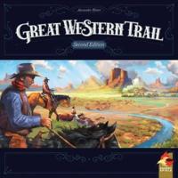
Great Western Trail Second Edition
Great Western Trail Second Edition America in the 19th century: You are a rancher and repeatedly herd your cattle from Texas to Kansas City, where you send them off by train. This earns you money and victory points. Needless to say, each time you arrive in Kansas City, you want to have your most valuable cattle in tow. However, the "Great Western Trail" not only requires that you keep your herd in good shape, but also that you wisely use the various buildings along the trail. Also, it might be a good idea to hire capable staff: cowboys to improve your herd, craftsmen to build your very own buildings, or engineers for the important railroad line.If you cleverly manage your herd and navigate the opportunities and pitfalls of Great Western Trail, you surely will gain the most victory points and win the game.The second edition of Great Western Trail will include solitaire rules, making for a player count of 1-4. Second Edition: Remember the old days in the West? Well, the times they are a-…
44,95
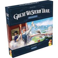
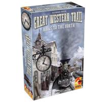
Great Western Trail Second Edition: Rails to the North
Great Western Trail Second Edition: Rails to the North Embark on a Journey with Great Western Trail Second Edition: Rails To The North Are you ready to embark on an adventure that's both challenging and rewarding? The Great Western Trail Second Edition: Rails To The North is not just a board game, it's a journey into the heart of the American frontier. This game is a metaphor for the opportunities that await you in the wild, untamed North. Expand Your Horizons Have you ever imagined what it would be like to deliver your cattle farther than ever before, even beyond American borders? The rails have progressed further, opening up a world of possibilities. This is not just a game of strategy, it's a test of your ability to seize opportunities and make the most of them. Challenges and Rewards But with great opportunities come great challenges. Are you ready to construct branchlets and work harder to gain different rewards? Just like in life, the most advantageous locations require the most …
34,95
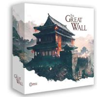
The Great Wall
The Great Wall
The Great Wall (incl. Miniatures) Embark on an Epic Journey with The Great Wall Are you ready to dive into an unforgettable adventure that combines strategy, cooperation, and competition? Welcome to The Great Wall , a groundbreaking board game that brings the ancient world of China to life! Designed by the renowned Awaken Realms, this game offers an exhilarating blend of asymmetric worker/soldier placement, engine building, and a relentless AI-driven enemy, the Mongolian Horde. Defend the Wall, Unleash Your Inner General In The Great Wall , you'll command an ancient Chinese clan striving to protect your homeland from invading Mongolian forces. Each player seeks to earn Honor (Victory Points) while also collaborating to repel the relentless enemy. With unique Leaders, resources, and workers at your disposal, will you rise to the challenge and lead your people to victory? Embrace the Asymmetry, Shape Your Destiny As a General, you'll forge your own path by hiring Advisors, each offering …
129,95
Wandelkaart Trekking map Indian Himalaya | TerraQuest
Mooie gedetailleerde kaart, geplastificeerd. De kaart heeft op de ene kant een algemeen overzicht van de Indische Himalaya met schaal 1/750.000 en op de andere zijde vind je de 22 trekking routes op schaal 1/350.000. Op zich geen zeer gedetailleerde wandelkaart. Er van uitgaande dat je de tochten toch met een gids of met een groep doet, dan is dit een uitstekende kaart. Dubbelzijdig geplastificeerde wandelkaart en overzichtskaart van de Indiase Himalaya (Noord-India) en op de achterzijde inzetkaarten met hoogtelijnen en trekkingroutes en voetpaden ingetekend van verschillende wandelroutes in Kashmir, Ladakh, Zanskar, Lahul, Rupshu, Spiti, Kinnaur, Garhwal, Kumaon en Sikim en verder toeristische informatie in symbolen aangegeven
22,50

Klanten-reviews van Wandelkaart The Great Himalaya Trail | GHT

Er zijn nog geen beoordelingen voor dit productBen jij de eerste die een review plaatst?

Meer over Wandelkaart The Great Himalaya Trail | GHT

Productomschrijving


Prachtige kaartenserie van één van 'swerelds mooiste wandeltochten.   The Far West is one of the least explored areas of Nepal. Its area is bounded to the east by mighty, turquoise Karnali river which flows from Tibet’s sacred Mount Kailash.   Myth and superstition remain part of the fabric of life here. Though the Nepali language originated here, it seems a distant world from ‘modern’ Nepal. One Nepali visitor described his visit as “fascinating, like travelling back to the 18th century.”   Along the trails you may meet a turbaned Dhami, a shaman, with silver-bangled limbs and gold-ringed ears, who are still depended on for treating sickness.   Organised tourism has so far been limited to Khaptad National Park, the only national park in the mid-hills of Nepal and held dearly by conservationists. Gentle hills, pristine forests and abundant wildlife with a snow-covered backdrop of the Nampa, Api and Saipal peaks make for beautiful trekking.   It’s also a holy place associated with Khaptad Swami, a great ascetic who was renowned for his wisdom. He lived to be 110 and people travelled from far to receive blessings from him in his cave dwelling.   The Jestha Purnima (June full-moon) festival attracts thousands to Tribeni, at the confluence of three rivers, to worship at Shiva’s shrine.   The lower route of the GHT passes just to the north here and it will one day connect Rara with the trail in India. Trekking here is less easy than elsewhere – porters are difficult to find and current maps lack detail. With patience however, and a sense of adventure, you’ll find your journey into this forgotten world to be an experience you’ll never forget.   The Chamar’s Dashain   During the Dashain festival, bull fighting, sadey judhai, takes place with the animals fuelled with rice-wine and cannabis sativa. The loser becomes dinner and the winner enjoys a year with the cows. You’ll see only the Chamar people celebrate Dashain in this way close to the border with Humla.   Ramaroshan   Lord Krishna once grazed his cows in nearby Ramaroshan, an area of lakes and lush green pastures, known as Patans. His cows were provided with very comfortable shelters. People who later came to live here and moved the cows out and lived in their shelters. The cows became wild, stopped giving milk and the people were cursed. To this day, some cow shelters are grander than people’s houses.

Productinformatie

    Verken gerelateerde categorieën

    Webshop.nl maakt gebruik van cookies. Ga je verder op onze website, ga dan akkoord met het plaatsen van cookies en de verwerking van deze data door ons en vermelde partners.