Great Western Trail Second Edition: Rails to the North

0
Great Western Trail Second Edition: Rails to the North Embark on a Journey with Great Western Trail Second Edition: Rails To The North Are you ready to embark on an adventure that's both challenging and rewarding? The Great Western Trail Second Edition: Rails To The North is not just a board game, it's a journey into the heart of the American front...

Alle aanbiedingen van dit product

Verkoper
Bezorging
Prijs
Boardgameshop.nl logo
Boardgameshop.nl
niet bekend
niet bekend
34,95

Anderen bekeken ook

Wandelgids North York Moors: Western Area | Hallewell Publications
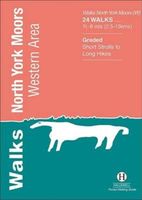
Rewalked and updated in 2022, Walks North York Moors (Western Area) features walks in the North York Moors National Park - an area of picturesque moorland intersected by narrow dales, butted up against the coast in the north-east corner of Yorkshire. This guide covers the western half of the area - as far east as the villages of Danby and Rosedale Abbey (for routes around Whitby and the east of the area, see Walks North York Moors (Eastern Area)). The 24 walks in the guide range from 1.5 to 8 miles (2.5 13km). Routes include the ascent of distinctive Roseberry Topping, the path to the famous White Horse near Thirsk, and from Helmsley to the ruin of Rievaulx Abbey. Walks North York Moors (Western Area) is part of a popular series of A6 pocket walking guides which describe routes which are suitable for walkers of all abilities and to suit all tastes. Route descriptions are accompanied by 2-colour sketch maps. The guides are illustrated with line illustrations, and will provide walkers w…
5,95
Wandelkaart Tour & Trail Mallorca - Tramuntana North | Discovery Walking Guides
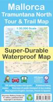
Let op: deze kaart dekt het noordelijke deel van Mallorca.   For your best adventures, use the best map. Water-proof, split-proof, tear-proof, adventure-proof. Mallorca's Tramuntana North Tour & Trail Super-Durable Map is simply the toughest, most accurate, easy-to-read, easy-to-use multi-purpose map that you can get.   Whether you plan to walk, or explore northern Tramuntana by car or the bus, this is the map for you. A large 960mm by 694mm double sided map sheet covers northern half of Serra de Tramuntana at 1:30,000 scale. This 8th edition sees a significant upgrade from the previous Mallorca North & Mountains Tour & Trail Map, as we have split Serra de Tramuntana in two halves to produce TWO much more detailed maps of larger scale.   This map covers a continuous area from Tramuntana's northern-most Cap de Formentor, including all the coastal resorts such as Port de Pollenca and Port d'Alcudia, all the way to Soller and Deia at the opposite end of the map (for the area from S…
19,95
Wandelgids The North Western Fells | Lake district | Frances Lincoln
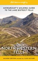
One name above all others has become associated with walking in the Lake District: A. Wainwright, whose seven-volume Pictorial Guide to the Lakeland Fells, first published in 1955–66, has become the definitive guidebook. Wainwright’s meticulously hand-drawn maps, diagrams and drawings take you up the 214 principal hills and mountains of the Lake District, describing the main routes of ascent from different starting points, as well as lesser-known variants, showing the summit viewpoint panoramas and the ridge routes that can be made to create longer walks. The North Western Fells, Book Six of Wainwright’s Walking Guide, covers the area between the rivers Derwent and Cocker, bordered by Crummock Water and Buttermere to the west and by Bassenthwaite Lake and Derwent Water to the east.  
23,50
Vogelgids Sibley Field Guide to Birds of Western North America - USA en Canada | Alfred Knopf
Goede vogelgids van het westen van de Vernigde Staten en Canada, ook Alaska. Met verspreidingskaarten en verschillende tekeningen per soort. De belangrijkste onderscheidende kenmerken worden nadrukkelijk vermeld en aangeduid. Enig nadeel is dat de tekeningen niet heel groot zijn.   Now completely revised and updated – the indispensable resource for all birders seeking an authoritative guide to the birds of the West in a portable format they will want to carry into the field.   Compact and comprehensive, The Sibley Field Guide to Birds of Western North America features 715 bird species, plus regional populations, found west of the Rocky Mountains. Entries include stunningly accurate illustrations – more than 5,046 in total – with descriptive captions pointing out the most important field marks. Each entry has been updated to include the most current information concerning frequency, nesting, behavior, food and feeding, voice description, and key identification features. Here too are mo…
25,95
Wandelkaart Tour & Trail Western Crete - West Kreta | Discovery Walking Guides
Goede, scheur- en watervaste, wandelkaart van west Kreta, met name het wandelgebied rond Lefka Ori en de Samaria Kloof. For your best adventures, use the best map. Water-proof, split-proof, tear-proof. Western Crete Tour & Trail Super-Durable Map is simply the toughest, most accurate, easy to read, easy to use map that you can buy at any price. A large 960mm by 694mm double sided map sheet at 1:40,000 scale covers area of over 1600km2, from Paleochora in the west to Preveli beach in the east. The map covers the most important hiking regions in the western Crete, including the famous Samaria Gorge, Lefka Ori (White Mountains) and much more. Our legendary 'Tour & Trail' level of detail ranges from major roads to secondary roads to minor roads to streets and narrow country roads, plus dirt roads, tracks and walking trails. Place names are in English and Greek to aid your navigation. Altitude shading is designed to clearly show the altitude range when travelling across the island by car o…
19,95
Wegenkaart - landkaart Western Canada | ITMB
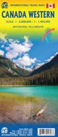
Een degelijke kaart met aanduidingen van o.a. nationale parken, vliegveld, benzinepomp, dirt-roads. Als overzichtskaart goed te gebruiken. This is actually our second attempt at mapping the western portion of Canada; the first covered everything from northwestern Ontario to the Pacific Ocean and, while it was an excellent map, the scale that such a huge area covered necessitated severe problems. In this version, all of British Columbia, Alberta, and the Yukon have been mapped from fresh digital data and presented at 1:1.4T scale. This would have been impossible when we prepared the first map. The Northwest Territories portion had to be compressed in two ways; first, the scale is 1:2M; second, only the portion with roads is shown. This is still an extremely large area. One has to consider the actual size of Canada when designing a map. Most countries in Europe would fit into this area, which only covers 20% of Canada. The Fort McMurray forest fire of a year ago covered an area larger t…
14,95
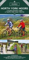
Fietskaart 10 Cycling guides North York Moors | Goldeneye
Scheur- en watervast foetskaart van de North York Moors  met ingetekende fietsroutes.   Our maps are double-sided, printed on an A2 sheet with a concertina fold. This allows for easy folding and folding, and an ease of access to the mapping. The material is rain and tear-resistant. Our early maps were designed at the scale of 2 miles to 1 inch/1:126,720. The later designs along with digitalisation are 1: 100,000. We were encouraged by the Cycle Touring Club to convert our cartography toward the cycle market (to replace the out-of-print Bartholomew series). As time and the series progressed we have added more data: The National Cycle Network routes, Regional Routes, and Traffic-Free Family Routes, as and when they are developed. These routes are in addition to the Circular Routes Goldeneye Commissioned at the outset of our publishing schedule. We are also adding to new editions; bike shops, cycle hire, and tea rooms, along with the tourist attractions already featured. Our plan is to m…
14,95
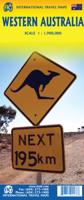
Wegenkaart - landkaart Western Australia | ITMB
The State of Western Australia occupies the western third of the continental country of Australia. The main city is Perth, in the southwest portion, and this is the part of the State with the best land and the most people. Much of the interior is arid desert-like grassland with shallow lakes that often dry out. The road network in the south is generally paved highways and secondary roads, with one road and one rail line heading east to SZ and the rest of the country. Roads in the north tend to be dirt, with the exception of the highway going towards Darwin in NT. There are no roads through the Great Sandy Desert, but the Canning Stock Route crosses the eastern fringe, going north-south. One needs an expensive permit to drive this hazardous track. Most of the attractions of the State are to be found fairly close to the coastline. Most of the larger urban areas tend to have been named after British places, such as Albany, Exmouth, and Port Hedland, but many names have been adopted from …
14,95
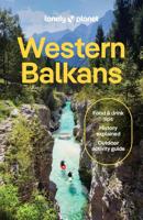
Reisgids Western Balkans | Lonely Planet
De perfecte reisgids voor zowel de georganiseerde als de zelfstandige reiziger. Naast een algemene inleiding van het land / streek vol met praktische informatie over hoe je er het beste kunt reizen: slapen, eten, vervoer, excursies ... alles kun je er in vinden.   Lonely Planet's local travel experts reveal all you need to know to plan the trip of a lifetime in this latest edition of our guide to the Western Balkans.   Discover the Western Balkans' most popular experiences and best kept secrets from hiking the snowcapped peaks and traditional mountain villages of Albania's Accursed Mountains; to gazing at glorious sea views from the resplendent city walls of Dubrovnik; and tasting the homespun cooking of North Macedonia, from paprika-tinged sausages to stuffed peppers.   Build a trip to remember with Lonely Planet's Western Balkans travel guide:   Our classic guidebook format contains the most comprehensive level of information for planning multi-week trips All-new structure a…
25,95
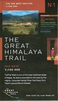
Wandelkaart The Great Himalaya Trail | GHT
  Prachtige kaartenserie van één van 'swerelds mooiste wandeltochten.   The Far West is one of the least explored areas of Nepal. Its area is bounded to the east by mighty, turquoise Karnali river which flows from Tibet’s sacred Mount Kailash.   Myth and superstition remain part of the fabric of life here. Though the Nepali language originated here, it seems a distant world from ‘modern’ Nepal. One Nepali visitor described his visit as “fascinating, like travelling back to the 18th century.”   Along the trails you may meet a turbaned Dhami, a shaman, with silver-bangled limbs and gold-ringed ears, who are still depended on for treating sickness.   Organised tourism has so far been limited to Khaptad National Park, the only national park in the mid-hills of Nepal and held dearly by conservationists. Gentle hills, pristine forests and abundant wildlife with a snow-covered backdrop of the Nampa, Api and Saipal peaks make for beautiful trekking.   It’s also a holy place associated with Kh…
26,95

Klanten-reviews van Great Western Trail Second Edition: Rails to the North

Er zijn nog geen beoordelingen voor dit productBen jij de eerste die een review plaatst?

Meer over Great Western Trail Second Edition: Rails to the North

Productomschrijving

Great Western Trail Second Edition: Rails to the North Embark on a Journey with Great Western Trail Second Edition: Rails To The North Are you ready to embark on an adventure that's both challenging and rewarding? The Great Western Trail Second Edition: Rails To The North is not just a board game, it's a journey into the heart of the American frontier. This game is a metaphor for the opportunities that await you in the wild, untamed North. Expand Your Horizons Have you ever imagined what it would be like to deliver your cattle farther than ever before, even beyond American borders? The rails have progressed further, opening up a world of possibilities. This is not just a game of strategy, it's a test of your ability to seize opportunities and make the most of them. Challenges and Rewards But with great opportunities come great challenges. Are you ready to construct branchlets and work harder to gain different rewards? Just like in life, the most advantageous locations require the most effort. But don't worry, the rewards are worth it. Upgraded and Reworked The Great Western Trail: Rails to the North (Second Edition) is not just a rehash of the original Rails to the North expansion. It's been reworked and upgraded, with dual-layered player boards and a game board extension that features different rail paths. It's like getting a new pair of glasses - everything you loved about the original game, but seen in a whole new light. More Than Just a Game This game is more than just a way to pass the time. It's a way to engage with family and friends, to challenge your strategic thinking, and to immerse yourself in a world of cattle, rails, and opportunities. It's a game that's as dynamic and unpredictable as the wild, untamed North itself. For the Solo Player And for those who prefer to play solo, the Great Western Trail: Rails to the North (Second Edition) has got you covered. With new solo-mode materials for Sam and a new breed of orange cows, you'll never feel alone on the trail. Experience the Adventure So, are you ready to experience the adventure of the Great Western Trail: Rails to the North (Second Edition) ? Are you ready to seize opportunities, face challenges, and embark on a journey that's both entertaining and informative? If so, then saddle up and hit the trail. The North awaits.If you're captivated by the strategic challenges of the Great Western Trail Second Edition: Rails to the North , you might also enjoy exploring the vibrant landscapes of South America in the Great Western Trail Argentina edition. Expand your gaming horizons today!

Productinformatie

    Productspecificaties

    Artikelnummer(s)
    EAN
    4061897501618

    Verken gerelateerde categorieën

    Webshop.nl maakt gebruik van cookies. Ga je verder op onze website, ga dan akkoord met het plaatsen van cookies en de verwerking van deze data door ons en vermelde partners.