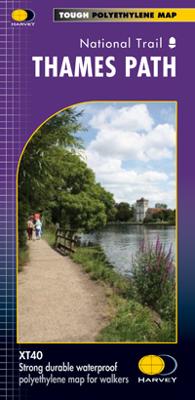
Wandelkaart Thames Path | Harvey Maps

0
Mooie, duidelijke kaart van het Thames Path in Engeland. Geplastificeerd met veel extra informatie en uitsnedes van de route.   Thames Path National Trail   The Thames Path follows the banks of the river for 184 miles (294KM) from the flood barrier at Woolwich in South East London to Kemble Gloucestershire. It is a long distance walking route, mos...

Verkopers met dit product

Verkoper
Bezorging
Prijs
DeZwerver.nl logo
DeZwerver.nl
2,95
25,95

Anderen bekeken ook

Wandelgids Thames Path | Trailblazer Guides
This book follows the Thames Path National Trail from the river's source in Gloucestershire to the Thames Barrier in London. Officially 184 miles (294km) in length (although the actual distance you walk will depend on a number of decisions you make en route), the path meanders, accompanied by its watery muse, through pristine and tranquil countryside, past historic sites and buildings, via pub, lock, weir, and the occasional scattering of waterfowl, to a city, once the fulcrum of an empire, and now the heart of modern day England. The river, responsible for the metropolis' very being, tells tales, inspires artists, accommodates swans, geese, and water voles, reflects the silhouettes of red kites and kingfishers, provides employment, entices adventure, and allows time for carefree pilgrims to procrastinate and think. Following its banks is a grand way to go for a ramble. The path begins, as the river does, in a meadow in the Cotswolds; its upper reaches lonely and wild, the meadows and…
19,95
Wandelkaart Northumberland Coast Path and Berwickshire Coastal Path | Harvey Maps
Mooie, duidelijke kaart van de Northumberland Coast Path en het vervolg daarop de Berwickshire Coastal Path in Noord-Engeland en Schotland. Geplastificeerd met veel extra informatie en uitsnedes van de route.    The Northumberland Coast Path stretches for 103km (64m) from Cresswell in the south to Berwick-upon-Tweed in the north. The Berwickshire Coastal Path stretches for 48km (28m) and continues this route from Berwick-upon-Tweed to Cockburnspath. These routes are part of the North Sea Trail and offer some of the finest coastal walking in the country with rugged coastline, stunning cliff scenery and panoramic views.   XT40 - These maps are a leap forward in technical excellence. They are tough, durable, light and 100% waterproof - virtually indestructible in normal use.   They are light to carry, and compact - not the great bulky package you get with a laminated map.   The map is detailed, with the routes clearly marked. It also contains general information, useful telephone numbers…
25,95
Wandelkaart - Topografische kaart 160 OS Explorer Map Windsor, Weybridge, Bracknell | Thames Path | Ordnance Survey
Follow the Thames Path through Windsor, home to the world’s largest and oldest inhabited castle, to Egham, Staines and Weybridge with its motoring and aviation museums. Walk in the footsteps of King John as you take the Three Castles Path from Windsor Castle southwest past Bracknell and Wokingham.     Enjoy a royal encounter at Windsor Castle, home to British kings and queens for over 1,000 years and Her Majesty the Queen’s favourite residence  Discover the pretty villages of Chertsey and Chobham, Ascot Racecourse and the London Bus Museum in Weybridge  Walk, ramble or cycle along the Thames Path and recreational paths including the Blackwater Valley Path, Colne Valley Way and Three Castles Path Met zijn 4cm voor 1 km (2 ½ cm voor 1 mijl) schaal, is de OS Explorer kaartenserie de ideale en meest gedetailleerde kaartenreeks voor mensen die graag outdoor-activiteiten zoals fietsen, wandelen, paardrijden, klimmen en watersporten. Deze kaart is nog gedetailleerder dan de 'gewone' Landr…
19,50
Wandelkaart - Topografische kaart 159 OS Explorer Map Reading, Wokingham & Pangbourne Map | Thames Path | Ordnance Survey
Experience everything Reading has to offer and discover the charms of Wokingham and of Pangbourne, an idyllic waterside town on the River Thames among the gorgeous North Wessex Downs. Follow the Thames Path through Pangbourne and Reading where it skirts the evocative, 900-year-old ruins of Reading Abbey.     Visit Basildon Park, immortalised in Pride & Prejudice, and neighbouring Beale Wildlife Park for a wilder experience  Swim in the Thames Lido or visit the award-winning, much-loved Museum of English Rural Life (MERL)  Walk, hike or cycle along this peaceful stretch of the Thames Path or other recreational paths including the Blackwater Valley Path Met zijn 4cm voor 1 km (2 ½ cm voor 1 mijl) schaal, is de OS Explorer kaartenserie de ideale en meest gedetailleerde kaartenreeks voor mensen die graag outdoor-activiteiten zoals fietsen, wandelen, paardrijden, klimmen en watersporten. Deze kaart is nog gedetailleerder dan de 'gewone' Landranger maps. Voor- en achterzijde bedrukt! Zek…
19,50
Wandelkaart St Oswald's Way | Harvey Maps
Mooie, duidelijke kaart van de St Oswald's Way Noord-Engeland. Geplastificeerd met veel extra informatie en uitsnedes van de route.   From Holy Island to Heavenfield, the 97 mile St Oswald's Way links some of the places associated with St Oswaldwho was the King of Northumbria in the early 7th century. The route runs through the Northumbria National Park following the stunning Northumberland Coast before heading inland across beautiful countryside to Heavenfield. It links with St Cuthbert's Way in the north and Hadrian's Wall Path in the south. Along the way you will encounter rolling farmland, villages, vast sandy beaches and fascinating history.   The HARVEY series of Long Distance Route maps is an established success. Now the advanced technology used in the creation of our best-selling British Mountain Maps is also applied to the route maps.   These maps are a leap forward in technical excellence. They are tough, durable, light and 100% waterproof - virtually indestructible in norma…
25,95
Wandelkaart North Wales Coast Path Map | Northern Eye Books
Enhanced, large scale (1: 25,000) Ordnance Survey mapping in a handy atlas format with all the mapping you need to walk a complete North Wales Coast section of the Wales Coast Path.   Continuous OS mapping covering the complete route from Chester to Bangor, on the Menai Strait. Contains generous coastal extracts from large-scale OS Explorer maps 266, 265, 264 and OL17.   The North Wales Coast Ordnance Survey mapping book is part of a series of map atlases covering the whole of the 870-mile long Wales Coast Path. The enhanced OS 1:25,000 maps are accurate, up-to-date and reliable. Additional map symbols show tea shops, cafes, extra parking, and public toilets.   A brief introduction to the North Wales Coast includes a fascinating photo mosaic highlighting notable views, places of interest and wildlife you’ll meet along the way. There is also a section of detailed Useful Information at the back of the atlas.   Laminated flapped covers showing Wales Coast Path signs and waymarkers, route…
16,50
Wandelgids Walking in the Thames Valley | Cicerone
Walking in the Thames Valley offers 25 challenging circular walks around the River Thames and River Kennet in the south of England, taking in the Southern Chilterns, the Berkshire and North Hampshire Downs, Southern Oxfordshire and the eastern edge of Wiltshire. All routes are within easy reach of Reading, Newbury, Abingdon and London. While some walks visit Iron Age hill forts, others pass more modern features such as Wilton Windmill and the Kennet and Avon Canal. Some follow sections of the Ridgeway, while others meander along the banks of the Thames. What they all have in common is that they take the keen rambler to some of the best parts of the Thames Valley – a patchwork of open chalk grassland, broadleaved woodland and farmland and home to two Areas of Outstanding Natural Beauty. • walks from 10 to 18 miles, including one 2-day route • shorter, less strenuous alternatives for many of the walks • detailed route descriptions with information on local points of interest, OS mapping…
18,50
Wandelkaart Rob Roy Way | Harvey Maps
Mooie, duidelijke kaart van de Rob Roy Way in Schotland. Geplastificeerd met veel extra informatie en uitsnedes van de route.    One of Scotland's Great Trails   Rob Roy Way is a walk across part of the Southern Highlands of Scotland taking in some of the most beautiful countryside in the UK. Starting from Drymen it goes north east to finish in Pitlochry. The Way is 77mls or 94 mls (124Km or 151Km) depending on your route choice. The tracks and paths you follow were used by Rob RoyMacGregor in the 17th & 18th centuries, other historical characters throughout the Jacobite uprisings and during the feuds between the local clans. Places you will pass through include Aberfoyle, Callander, Strathyre, Killin or Amulree and Aberfeldy. Lochs you will walk along include Venachar, Lubnaig and Tay passing by Ben Ledi, Ben Chonzie and Ben Lawers.   XT40 New generation of tough polyethylene maps   The HARVEY series of Long Distance Route maps is an established success. Now the advanced technology u…
25,95
Wandelgids The Thames Path | Cicerone
All the mapping you need to complete the 182 mile (290km) Thames Path National Trail, from the Woolwich Foot Tunnel in London to the river's source in Gloucestershire. This booklet is included with the Cicerone guidebook to the Thames Path, where the route is divided into 20 stages, with each stage ranging from 4 to 16 miles. This gentle riverside walk takes roughly two weeks to complete.   This booklet of Ordnance Survey 1:25,000 Explorer maps has been designed for convenient use on the trail. It shows the full and up-to-date line of the National Trail, along with the relevant extract from the OS Explorer map legend. Conveniently sized for slipping into a jacket pocket or top of a rucksack and provides all the mapping needed to complete the trail.   Passing through London, Windsor and Oxford as well as rural countryside, this National Trail offers walkers a diverse range of landscapes and scenery. With excellent public transport services at each stage, this trail can also be complete…
18,50
Wandelatlas Wales Coast Path Llyn Peninsula Map | Northern Eye Books
Enhanced, large scale (1: 25,000) Ordnance Survey mapping in a handy atlas format with all the mapping you need to walk a complete circuit of the Anglesey section of the Wales Coast Path.   Continuous OS mapping covering the complete route from Bangor to Porthmadog. Contains coastal extracts from large scale Explorer maps 253 and 254.   The Llyn Peninsula Ordnance Survey mapping book is part of a series of map atlases covering the whole of the 870-mile long Wales Coast Path. The enhanced OS 1:25,000 maps are accurate, up-to-date and reliable. Additional map symbols show tea shops, cafes, extra parking, and public toilets.   A brief introduction to the Llyn Peninsula includes a fascinating photo mosaic highlighting notable views, places of interest and wildlife you’ll meet along the way. There is also a section of detailed Useful Information at the back of the atlas.   Laminated flapped covers showing Wales Coast Path signs and waymarkers, route details and map symbols make these atlas…
13,95

Klanten-reviews van Wandelkaart Thames Path | Harvey Maps

Er zijn nog geen beoordelingen voor dit productBen jij de eerste die een review plaatst?

Meer over Wandelkaart Thames Path | Harvey Maps

Productomschrijving

Mooie, duidelijke kaart van het Thames Path in Engeland. Geplastificeerd met veel extra informatie en uitsnedes van de route.   Thames Path National Trail   The Thames Path follows the banks of the river for 184 miles (294KM) from the flood barrier at Woolwich in South East London to Kemble Gloucestershire. It is a long distance walking route, most of it cannot be cycled. The Trail passes through water meadows, historic towns & lovely villages. The path is flat which makes for easy walking. Jos Joslin National Trails Manager (Marketing & Projects) said of this map "Really beneficial to have the whole length of the Thames Path upstream of London on just one map. Clear mapping and useful information makes this a very practical map"   XT40 New generation of tough polyethylene maps   The HARVEY series of Long Distance Route maps is an established success. Now the advanced technology used in the creation of our best-selling British Mountain Maps is also applied to the route maps.   These maps are a leap forward in technical excellence. They are tough, durable, light and 100% waterproof - virtually indestructible in normal use.   They are light to carry, and compact - not the great bulky package you get with a laminated map.   The map is detailed, with the routes clearly marked. It also contains general information, useful telephone numbers and a full key.

Productinformatie

    Verken gerelateerde categorieën

    Webshop.nl maakt gebruik van cookies. Ga je verder op onze website, ga dan akkoord met het plaatsen van cookies en de verwerking van deze data door ons en vermelde partners.