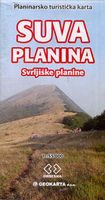
Wandelkaart Suva Planina - Servië | Geokarta

0
One side topographic marked with footpaths, ski trails, ski lifts, camp sites, picnic sites, mountain huts, also notable features in the landscape. Other side further information, additional words and pics of notable features, mountain huts etc. Suva Mountains with the Gorges of the Jelašnicka River on a detailed contoured map at 1:55,000, plus ex...

Verkopers met dit product

Verkoper
Bezorging
Prijs
DeZwerver.nl logo
DeZwerver.nl
niet bekend
2,95
13,95

Anderen bekeken ook

Wandelkaart Suva Planina - Servië | Geokarta
One side topographic marked with footpaths, ski trails, ski lifts, camp sites, picnic sites, mountain huts, also notable features in the landscape. Other side further information, additional words and pics of notable features, mountain huts etc. Suva Mountains with the Gorges of the Jelašnicka River on a detailed contoured map at 1:55,000, plus extensive information on the tourist facilities in the area with colour photos of mountain shelters, notes on fauna and flora, etc. The map has contours at 20m intervals with relief shading and colouring for woodlands. Different levels of protection zones are marked and areas where hunting is allowed are indicated. An overprint highlights waymarked hiking trails including the 130km long-distance trail across the Niš range. Also marked are different types of tourist accommodation including campsites and hunting lodges, paragliding sites, skiing areas, etc. The map has latitude and longitude lines at intervals of 5’. Map legend includes English. …
13,95
Wandelkaart Rajac suvoborski | Geokarta
Gedetailleerde wandelkaart met hoogtelijnen, wandelroutes en toeristische informatie ingetekend van het Suvobor Rajac gebergte in noord Servië. This map covers the popular tourist areas   Rajac is famous for it's limestone caverns, climbing, hiking routes and orienteering events   Very detailed full colour topographc mapping   Footpaths and hiking trails clearly marked   Spot heights and relief shading   Contours at 5m vertical intervals   Reverse on map includes useful local information in English and Serbian
12,95
Wandelkaart 11 Banff Up-Close | Gem Trek Maps
Waterproof and tear-resistant hiking and recreation map for the town of Banff and surrounds in the Canadian Rockies.   Designed for both locals and visitors, Gem Trek’s 1:35,000 Banff Up-Close Map is a detailed relief-shaded topographic map of the Banff area. All hiking and biking trails are labeled, and distances are marked. Like all Gem Trek maps, the Banff Up-Close Map features detailed cartography and accurate hiking trails with distances, elevation gain, and directions to the trailhead noted. An inset on the back increases coverage of downtown Banff, with museums and all streets marked. Also on the flipside are descriptions of the sights, museums and scenic drives in Banff. We've also included a hand-picked list of the best seven walks and day hikes in the area. The highlights of each trail are noted, as well as distance, elevation gain and directions to the trailhead.   Map specs   Edition: 4th Scale: 1:35,000 Folded size: 4.5 x 9.5 inches Flat size: 18 x 24 inches Paper: Waterp…
13,95
Wandelkaart - Topografische kaart 747 Green Mountain National Forest North - Moosalamoo NRA - Rutland | National Geographic
Prachtige geplastificeerde kaart van het bekende nationaal park. Met alle recreatieve voorzieningen als campsites, maar ook met topografische details en wandelroutes ed. Door uitgekiend kleurgebruik zeer prettig in gebruik. Scheur en watervast! National Geographic's Green Mountain National Forest North Trails Illustrated topographic map is the most comprehensive available for outdoor enthusiasts of all types. Designed to be easy-to-read, yet highly detailed – this map includes a comprehensive road and trail network distinguishing between major, secondary and 4x4 roads, hiking, horse, biking, multi-use and non-motorized winter trails. All forest roads are labeled with their official road number and trails are clearly identified with their given name. Land management boundaries are color-coded showing National Forest, Ranger District, Wilderness Areas, Conservation Areas and more, plus the locations of private land within the Green Mountain National Forest. The renowned Appalachian Trai…
17,95
Wandelkaart - Topografische kaart 748 Green Mountain National Forest South - Robert T. Stafford White Rocks NRA - Manchester | National Geographic
Prachtige geplastificeerde kaart van het bekende nationaal park. Met alle recreatieve voorzieningen als campsites, maar ook met topografische details en wandelroutes ed. Door uitgekiend kleurgebruik zeer prettig in gebruik. Scheur en watervast! National Geographic's Green Mountain National Forest South Trails Illustrated topographic map is the most comprehensive available for outdoor enthusiasts of all types. Designed to be easy-to-read, yet highly detailed – this map includes a comprehensive road and trail network distinguishing between major, secondary and 4x4 roads, hiking, horse, biking, multi-use and non-motorized winter trails. All forest roads are labeled with their official road number and trails are clearly identified with their given name. Land management boundaries are color-coded showing National Forest, Ranger District, Wilderness Areas, Conservation Areas and more, plus the locations of private land within the Green Mountain National Forest. The renowned Appalachian Trai…
17,95
Wandelkaart - Topografische kaart 744 Adirondack Park - Northville - Raquette Lake | National Geographic
Prachtige geplastificeerde kaart van het bekende nationaal park. Met alle recreatieve voorzieningen als campsites, maar ook met topografische details en wandelroutes ed. Door uitgekiend kleurgebruik zeer prettig in gebruik. Scheur en watervast! National Geographic's Trails Illustrated map of Adirondack Park Northville/Raquette Lake is a two-sided, waterproof, topographic trail map designed to meet the needs of outdoor enthusiasts with unmatched durability and detail. This map was created in cooperation with the Adirondack Mountain Club and is loaded with valuable recreation information for boating, hiking, fishing, sailing, cycling, ice fishing, skiing, and snowmobiling. Trails and major roads are clearly distinguished, from the picturesque foothills to the northern peaks and around lakes of all sizes. Campgrounds, climbing areas, marinas, and museums are labeled and easy to find and boundaries for park lands, wilderness, primitive, forest, and protected areas are clearly marked. Disc…
17,95
Wandelkaart Mount Everest - Himalaya | ITMB
Deelkaart van het Everest gebied: niet altijd even makkelijk kleurgebruik. Op de andere kant een grove kaart van de hele Himalaya! Roads by classification, check points, viewpoints, points of interest, camps, monasteries, lodging, stupas, airports, waterfalls, glaciers, health posts and other information. Mt Everest region at 1:90,000 from ITMB on a contoured map with tourist information but with somewhat unusual choice of colouring which makes the whole area appear more like a desert rather the highest mountain range covered in glaciers! Coverage extends from Lukla to beyond the North Base Camp on the Tibetan side. The map has contour lines at 100m intervals, plus additional altitude colouring and graphics for glaciers, moraine, scree, rock and vegetation. Numerous mountain ranges, glaciers, peaks and passes are named. Main Everest trekking routes are marked and symbols highlight various places of interest and tourist facilities. The map has latitude and longitude lines at intervals …
13,95
Wandelkaart 01 Jasper National Park & Maligne Lake | Gem Trek Maps
Scheur- en Watervast papier Gem Trek’s JASPER AND MALIGNE LAKE MAP map is designed for outdoor enthusiasts looking to explore the section of Jasper National Park near the town and out to Maligne Lake. Whether you are touring along the roads or heading into the backcountry, you’ll find the waterproof and tear-resistant Jasper & Maligne Lake Map to be an invaluable tool.   This map features detailed cartography, accurate hiking trails with distances, and details such as campgrounds, equestrian routes, picnic areas, and fire lookouts. On the back of the map are trail descriptions and photos of 18 recommended day hikes, four overnight or multi-day trips, and six classic mountain bike rides. Each of these described trails is referenced and colour-coded to the map on the front. Also on the back is contact information for Jasper National Park, as well for as the three backcountry lodges located in the Tonquin Valley and on the Skyline Trail.   Jasper & Maligne Lake Map Coverage The Jas…
16,95

Klanten-reviews van Wandelkaart Suva Planina - Servië | Geokarta

Er zijn nog geen beoordelingen voor dit productBen jij de eerste die een review plaatst?

Meer over Wandelkaart Suva Planina - Servië | Geokarta

Productomschrijving

One side topographic marked with footpaths, ski trails, ski lifts, camp sites, picnic sites, mountain huts, also notable features in the landscape.

Other side further information, additional words and pics of notable features, mountain huts etc.

Suva Mountains with the Gorges of the Jelašnicka River on a detailed contoured map at 1:55,000, plus extensive information on the tourist facilities in the area with colour photos of mountain shelters, notes on fauna and flora, etc.

The map has contours at 20m intervals with relief shading and colouring for woodlands. Different levels of protection zones are marked and areas where hunting is allowed are indicated. An overprint highlights waymarked hiking trails including the 130km long-distance trail across the Niš range. Also marked are different types of tourist accommodation including campsites and hunting lodges, paragliding sites, skiing areas, etc. The map has latitude and longitude lines at intervals of 5’. Map legend includes English.

On the reverse are extensive bilingual notes on the area and its tourist facilities illustrated with numerous photos.


Productinformatie

    Verken gerelateerde categorieën

    Webshop.nl maakt gebruik van cookies. Ga je verder op onze website, ga dan akkoord met het plaatsen van cookies en de verwerking van deze data door ons en vermelde partners.