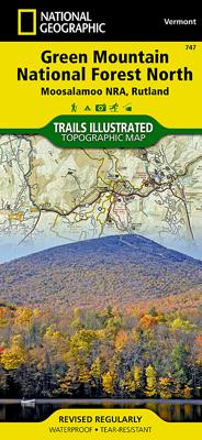
Wandelkaart - Topografische kaart 747 Green Mountain National Forest North - Moosalamoo NRA - Rutland | National Geographic

0
Prachtige geplastificeerde kaart van het bekende nationaal park. Met alle recreatieve voorzieningen als campsites, maar ook met topografische details en wandelroutes ed. Door uitgekiend kleurgebruik zeer prettig in gebruik. Scheur en watervast! National Geographic's Green Mountain National Forest North Trails Illustrated topographic map is the mos...

Alle aanbiedingen van dit product

Verkoper
Bezorging
Prijs
DeZwerver.nl logo
DeZwerver.nl
2,95
17,95

Anderen bekeken ook

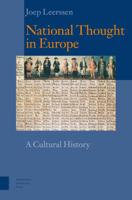
National Thought in Europe (Paperback)
Bringing together sources from many countries and many centuries, this study critically analyses the growth of national thought and of nationalism - from medieval ethnic prejudice to the Romantic belief in a nation's 'soul'. The belief and ideology of the nation's cultural individuality emerged from a Europe-wide exchange of ideas, often articulated in literature and 'belles lettres'. In the last two centuries, these ideas have transformed the map of Europe and the relations between people and government. In tracing the modern European nation-state, cross-nationally and historically, as the outcome of a cultural self-invention, Leerssen also provides a surprising perspective on Europe's contemporary identity politics. 'National Thought in Europe' has been brought up to date in this new, third edition.
43,99
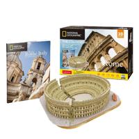
Cubic Fun National geographic - 3d puzzel - het colosseum
Cubic Fun National Geographic 3D Puzzel The Colosseum RomeEen combinatie van puzzelen én bouwen. Het eindresultaat is een stevig gebouw, zonder daarbij lijm te hoeven gebruiken. Het Colosseum was het grootste amfitheater (ronde theater) uit het Romeinse rijk. Mede daarom had het had vele gebruiken: voor sportevenementen, gevechten met wilde dieren en natuurlijk de beroemde gladiatorengevechten. De bouw van dit amfitheater heeft naar schatting zon acht jaar geduurd heeft. Hopelijk lukt het jou thuis sneller! Bestaat uit 131 losse onderdelen. Geschikt voor kinderen vanaf 10 jaar. National Geographic 3D-puzzel van het Colosseum is een combinatie van puzzelen én bouwen. Het eindresultaat is een stevig gebouw, zonder daarbij lijm te hoeven gebruiken. Het Colosseum was het grootste amfitheater (ronde theater) uit het Romeinse rijk. Mede daarom had het had vele gebruiken: voor sportevenementen, gevechten met wilde dieren en natuurlijk de beroemde gladiatorengevechten. De bouw van dit amfithea…
24,99
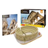
Cubic Fun National geographic - 3d puzzel - het colosseum
Cubic Fun National Geographic 3D Puzzel The Colosseum RomeEen combinatie van puzzelen én bouwen. Het eindresultaat is een stevig gebouw, zonder daarbij lijm te hoeven gebruiken. Het Colosseum was het grootste amfitheater (ronde theater) uit het Romeinse rijk. Mede daarom had het had vele gebruiken: voor sportevenementen, gevechten met wilde dieren en natuurlijk de beroemde gladiatorengevechten. De bouw van dit amfitheater heeft naar schatting zon acht jaar geduurd heeft. Hopelijk lukt het jou thuis sneller! Bestaat uit 131 losse onderdelen. Geschikt voor kinderen vanaf 10 jaar. National Geographic 3D-puzzel van het Colosseum is een combinatie van puzzelen én bouwen. Het eindresultaat is een stevig gebouw, zonder daarbij lijm te hoeven gebruiken. Het Colosseum was het grootste amfitheater (ronde theater) uit het Romeinse rijk. Mede daarom had het had vele gebruiken: voor sportevenementen, gevechten met wilde dieren en natuurlijk de beroemde gladiatorengevechten. De bouw van dit amfithea…
24,99
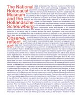
The National Holocaust Museum and the Hollandsche Schouwburg (Hardback)
The National Holocaust museum and the Hollandsche Schouwburg Learn all about the Nazi persecution of the Jews in the Netherlands. Remember and commemorate at a historic site. The National Holocaust Museum tells the story of the Nazi persecution and murder of the Jews of the Netherlands. Before the Second World War, Jews and non-Jews lived side by side. They had the same rights. But during the war, the Nazis and their collaborators killed around six million Jews in Europe. That was the Holocaust or Shoah. This is the first and only museum to relate the history of the persecution of the Jews of the entire Netherlands. Including the daytoday life of Jews on the eve of the Second World War, the liberation as Jews experienced it, and how the Holocaust has been treated in our national culture of remembrance: all this is examined in the museum and this book. Once a theatre, the Hollandsche Schouwburg was seized by the Nazis in the Second World War. From July 1942, Jews ordered to report for
29,95
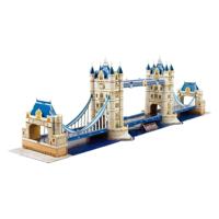
Cubic Fun 3d puzzel national geographic tower bridge
National Geographic 3D-puzzel De Tower Bridge, gebouwd in neogotische stijl, is een van de beroemdste bruggen ter wereld. Het ligt dicht bij de Tower of London en laat dagelijks 40.000 voertuigen toe om de rivier de Theems over te steken. Plezier voor jong en oud! De nauwkeurig geperforeerde schuimcomponenten maken de montage eenvoudig - geen vijzels of gereedschap nodig. Afhankelijk van de grootte en complexiteit van het model varieert het knutselplezier van enkele minuten tot enkele uren. Bestaat uit 66 stukjes. Verpakt in full-colour doos. Geschikt vanaf 10 jaar.
34,99

Klanten-reviews van Wandelkaart - Topografische kaart 747 Green Mountain National Forest North - Moosalamoo NRA - Rutland | National Geographic

Er zijn nog geen beoordelingen voor dit productBen jij de eerste die een review plaatst?

Meer over Wandelkaart - Topografische kaart 747 Green Mountain National Forest North - Moosalamoo NRA - Rutland | National Geographic

Productomschrijving

Prachtige geplastificeerde kaart van het bekende nationaal park. Met alle recreatieve voorzieningen als campsites, maar ook met topografische details en wandelroutes ed. Door uitgekiend kleurgebruik zeer prettig in gebruik. Scheur en watervast!

National Geographic's Green Mountain National Forest North Trails Illustrated topographic map is the most comprehensive available for outdoor enthusiasts of all types. Designed to be easy-to-read, yet highly detailed – this map includes a comprehensive road and trail network distinguishing between major, secondary and 4x4 roads, hiking, horse, biking, multi-use and non-motorized winter trails. All forest roads are labeled with their official road number and trails are clearly identified with their given name. Land management boundaries are color-coded showing National Forest, Ranger District, Wilderness Areas, Conservation Areas and more, plus the locations of private land within the Green Mountain National Forest. The renowned Appalachian Trail, Catamount Trail, and Long Trails are highlighted on the map.   An extensive collection of important and unique locations are pinpointed on the map including: visitor centers, campgrounds and backcountry shelters, picnic facilities, parking areas, RV dump sites, interpretive trails, boat launches, swimming holes, fishing areas, downhill and cross-country ski areas, waterfalls, viewpoints, museums, concessions, and Vermont's scenic covered bridges.   Every National Geographic Trails Illustrated map is an essential tool for safely navigating the backcountry with GPS or compass as they are clearly marked with both Latitude/Longitude and UTM coordinate grids, compass rose with magnetic declination, scale bar, and full legend.   Some of the places shown on the west side of the Green Mountain N.F. map are: Moosalamoo National Recreation Area, Joseph Battell Wilderness, Bristol Cliffs Wilderness, Breadloaf Wilderness, Rutland, Killington, Pico Ski Area, Sugarbush Ski Area, Lake Bomoseen, and more.   The east side of the map features: Hanover (NH), White River Junction, Woodstock, Quechee, Killington, White River, Connecticut River, Suicide Six Ski Area, Les Newell Wildlife Management Area, Granville Reservation, Roxbury State Forest, and more.   This Trails Illustrated map is printed in the U.S.A. on a durable synthetic paper, making it waterproof, tear-resistant, and capable for withstanding any condition mother nature can dish out. The map is two-sided, and can be folded to a packable size of (4.25" x 9.25"), unfolded size is (26" x 38")."   Green Mountains National Forest North adjoins the Green Mountains National Forest South map providing seamless coverage of Vermont's Green Mountain National Forest.

Productinformatie

    Verken gerelateerde categorieën

    Webshop.nl maakt gebruik van cookies. Ga je verder op onze website, ga dan akkoord met het plaatsen van cookies en de verwerking van deze data door ons en vermelde partners.