Wandelkaart South Africa: Table Mountain | Slingsby Maps

0
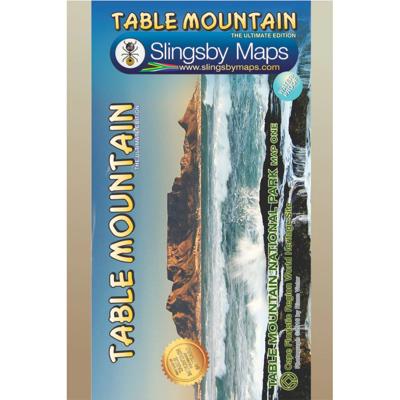
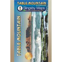
This highly detailed map shows all approved paths on the mountain and includes full GPS information. The map shows the Hoerikwaggo and the Peoples Trail, and covers the area from Signal Hill to Devils Peak and Llandudno to Constantia Nek and the Vlakkenberg Plateau. This is the only map of the mountain endorsed by the Table Mountain National Park,...

Verkopers met dit product

Verkoper
Bezorging
Prijs
DeZwerver.nl logo
DeZwerver.nl
2,95
29,95

Anderen bekeken ook

Wandelkaart South Africa: Silvermine & Hout Bay | Slingsby Maps
The map also includes:   The Constantia Winelands All sections of the Hoerikwaggo Trail are shown All approved paths, with detailed DDMMSS GPS coordinates for major junctions, are clearly marked with distances and approximate times for each path section 10 metre contours and delicate colour height shading bring the topography to life Additional info:   Silvermine and Hout Bay areas of the Cape Peninsula at 1:20,000 on a double-sided map printed on water-proof and tear-resistant synthetic paper.   The title is part of a series of high quality, detailed walking maps from Slingsby Maps, with excellent cartog- raphy and plenty of tourist information.   Contour lines are drawn at 10m intervals with additional altitude colouring. Roads indicate restricted access. Footpaths are highlighted and show waymarked routes and sections not recommended or dangerous. Sym- bols indicate information for visitors to the area: car parks, view points, signposts, public toilets, picnic areas, places of inte…
29,95
Wegenkaart - landkaart South Africa: Swartberg & Klein-Karoo | Slingsby Maps
All roads from National Highways to minor gravel roads are shown; the many classifications that indi- cate the quality of each road help you plan your route No less than 28 mountain passes are shown — all are public roads! Distances are clearly shown; comprehensive 4 x 4 information GPS coordinates in DD MM SS format are provided for every road-junction All tourism facilities and accommodation establishments are shown in the out-of-town areas; there are insets of the major towns The map links to our maps of the Baviaanskloof, the Garden Route, Overberg and the Tankwa-Karoo Additional info:   Swartberg and Klein-Karoo region on a contoured and GPS compatible, double-sided, waterproof and   tear-resistant map at 1:160,000 from Slingsby Maps, with excellent topographic detail and plenty of tourist information, including street plans of ten main towns.   The map provides a very detailed picture of this mountainous terrain, with altitude colouring, shading, con- tours at 20m intervals and …
29,95
Nieuw
Wandelkaart Namibia: Fish River Canyon | Slingsby Maps
This double-sided A1-sized map covers the entire iconic Fish River Canyon hike; and on the reverse the complete and fascinating geological map of the oldest canyon on Planet Earth matches the hiking map exactly. The map is printed on Duraflex waterproof material and is packaged in a plastic pocket.Data collected over four years has informed the content of this first-ever detailed topo map of the world-famous canyon. The map shows the suggested sides of the river to hike on, all the short-cuts, the usually-perennial pools, suggested overnight spots, etc etc. The maps includes distances both down the river and along the recommended route, as well as GPS coordinates, altitudes, etc A1+ full colour, double-sided map Scale 1:40 000 (2.5cm = 1km) 10m contours; relief shading 10" Long/Lat grid Coords in DDMMSS format at all recognised path junctions Contact numbers and detailed safety information WATERPROOF and TEAR RESISTANT in plastic wallet
29,95
Wandelkaart South Africa: Cape Point and Simon's Town & Fish Hoek | Slingsby Maps
This is map three in our three-map series of Table Mountain National Park. Waterproof and tear resistant in plastic sleeve.   This brand new, fully redrawn and highly detailed map shows all approved paths and includes full GPS information for this historically-fascinating hiking area. The double-sided map with Cape Point on one side and Simon’s Town (including Kommetjie, Glencairn, Fish Hoek and Kalk Bay) on the reverse also highlights the Hoerikwaggo Trail.   The Cape Point side includes the whole Cape Point Nature Reserve: the area south of Miller’s Point and Klaasjagers all the way to Cape Point and the Cape of Good Hope.   The Simon’s Town side covers the area from Kommetjie to Fish Hoek/Kalk Bay and south to Glencairn, Simon’s Town and Miller’s Point, and west to Red Hill, Scarborough and Witsand.
29,95
Wandelkaart 01 Jasper National Park & Maligne Lake | Gem Trek Maps
Scheur- en Watervast papier Gem Trek’s JASPER AND MALIGNE LAKE MAP map is designed for outdoor enthusiasts looking to explore the section of Jasper National Park near the town and out to Maligne Lake. Whether you are touring along the roads or heading into the backcountry, you’ll find the waterproof and tear-resistant Jasper & Maligne Lake Map to be an invaluable tool.   This map features detailed cartography, accurate hiking trails with distances, and details such as campgrounds, equestrian routes, picnic areas, and fire lookouts. On the back of the map are trail descriptions and photos of 18 recommended day hikes, four overnight or multi-day trips, and six classic mountain bike rides. Each of these described trails is referenced and colour-coded to the map on the front. Also on the back is contact information for Jasper National Park, as well for as the three backcountry lodges located in the Tonquin Valley and on the Skyline Trail.   Jasper & Maligne Lake Map Coverage The Jas…
16,95
Nieuw
Wandelkaart 11 Banff Up-Close | Gem Trek Maps
Waterproof and tear-resistant hiking and recreation map for the town of Banff and surrounds in the Canadian Rockies.   Designed for both locals and visitors, Gem Trek’s 1:35,000 Banff Up-Close Map is a detailed relief-shaded topographic map of the Banff area. All hiking and biking trails are labeled, and distances are marked. Like all Gem Trek maps, the Banff Up-Close Map features detailed cartography and accurate hiking trails with distances, elevation gain, and directions to the trailhead noted. An inset on the back increases coverage of downtown Banff, with museums and all streets marked. Also on the flipside are descriptions of the sights, museums and scenic drives in Banff. We've also included a hand-picked list of the best seven walks and day hikes in the area. The highlights of each trail are noted, as well as distance, elevation gain and directions to the trailhead.   Map specs   Edition: 4th Scale: 1:35,000 Folded size: 4.5 x 9.5 inches Flat size: 18 x 24 inches Paper: Waterp…
13,95
Nieuw
Wandelkaart 07 Kananaskis Lakes | Gem Trek Maps
Waterproof and tear-resistant hiking and recreation map for the Kananaskis Lakes region of the Canadian Rockies   Gem Trek's Kananaskis Lakes Map is designed for hikers and outdoor enthusiasts looking to explore the south-central portion of Kananaskis Country immediately south of our Canmore and Kananaskis Village Map. Whether you are touring along the roads or heading into the backcountry, you'll find the waterproof and tear-resistant Kananaskis Lakes Map to be an invaluable tool.   This map features detailed cartography, accurate hiking trails with distances, and details such as logging roads, campgrounds, equestrian routes, picnic areas, and fire lookouts. On the back are descriptions of the most popular hiking trails, as well details of services such as campgrounds and visitor centres.   – Map scale: 1:50,000 – Sheet size: 27 x 39 inches – Folded size: 4.5 x 9.5 inches   Map Coverage   The Kananaskis Lakes Map covers Peter Lougheed Provincial Park, located off Highway 40 south of …
18,95
Nieuw
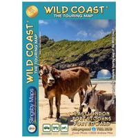
Wegenkaart - landkaart South Africa: Wild Coast | Slingsby Maps
Wild Coast   Brand new 6th Edition of this great map : for 15 years the best and only detailed touring map of the Wild Coast!   The Wild Coast is a wilderness paradise, strewn with natural wonders. Over one hundred lagoons thread this romantic coast, pristine beaches await fishermen, surfers and holiday makers; mighty waterfalls plunge directly into the sea, rivers gouge deep secret valleys into this heartland of South Africa’s history. Birthplace and resting place of Nelson Rolihlahla Mandela, this extraordinary landscape is where visions were dreamed, battles fought, ships came to dramatic ends.   The sixth edition of our Wild Coast map is bigger and better than ever. The fully-revised map now includes larger insets of some important areas, as well as distance charts for coastal hikers, with the estuary-to-estuary distances down the length of the coast, from Port Edward to East London, amongst many other updates.
29,95
Wandelkaart 08 Bragg Creek and Sheep Valley | Gem Trek Maps
Gem Trek’s BRAGG CREEK & SHEEP VALLEY MAP is for hikers and outdoor enthusiasts looking to explore Kananaskis Country west and south of Bragg Creek. Whether you are touring along the roads or heading into the backcountry, you’ll find the waterproof and tear-resistant Bragg Creek & Sheep Valley Map to be an invaluable tool.   This map features detailed cartography, accurate hiking trails with distances, and details such as logging roads, campgrounds, equestrian routes, picnic areas, and fire lookouts.   On the back of the Bragg Creek & Sheep Valley Map are detailed descriptions of 20 hiking trails colour-coded by region, eight mountain bike trails, as well details of services such as campgrounds and visitor centres.   Bragg Creek & Sheep Valley Map Coverage The Bragg Creek & Sheep Valley Map covers a large chunk of the eastern portion of Alberta’s Kananaskis Country. The map centres on the Elbow Valley, which is accessed from the village of Bragg Creek, a short drive southwest of Calga…
18,95
Nieuw
Wandelkaart 03 Bow Lake / Saskatchewan Crossing | Gem Trek Maps
Waterproof and tear-resistant hiking and recreation map for the Bow Lake and Saskatchewan Crossing region of Banff National Park.   Gem Trek's 1:70,000 Bow Lake and Saskatchewan Crossing Map is designed for outdoor enthusiasts looking to explore the Bow Lake and Saskatchewan Crossing region at the north end of Banff National Park. Whether you are touring along the roads or heading into the backcountry, you’ll find the waterproof and tear-resistant Bow Lake and Saskatchewan Crossing Map to be an invaluable tool. This map features detailed cartography, accurate hiking trails with distances, and details such as logging roads on the British Columbia side of the Continental Divide, campgrounds, picnic areas, and abandoned fire lookouts. On the back are descriptions of 24 recommended hikes, ranging from short walks to overnight treks, as well as details of services such as campgrounds and visitor centres.   Map specs     – Edition: 6th – Map scale: 1:70,000 – Sheet size: 27 x 39 inches – Fo…
18,95

Klanten-reviews van Wandelkaart South Africa: Table Mountain | Slingsby Maps

Er zijn nog geen beoordelingen voor dit productBen jij de eerste die een review plaatst?

Meer over Wandelkaart South Africa: Table Mountain | Slingsby Maps

Productomschrijving

This highly detailed map shows all approved paths on the mountain and includes full GPS information. The map shows the Hoerikwaggo and the Peoples Trail, and covers the area from Signal Hill to Devils Peak and Llandudno to Constantia Nek and the Vlakkenberg Plateau. This is the only map of the mountain endorsed by the Table Mountain National Park, and approved by the Mountain Club of South Africa.  
  • Distances and estimated times shown for all paths above the Contour Path or Pipe Track
  • Long/Lat grid at 10" intervals as well as the 200 metre square UTM grid; Completely revised vegetation distribution
  • Some vanished paths removed; some new ones added
  • Three Firs, Oudekraal Ravine and Constantia Corner routes upgraded; Clearer depiction of many features, including dangerous routes
  • All approved paths, with DD MM SS GPS coordinates for major junctions
  • 10 metre contours & delicate colour height shading bring the topography to life
  • Forty quality photos of the most prominent mountain flowers, as well as line sketches of flora and fauna are included on the map
  • A sketch of the view from Maclear's Beacon, with names and distances to prominent peaks on the eastern horizon
  • Written descriptions of 23 of the most popular routes, with distances and approximate times
  • Important safety instructions, emergency telephone numbers, Cableway and National Park details
  • A2+ full colour map
  • Scale 1:20 000 (5cm = 1km)
  • 10m contours; relief shading
  • 200m2 UTM grid, WGS84
  • 10" Long/Lat grid
  • Coords in DDMMSS format at important junctions
  • 23 Route descriptions
  • Safety information & contact numbers
  • WATERPROOF and TEAR RESISTANT in plastic sleeve

Verken gerelateerde categorieën

Webshop.nl maakt gebruik van cookies. Ga je verder op onze website, ga dan akkoord met het plaatsen van cookies en de verwerking van deze data door ons en vermelde partners.