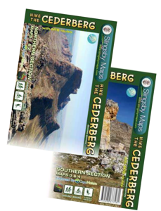
Wandelkaart South Africa: Hike the Cederberg | Slingsby Maps

0
HIKE THE CEDERBERG:   There are two double-sided A1-sized maps in the set (i.e., four maps in all), covering the entire Cederberg Wilderness and extending north to Wolfdrif and south to Mount Ceder.   The maps are printed on Duraflex waterproof material and are packaged together in a folding slipcase. The maps are not available separately.   More ...

Verkopers met dit product

Webshop
Bezorging
Prijs
DeZwerver.nl logo
DeZwerver.nl
2,95
29,95

Anderen bekeken ook

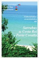
Wandelkaart A15 Sarrabus da Costa Rei a Porto Corallo | Abies
Sarrabus is a territory that is not known by everybody yet. Here lies its charm and this has made possible to keep this environmental area out of big building speculations and also out of history. In fact it preserves little traces of the past, and paradoxically the remains from the prehistoric age are more meaningful than those back to more recent times. We can find traces from the most remote past not far from the State Road SS125, that from Muravera goes to Costa Rei, by visiting the nuraghe Murtas, the nuraghe S’Aqua Secis and the megalithic complexes of Scalas and Cuili Piras. They are about ten menhirs, almost fully intact, arranged in groups and fixed in the ground in the original orthostatic position. They have been put in relation with the position of the sun and the moon, at dawn and at sunset. In fact they were used as a very precise astronomic calendar but also for religious purposes since they represented both the masculine divinity and the fertility according to the wors…
12,95
Wandelkaart Cape Wrath Trail South | Harvey Maps
Een bijzonder handige kaart van dit lange-afstands-wandelpad. Op waterafstotend papier met veel details. Het enige dat je eigenlijk een beetje mist is een overzicht. Verder uitstekend en voldoende voor de route. XT40 - Leap forward in technical excellence. Tough, light and 100% waterproof   Compact and light - the map itself weighs just 60gms - a third of the weight of a laminated map, and much less bulky. And you can fold or refold it time and again, or stuff it in your back pocket and it won't fall to pieces. Shows the entire route on one sheet.   The Cape Wrath Trail is a challenging route from Fort William to Cape Wrath. It is around 200 miles long and passes through some of Scotland's wildest and most spectacular scenery.   This map covers the southern section of the route, from Fort William to Strathcarron.   The trail has evolved from use and is not an officially recognised National Trail. There is no single definitive route. There are various ways of tackling the traverse all …
28,50
Campergids All the Aires France South | Vicarious Books
Due to the increased number of Aires entries, All the Aires France is now divided into two volumes: North and South. You are currently looking at the South guide which lists the Aires in southern France only. These books can be purchased individually or as a double deal together.   As the name suggests, All the Aires France South maps and details 1801 dedicated motorhome stopovers in France. It is the only complete French Aires de services guide book available in English. The guidebook enables you to make an informed choice about where to stop and where to stay overnight on your travels in your motorhome or campervan throughout southern France.   All the Aires France South has been revised and updated into its most user-friendly format. All the nearby Aires fall on the same page. This makes it easier to cross reference and select an Aire within an area. Closed Aires are now marked with an X on the maps and are found in a list at the rear of the book. Motorway Aires are marked with a l…
20,95
Wandelkaart - Topografische kaart 161 OS Explorer Map London South (greenw.m) | Ordnance Survey
Follow the Thames Path through the heart of London’s oldest and most historic areas. Discover Westminster, a square mile densely packed with some of the world’s most famous attractions: Buckingham Palace, Westminster Abbey, Westminster Cathedral and the Palace of Westminster, home to the Houses of Parliament.    Visit the World Heritage Sites of Kew Gardens, Maritime Greenwich including the Royal Observatory and the Palace of Westminster & Abbey complex  Explore the suburbs of Croydon, Esher and Twickenham, home of English rugby and Horace Walpole’s miniature Gothic castle, Strawberry Hill  Walk or cycle the Thames Path National Trail or recreational paths including the London Loop and Vanguard Way  Met zijn 4cm voor 1 km (2 ½ cm voor 1 mijl) schaal, is de OS Explorer kaartenserie de ideale en meest gedetailleerde kaartenreeks voor mensen die graag outdoor-activiteiten zoals fietsen, wandelen, paardrijden, klimmen en watersporten. Deze kaart is nog gedetailleerder dan de 'gewone' L…
19,50
Wandelkaart The Great Himalaya Trail | GHT
  Prachtige kaartenserie van één van 'swerelds mooiste wandeltochten.   The Far West is one of the least explored areas of Nepal. Its area is bounded to the east by mighty, turquoise Karnali river which flows from Tibet’s sacred Mount Kailash.   Myth and superstition remain part of the fabric of life here. Though the Nepali language originated here, it seems a distant world from ‘modern’ Nepal. One Nepali visitor described his visit as “fascinating, like travelling back to the 18th century.”   Along the trails you may meet a turbaned Dhami, a shaman, with silver-bangled limbs and gold-ringed ears, who are still depended on for treating sickness.   Organised tourism has so far been limited to Khaptad National Park, the only national park in the mid-hills of Nepal and held dearly by conservationists. Gentle hills, pristine forests and abundant wildlife with a snow-covered backdrop of the Nampa, Api and Saipal peaks make for beautiful trekking.   It’s also a holy place associated with Kh…
26,95
Wandelgids South Downs Way | Trailblazer Guides
The South Downs Way is a 100-mile footpath which follows the line of chalk hills stretching from Winchester to Eastbourne. Walking the length of the Downs is the best way to experience this beautiful landscape with its mixture of rolling hills, steep hanging woodland and windswept fields. You'll also pass through picture-postcard villages with welcoming pubs, thatched cottages and country gardens. 1. Unique mapping features - In many walking guides the reader has to read a route description then try to relate it to the map. Our guides are easier to use because walking directions, tricky junctions, places to stay and eat, points of interest and walking times are all written onto the maps themselves in the places to which they apply. With their uncluttered clarity, these are not general-purpose maps but fully-edited maps drawn by walkers for walkers. Downloadable GPS waypoints also included. 2. The largest scale walking maps available - At just under 1:20,000 (8cm or 31/8 inches to 1 mi…
20,95
Wandelkaart - Topografische kaart 331 OS Explorer Map Teviotdale South | Ordnance Survey
Met zijn 4cm voor 1 km (2 ½ cm voor 1 mijl) schaal, is de OS Explorer kaartenserie de ideale en meest gedetailleerde kaartenreeks voor mensen die graag outdoor-activiteiten zoals fietsen, wandelen, paardrijden, klimmen en watersporten. Deze kaart is nog gedetailleerder dan de 'gewone' Landranger maps. Voor- en achterzijde bedrukt! Zeker op de moors en andere natuurgebieden van onschatbare waarden met echt alle aspecten van het landschap op de kaart ingetekend. Zeer goede detailkaart met topografische ondergrond. Hierop zijn toeristische symbolen van bezienswaardigheden ingetekend, daarnaast staan bijvoorbeeld campings en jeugdherbergen vermeld en - voor wandelaars het belangrijkst - alle right of way paden en Lange afstands Wandelpaden zijn er op te vinden. De ideale kaart voor het wandelen in Engeland, Wales of Schotland.   These highly detailed maps show all the administrative boundaries, settlements as small as isolated farms, the road network down to unfenced roads and country tra…
19,50
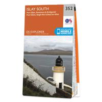
Wandelkaart - Topografische kaart 352 OS Explorer Map Islay South | Ordnance Survey
Met zijn 4cm voor 1 km (2 ½ cm voor 1 mijl) schaal, is de OS Explorer kaartenserie de ideale en meest gedetailleerde kaartenreeks voor mensen die graag outdoor-activiteiten zoals fietsen, wandelen, paardrijden, klimmen en watersporten. Deze kaart is nog gedetailleerder dan de 'gewone' Landranger maps. Voor- en achterzijde bedrukt! Zeker op de moors en andere natuurgebieden van onschatbare waarden met echt alle aspecten van het landschap op de kaart ingetekend. Zeer goede detailkaart met topografische ondergrond. Hierop zijn toeristische symbolen van bezienswaardigheden ingetekend, daarnaast staan bijvoorbeeld campings en jeugdherbergen vermeld en - voor wandelaars het belangrijkst - alle right of way paden en Lange afstands Wandelpaden zijn er op te vinden. De ideale kaart voor het wandelen in Engeland, Wales of Schotland.   These highly detailed maps show all the administrative boundaries, settlements as small as isolated farms, the road network down to unfenced roads and country tra…
19,50
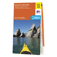
Wandelkaart - Topografische kaart OL20 OS Explorer Map South Devon | Ordnance Survey
Met zijn 4cm voor 1 km (2 ½ cm voor 1 mijl) schaal, is de OS Explorer kaartenserie de ideale en meest gedetailleerde kaartenreeks voor mensen die graag outdoor-activiteiten zoals fietsen, wandelen, paardrijden, klimmen en watersporten. Deze kaart is nog gedetailleerder dan de 'gewone' Landranger maps. Voor- en achterzijde bedrukt! Zeker op de moors en andere natuurgebieden van onschatbare waarden met echt alle aspecten van het landschap op de kaart ingetekend. Zeer goede detailkaart met topografische ondergrond. Hierop zijn toeristische symbolen van bezienswaardigheden ingetekend, daarnaast staan bijvoorbeeld campings en jeugdherbergen vermeld en - voor wandelaars het belangrijkst - alle right of way paden en Lange afstands Wandelpaden zijn er op te vinden. De ideale kaart voor het wandelen in Engeland, Wales of Schotland.   These highly detailed maps show all the administrative boundaries, settlements as small as isolated farms, the road network down to unfenced roads and country tra…
19,50
Reisgids South Africa | Eyewitness
Whether you're hoping to catch a glimpse of nature's most majestic animals, get an adrenaline fix scaling the heights of Table Mountain or simply soak up the summer sunshine with a glass of world-class wine, your DK Eyewitness travel guide makes sure you experience all that South Africa has to offer. Inside you'll also find a detailed guide to the country's animals, terrain and flora as well as information on local conservation efforts. From vibrant city life to abundant wildlife, rugged vistas to beautiful beaches, prehistoric paintings to cutting edge contemporary art, South Africa has it all.   This vast and varied country offers so many travel possibilities you'll be spoilt for choice. Our updated 2023 guide brings South Africa to life, transporting you there like no other travel guide does with expert-led insights, trusted travel advice, detailed breakdowns of all the must-see sights, photographs on practically every page, and our hand-drawn illustrations which place you inside t…
24,95

Klanten-reviews van Wandelkaart South Africa: Hike the Cederberg | Slingsby Maps

Er zijn nog geen beoordelingen voor dit productBen jij de eerste die een review plaatst?

Meer over Wandelkaart South Africa: Hike the Cederberg | Slingsby Maps

Productomschrijving

HIKE THE CEDERBERG:   There are two double-sided A1-sized maps in the set (i.e., four maps in all), covering the entire Cederberg Wilderness and extending north to Wolfdrif and south to Mount Ceder.   The maps are printed on Duraflex waterproof material and are packaged together in a folding slipcase. The maps are not available separately.   More than a hundred hikers, mountaineers, conservationists and locals have contributed their special knowl- edge to the project, which has been proudly endorsed by CapeNature.   Every single public footpath has been researched on foot, and the maps include distances between path junctions, as well as GPS coordinates, altitudes, etc. etc.

Verken gerelateerde categorieën

Webshop.nl maakt gebruik van cookies. Ga je verder op onze website, ga dan akkoord met het plaatsen van cookies en de verwerking van deze data door ons en vermelde partners.