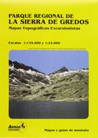
Wandelkaart Sierra de Gredos | Adrados Ediciones

0
On one side is a detailed 1:25,000 walking map concentrating on the central sector of the Regional Park around the Almanzor and La Mira peaks. Detailed contours are at 10m intervals, walking trails are marked and springs & refuges are highlighted. On the reverse is a smaller scale map at 1:135,000 extending over a larger area - well beyond the lim...

Verkopers met dit product

Verkoper
Bezorging
Prijs
DeZwerver.nl logo
DeZwerver.nl
2,95
14,95

Anderen bekeken ook

Wandelkaart Picos de Europa National | Adrados Ediciones
Picos de Europa National Park Short and Long-Distance Trails at 1:50,000 on an excellent, contoured and GPS compatible map from Adrados Ediciones highlighting three hiking routes which can be combined into a Tour of the Picos, plus English language descriptions of the routes and lists of mountain huts and refuges.   The map covers the whole of the National Park area and extends north and west beyond its borders to include Potes and other surrounding villages. Very fine cartography provides an excellent presentation of the terrain through contours at 20m intervals enhanced by relief shading and altitude colouring, numerous spot heights, and plenty of names of peaks and other topographic features. Symbols highlight locations of campsites, mountain huts, refuges and hostels, as well as petrol stations on local roads. The map has a 1-km UTM grid.   A special feature of this map is an overprint highlighting three long-distance hiking routes: a circuit of the western massif, a traverse of t…
14,95
Wegenkaart - landkaart Cordillera Cantabrica - Asturias y provincias limitrofes | Adrados Ediciones
Gedetailleerde wegenkaart an de Cordillera Cantabrica met hoogtelijnen, hoogte verschillen in kleur en schaduw en UTM coördinaten. Met plaatsnamen index! Cordillera Cantabrica on a detailed road map from the Oviedo based Adrados Ediciones, presenting this mountainous region with contours at 100m intervals, altitude coluring, relief shading and UTM coordinates. Since the publishers specialize in detailed hiking maps, including the best coverage of the Picos de Europa, the map includes an exceptionally large number of names of peaks, passes, etc. Symbols highlight best rock and ice climbing areas, huts and refuges, campsites, mountain rescue posts and information centres. Along the coast numerous beaches are named. Road network includes small country roads and tracks. Local railway lines are shown, although not very easy to see on the base map filled with so much information. The map has a 10km UTM grid. Map legend is in Spanish only. On the reverse is a panorama drawing of the area, lo…
14,95
Wandelkaart Macizo de Fuentes Carrionas | Adrados Ediciones
Fuentes Carrionas Massif, just south of the Picos de Europa, on a detailed hiking map from Adrados Ediciones combining coverage at 1:60,000 of the western part of Fuentes Carrionas and Fuentes del Cobre Natural Park with more detailed mapping at 1:25,000 of Peña Prieta Massif. The main map at 1:50,000 has contours at 20m intervals with bold relief shading and altitude colouring. Numerous peaks and other topographical features are named. Hiking, mountain bike and ski trails are highlighted and symbols mark campsites, mountain shelters and cabins, viewpoints, climbing areas, tourist information centres, locations of petrol stations, etc. On the reverse the central part of the main map, the Peña Prieta Massif is shown at 1:25,000 with the excellent cartography used in the publishers’ coverage of the Picos de Europa. Contours are at 10, intervals with additional graphic relief for exposed rocky faces.  
14,95
Wandelkaart - Topografische kaart 179 OS Explorer Map Gloucester, Cheltenham, Stroud | Ordnance Survey
The essential map for outdoor activities in Gloucester, Cheltenham and Stroud. The OS Explorer Map is the Ordnance Survey's most detailed folding map and is recommended for anyone enjoying outdoor activities including walking, horse riding and off-road cycling. This map now comes with a digital version which you can download to your smartphone or tablet.Providing complete GB coverage, the OS Explorer map series details information essential in the great outdoors, including youth hostels, pubs and visitor information. Rights of way, fences, permissive paths and bridleways are clearly shown, ensuring you have the best information to get the most out of your time in the countryside. FeaturesCotswold Way Severn Way Gloucestershire Way Macmillan Way Wysis WayCotswold Way (National Trail) GloucesterCheltenhamGloucester Stroud1:25 000 scale (4 cm to 1 km - 2.5 inches to 1 mile) Met zijn 4cm voor 1 km (2 ½ cm voor 1 mijl) schaal, is de OS Explorer kaartenserie de ideale en meest gedetailleerd…
19,50
Wandelkaart - Topografische kaart 181 OS Explorer Map Chiltern Hills North | Ordnance Survey
The essential map for outdoor activities in Chiltern Hills North. The OS Explorer Map is the Ordnance Survey's most detailed folding map and is recommended for anyone enjoying outdoor activities including walking, horse riding and off-road cycling. This map now comes with a digital version which you can download to your smartphone or tablet.Providing complete GB coverage, the OS Explorer map series details information essential in the great outdoors, including youth hostels, pubs and visitor information. Rights of way, fences, permissive paths and bridleways are clearly shown, ensuring you have the best information to get the most out of your time in the countryside. FeaturesIcknield Way RidgewayNorth Buckinghamshire Way Icknield Way PathSwan's Way Two Ridges Link Aylesbury RingSouth Bucks Way Chess Valley Walk Chiltern Link Thame Valley WalkGrand Union Canal Walk Midshires Way Bledlow Circular Ride Hertfordshire Way Chiltern WayRidgeway (National Trail) Bedfordshire Buckinghamshire H…
19,50
Wandelkaart Tour & Trail Costa de Sol - Axarquia | Discovery Walking Guides
Goede wandelkaart van de omgeving Nerja - Competa in het binnenland. For better adventures, use the best map. Costa del Sol (Axarquia) Tour & Trail Super-Durable Map comes with a 2 year adventurous use wear and tear guarantee against splitting or falling apart, see Discovery Walking Guides website for details. From 1 April 2020 a free Custom Map digital edition for Garmin users is available to download from the Discovery Walking Guides website.   Our large 1:40,000 scale, combined with splitting the region into West and East sections with a generous overlap, produces double sided map whose total size is 840mm by 700mm that folds to a pocketable 240mm by 120mm. Costa del Sol (Axarquia) covers the region from Ventas de Zafarraya in the North-West to Almunecar in the South-East; approx 3 42'W to 4 08'W and 36 43'N to 36 58'N. You get the most detailed map of the region that is produced including our 'Tour & Trail' level of detail ranging from major roads to secondary roads to minor ro…
15,95
Wandelkaart 901 Banff North National Park | National Geographic
Prachtige geplastificeerde kaart van het bekende nationaal park. Met alle recreatieve voorzieningen als campsites, maar ook met topografische details en wandelroutes ed. Door uitgekiend kleurgebruik zeer prettig in gebruik. Scheur en watervast! The front side of the Banff North map details the south side of the national park, from Siffleur Wilderness Area to the north, to Kootenay National Park to the south. This side also covers survival tips, area trails, entry fees and details both Kootenay and Yoho Nationals Parks. The reverse side of the map details the north side of the park, extending from Siffleur Wilderness area to the south, to White Goat Wilderness to the North. Insets show safe travel in Bear Country, and all the recreation the park has to offer with backpacking, camping, biking, hiking and horseback riding.  National Geographic's Trails Illustrated map of Banff North is a two-sided, waterproof map designed to meet the needs of outdoor enthusiasts with unmatched durability…
17,95
Wandelkaart - Topografische kaart OL60 OS Explorer Map Lochindorb, Grantown-on-Spey & Carrbridge | Ordnance Survey
Met zijn 4cm voor 1 km (2 ½ cm voor 1 mijl) schaal, is de OS Explorer kaartenserie de ideale en meest gedetailleerde kaartenreeks voor mensen die graag outdoor-activiteiten zoals fietsen, wandelen, paardrijden, klimmen en watersporten. Deze kaart is nog gedetailleerder dan de 'gewone' Landranger maps. Voor- en achterzijde bedrukt! Zeker op de moors en andere natuurgebieden van onschatbare waarden met echt alle aspecten van het landschap op de kaart ingetekend. Zeer goede detailkaart met topografische ondergrond. Hierop zijn toeristische symbolen van bezienswaardigheden ingetekend, daarnaast staan bijvoorbeeld campings en jeugdherbergen vermeld en - voor wandelaars het belangrijkst - alle right of way paden en Lange afstands Wandelpaden zijn er op te vinden. De ideale kaart voor het wandelen in Engeland, Wales of Schotland.   Showing the north-western area of Cairngorms National Park, plus Strathdearn and the River Findhorn, OS Explorer map OL 60 is the perfect companies for walking, …
19,50
Wandelkaart - Topografische kaart OL44 OS Explorer Map Torquay & Dawlish | Ordnance Survey
Met zijn 4cm voor 1 km (2 ½ cm voor 1 mijl) schaal, is de OS Explorer kaartenserie de ideale en meest gedetailleerde kaartenreeks voor mensen die graag outdoor-activiteiten zoals fietsen, wandelen, paardrijden, klimmen en watersporten. Deze kaart is nog gedetailleerder dan de 'gewone' Landranger maps. Voor- en achterzijde bedrukt! Zeker op de moors en andere natuurgebieden van onschatbare waarden met echt alle aspecten van het landschap op de kaart ingetekend. Zeer goede detailkaart met topografische ondergrond. Hierop zijn toeristische symbolen van bezienswaardigheden ingetekend, daarnaast staan bijvoorbeeld campings en jeugdherbergen vermeld en - voor wandelaars het belangrijkst - alle right of way paden en Lange afstands Wandelpaden zijn er op te vinden. De ideale kaart voor het wandelen in Engeland, Wales of Schotland. Ingetekende Langeafstandswandelroute South west coast Path Map sheet OL 44 Map is the perfect map for exploring the Eastern edge of Dartmoor national park and the c…
19,50
Wandelkaart - Topografische kaart OL38 OS Explorer Map Loch Lomond South | Ordnance Survey
Met zijn 4cm voor 1 km (2 ½ cm voor 1 mijl) schaal, is de OS Explorer kaartenserie de ideale en meest gedetailleerde kaartenreeks voor mensen die graag outdoor-activiteiten zoals fietsen, wandelen, paardrijden, klimmen en watersporten. Deze kaart is nog gedetailleerder dan de 'gewone' Landranger maps. Voor- en achterzijde bedrukt! Zeker op de moors en andere natuurgebieden van onschatbare waarden met echt alle aspecten van het landschap op de kaart ingetekend. Zeer goede detailkaart met topografische ondergrond. Hierop zijn toeristische symbolen van bezienswaardigheden ingetekend, daarnaast staan bijvoorbeeld campings en jeugdherbergen vermeld en - voor wandelaars het belangrijkst - alle right of way paden en Lange afstands Wandelpaden zijn er op te vinden. De ideale kaart voor het wandelen in Engeland, Wales of Schotland.   Map sheet number OL 38 covers Loch Lomond South, Helensburgh and Dumbarton. Highlights include the Loch Lomond and The Trossarchs National Park and the Argyll For…
19,50

Klanten-reviews van Wandelkaart Sierra de Gredos | Adrados Ediciones

Er zijn nog geen beoordelingen voor dit productBen jij de eerste die een review plaatst?

Meer over Wandelkaart Sierra de Gredos | Adrados Ediciones

Productomschrijving

On one side is a detailed 1:25,000 walking map concentrating on the central sector of the Regional Park around the Almanzor and La Mira peaks. Detailed contours are at 10m intervals, walking trails are marked and springs & refuges are highlighted.

On the reverse is a smaller scale map at 1:135,000 extending over a larger area - well beyond the limits of the Regional Park border, to Avila in the extreme north east of the sheet and to Jaraiz de la Vera in the south west. It shows the general topography of the region through contouring, altitude tinting and hill shading, and includes roads and paths with symbols for petrol stations, campsites, refuges and information offices. Map legend and explanatory notes for interpreting the maps are in Spanish only.
UTM grid lines are printed over both maps.


Verken gerelateerde categorieën

Webshop.nl maakt gebruik van cookies. Ga je verder op onze website, ga dan akkoord met het plaatsen van cookies en de verwerking van deze data door ons en vermelde partners.